A Day tour of the Swedish island of Öland
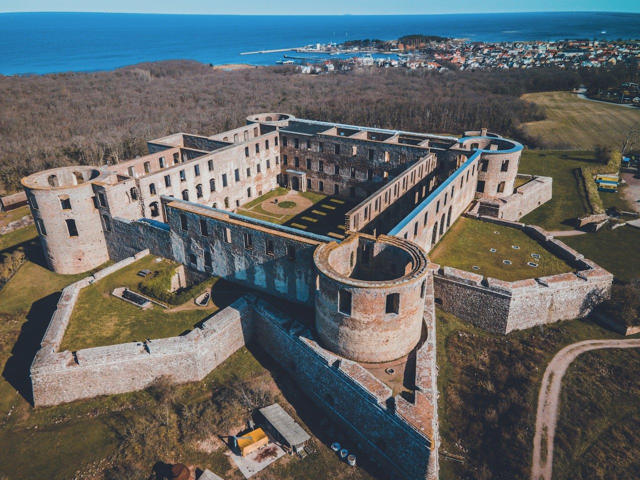
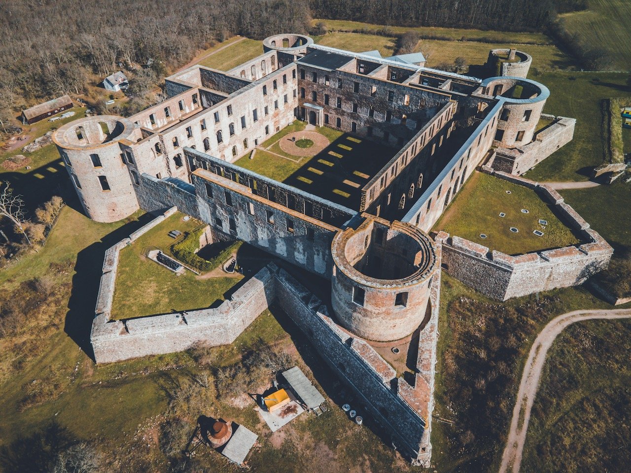
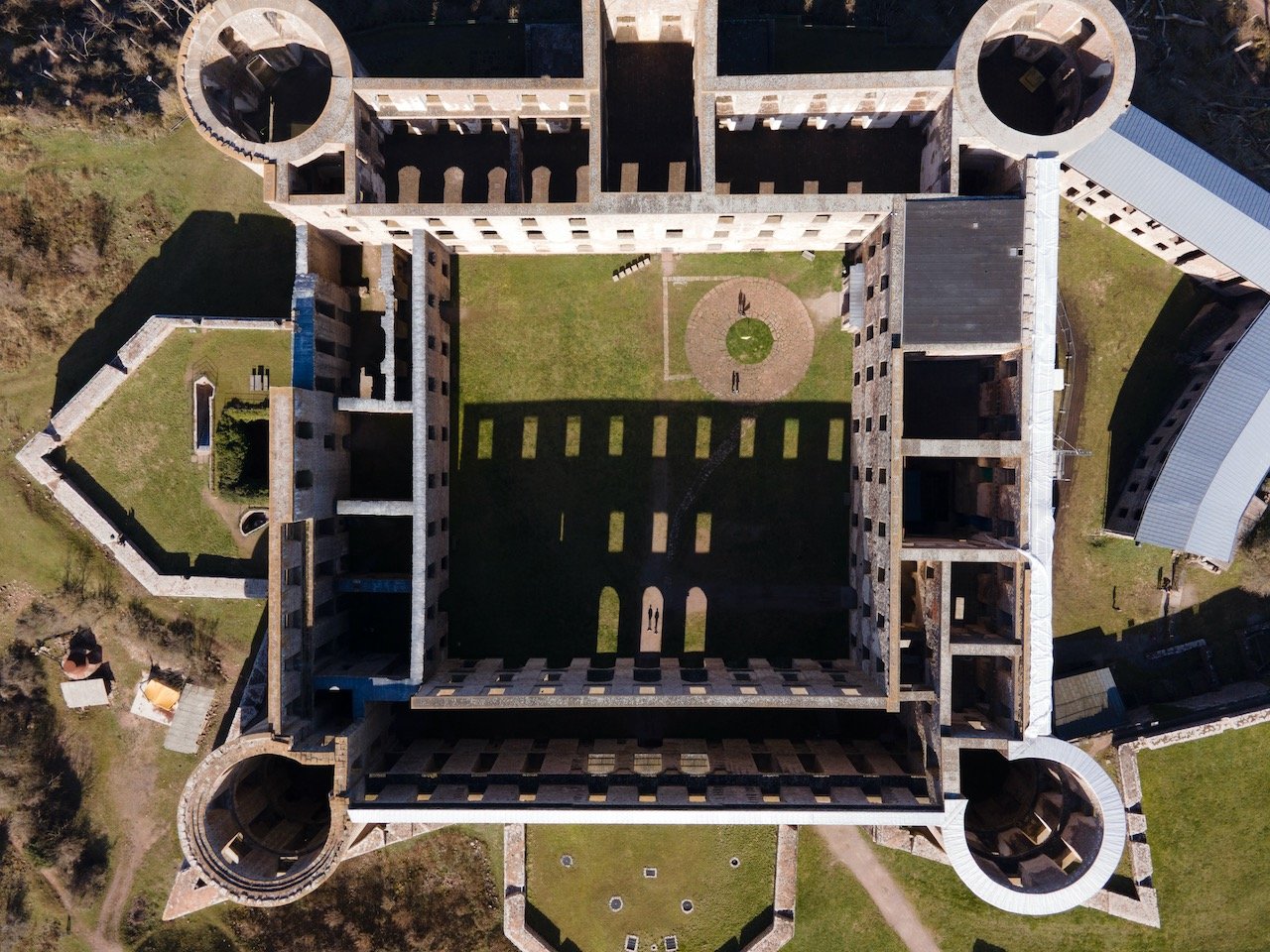
Borgholm Fortress, Öland, Sweden (ISO 100, 4.5 mm, f/2.8, 1/30 s)
(Some links in this post are affiliate links. If you click through and take action, I'll be compensated.) If you are also interested in any PRINTS from any of my posts, be sure to check out my store where you can buy prints as posters, in metal/wooden frames or on canvas.
When I moved to Sweden, I had known about a few of its cities like Stockholm, Gothenburg, and Uppsala but I never heard much about other places, let alone some popular Swedish islands. Gotland is perhaps the most popular island in Sweden as it is where Swedes go during the warm winter months for holiday.
It wasn’t until my visit to the small Swedish city of Kalmar, that I had first heard about the island of Öland, which lies right next to the city, accessible by a bridge and is full of old relics of Sweden’s past. So you can rest assured that I took some time out to explore this island when visiting Kalmar.
As I alluded to before, the origins of Öland date back to around 8000 BC where early settlers were able to access the island (and present-day Kalmar) by using an ice bridge that formed across the Kalmar Strait. The island is full of Viking-age burial grounds and ring forts, all of which have yielded about 24,000 artifacts to date.
I’m such a sucker for incredibly old historical finds and combine that with my love for Sweden, and you have a perfect marriage, and a very excited CK to explore the island. Getting to Kalmar (and therefore Öland) is easy as it requires just a 4.5 hour SJ train from Stockholm with 1 change.
Check out my drone video on Öland, Sweden below!

If you’d like a bit more information about some of the other Swedish cities I have seen, check out my blog posts below:
Stockholm (Blog Post Title: Why Stockholm is the best Scandinavian capital)
Stockholm Tunnelbana (Blog Post Title: The World’s Longest Art Gallery - Riding on the Stockholm Tunnelbana)
Gothenburg (Göteborg) (Blog Post Title: A Tour of Gothenburg: Sweden's 2nd Largest City)
Uppsala (Blog Post: Uppsala: the hidden gem just North of Stockholm)
Helsingborg (Blog Post: Just a few reasons to see Helsingborg in the South of Sweden)
Malmö (Blog Post: Take a weekend break in Malmö, Sweden)
Lund (Blog Post: A Day tour of the university town of Lund)
Kalmar (Blog Post: Kalmar: The town you should know more about in Sweden)
Marstrand (Blog Post: A day trip to the Swedish island of Marstrand)
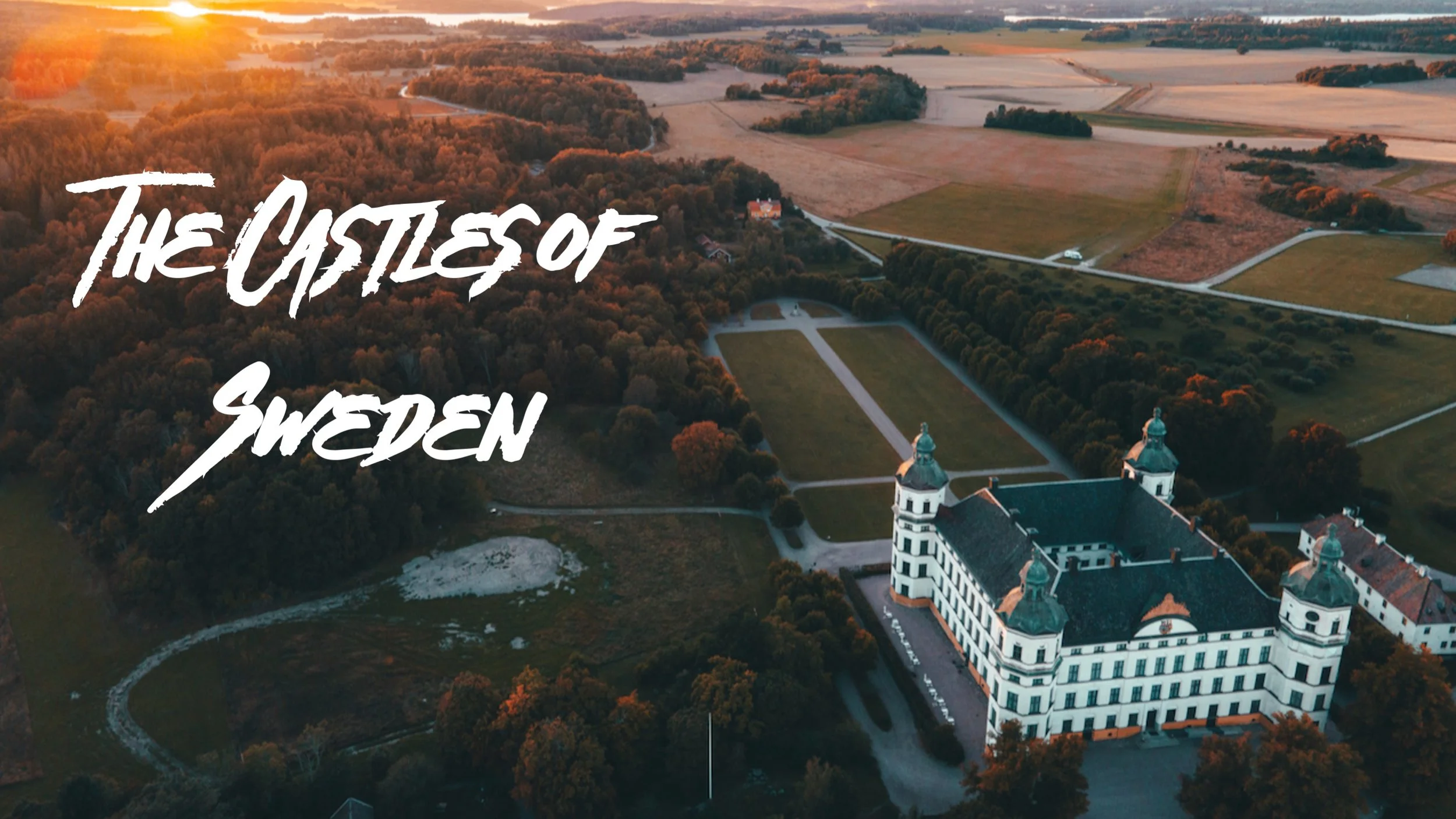
Swedish Castles (Blog Post: A Tour of Sweden’s Coolest Castles)
Fårö (Blog Post: A Guide to the Swedish Island of Fårö)
Visby (Blog Post: A Closer Look at the Hanseatic Town of Visby)
Gotland (Blog Post: A Guide to the Swedish Island of Gotland)

What I will discuss in this post is a highlight of the sites I saw during my trip and is in no way a comprehensive guide to all the great places to explore on the island.
We managed to see Öland for a (very long) day but to properly see it, I would recommend taking a long weekend to explore all of it at your own pace. Nonetheless, it was nearly 300 km of driving all in one day. Our journey started northwards upon crossing over from Kalmar towards the city of Borgholm.
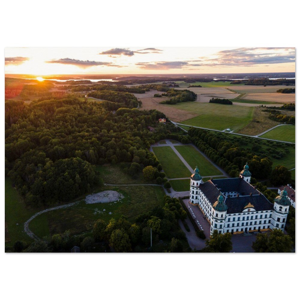
Just outside that city lies a few awesome sites such as Sollidens Slott and Borgholms Slott (‘Slott’ in Swedish means ‘Castle’).
Solliden’s Slott is only accessible in the summer time but is a pristine white structure that looks less like a castle and more like a countryside manor. Nonetheless, it has nice elegant gardens around it and is nestled onto the hillside.
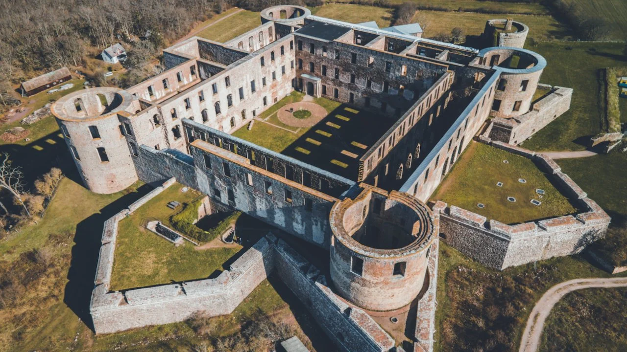
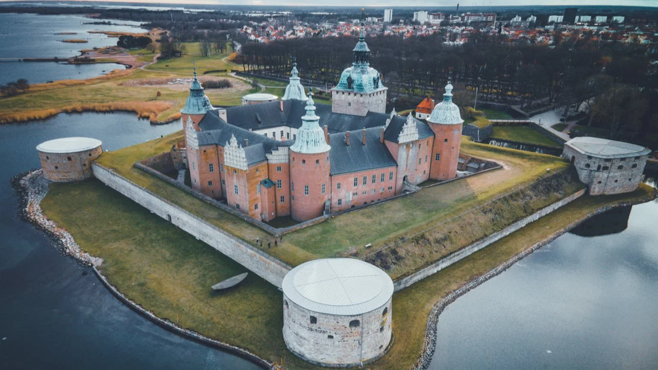
Borgholms Slott is much larger. It also has no roof, so keep that in mind if it is raining. The museum inside the castle is extremely informative and you can more or less explore every single crevice of the place. There are relics that have been found on display there as well. I used this opportunity to see the entirely of the castle through the eyes of my drone and I was not disappointed.
If you like some of my photos that you have come across, just know that I have many prints showcasing a variety of landscapes, including Sweden, available for purchase below! (Sold as Posters, Canvas, or in Metal-Frames and Wooden-Frames).


Köpingsvik Beach Pier, Öland, Sweden (ISO 100, 4.5 mm, f/2.8, 1/40 s)
From here, we drove up to the Northern tip of Öland to see the lighthouse Långe Erik. There are other stops along the way, such as the beach and pier at Köpingsvik. The sand was extremely fine and the water made me feel like I was on a Caribbean island, instead of Sweden. At the end of the pier is a Bryggen Bar, which was sadly closed when we visited. I imagine this around would be quite popular in the summer time but it was worth stopping at!
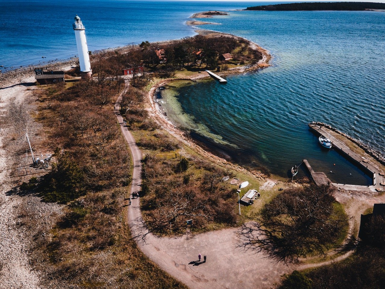
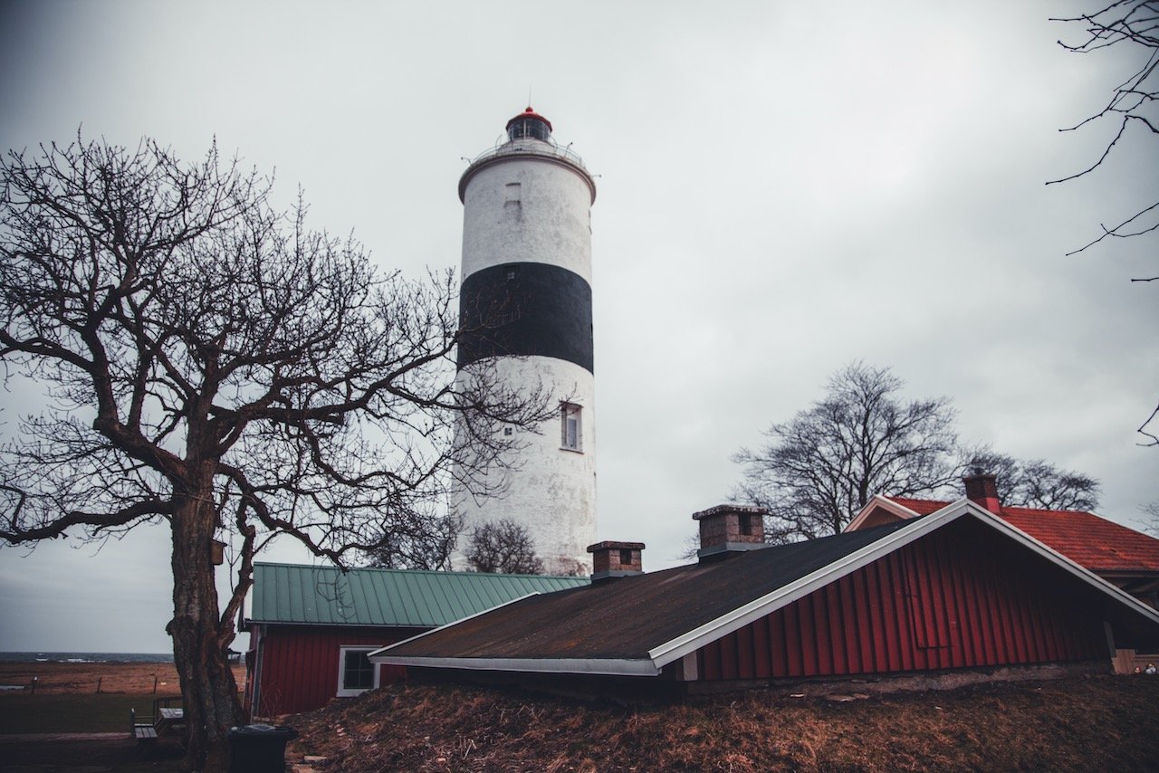
Långe Erik, Öland, Sweden (ISO 100, 4.5 mm, f/2.8, 1/25 s)
The Långe Erik Lighthouse is extremely well-maintained, situated on a little island accessible by a bridge at the top of Öland, and is accompanied by a rocky beach and small dock area, which was popular for picnics when we went. There are a few support buildings around which are no longer in use. But the lighthouse today, built in 1845, remains home to simple aerobeacon, which operates without the need for an operator. You can access the lighthouse interior in the warm summer months.

Lerkaka, Öland, Sweden (ISO 100, 58 mm, f/4, 1/1600 s)
At this point, you will probably notice the massive amount of windmills on the island and will want to stop off for a photo. I would recommend waiting to do this until you reach the small village of Lerkaka, where there is a row of them, waiting for any photographic opportunity to be had. These windmills are position across the road from a number of wind turbines, that are more modern of course. I found this juxtaposition to be rather comical and fitting. After all, the island also tends to be extremely windy.
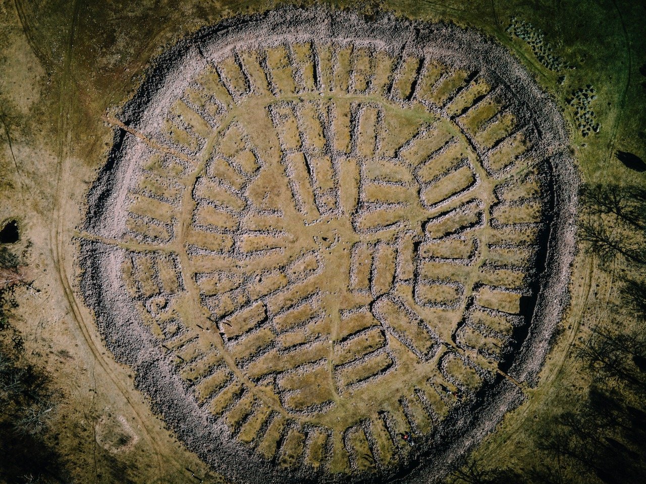
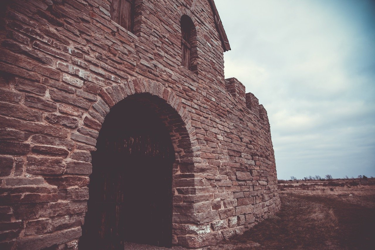
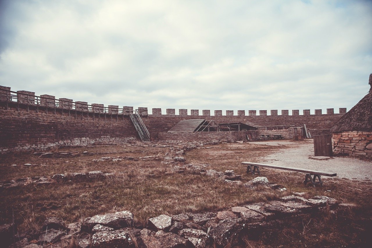
Ismantorp Fortress, Öland, Sweden (ISO 100, 4.5 mm, f/2.8, 1/25 s)
Just nearby is Ismantorp Fortress, the remnant of a giant circular fortification, outlined by piles and piles of stones. From ground level, this fort is a maze of rocky ledges and plush grasses that meander about inside the walls, but from above…quite a different view. The approximate year of its construction is believed to be around 200 CE, while it was abandoned around 650 CE. Twelve blocks containing 95 houses are estimated to have been built in the ringfort, considered to be the oldest on the island.

Träby Borg, Öland, Sweden (ISO 170, 4.5 mm, f/2.8, 1/15 s)
We had a very difficult time trying to find Träby Borg but managed to get there. The weather has turned for the worse at this time and the wind really started to pick up. It is also hard to find something when its really just ruins that you are looking for. The best way to see this fort is from above, where you can see an outline of what the stones once help up, not populated by fallen trees and colorful mosses. Though not my favorite place in Öland from this trip, I enjoyed how isolated it was and meandering around the grounds alone.
A spectacular contrast to this happens to be a bit further south at Eketorps Borg. Upon first glance, you would think that this fortress had never been attacked and is in the most pristine condition imaginable, however, you will find that this fort is merely a reconstruction of what archaeologists imagined it to look like. So it is a modern day twist based on historical features. In this sense, it is a welcoming sight considering most of what the island holds are stacks of rocks from derelict ruins.
Långe Jan, Öland, Sweden (ISO 100, 24 mm, f/4, 1/320 s)
The other lighthouse, Långe Jan, sits on the southern end of Öland. I must say, after seeing both, I do prefer Långe Erik more. But nonetheless is the tallest lighthouse in Sweden, and is decades older than Långe Erik. It was constructed in 1785, thought to be by Russian prisoners of war. The greater site as a whole is home to a birding station.

Öland, Sweden (ISO 100, 4.5 mm, f/2.8, 1/20 s)
Mysinge hög is a bronze age tomb, a large burial mound about 1 kilometer across just north of the village of the same name. The tomb chambers were excavated and found to contain many dated relics as well as skeletal remains.
The Gettlinge grave field is best known for its Viking stone ship burial ground. The stones used to make the grave are granite and the entire area is a UNESCO World Heritage Site.
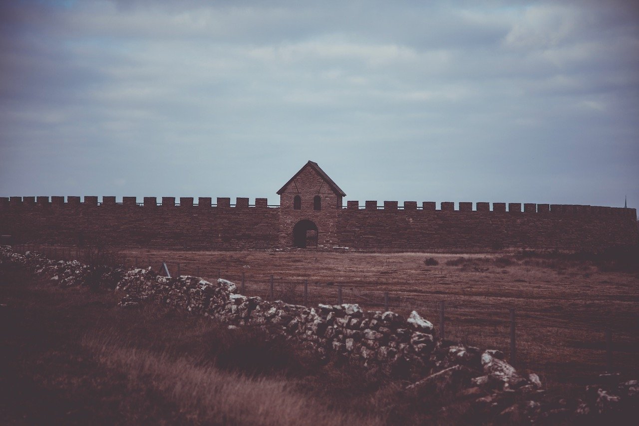
Karl X Gustavs mur is a wall in Southern Öland, dedicated to the heir to the throne at the time. While aesthetically pleasing to look at, its only purpose was to confine the local deer for royal hunts.
If you take some time to see Öland and you haven’t seen Kalmar yet, you should make the effort. Kalmar isn’t the largest city in Sweden, by far, but it really has a lot of nice sites while still being quite compact.
There is an abundance of nature at places like Laboratorieholmen and Svinö, historical sites like Kalmar Castle, museums like Kalmar Konstmuseum, an old town square at Gamla Torget, cultural monuments at Klapphuset and Tripp Trapp Trull, just to name a few.