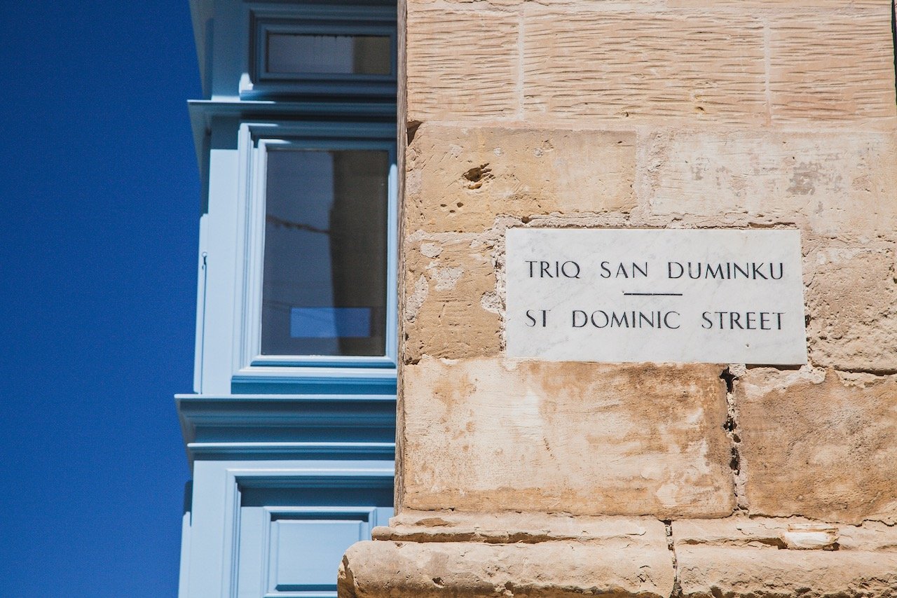
A Tour through Valletta, the Capital City of Malta

Fort Manoel, Valletta, Malta (ISO 100, 4.5 mm, f/2.8, 1/25 s)
(Some links in this post are affiliate links. If you click through and take action, I'll be compensated.) If you are also interested in any PRINTS from any of my posts, be sure to check out my store where you can buy prints as posters, in metal/wooden frames or on canvas.
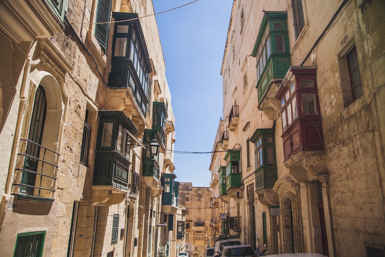
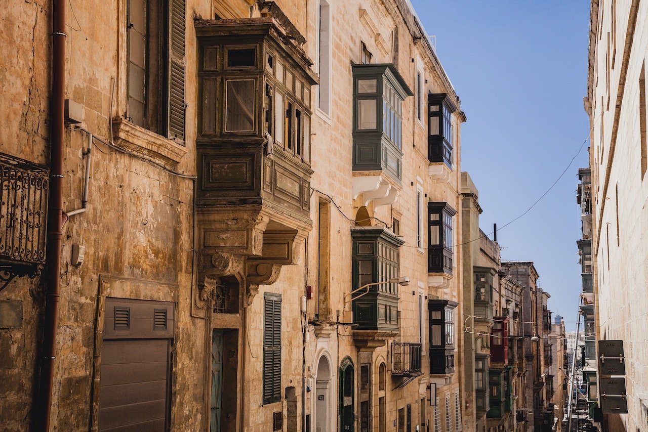
Valletta is the capital city of Malta, and where the highest concentration of Maltese live. It is the southernmost capital of Europe and is the EU’s smallest capital city. Due to Malta’s strategic location in the Mediterranean Sea, it has often been the site of sieges and battles from warring factions.
Given the influences of such a plethora of cultures, the architecture of Valletta is a mixture of Baroque, Mannerist, Neo-Classical, and Modern Architecture. As a result, the city was awarded UNESCO World Heritage status in 1980.
I stayed here in Valletta during my entire stay and used it as a launching off point during my trip. In fact, I found the public transportation system that encompasses Malta, originating from Valletta to be reliable, cheap, and very convenient.
You can see all my Malta related blog posts below:
Valletta (A Tour through Valletta, the Capital City of Malta)
Mdina (A Guide to the City of Mdina in Malta)
The Island of Malta (A trip to the archipelago of Malta: The Main Island)
The Island of Gozo (A trip to the archipelago of Malta: The Island of Gozo)
The Island of Comino (A trip to the archipelago of Malta: The Island of Comino)
Summary (A Guide to Malta: Valletta, Mdina, Gozo, Comino, and Malta)
Check out my drone video of Malta below!

How to get to Valletta
Since Malta is an island, the most convenient way to get there is via Malta International Airport (Airport Code: MLA), the only airport in the country. Flights arriving here originate from all over the Mediterranean.
Once you have landed, you are only 9 km away from Valletta. From the airport you can take a:
Taxi - Will run you about 30 Euros. Can also use a rideshare such as Uber or Bolt (download the apps before you arrive).
Bus - You can take the X4 bus between Valletta and the Airport. The ticket costs 2 Euros. The airport stop is called ‘Birzebbuga’ (X4 Bus Timetable here).
Shuttle Bus - Usually booked through your hotel or accommodation, and costs from 6 Euros and higher. You can use MaltaTransfer to book this.
Rental Car - The most flexible way to get around Malta, but perhaps not necessary given how accessible the bus network is.
If you find yourself in Italy and want to take a trip to Malta, there are a number of ferry companies with different origins that take you right to Valletta. These origins and ferry companies are:
Civitavecchia (80 km north of Rome) - Grimaldi Ferries
Pozzallo (Sicily) - Virtu Ferries
Genoa/Livorno (Northern Italy) - Viamare
Palermo (Sicily) - Grandi Navi Veloci
Here are some of the best places to check out while in Valletta:
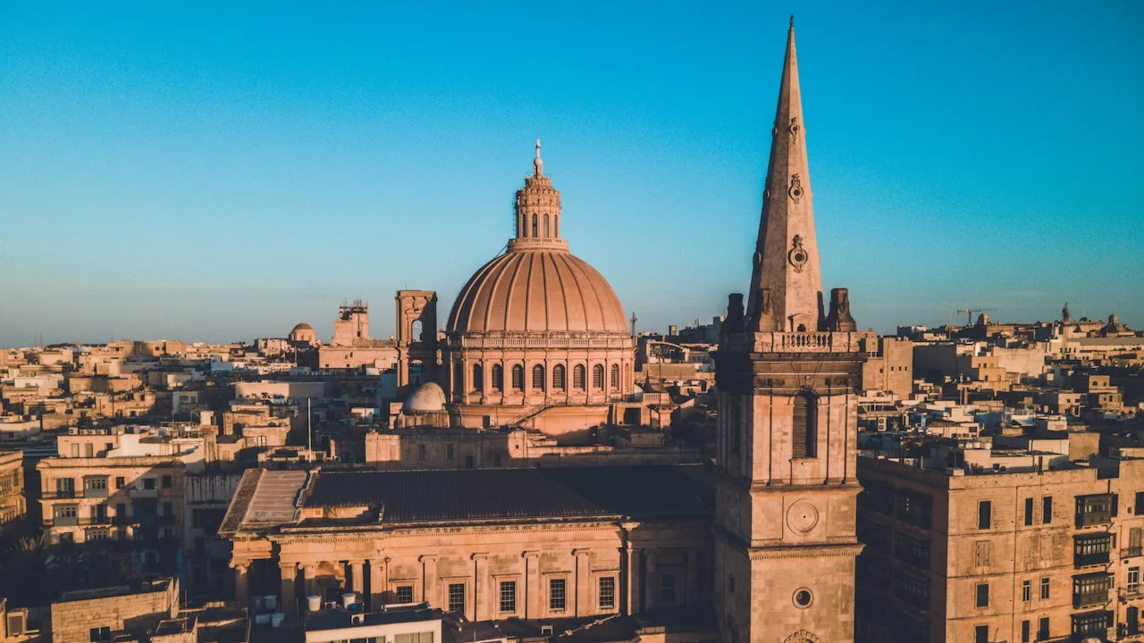
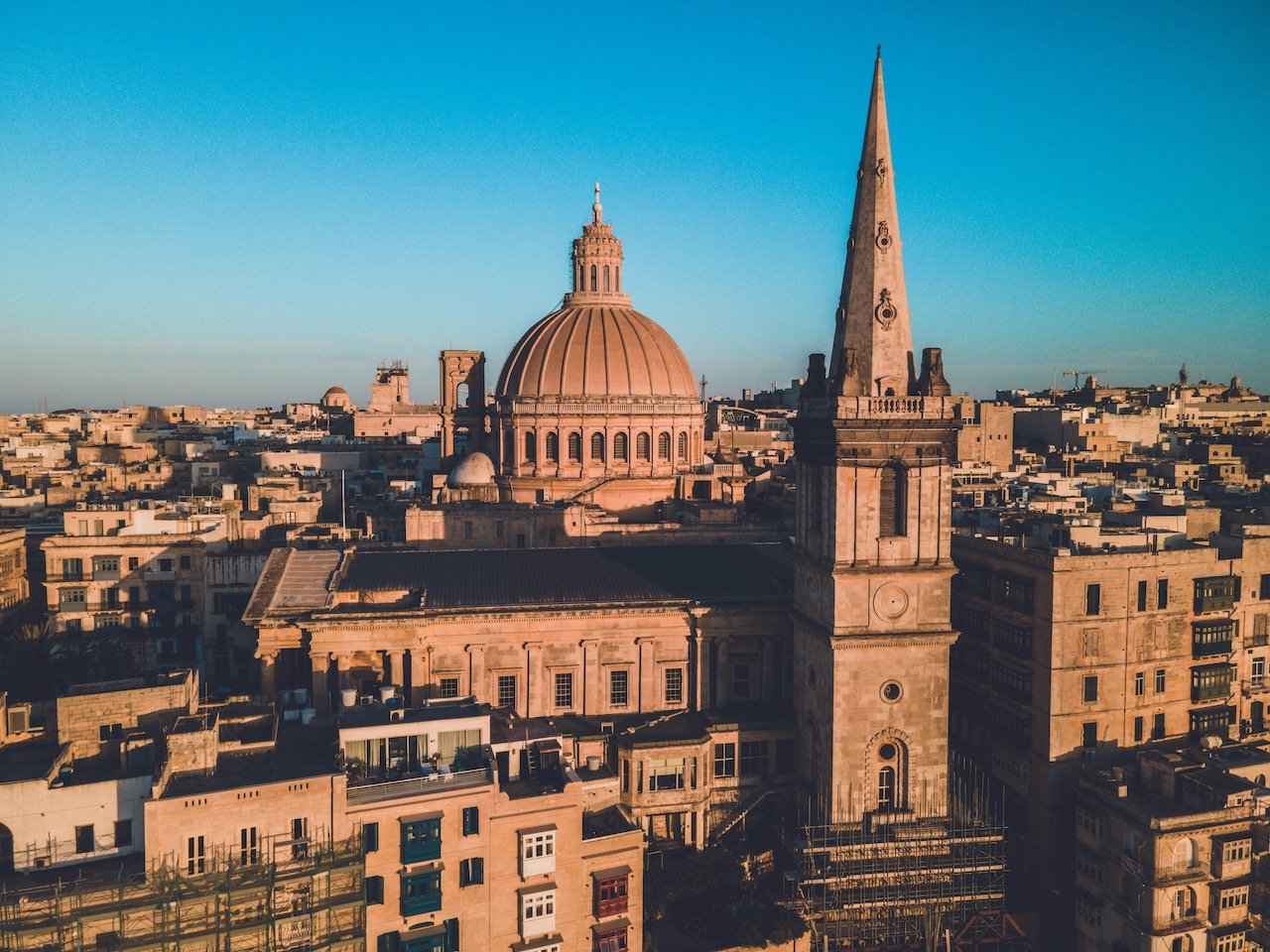
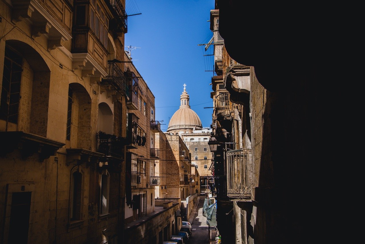
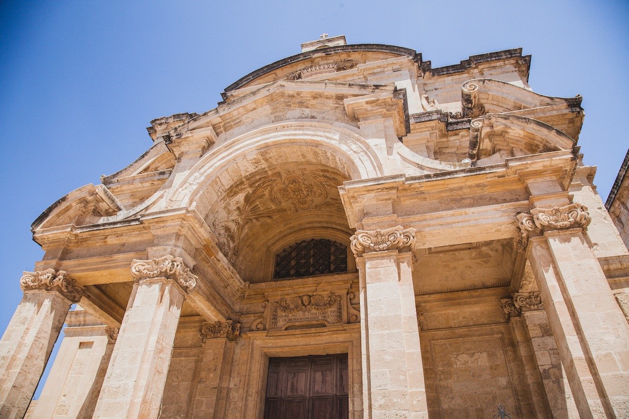
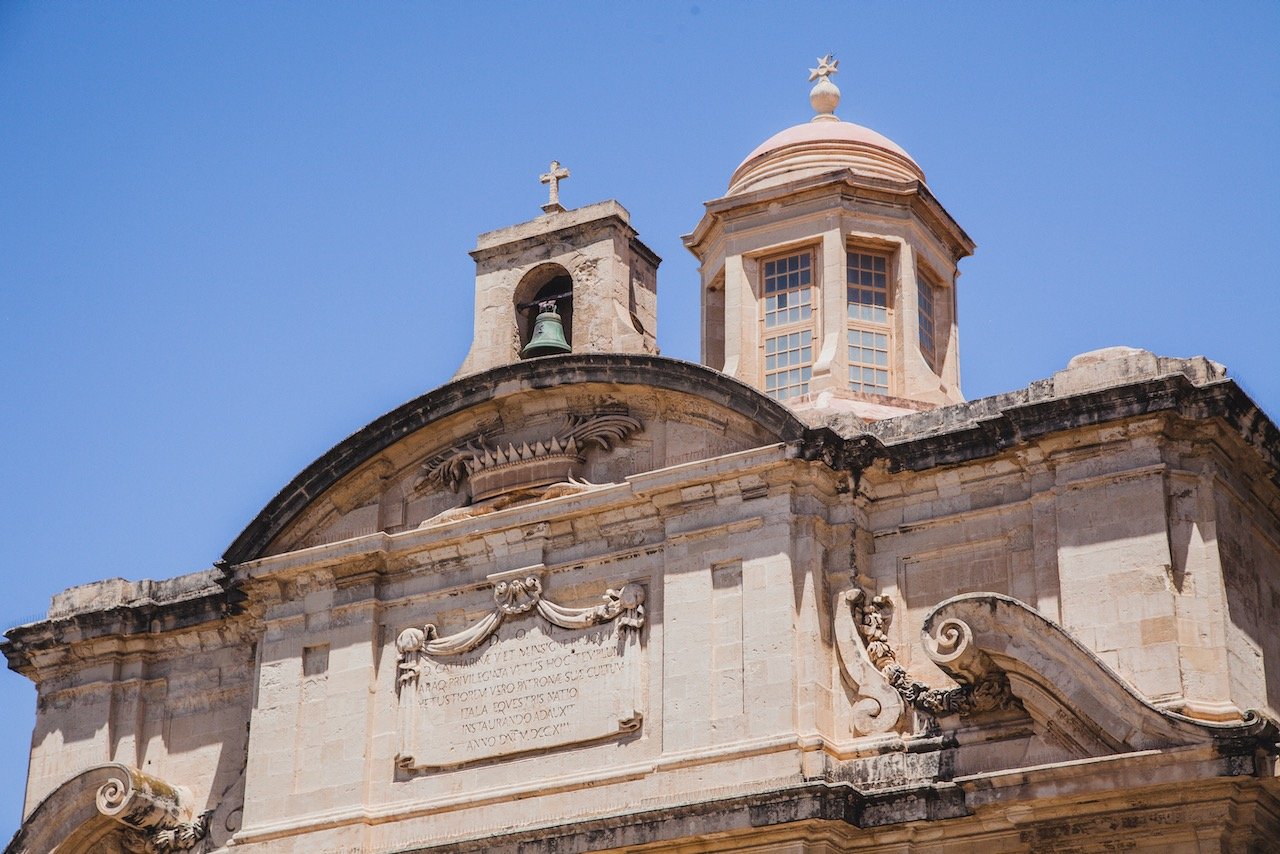
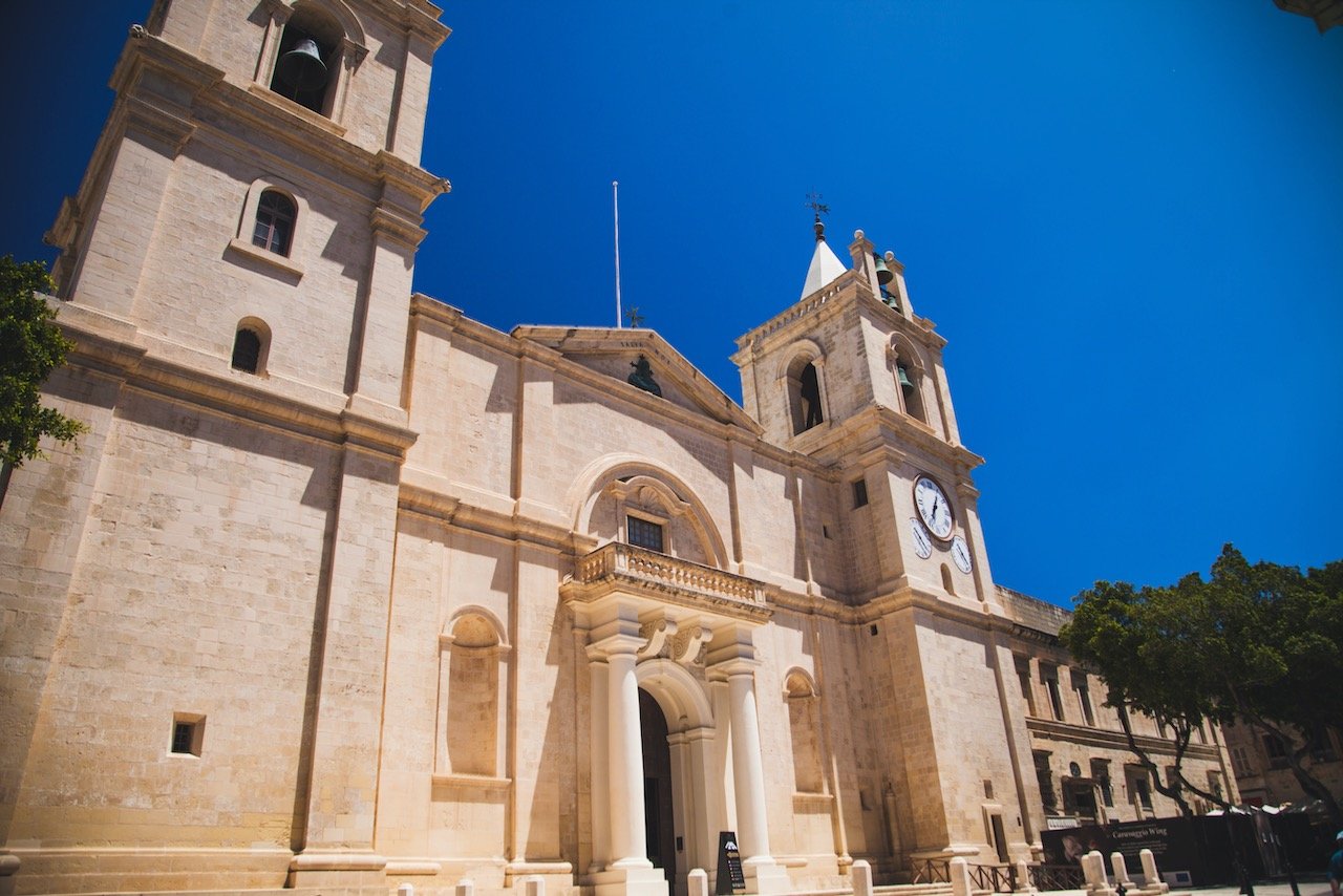
St. Paul’s Cathedral
As the EU’s smallest capital city, Valletta is most recognized by the spire and dome of St. Paul’s Cathedral. This cathedral sits in Independence Square and is a ‘Pro-cathedral’, meaning that it has cathedral status without officially being a cathedral. It was commissioned in the 19th century since there was no official Anglican place of worship on Malta at that time. It was completed in 1844 and is a landmark of Valletta and Malta as a whole.
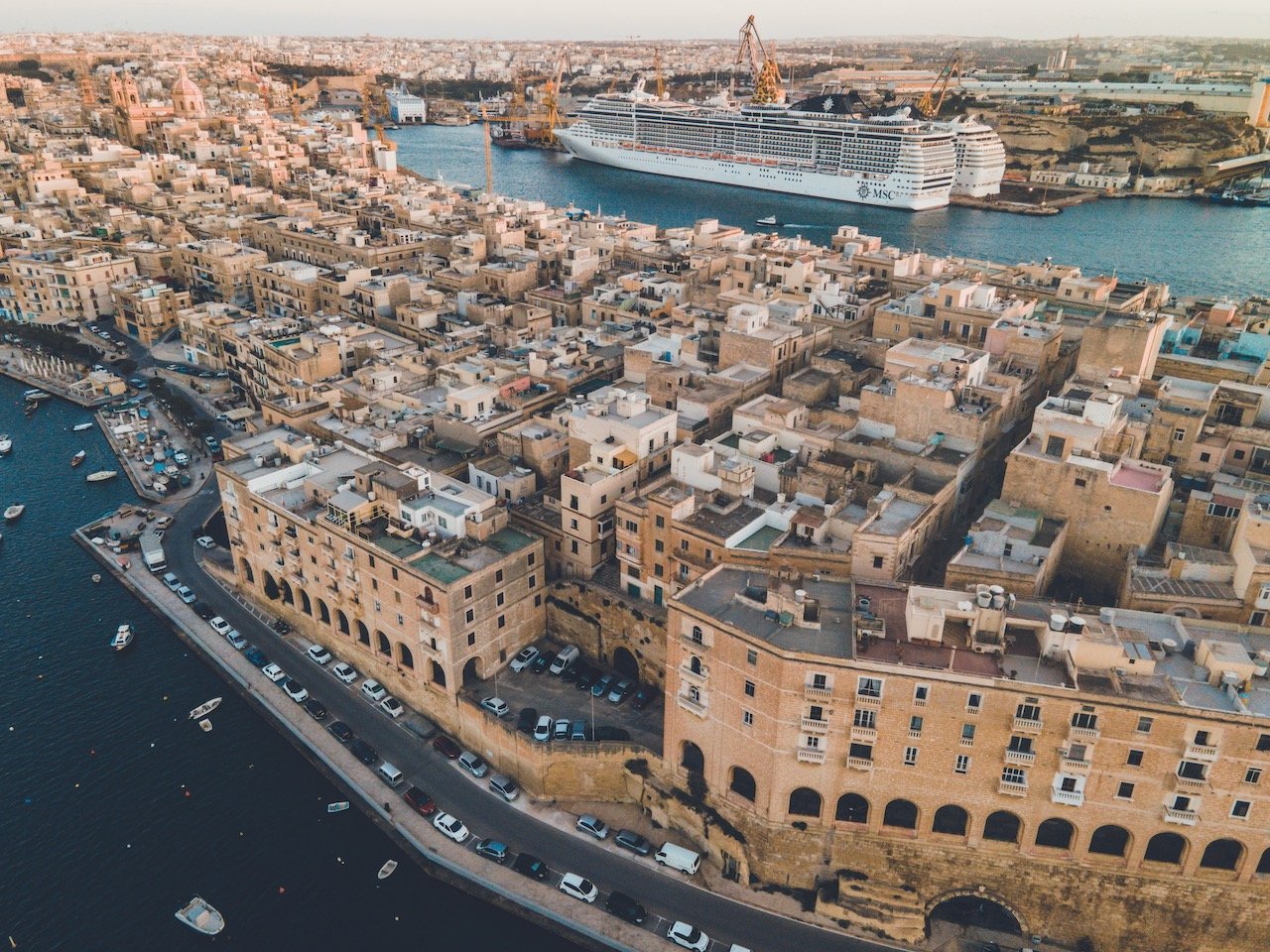
Marsamxett and Grand Harbors
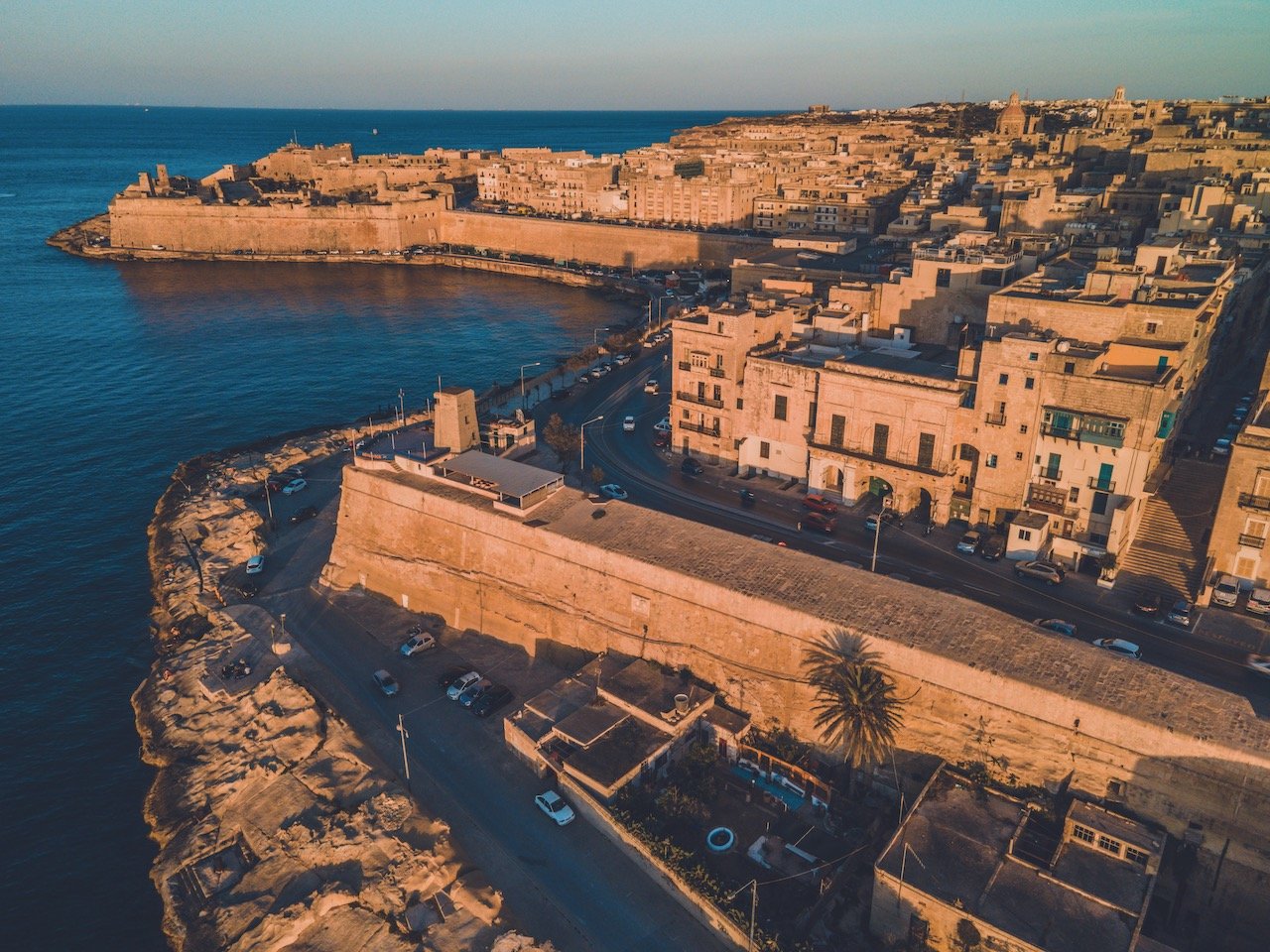
The waterways flanking the peninsular part of Valletta are the Grand Harbor and Marsamxett Harbor, situated just south and north of the landmass, respectively. Each harbor boats an impressive array of ships and historical landmarks.
You can get great views of both these harbors just by walking along the Valletta city walls, however the views OF Valletta from across these harbors are just as good. You must take a boat or a ferry or walk at least 1 hour for that.
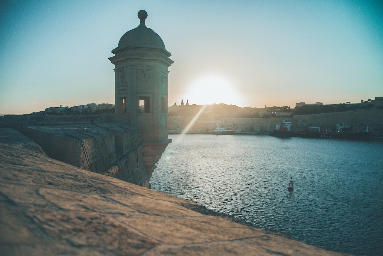
Gardjola Gardens
One day I wanted to catch the sunset over Valletta from the Southeast, so I took a bus to the peninsula of Senglea and went to the Gardjola Gardens during golden hour, which was just fantastic. From here I got a great view of the walls of Valletta and a close up of Fort St. Angelo, on the nearby peninsula of Birgu.
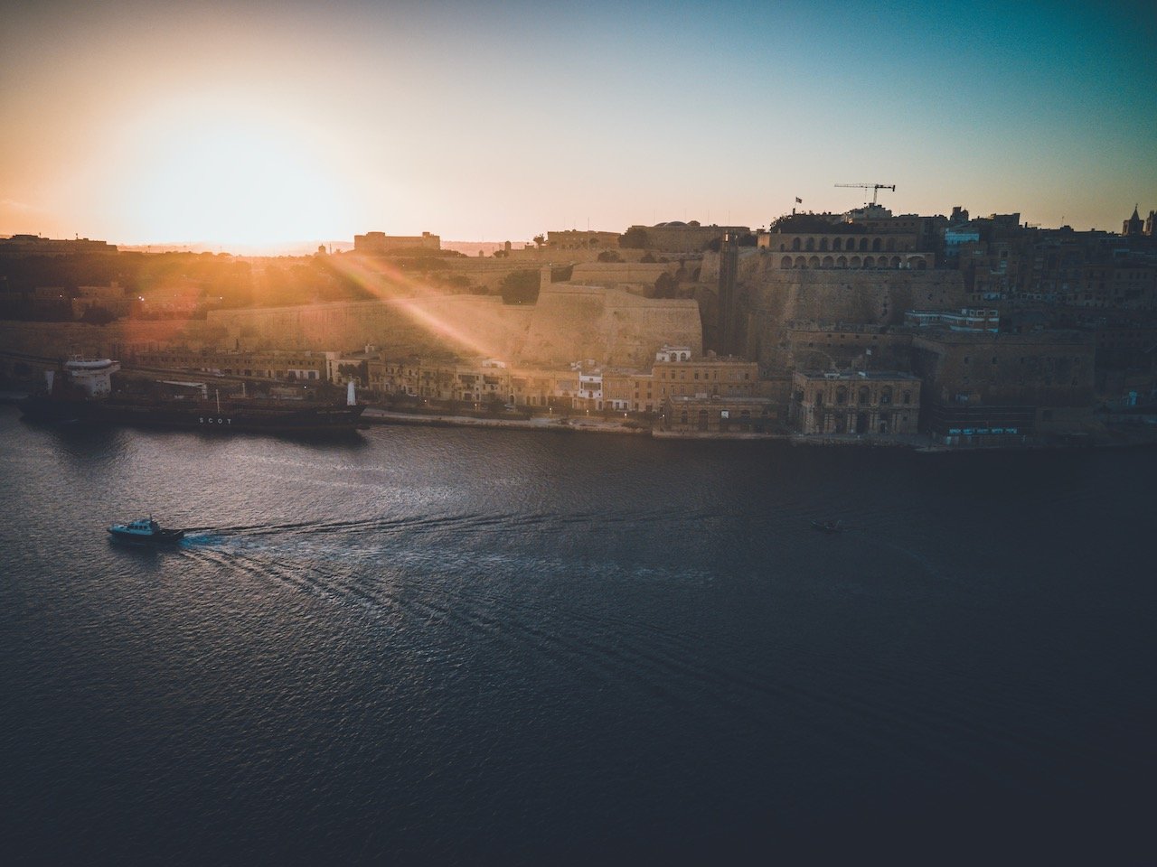
Fort St. Angelo
Fort St. Angelo was originally built as a castle during the medieval period, called Castrum Maris. It served as a crucial headquarters during the Great Siege of Malta in 1565. It wasn’t until the 1690s where it underwent a major reconstruction to its current appearance.
The fort suffered considerable damage during World War II but was restored to its former glory. You can take a tour through the premises but perhaps the best time to see it is during sunset, where you can sit on the edge of the water, next to the fort and watch the sun disappear below Valletta’s walls.
Fort Ricasoli
One more peninsula over, you have Kalkara, which sits Fort Ricasoli, another bastioned fort built in the late 1600s. It is the largest fort in the entire country and was used during the invasion of Malta by the French in 1798. Parts of it were destroyed in WWII by aerial bombardment and it was decommissioned in the 1960s.Unfortunately, it lay in near ruin as plans to restore it have recently just been approved.

Fort St. Angelo, Valletta, Malta (ISO 210, 4.5 mm, f/2.8, 1/13 s)
Upper Barrakka Gardens
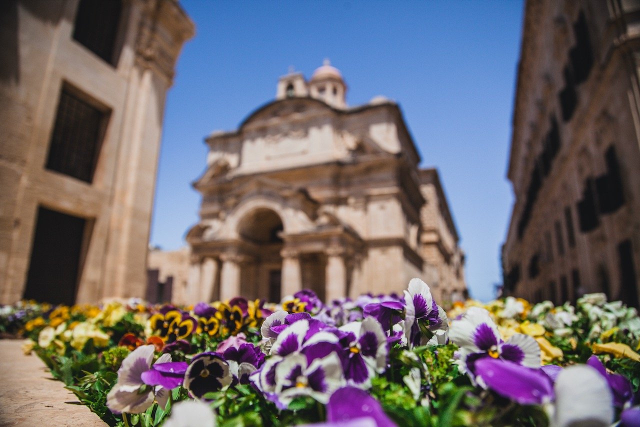
Of course if you wanted to view these landmarks from Valletta itself (the opposite direction), head on to the Upper Barrakka Gardens, which are elevated positions above the city facing the Southeast. They are located on the upper part of the St. Peter and Paul’s Bastion. The area includes many memorials and monuments to prominent historical figures with well manicured flower paths.

Fort Ricasoli, Valletta, Malta (ISO 100, 4.5 mm, f/2.8, 1/40 s)
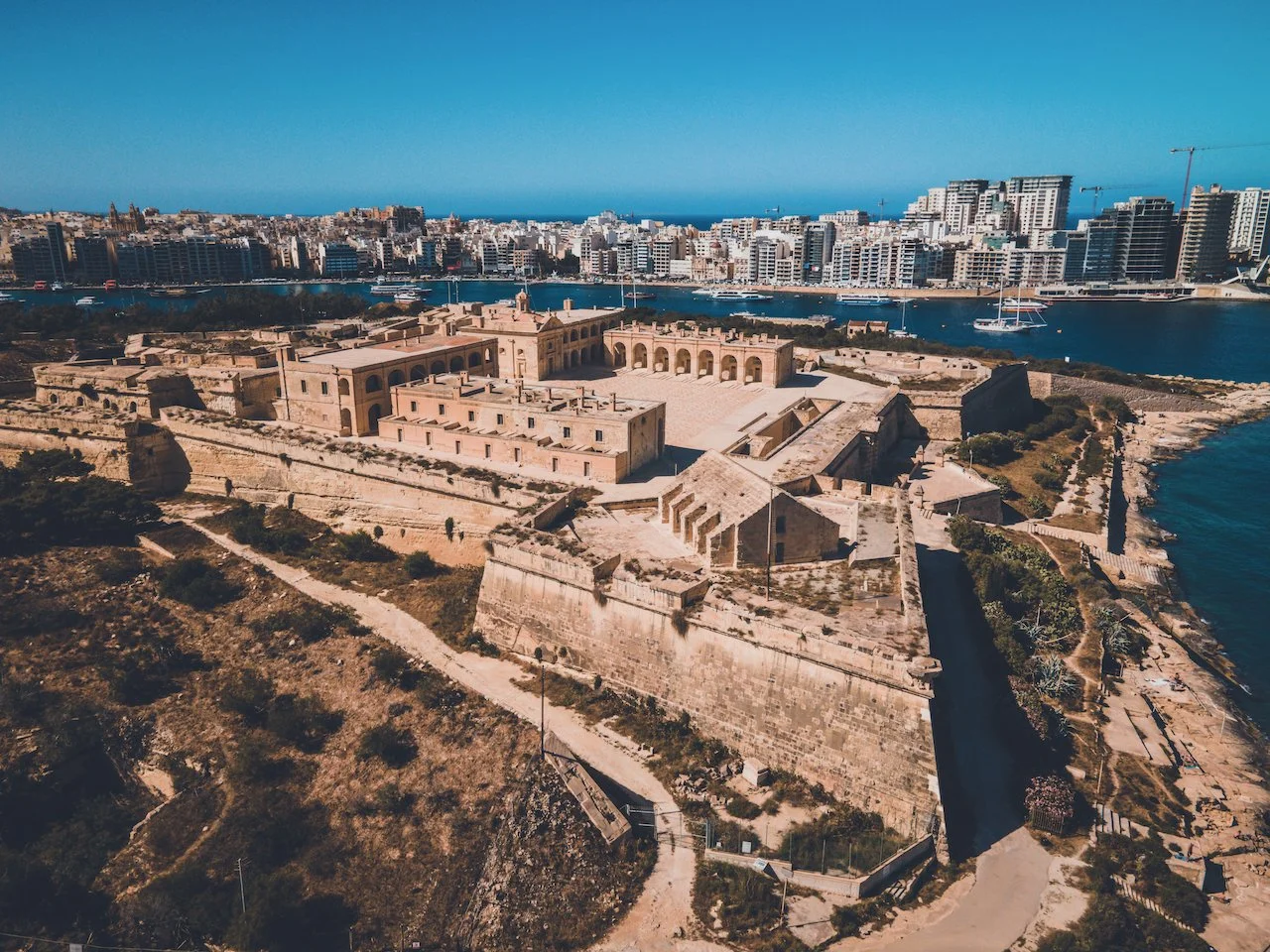
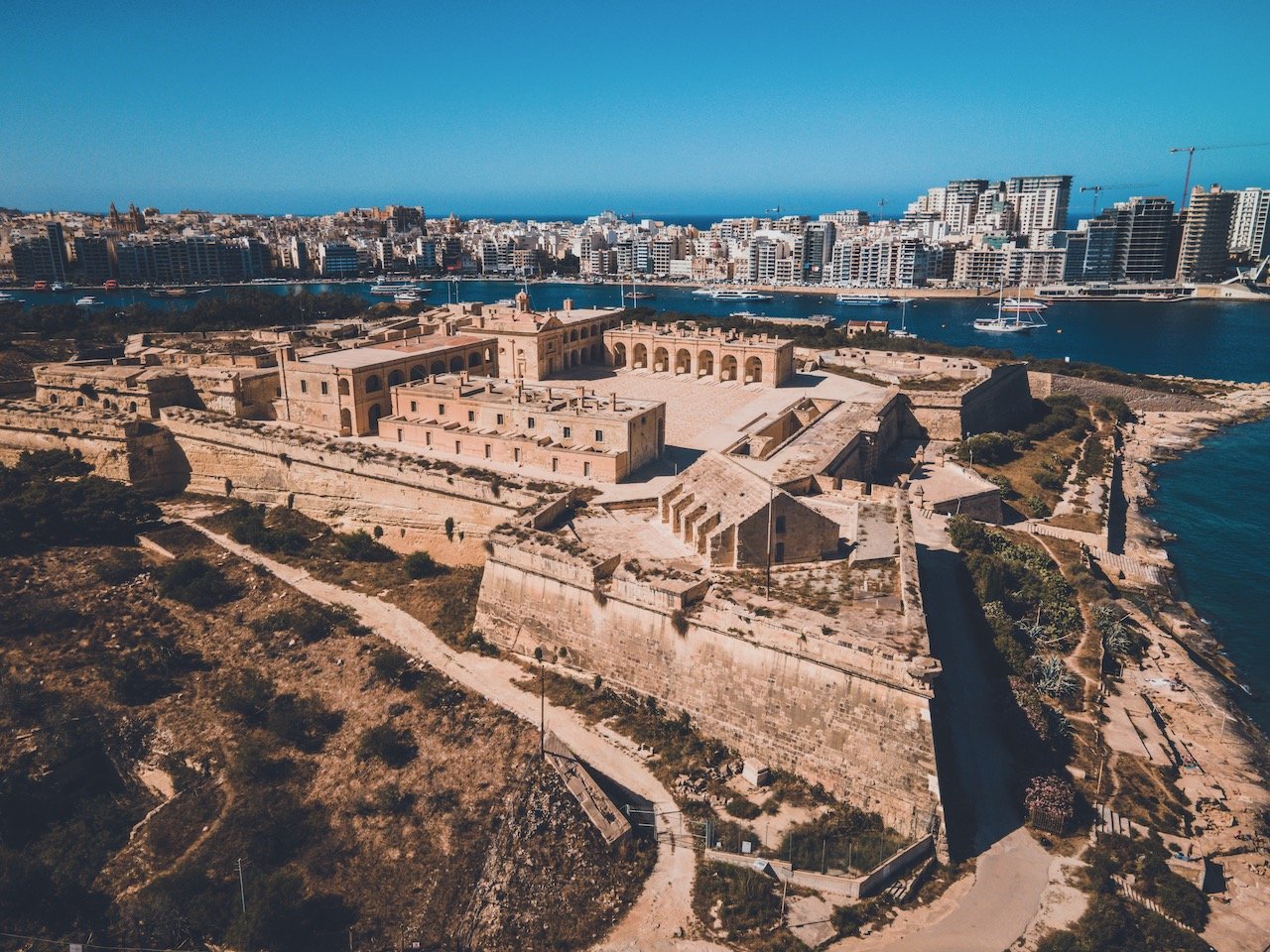
Fort Manoel
As previously stated, the Marsamxett Harbour is situated north of the Valletta walled peninsula and features Fort Manoel and the areas of Gzira and Silema, the latter of which you can take a ferry to. In fact, this ferry station is also the perfect place to see the sunset over Valletta (highly recommend).
Fort Manoel is a star fort built in the 18th century that sits on its own island and is accessible via Gzira. It is an example of Baroque architecture and was in use by the British from 1800 to 1964. Like Fort Angelo, it was also badly damaged during WWII but has since been restored.
Valletta, Malta (ISO 100, 4.5 mm, f/2.8, 1/8 s)
If you like some of my photos that you have come across, just know that I have many prints showcasing a variety of landscapes, including in Malta, available for purchase below! (Sold as Posters, Canvas, or in Metal-Frames and Wooden-Frames).


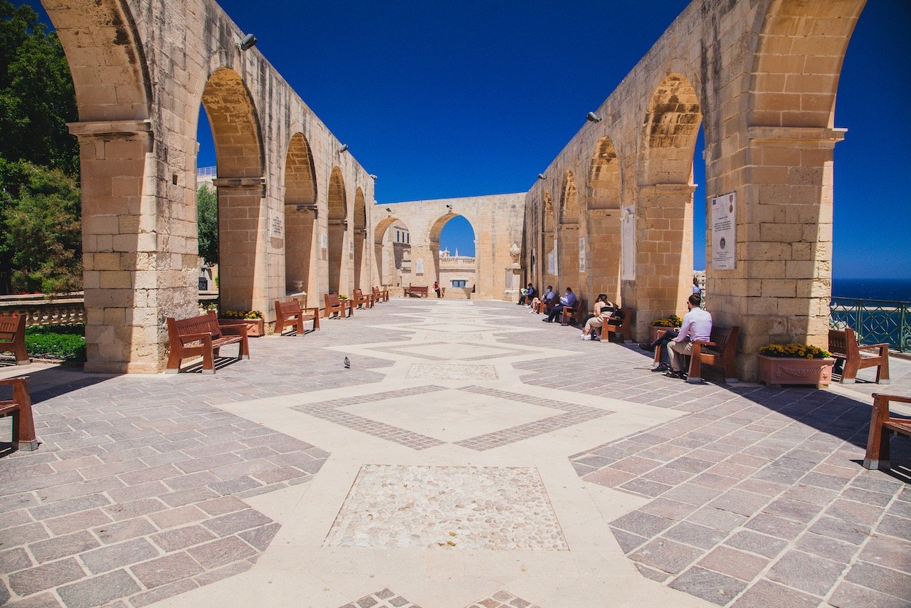
Upper Barrakka Gardens, Valletta, Malta (ISO 320, 24 mm, f/8, 1/320 s)
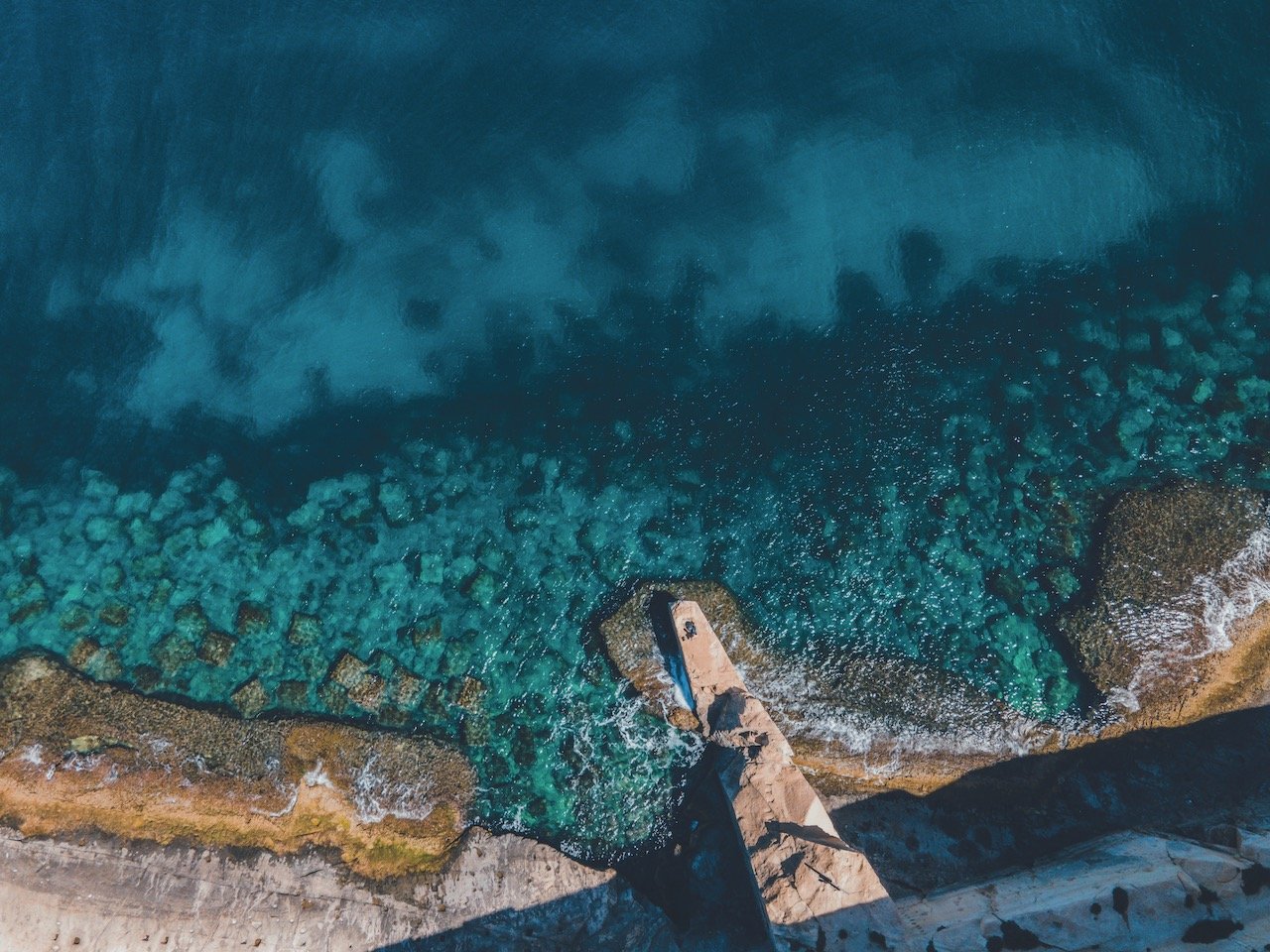
It was around 30C the day I arrived from a cold Sweden, so I wanted to take advantage of the warm and sunnier weather. After checking into my room, I walked the city walls and found many places to swim and small walkways leading around the peninsula.
Fort Manoel, Valletta, Malta (ISO 100, 4.5 mm, f/2.8, 1/25 s)
Ricasoli East and St. Elmo Breakwater
From this walk I was able to see the Ricasoli East Breakwater and St. Elmo Breakwater while taking a short break. These two structures possess lighthouses guiding ships into the entrance of the Grand Harbor (in addition to protecting the harbors from rougher seas). If they are open, you can walk their entire length and watch the boats go by. It is incredibly relaxing I promise you.
After you have explored a good amount of this capital city, there are plenty of options when it comes to exploring all the other parts of the country (including the islands of Gozo and Comino, which I will cover in other posts).
Your Valletta bus pass in this case will be your best asset in seeing the rest of the country with cheap and timely transport. You can pick up a Tallinja card which can be used on Malta’s bus network.
It is a very cost effective option as you can get unlimited bus rides for a week for 25 Euros. You can also get a single journey card which allows for 12 bus trips for 21 Euros. I did the latter.
Overall, I think seeing Valletta on your trip to Malta is a must. As a capital city, its importance cannot be overstated. It would also be a mistaken to not venture out of Valletta as well and to check out some of the other sights that the island has to offer.
If time also allows, taking a ferry to either Gozo or Comino is widely recommended and getting to either island cannot easier with your Tallinja Card.