A trip to the archipelago of Malta: The Main Island
Valletta, Malta (ISO 150, 4.5 mm, f/2.8, 1/15 s)
(Some links in this post are affiliate links. If you click through and take action, I'll be compensated.) If you are also interested in any PRINTS from any of my posts, be sure to check out my store where you can buy prints as posters, in metal/wooden frames or on canvas.
When I booked my trip to Malta, I really wasn’t sure what to expect. To be honest, I embarrassingly admit that I couldn’t exactly locate it on a map. I knew it was in the Mediterranean somewhere, just not exactly where. Now, I know that it is near the Italian island of Sicily. Now, I also know that its population is roughly half a million people, was a former British colony, has origins dating back to 5900 BC, and national language is indeed, Maltese.
Malta as a destination is the perfect combination of plentiful sunny beaches and lagoons, mixed with countless historical entities and gorgeous natural features. So it’s a great balance of adventure and relaxation.
The country is actually an archipelago, made up of three habited islands and several smaller ones. In order of largest to smallest, the islands are: Malta, Gozo, and Comino. The overwhelming majority of attractions are obviously on the main island of Malta, but missing out on Gozo and Comino would be a mistake!
I spent 6 days/5 nights in Malta on my trip, and spent three days on Malta, 1 in Gozo, and 1 in Comino, and I think it was just the perfect amount of time in each place. This post will focus on what you should consider seeing on the Main island of Malta. A Google Map of all the places I will talk about can be found at the end of this post.
You can check out my drone video of Malta below!

You can see all my Malta related blog posts below:
Valletta (A Tour through Valletta, the Capital City of Malta)
Mdina (A Guide to the City of Mdina in Malta)
The Island of Malta (A trip to the archipelago of Malta: The Main Island)
The Island of Gozo (A trip to the archipelago of Malta: The Island of Gozo)
The Island of Comino (A trip to the archipelago of Malta: The Island of Comino)
Summary (A Guide to Malta: Valletta, Mdina, Gozo, Comino, and Malta)
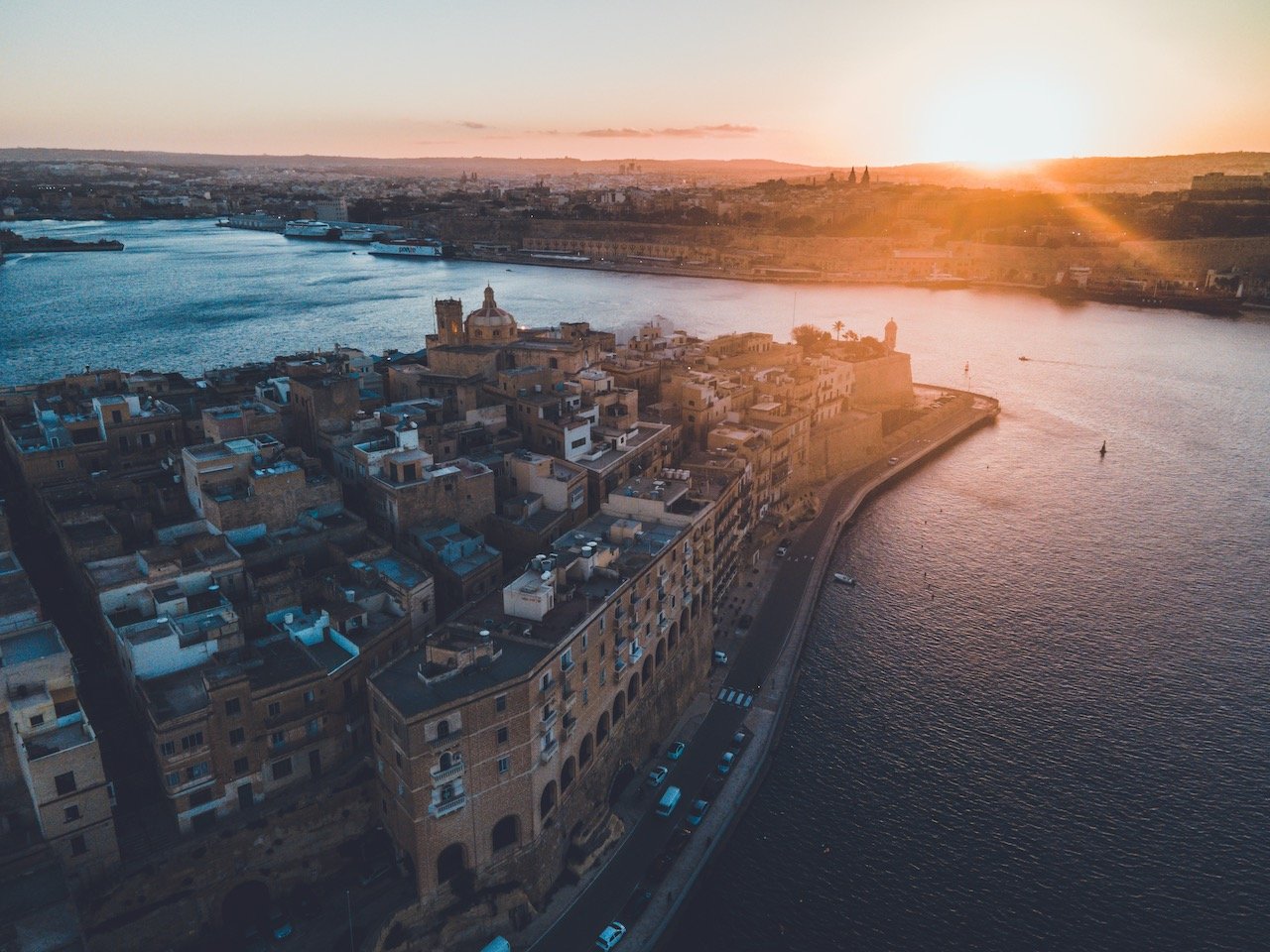
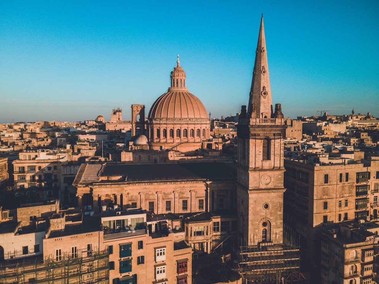
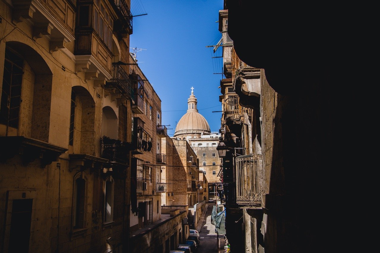
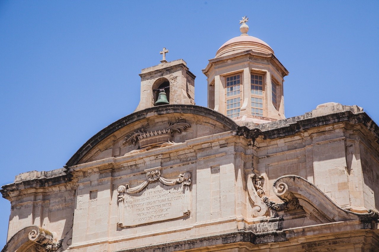
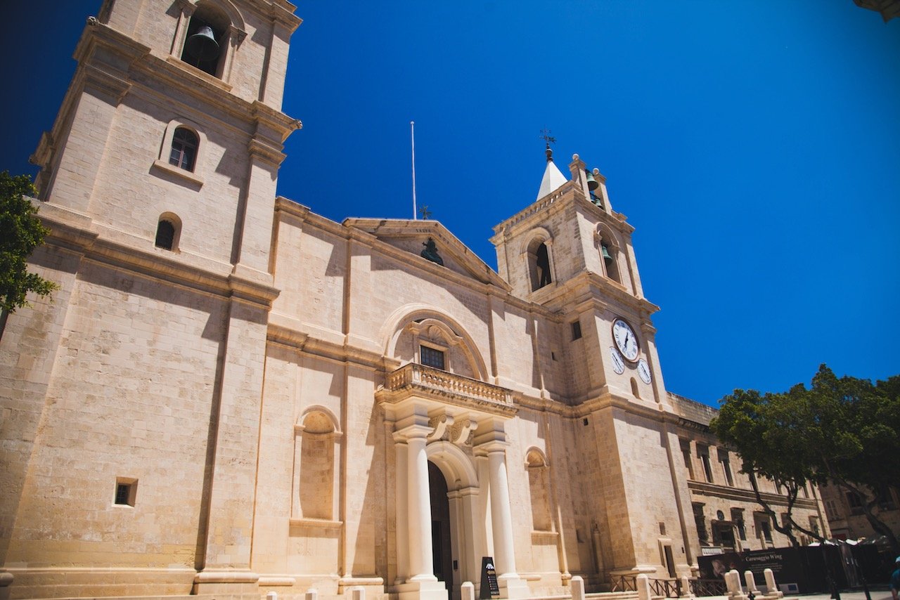
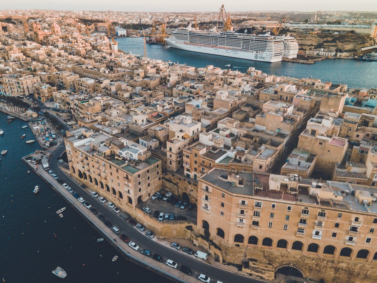
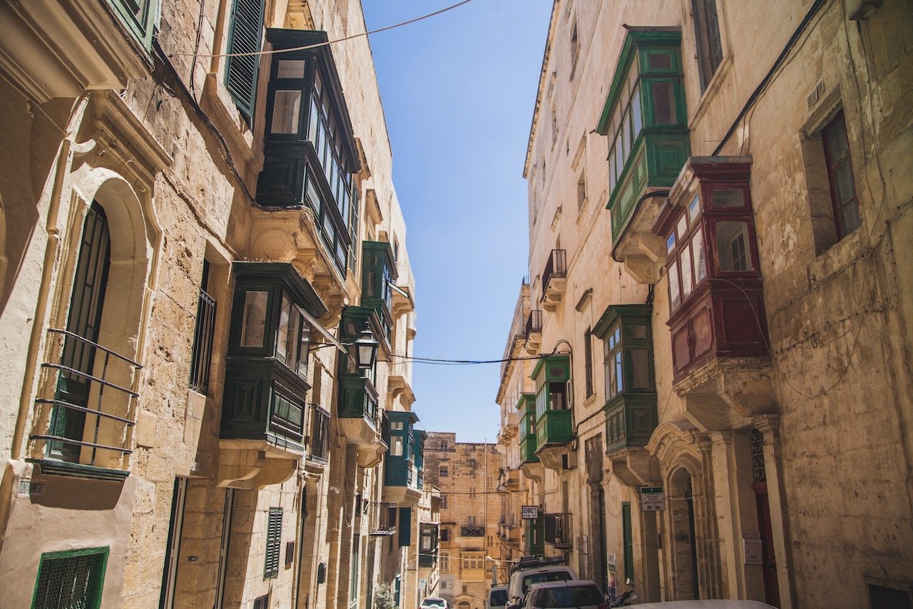
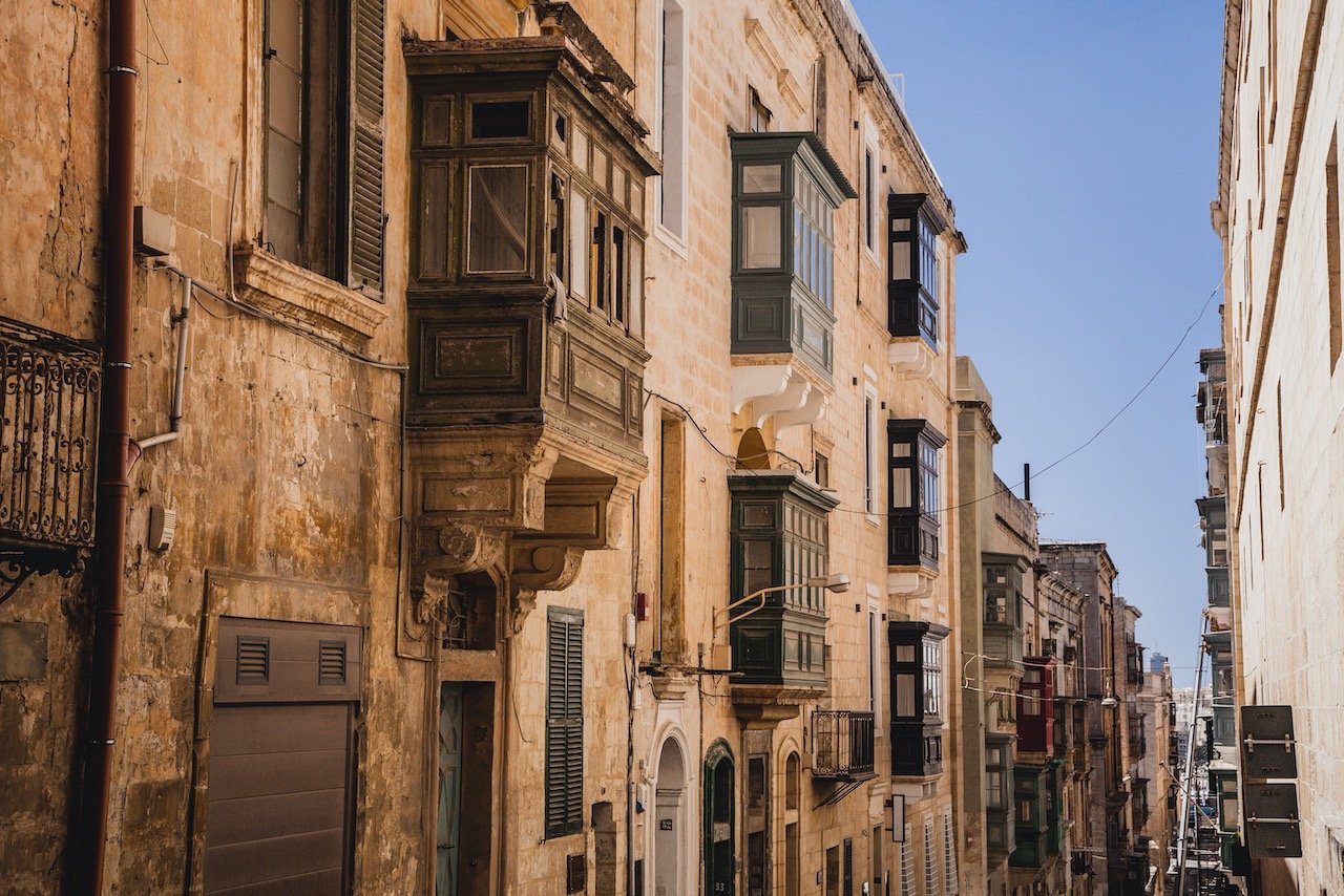
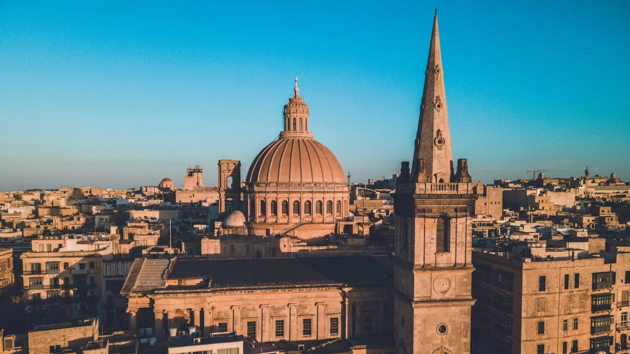
Valletta is the capital city of Malta, and where the highest concentration of Maltese live. I stayed here during my entire stay and used it as a launching off point during my trip. If I were to do it again, I would stay in Valletta and a day or two in Gozo as well just to experience more of that island. Nonetheless, the city is confined by a giant wall of stone with an array of small peninsulas and harbors replete with boats of all sizes. As the EU’s smallest capital city, Valletta is most recognized by the spire and dome of St. Paul’s Cathedral.
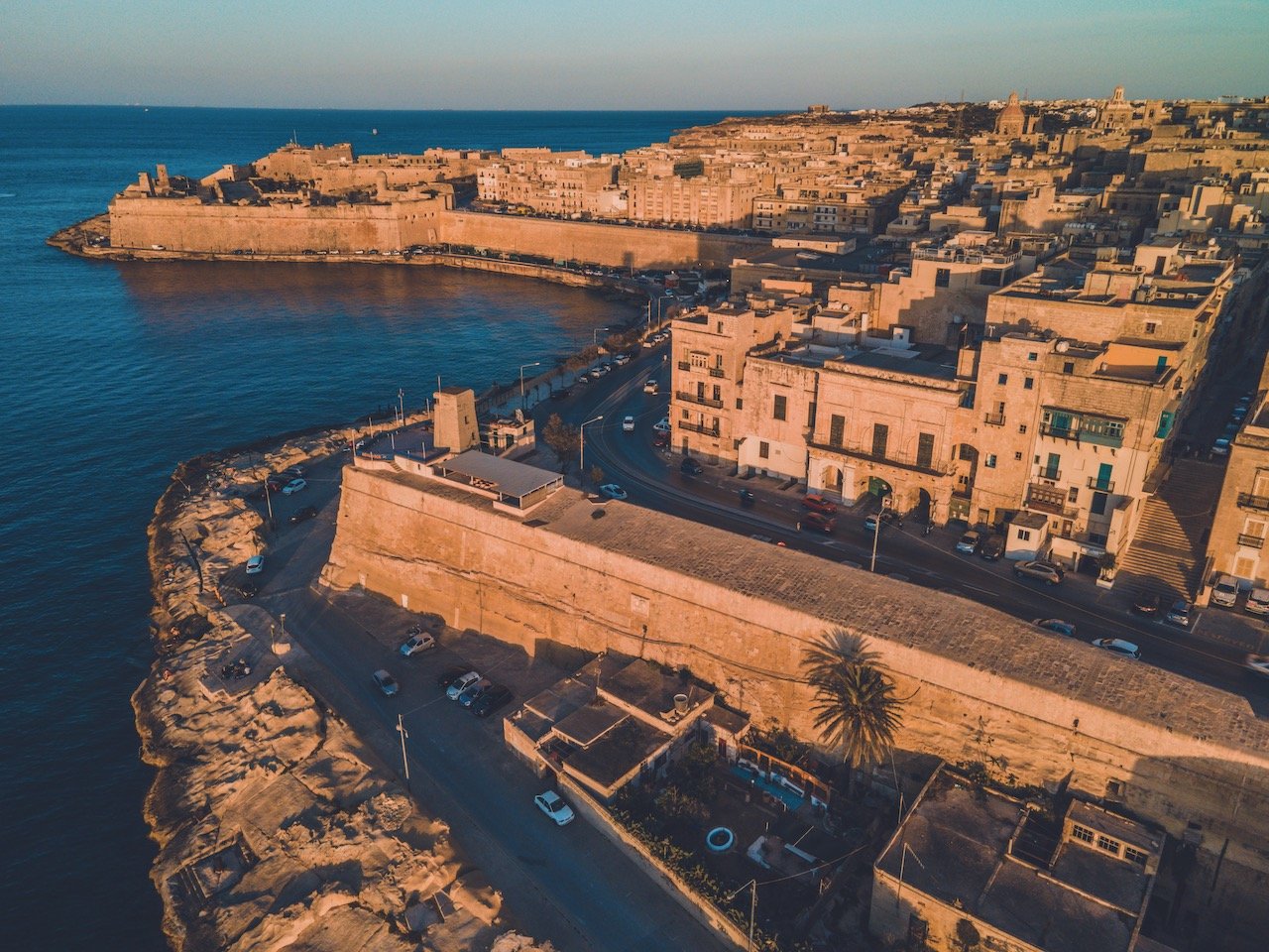
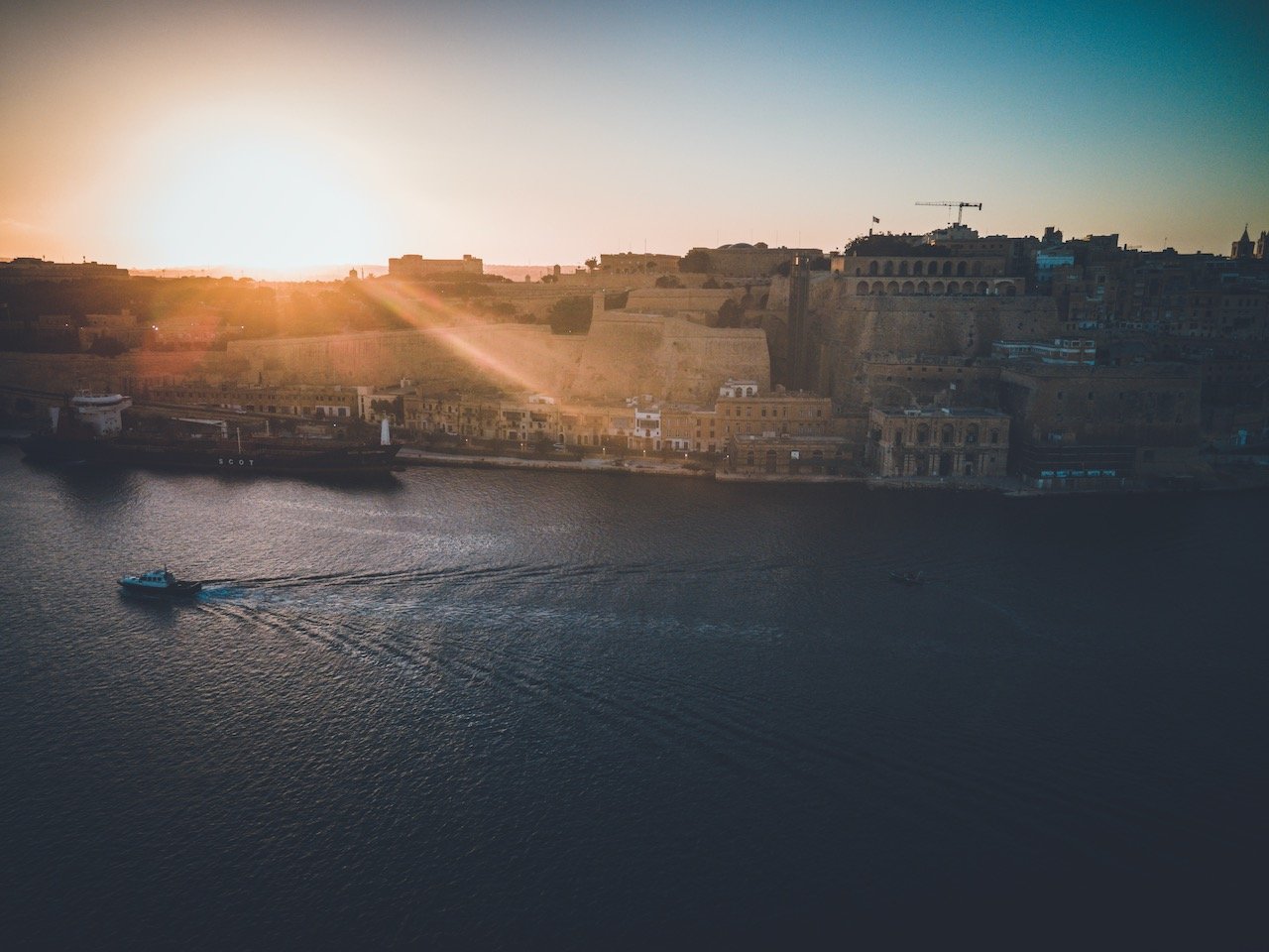
The waterways flanking the peninsular part of Valletta are the Grand Harbor and Marsamxett Harbor, situated just south and north of the landmass, respectively. Each harbor boats an impressive array of ships and historical landmarks. You can get great views of both these harbors just by walking along the Valletta city walls, however the views OF Valletta from across these harbors are just as good. You must take a boat or a ferry or walk at least 1 hour for that.
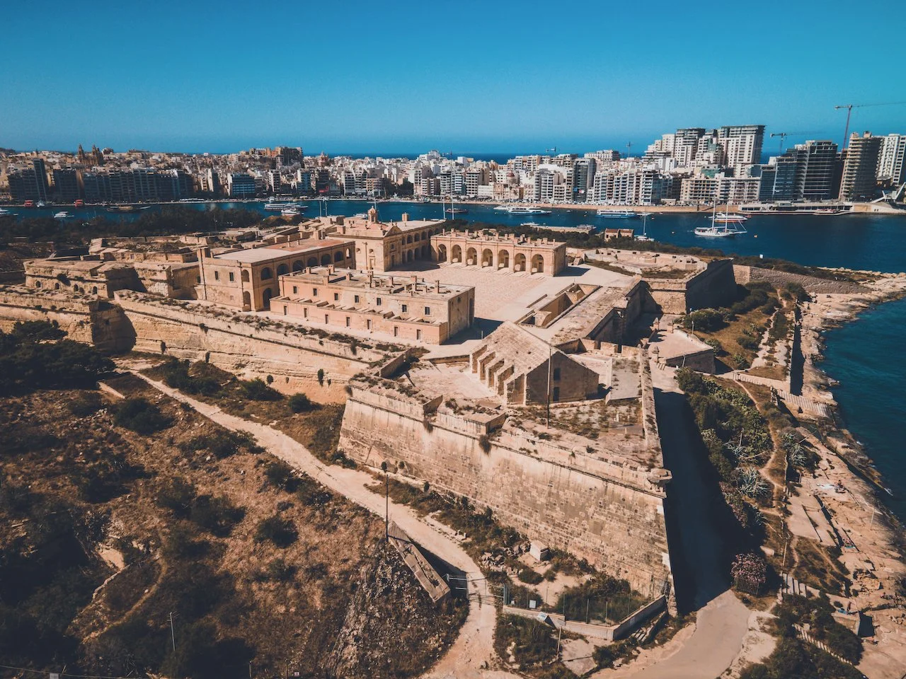
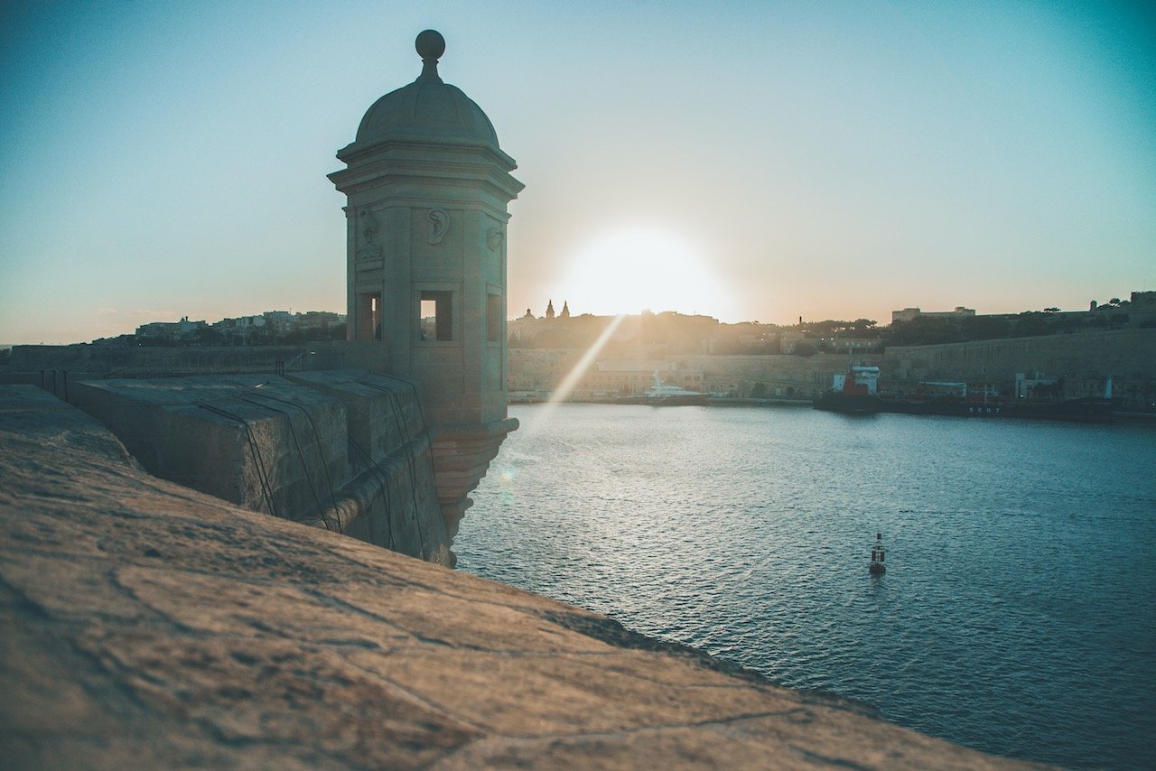
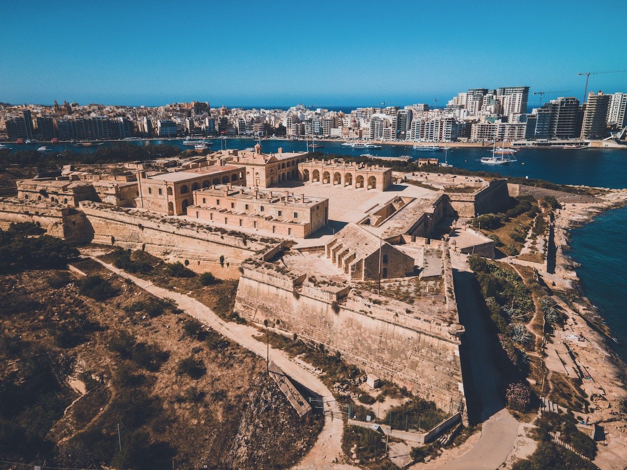
One day I wanted to catch the sunset over Valletta from the Southeast, so I took a bus to the peninsula of Senglea and went to the Gardjola Gardens during golden hour, which was just fantastic. From here I got a great view of the walls of Valletta and a close up of Fort St. Angelo, on the nearby peninsula of Birgu.
Fort St. Angelo was originally built as a castle during the medieval period, called Castrum Maris. The fort suffered considerable damage during World War II but was restored to its former glory. You can take a tour through the premises but perhaps the best time to see it is during sunset, where you can sit on the edge of the water, next to the fort and watch the sun disappear below Valletta’s walls.
One more peninsula over, you have Kalkara, which sits Fort Ricasoli, another bastioned fort built in the late 1600s. Unfortunately, it lay in near ruin as plans to restore it have recently just been approved.

Fort St. Angelo, Valletta, Malta (ISO 210, 4.5 mm, f/2.8, 1/13 s)
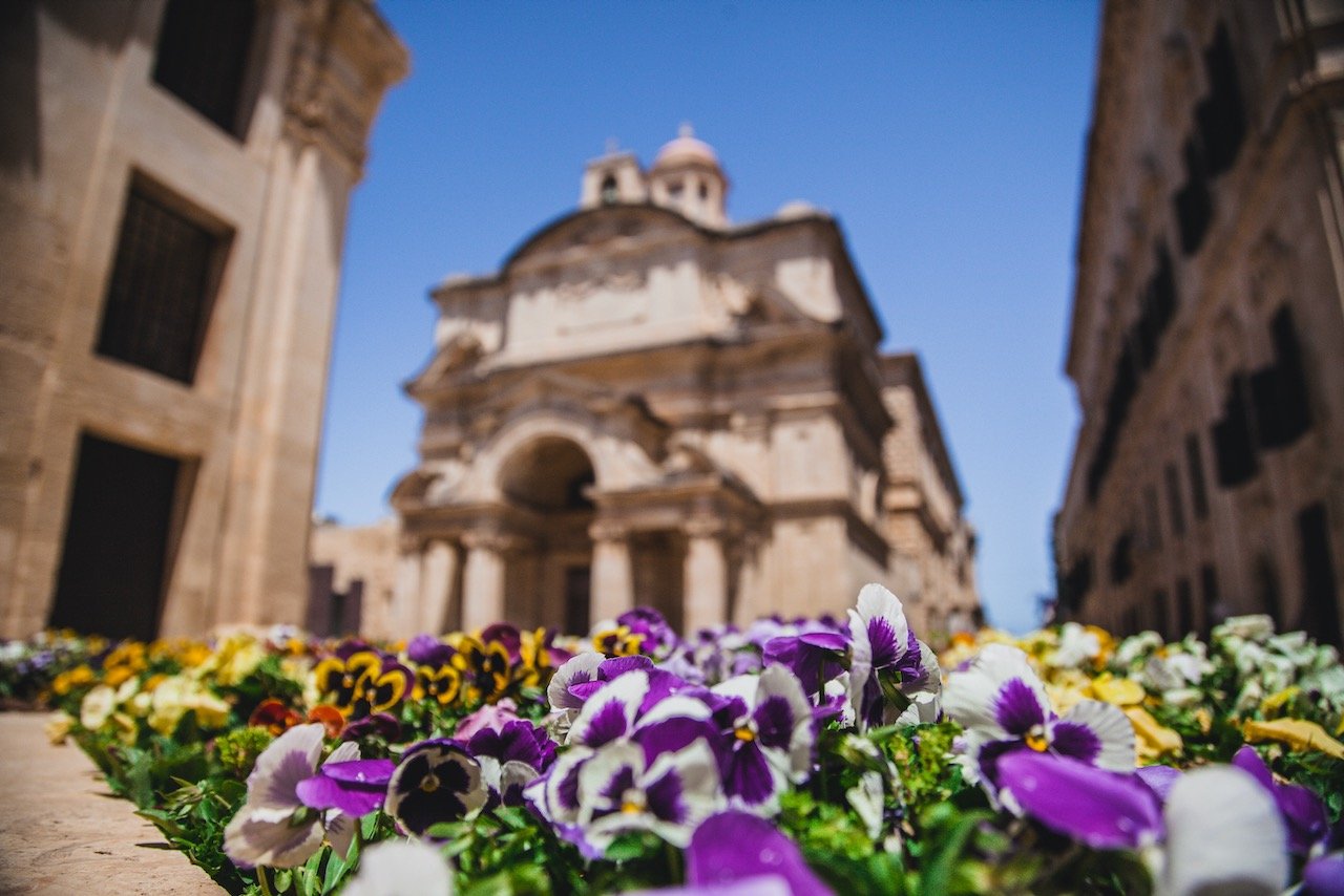
Of course if you wanted to view these landmarks from Valletta itself (the opposite direction), head on to the Upper Barrakka Gardens, which are elevated positions above the city facing the Southeast. They are located on the upper part of the St. Peter and Paul’s Bastion. The area includes many memorials and monuments to prominent historical figures with well manicured flower paths.

Fort Ricasoli, Valletta, Malta (ISO 100, 4.5 mm, f/2.8, 1/40 s)
As previously stated, the Marsamxett Harbour is situated north of the Valletta walled peninsula and features Fort Manoel and the areas of Gzira and Silema, the latter of which you can take a ferry to. In fact, this ferry station is also the perfect place to see the sunset over Valletta (highly recommend). Fort Manoel is a star fort built in the 18th century that sits on its own island and is accessible via Gzira. Like Fort Angelo, it was also badly damaged during WWII but has since been restored.
If you like some of my photos that you have come across, just know that I have many prints showcasing a variety of landscapes, including in Malta, available for purchase below! (Sold as Posters, Canvas, or in Metal-Frames and Wooden-Frames).


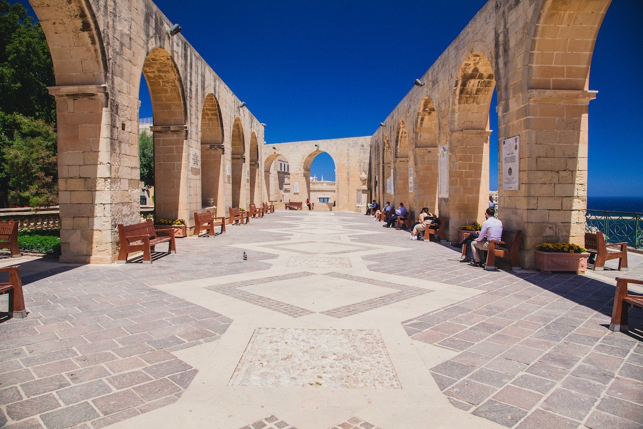
Upper Barrakka Gardens, Valletta, Malta (ISO 320, 24 mm, f/8, 1/320 s)
It was around 30C the day I arrived from a cold Sweden, so I wanted to take advantage of the warm and sunnier weather. After checking into my room, I walked the city walls and found many places to swim and small walkways leading around the peninsula.
Fort Manoel, Valletta, Malta (ISO 100, 4.5 mm, f/2.8, 1/25 s)
From this walk I was able to see the Ricasoli East Breakwater and St. Elmo Breakwater while taking a short break. These two structures possess lighthouses guiding ships into the entrance of the Grand Harbor (in addition to protecting the harbors from rougher seas). If they are open, you can walk their entire length and watch the boats go by. It is incredibly relaxing I promise you.
After you have explored a good amount of this capital city, there are plenty of options when it comes to exploring all the other parts of the country (excluding the islands of Gozo and Comino, which I will cover in other posts). Your Valletta bus pass in this case will be your best asset in seeing the rest of the country with cheap and timely transport.
Valletta, Malta (ISO 100, 4.5 mm, f/2.8, 1/8 s)
Trips Outside Valletta
Southeast Malta
The Southeast Coast of Malta in the district of Marsaskala is a great place to start. Buses 92 and 93 take you directly there in 30 minutes. I came this way because I heard of a few landmarks I wanted to see.
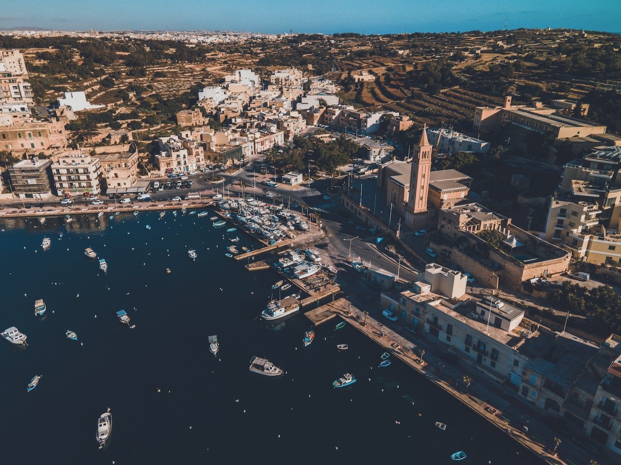
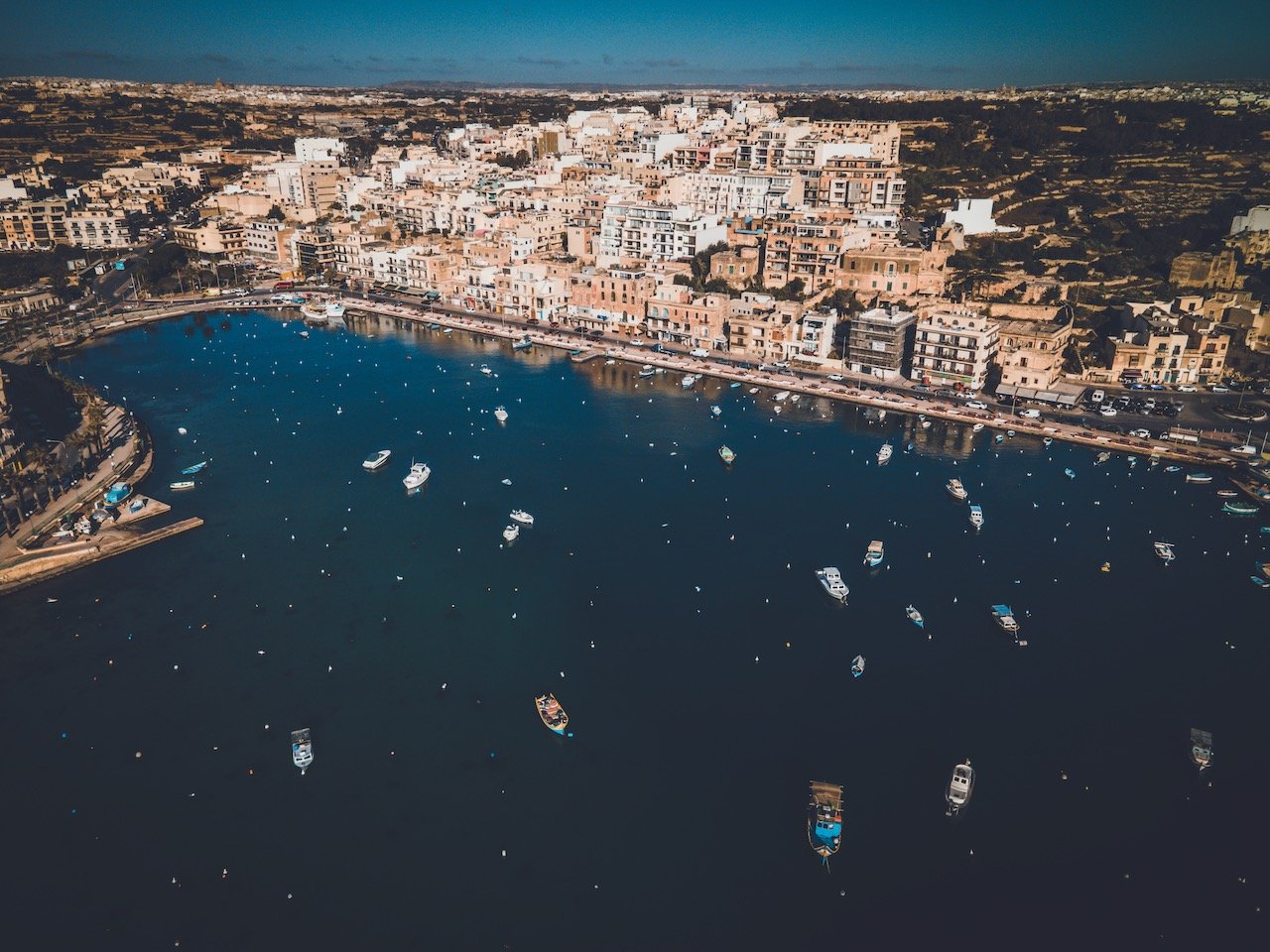
What first greeted me was the harbor, full of buoys and small boats, bobbing about during the early morning golden hour. Just nearby is the Knisja Parrokkjali ta 'Marsascala, the local church noticeable by its large limestone spire reaching for the heavens.

Marsaskala Salt Pans, Malta (ISO 100, 4.5 mm, f/2.8, 1/4 s)
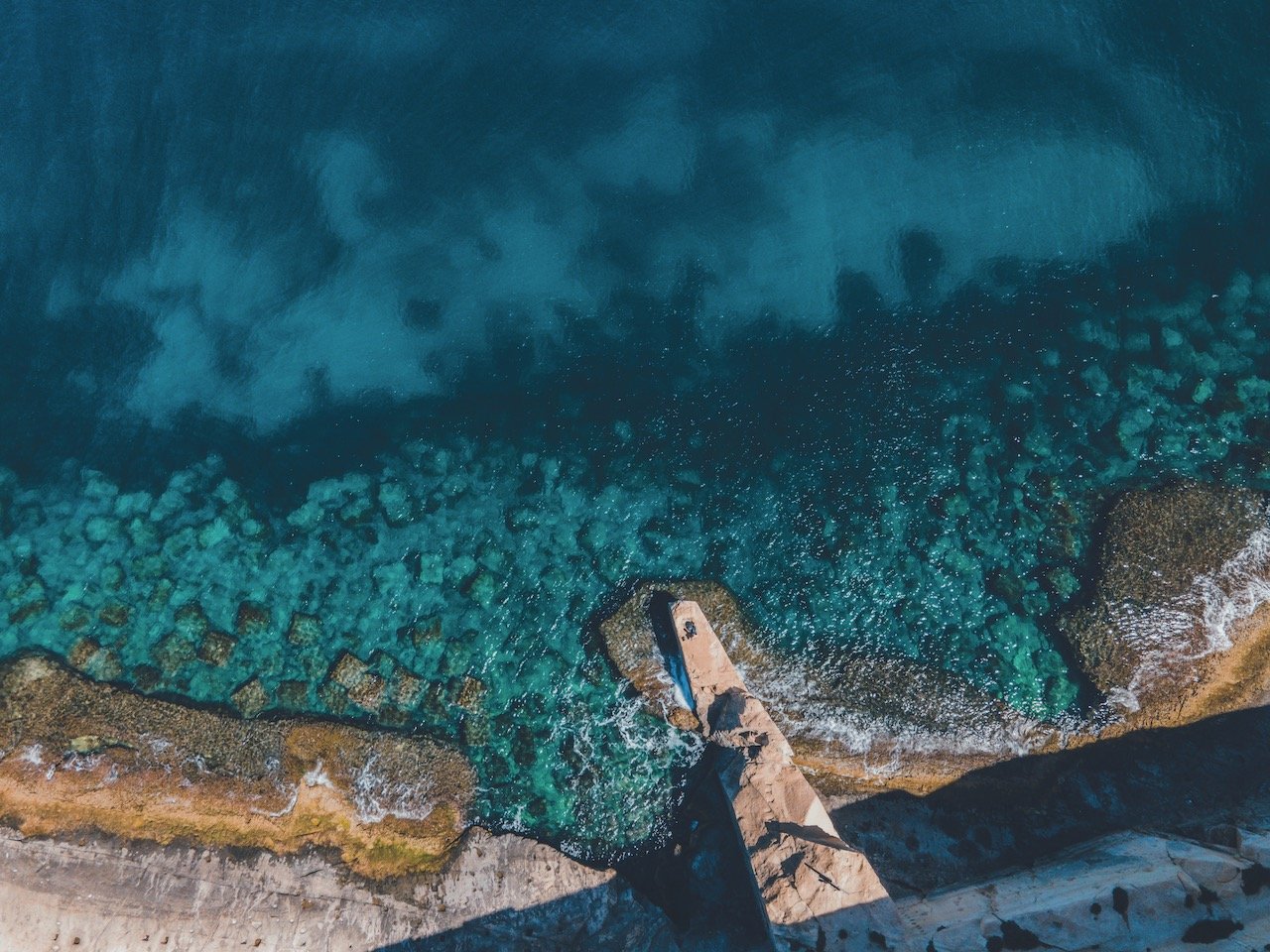
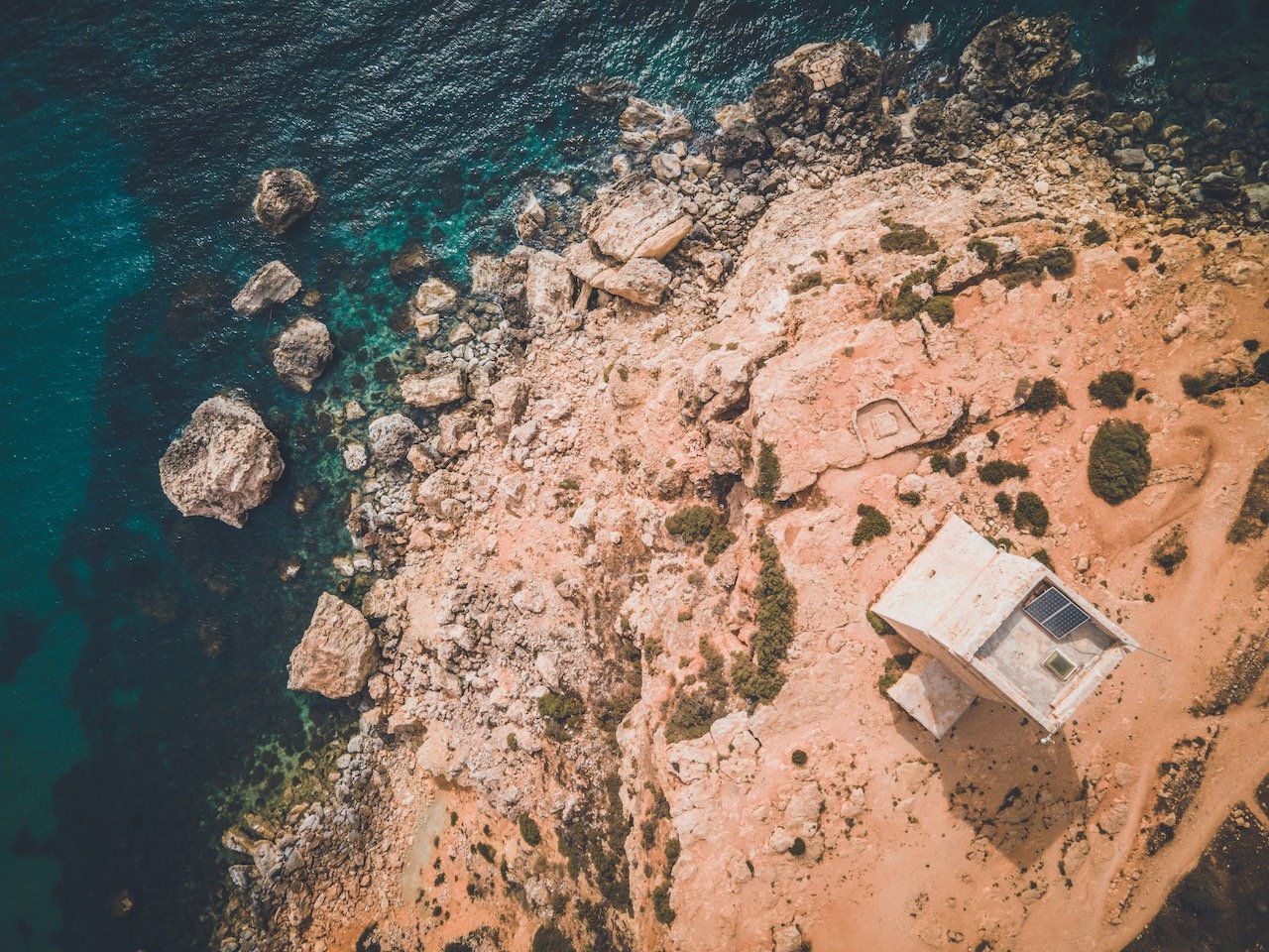
Walking along the coastline to find the fort in the area, I came upon many square shaped pits in the ground, which turned out to be salt pans. These areas are critical for salt production, though many you will find aren’t used anymore. They still make for some spectacular photos from above with the drone however! You can find these ones at Salinas.
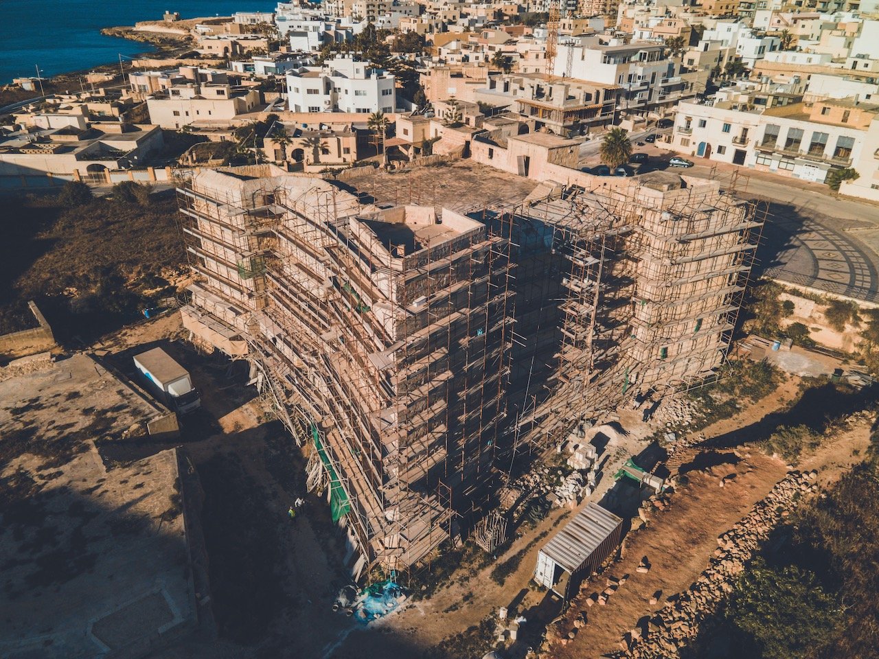
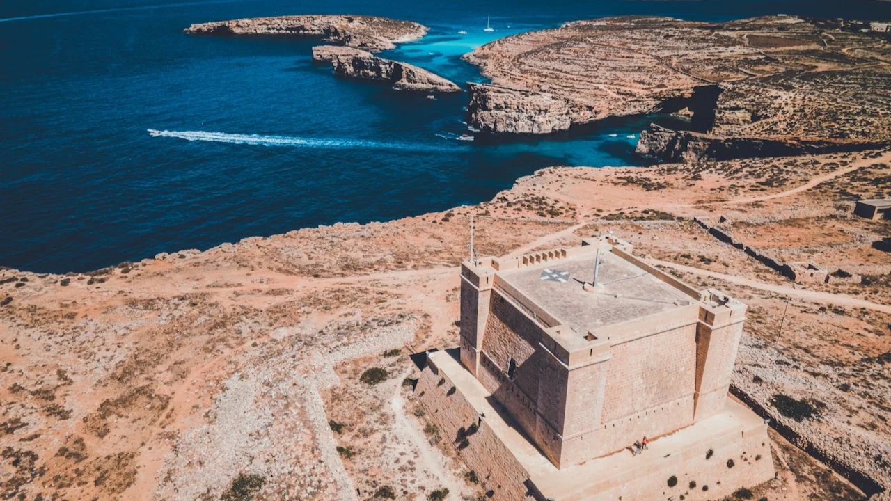
When I reached St. Thomas Tower, it was unfortunately adorned with scaffolding. Nonetheless it was truly impressive to see just how big the largest watchtower in Malta was. It is one of the six Wignacourt Towers, that is six towers that were built in Malta between 1610 and 1620 (four on Malta, one on Comino, one on Gozo).
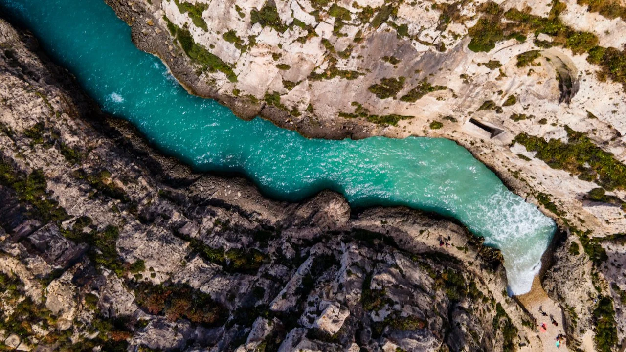
Walking further south from here, you will encounter St. Thomas Bay, a picturesque location with bright blue water and towering limestone cliffs. I just kept walking along the coastline along the bay until I reached Munxar Path. From here, it took me from nice secluded beaches, to old batteries, to cliffside viewpoints, etc.

Munxar Path, Malta (ISO 100, 4.5 mm, f/2.8, 1/20 s)
You pass such sites like Riħama Battery and Ta Kalanka Sea Cave, en route to the two bays of Il-Ħofra l-Kbira and Il-Ħofra ż-Żgħira. For clarification, I have NO idea how to pronounce those names…I just know where they are on the map. I decided to walk through the little patch of land that separates these two bays for great views of both. This led me to Ras il-Fniek. It was here where I had lunch and rested from my walk along Munxar Path and reflected on the day.

It-Taqtiegha, Malta (ISO 100, 4.5 mm, f/2.8, 1/10 s)
South Malta
The Fisherman’s Cave (Ghar ir-Rih) was a bit of an adventure to find. You can take bus 119 or X4 to the town of Birzebbuga and get off at Hasan. From here, it was about a 20 minute walk towards the south coast to an area where I thought the cave was. I followed Google Maps as best I could but found myself in an area near the ocean cliffs. I didn’t really know what to look for or to expect.

Fisherman’s Cave, Malta (ISO 100, 24 mm, f/4, 1/80 s)
I had seen photos of the cave online but saw nothing like it in the area. Right as I was about to give up, I started walking back to the main road and found a small cave entrance facing west. It could have been a shallow cave with a dead end since it looked quite dark. I stepped in a few meters and found that there was some light coming from further ahead. And behold, there it was, the ocean staring back at me through this crack on the cave. Use the google map at the end of this post to get an idea as to where it’s at since I was not able to get exact coordinates to the cave entrance.

Blue Grotto, Malta (ISO 400, 24 mm, f/8, 1/200 s)
The Blue Grotto is quite the stunning geological feature. There are many boats that can bring you to the water level of this scenic spot but there is also a viewpoint from above that is reached by taking bus 74 or 201 to bus stop Panorama. Scuba diving, snorkeling, and rock climbing are the most popular activities here. The abundance of underwater flora and fauna make this an ideal place to see by boat.
West Malta
The Dingli Cliffs are reached by taking bus 201 (best to see them after seeing the Blue Grotto in one go) and mark the highest point of the Maltese islands at 253 meters high. The cliffs provide an excellent vantage point to see the tiny, uninhabited isle of Filfla. They are believed to be named after the British Knight Sir Thomas Dingley.
Also nearby here is the Saint Mary Magdalene Chapel and the Dingli Aviation Radar.
If you’re feeling really adventurous and down for a hike, then the cliffs at Ras id-Dawwara are well worth seeing. There is no bus stop that really takes you close to here so best to hire your own car or get a taxi to reach it.
Central Malta
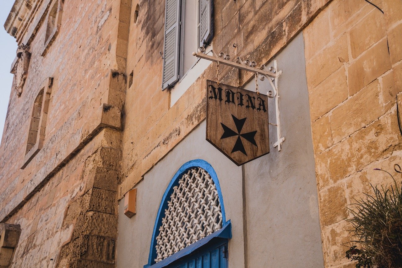
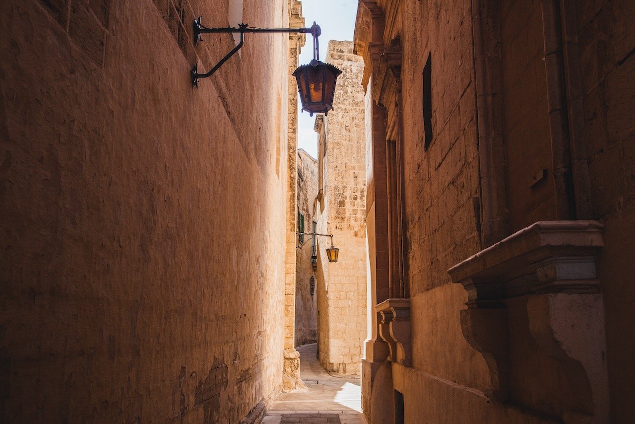
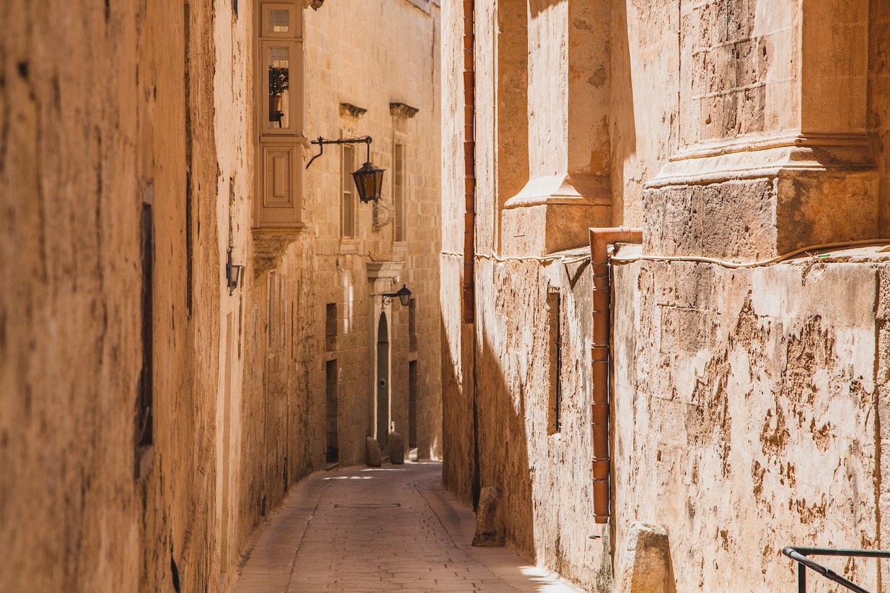
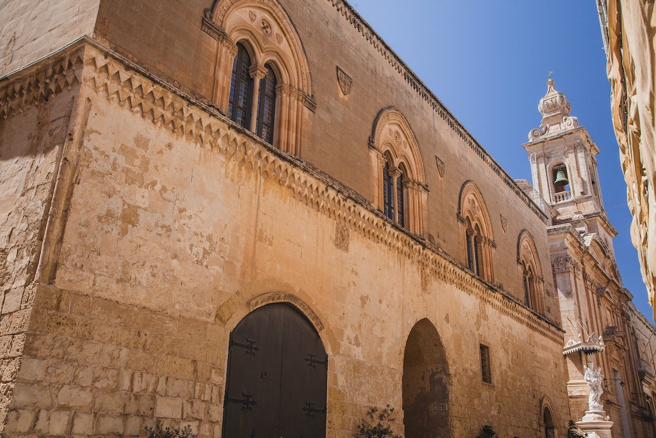
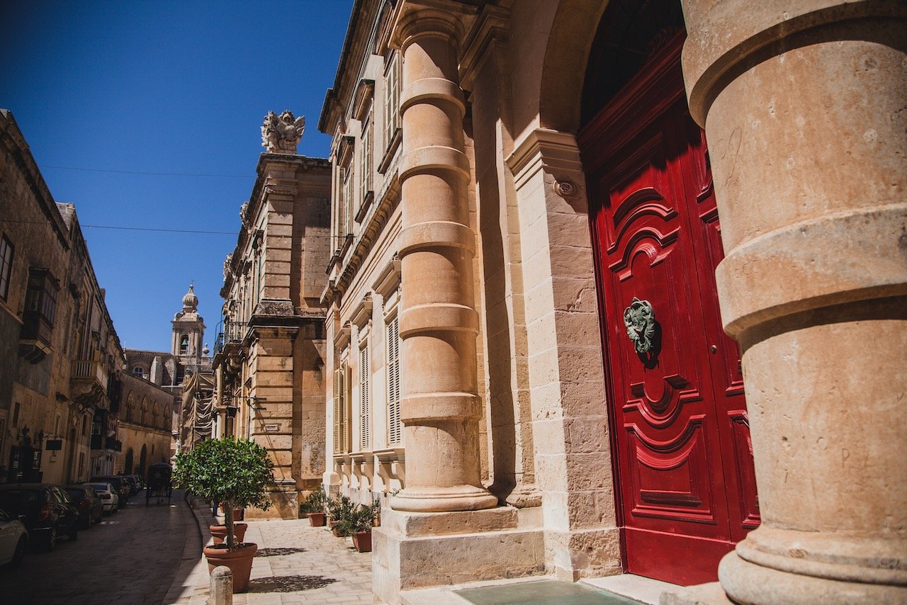
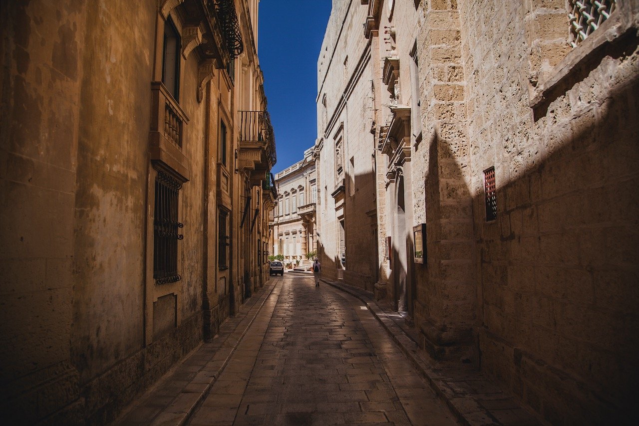
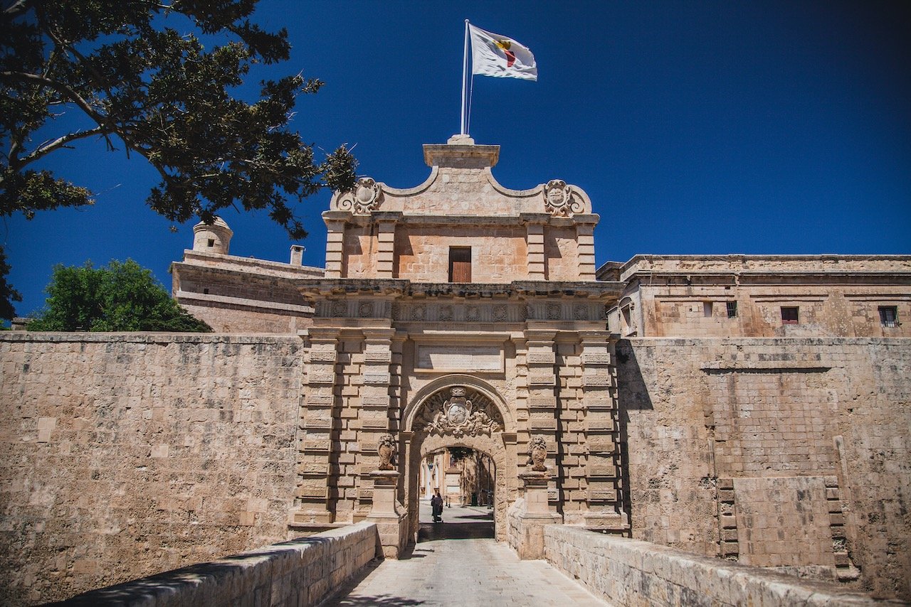
Mdina was the former capital of Malta from antiquity to the medieval period. This walled city is not to be missed, replete with small passageways and in excellent condition considering how old the town is. Just take bus 51, 52, or 53 from Valletta to get to Mdina and take half a day to meander inside the city walls.
Some notable places to check out include:
St. Paul’s Cathedral
Palazzo Santa Sofia
Palazzo Falson
Mdina Gate
Banca Giuratale
Fontanella Tea Garden

The town of Rabat is accessible by the same bus as Mdina.
North Malta
The Ghajn Tuffieħa Tower to me looks like quintessential Malta. A sleek, limestone tower perched atop a giant cliffside, above a picturesque bay with pristine blue water. Bus 44 from Valletta will get you to the Mixquqa bus stop, at which you must then walk 1.2 km to get to this tower (worth it). You can get up close to the tower and it’s best seen in mid day.
Għajn Tuffieħa Tower, Malta (ISO 200, 4.5 mm, f/2.8, 1/20 s)
Just nearby is Golden Bay, a nice beach area with a restaurant and other beach vendors. I thought the water temperature here in May was just a little bit cold, but nothing that would prevent you from getting completely submerged. There was also volleyball courts should you feel the itch. I am told that this beach is one of the more popular ones but at no point did I feel like it was overcrowded (your mileage may vary).
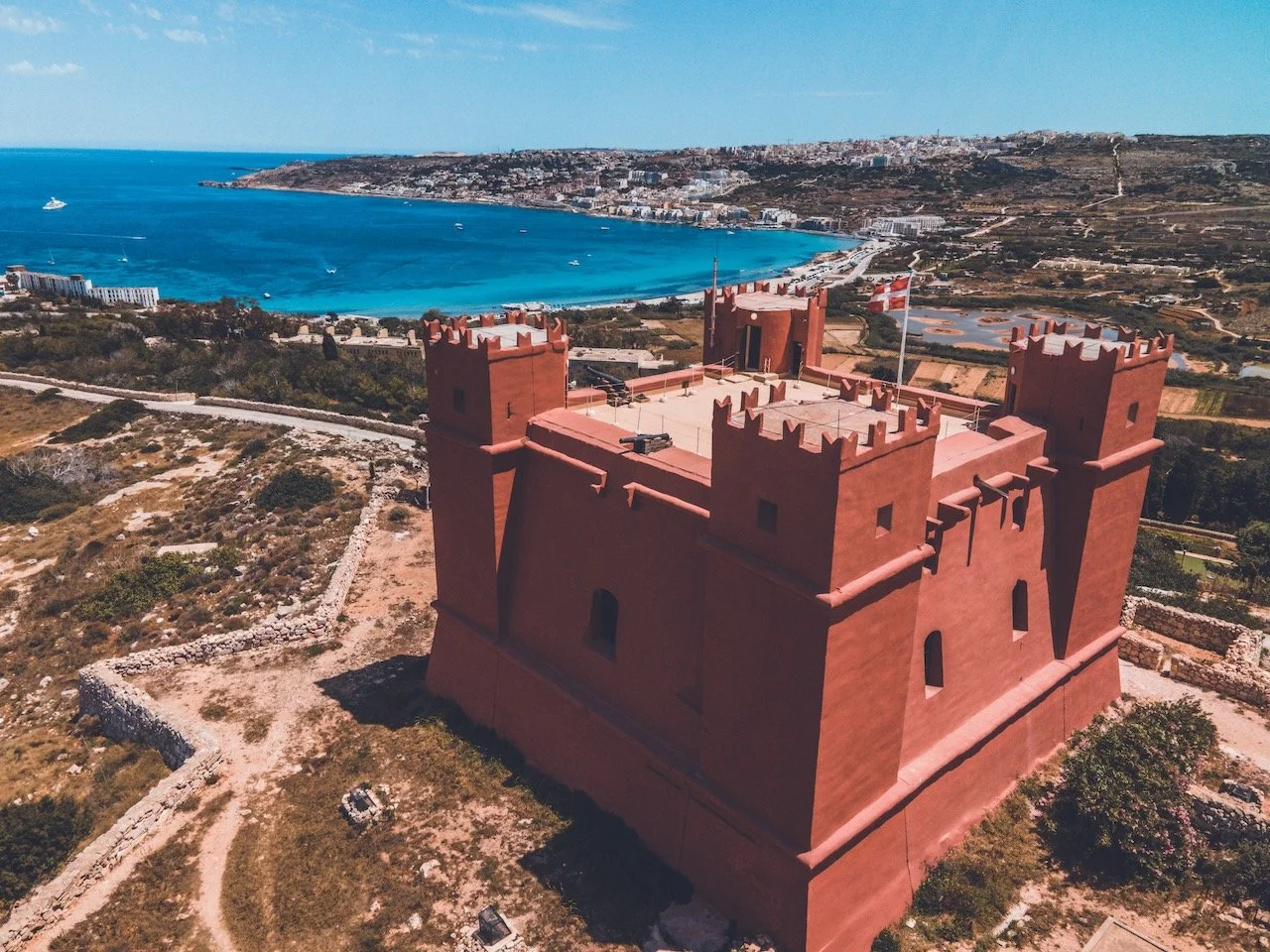
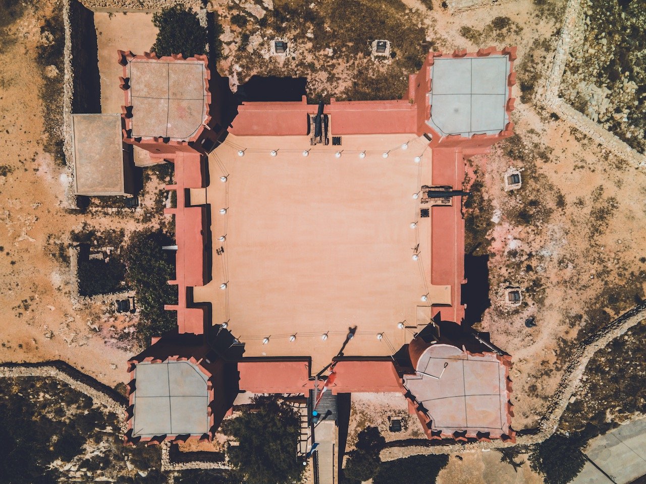
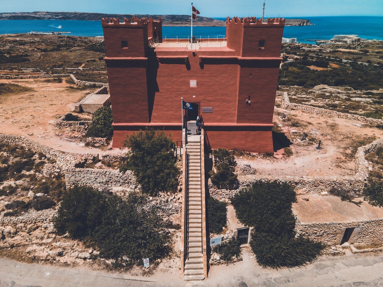
The Red Tower is an incredibly well preserved, bright reddish tower situated high atop the hillside in Northern Malta (Take bus 41 or 42 from Valletta). It is also known as Saint Agatha's Tower and was built between 1647 and 1649 was the last of the Lascaris towers built (towers built by the Order of St. John). Manned by 30 men, it had enough storage to resist a siege of up to 40 days. It contains four corner towers as well as a chapel. I would say that it is one of the most visually appearing pieces of Maltese history that I saw during my trip.
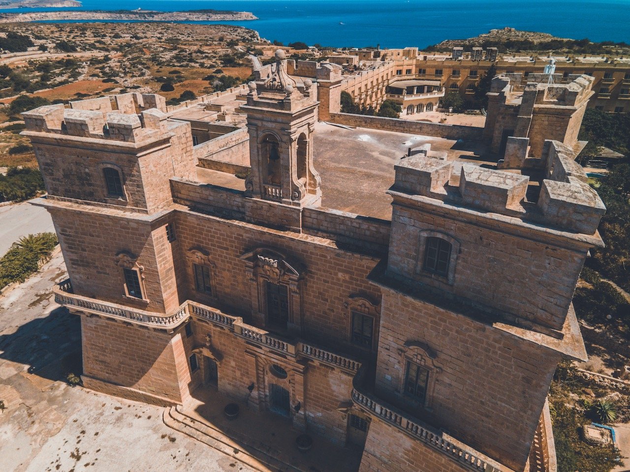
Selmun Palace, Malta (ISO 100, 4.5 mm, f/2.8, 1/25 s)
Selmun Palace is actually a pretty sweet Villa and a former hotel that closed down in 2011. It has a great vantage point of Mistra Bay just below it. It used to be rented out to Knights by the Order of Saint John to relax and hunt rabbits but was later used by the British during their control as a hospital. It’s an example of Baroque architecture and its four corner bastions are merely decorative as the Palace has no military capability. Still nice to look at!
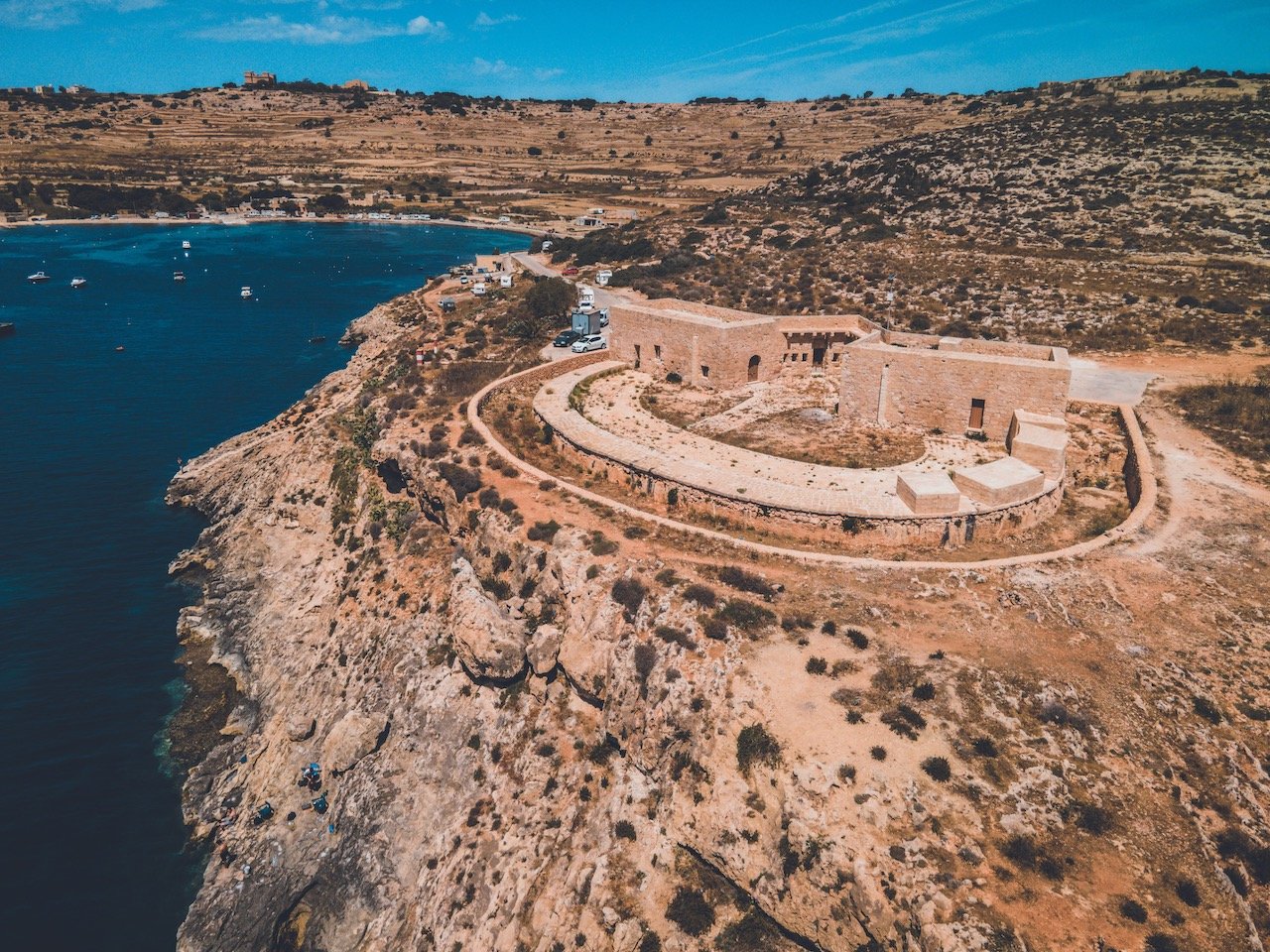
Mistra Battery, Malta (ISO 100, 4.5 mm, f/2.8, 1/25 s)