A Journey to the Faroe Islands: The Island of Eysturoy
Risin og Kellingin, Eysturoy, Faroe Islands (ISO 400, 4.5 mm, f/2.8, 1/40 s)
(Some links in this post are affiliate links. If you click through and take action, I'll be compensated.) If you are also interested in any PRINTS from any of my posts, be sure to check out my store where you can buy prints as posters, in metal/wooden frames or on canvas.
**This post is the 4th of a 11-post series discussing what to see in this part of the Faroe Islands (You can check out the other parts in the list below, separated by each specific island (just click on the island name to see the blog post. Everything is also summarized in another post here.**
The Faroe Islands, or the Faroes, are an archipelago located in the North Atlantic Ocean and are a part of Denmark. The subpolar oceanic climate, moderated by the Gulf Stream, make the temperature of the Faroes nearly constant throughout the year. Origins of the Faroe Islands date back as early as 500 AD, thought to be settled by people from Great Britain or Ireland. [Funfact: The population of sheep (70,000) outnumber the human population (54,000)]
Featured

Tórshavn (Blog Post: A Journey to the Faroese Capital of Tórshavn)
Vágar (Blog Post: A Journey to the Faroe Islands: The Island of Vágar)
Streymoy (Blog Post: A Journey to the Faroe Islands: The Island of Streymoy)
Eysturoy (Blog Post: A Journey to the Faroe Islands: The Island of Eysturoy)
Bordoy (Blog Post: A Journey to the Faroe Islands: The Island of Bordoy)
Kalsoy (Blog Post: A Journey to the Faroe Islands: The Island of Kalsoy)
Vidoy (Blog Post: A Journey to the Faroe Islands: The Island of Vidoy)
Mykines (Blog Post: A Journey to the Faroe Islands: The Island of Mykines)
Sandoy (Blog Post: A Journey to the Faroe Islands: The Island of Sandoy)
Kunoy (Blog Post: A Journey to the Faroe Islands: The Island of Kunoy)
The Waterfalls of the Faroe Islands (Blog Post: The Waterfalls of the Faroe Islands)
Eidi, Eysturoy, Faroe Islands (ISO 400, 4.5 mm, f/2.8, 1/40 s)
In this blog post, I will cover the island of Eysturoy. A Google Map of these places I will talk about can be seen at the end of this article. Check out my drone video from the Faroe Islands below!

Eysturoy is one of the more mountainous islands in Faroe, with 66 separate peaks, the tallest being Slættaratindur. The fjords of Skálafjørður and Funningsfjørður nearly split the island into two. You can access this island by the Streymin Bridge from Eysturoy. It is also accessible via the Eysturoyartunnilin (the Eysturoy Tunnel) with direct access to the capital Tórshavn.
You can explore this island in a day, checking out some of the towns, mountains, and natural formations most easily with a car. Here are some of the sights to see:

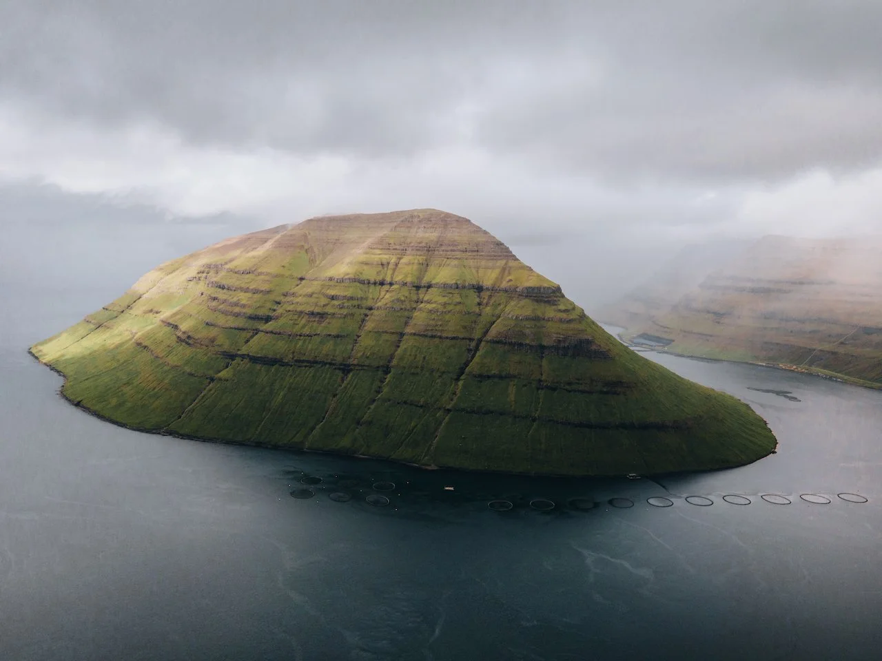
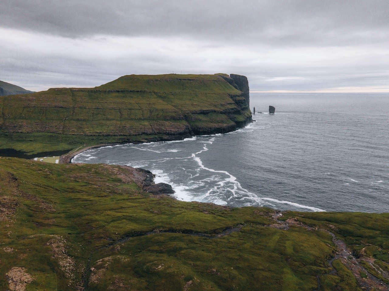
Risin og Kellingin, Eysturoy, Faroe Islands (ISO 100, 88 mm, f/4, 1/400 s)
Risin og Kellingin are sea stacks off the coast of the island, the name translating to ‘The Giant and the Witch’, relating to their original legends. They are nearly the same height as Risin is 71 meters tall and Kellingin is 67 meters high. You can see these stacks from a viewing point (on Google Maps) near the village of Eidi on Eysturoy as well as from the village of Tjørnuvík on the island of Streymoy. Nonetheless the legend of these stacks goes:
“Once upon a time, the giants in Iceland were envious and decided that they wanted the Faroes. So the giant and the witch were sent down to the Faroe Islands to bring them back.
They reached the north-westernmost mountain Eiðiskollur, and the giant stayed in the sea while the witch climbed up the mountain with a heavy rope to tie the islands together so that she could push them onto the giant's back. However, when she attached the rope to the mountain and pulled, the northern part of the mountain split. Further attempts were also unsuccessful, and they struggled through the night, but the base of the mountain was firm and they could not move it.
If the sun shines on a giant or witch, it turns to stone. So it was that as they continued to struggle they didn't notice time passing, and as dawn broke a shaft of sunlight put a stop to their efforts by turning them to stone on the spot. They have stood there ever since, staring longingly across the ocean towards Iceland.”

Eidi, Eysturoy, Faroe Islands (ISO 200, 4.5 mm, f/2.8, 1/15 s)
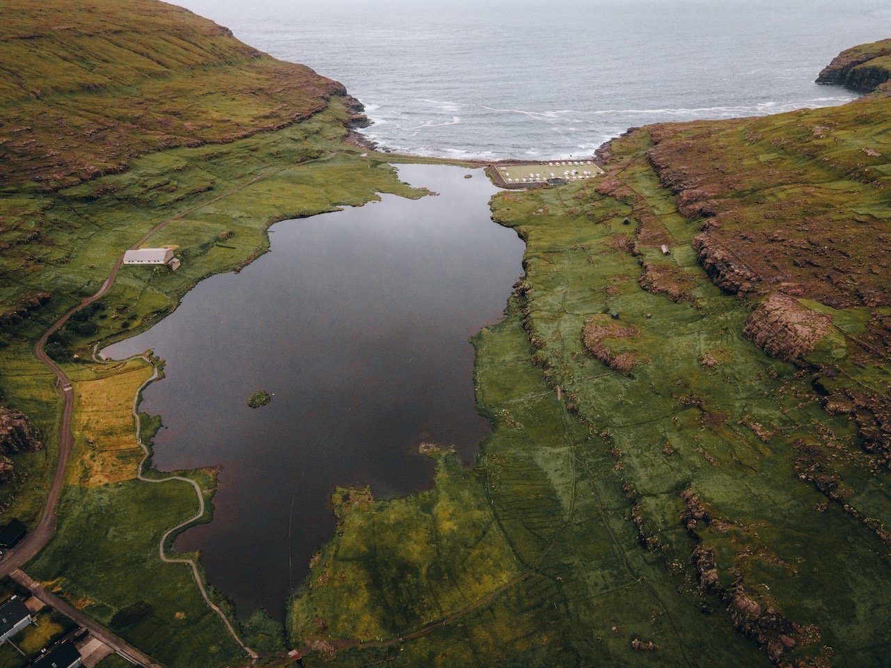
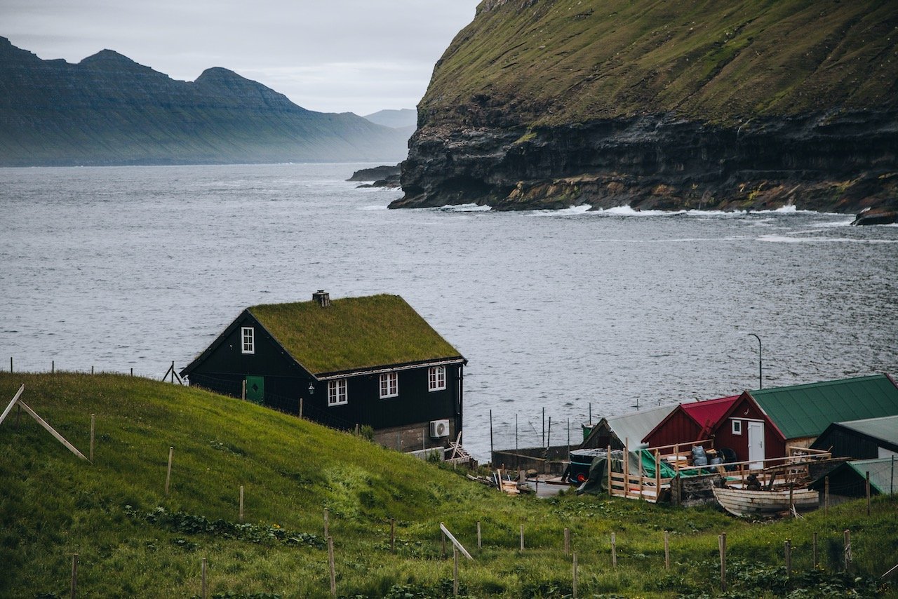
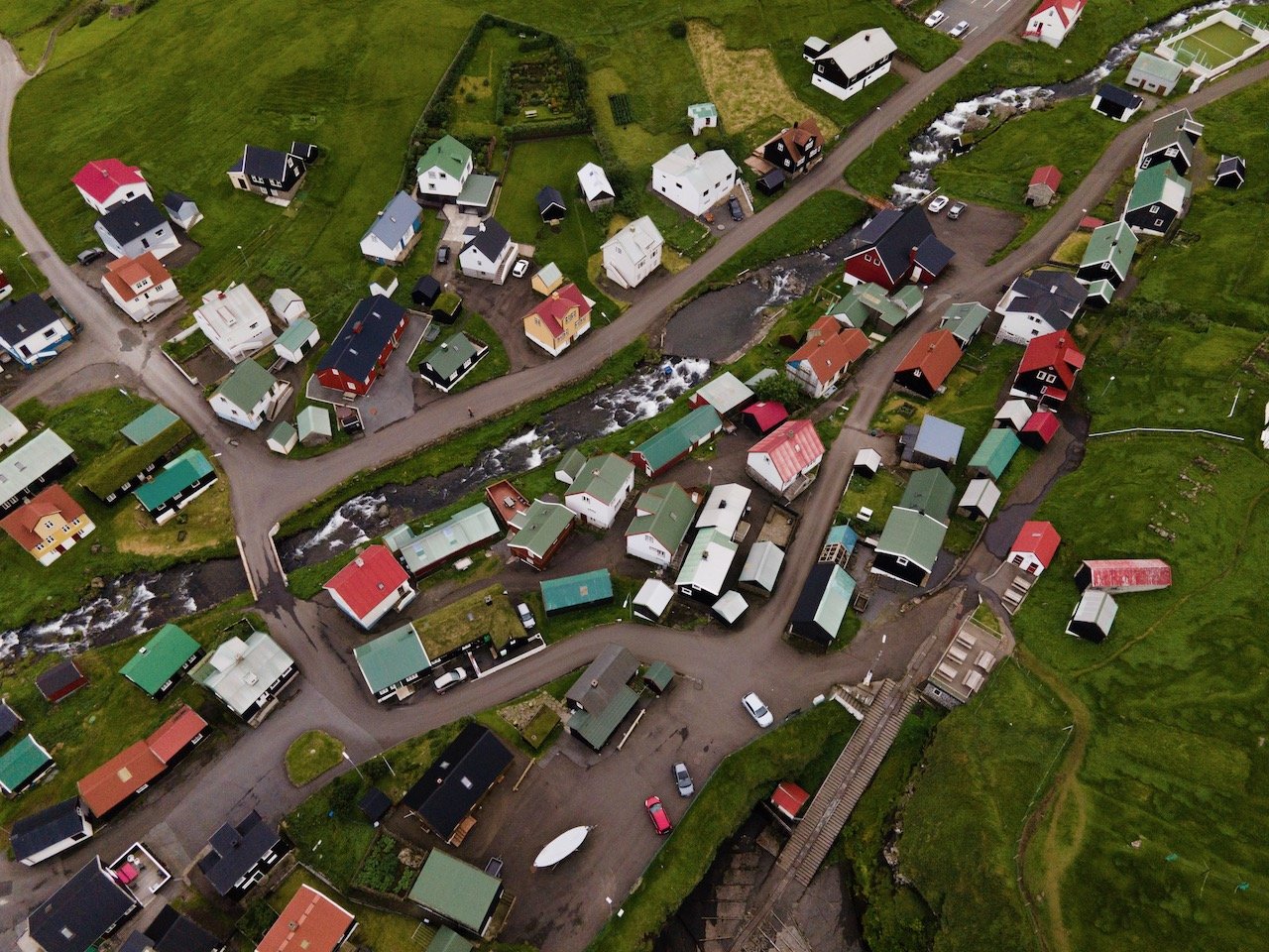
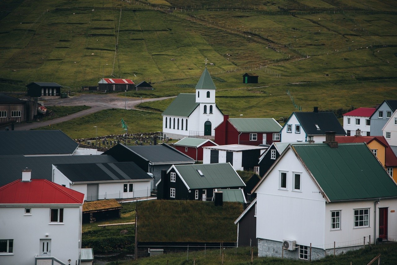
Eidi is located on the northwest portion of Eysturoy. Its first mention in history was from the 14th century however archeological dating methods (carbon dating) determined that the Vikings settled in the area back in the 9th century. You will find numerous rows of homes on as cascading hillside here with two salmon cages in the water for local fisherman. Not too far away is the Eidi Church as well as a football field. When I came, the football field was converted to a site for camper vans.
If you like some of my photos that you have come across, just know that I have many prints showcasing a variety of landscapes, including Faroe, available for purchase below! (Sold as Posters, Canvas, or in Metal-Frames and Wooden-Frames).


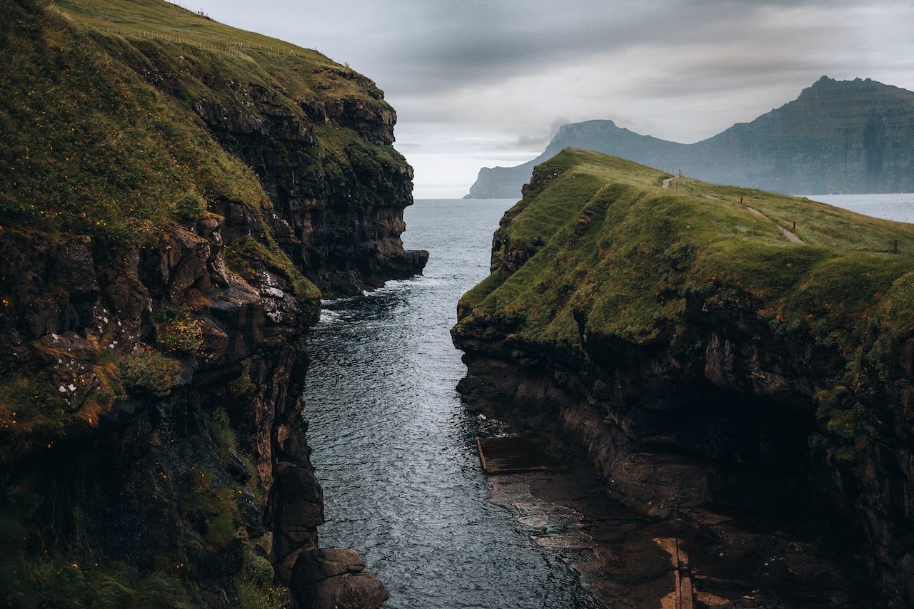
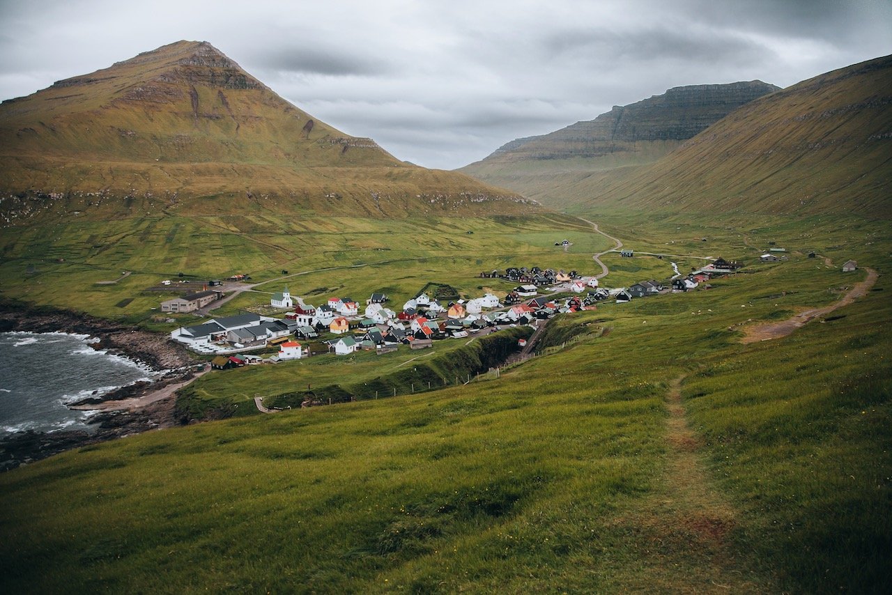
The village of Gjógv (meaning ‘gorge’) is just a short drive from Eidi. It got its name from the sea-filled gorge that runs from the village to the sea. This is a common feature with Faroese villages, where streams of water literally flow through the village with homes on either side. The old industry of the village was fishing and selling dried and salted fish (klippfiskur).

Some nice places to check out in the village include the Gjógv Natural Harbor. As the name suggests, it’s a small waterway that makes its way inland, with cliff faces on both sides leading up to a natural plateau that you can take stairs down to. Also near here is the Gjáarkaffi, a comfortable cafe which is also the starting point of a short uphill hike that gives you a great view of the entire village.
From Gjógv is the valley of Ambadalur, reachable by hiking 1.5 hours from the village. The vantage point from this valley gives a fantastic view of the largest sea stack in the Faroe Islands, Búgvin, which is home to puffins and guillemots.