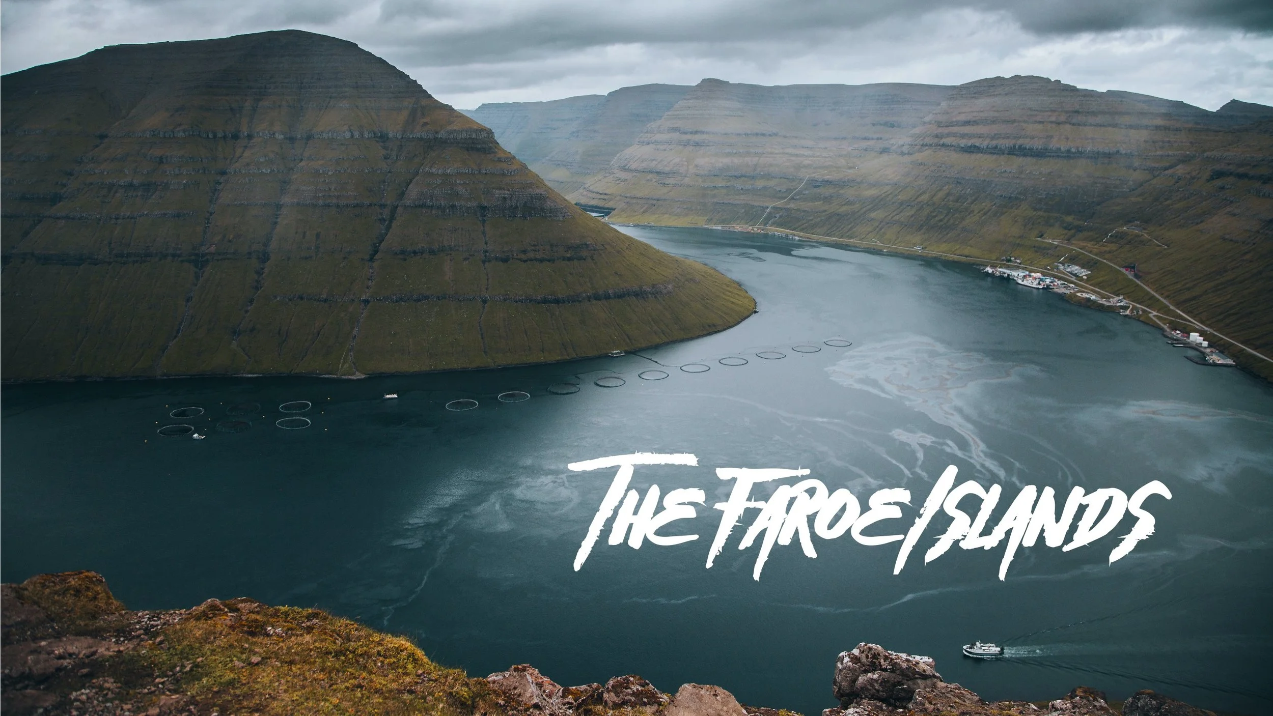
A Journey to the Faroe Islands: The Island of Streymoy

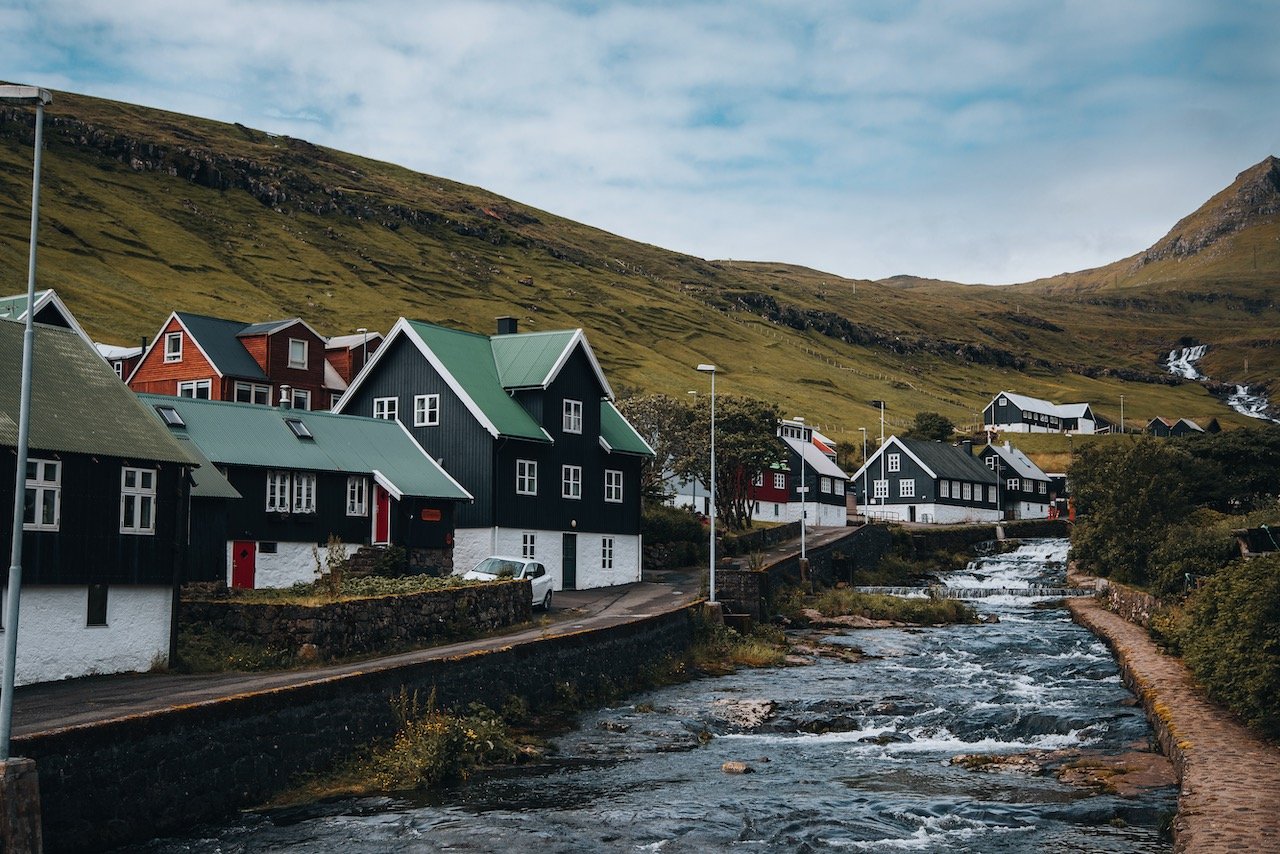
Tjørnuvík, Streymoy, Faroe Islands (ISO 200, 4.5 mm, f/2.8, 1/40 s)
(Some links in this post are affiliate links. If you click through and take action, I'll be compensated.) If you are also interested in any PRINTS from any of my posts, be sure to check out my store where you can buy prints as posters, in metal/wooden frames or on canvas.
**This post is the 3rd of a 11-post series discussing what to see in this part of the Faroe Islands (You can check out the other parts in the list below, separated by each specific island (just click on the island name to see the blog post. Everything is also summarized in another post here.**
The Faroe Islands, or the Faroes, are an archipelago located in the North Atlantic Ocean and are a part of Denmark. The subpolar oceanic climate, moderated by the Gulf Stream, make the temperature of the Faroes nearly constant throughout the year.
Origins of the Faroe Islands date back as early as 500 AD, thought to be settled by people from Great Britain or Ireland. [Funfact: The population of sheep (70,000) outnumber the human population (54,000)]
Featured

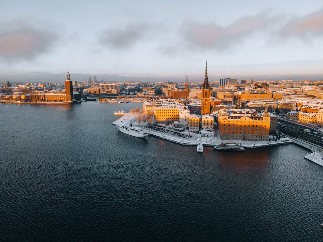
Tórshavn (Blog Post: A Journey to the Faroese Capital of Tórshavn)
Vágar (Blog Post: A Journey to the Faroe Islands: The Island of Vágar)
Streymoy (Blog Post: A Journey to the Faroe Islands: The Island of Streymoy)
Eysturoy (Blog Post: A Journey to the Faroe Islands: The Island of Eysturoy)
Bordoy (Blog Post: A Journey to the Faroe Islands: The Island of Bordoy)
Kalsoy (Blog Post: A Journey to the Faroe Islands: The Island of Kalsoy)
Vidoy (Blog Post: A Journey to the Faroe Islands: The Island of Vidoy)
Mykines (Blog Post: A Journey to the Faroe Islands: The Island of Mykines)
Sandoy (Blog Post: A Journey to the Faroe Islands: The Island of Sandoy)
Kunoy (Blog Post: A Journey to the Faroe Islands: The Island of Kunoy)
The Waterfalls of the Faroe Islands (Blog Post: The Waterfalls of the Faroe Islands)
In this blog post, I will cover the island of Streymoy. A Google Map of these places I will talk about can be seen at the end of this article. Check out my drone video on the island of Streymoy in the Faroe Islands below!

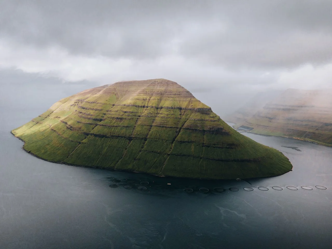
The island of Streymoy bears most of the Faroese population, most of them centered around the capital city of Tórshavn on the southeast coast. Streymoy translates to ‘island of currents', presumably because this area also includes the islands of Hestur, Nólsoy, and Koltur (all a part of the Tórshavn Municipality).
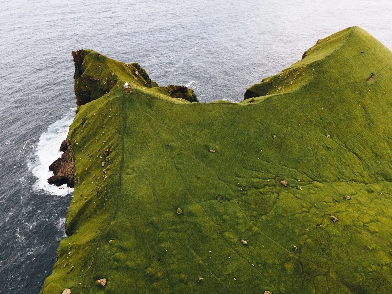
The north of Streymoy is known for its mountains, in an area called Vestmannabjørgini (‘Cliffs of Vestmanna’). There are also a number of beaches spread out along the coastline of this island. What you won’t find much of on Streymoy though is trees, which is a common sight (or lack thereof) in all of Faroe. Here are some cool places to check out on the island:
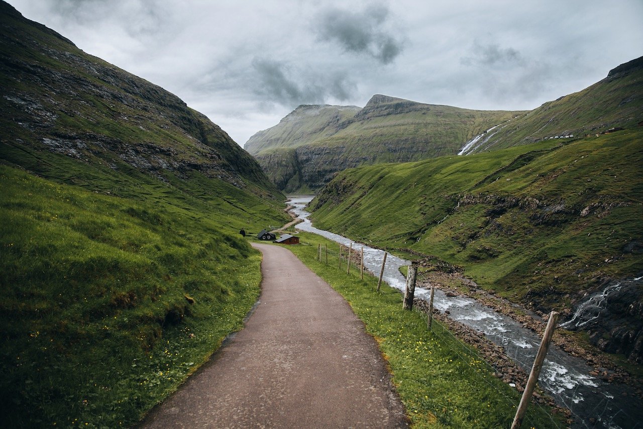
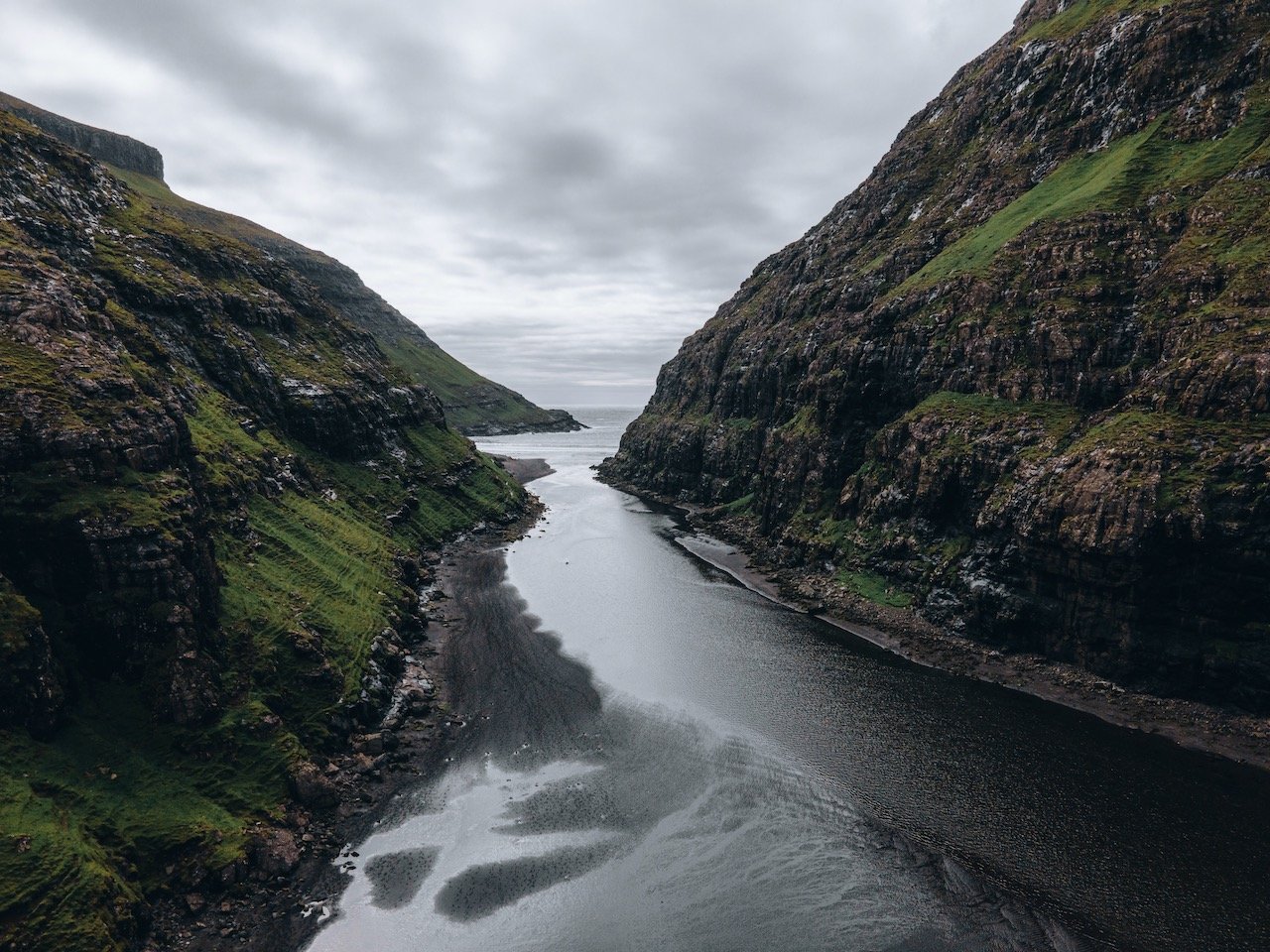
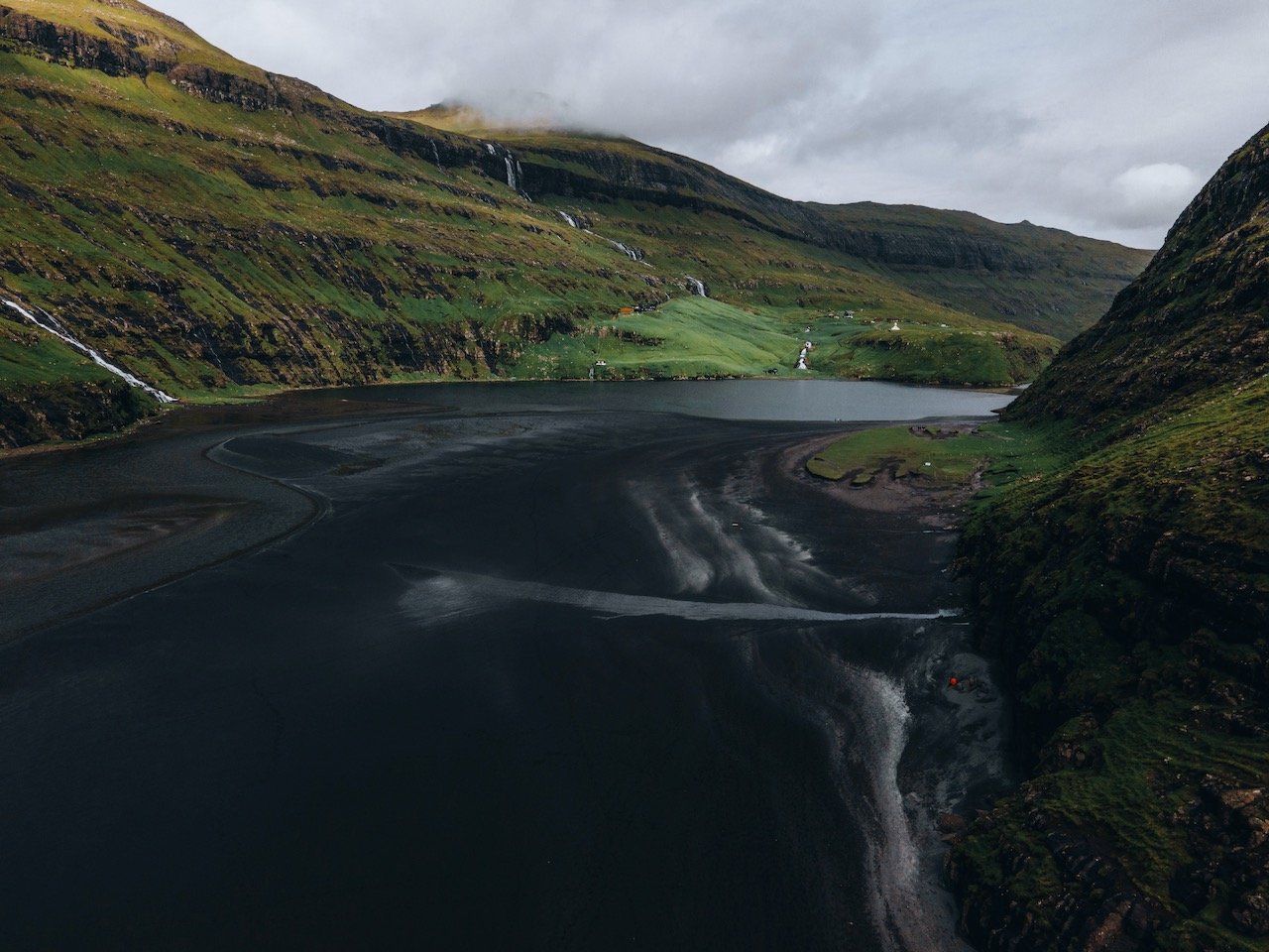
Saksun is a small village that is remote and features a pristine and idyllic lagoon. Getting here requires driving up the eastern coast of Streymoy and then taking road 53 towards the western side of the island.
A must see in Saksun has to be Út á Lónna (Black Beach Saksun). This black sand beach reminds me of Vík in Iceland, however this one is surrounded by mountains. You can access the beach when the tide is low, which it was when I arrived at mid day. After parking (free), you will reach a gate where you have to pay 75 DKK to get through (the gate takes card), and it’s a 3 kilometer hike to the beach. The walk is enjoyable and not strenuous at all.
If you like some of my photos that you have come across, just know that I have many prints showcasing a variety of landscapes, including Faroe, available for purchase below! (Sold as Posters, Canvas, or in Metal-Frames and Wooden-Frames).


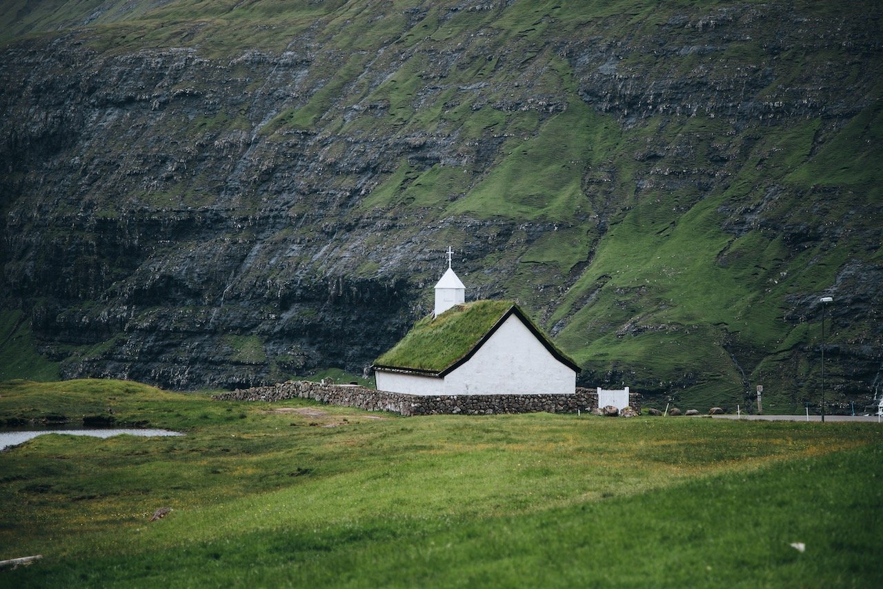
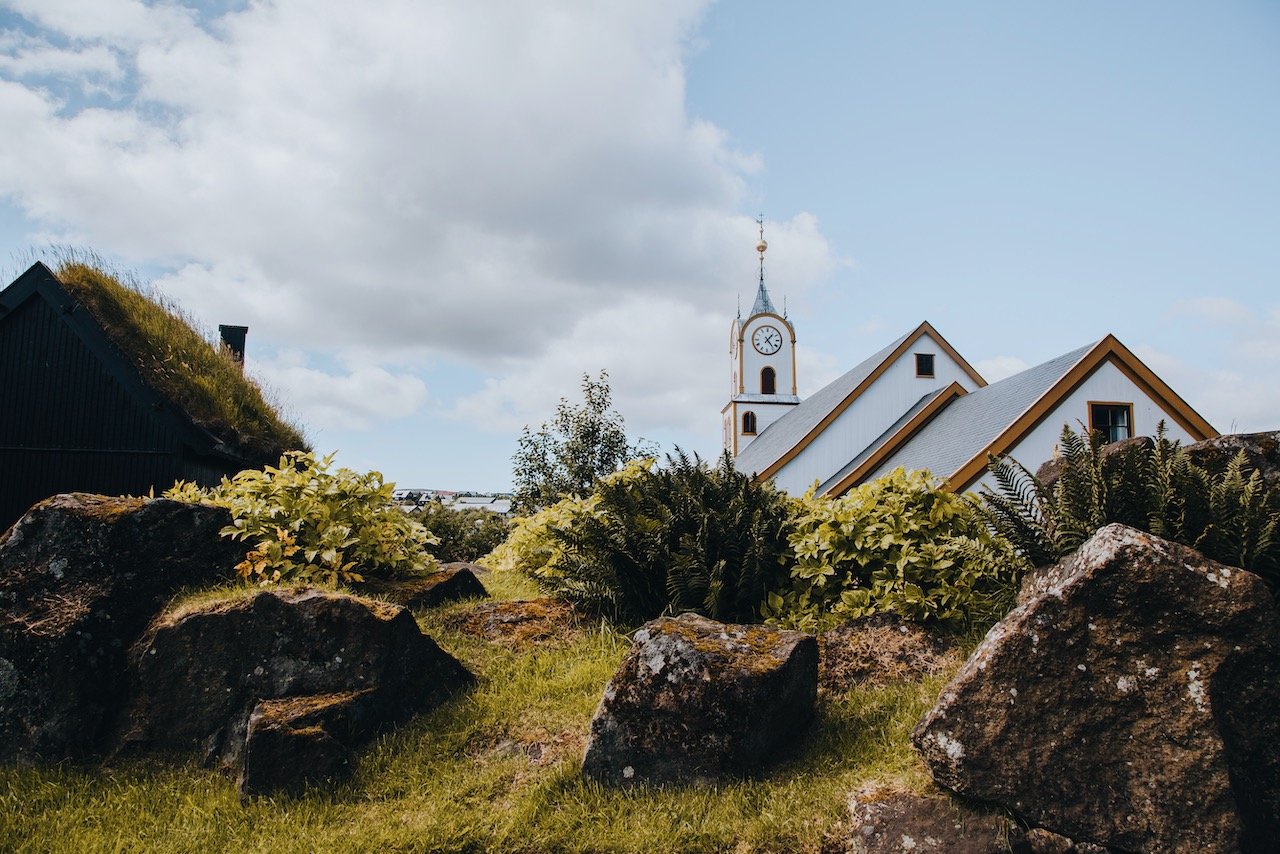
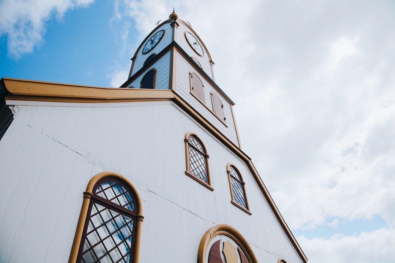
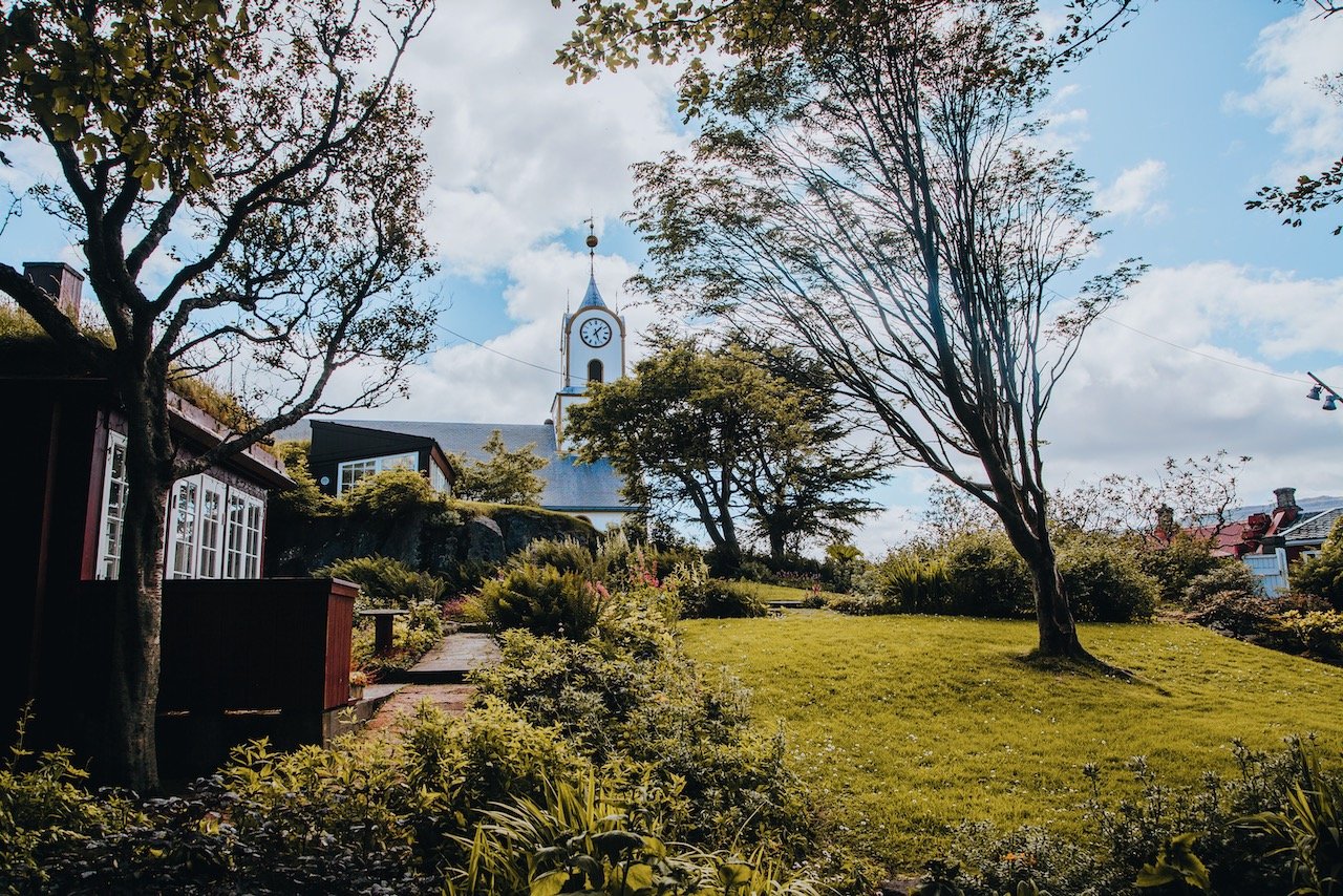
After parking, you also can’t miss the Saksun Church (Saksunar kirkja). This church was built with stone and wood and features a turf roof, very common for structures from its era. Its history dates back to 1858 when it was consecrated, however interestingly enough, it was actually moved from a neighboring village of Tjørnuvík two years prior before arriving at its current location today.
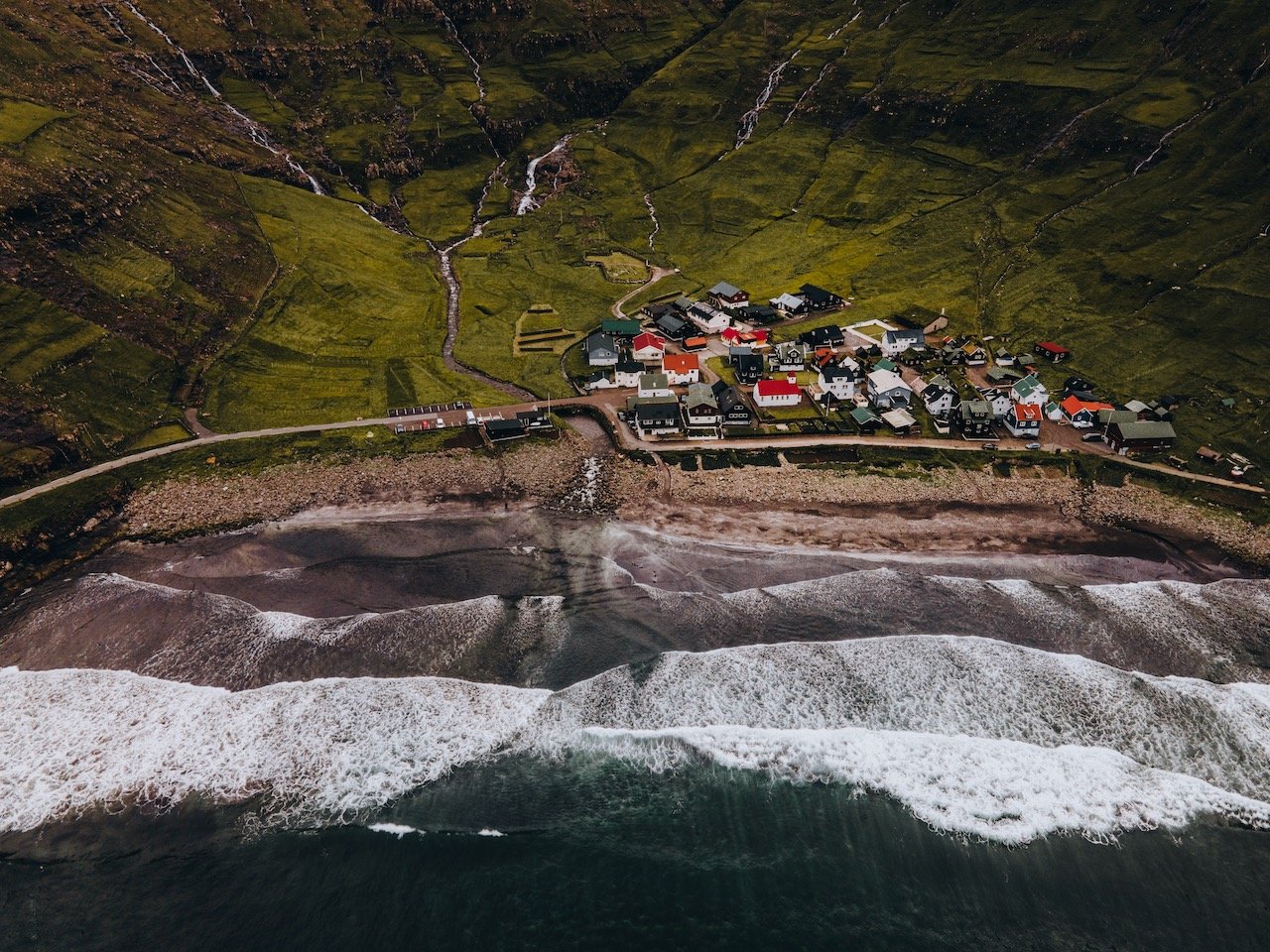
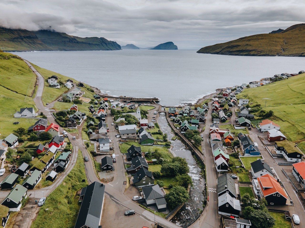
Tjørnuvík, Streymoy, Faroe Islands (ISO 100, 4.5 mm, f/2.8, 1/13 s)
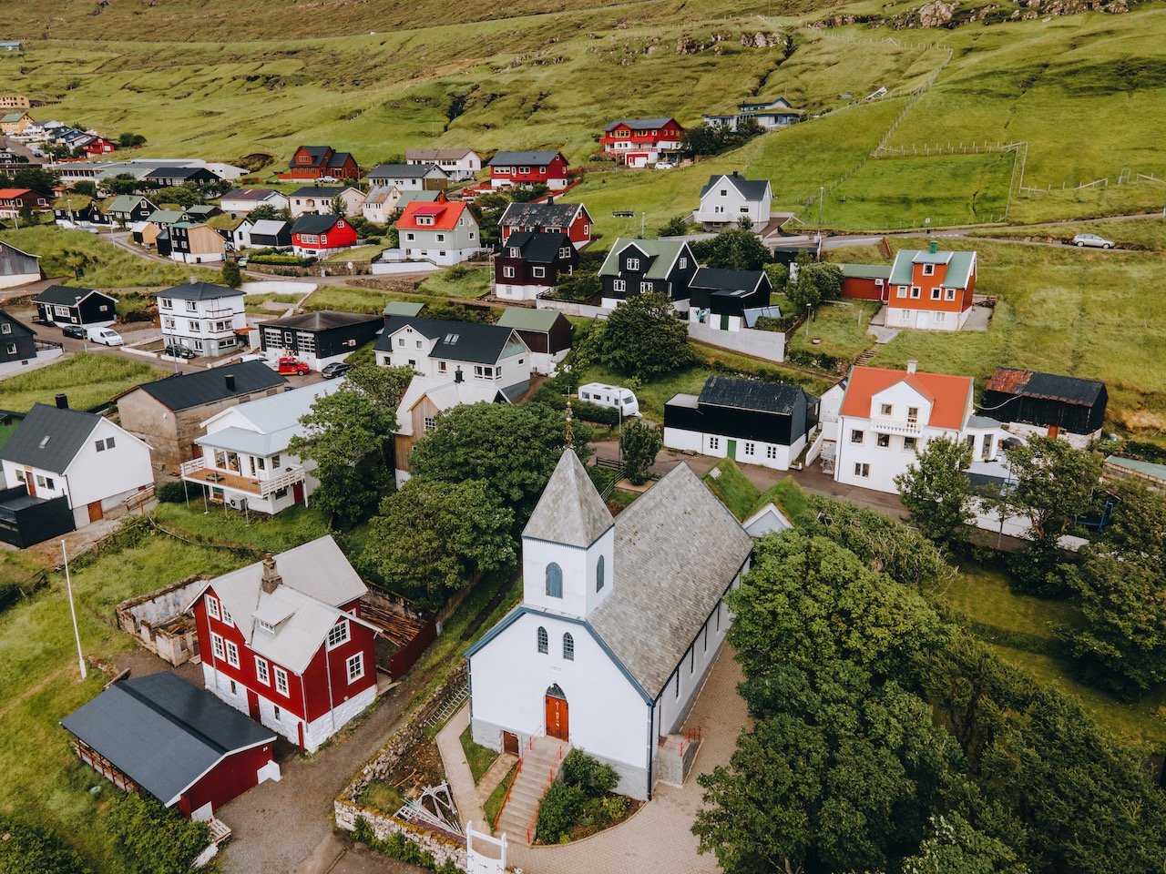
Tjørnuvik is a small village, located on the northeast coast of Streymoy, situated in a valley that feeds right into the North Atlantic Ocean. There’s only 55 homes there and even the road getting here along tall cliffs overlooking the ocean are stunning. The beach is also popular for surfing. What I enjoyed most was the colorful homes that stand out quite nicely against the earthly-toned landscape, as seen in my drone photos.
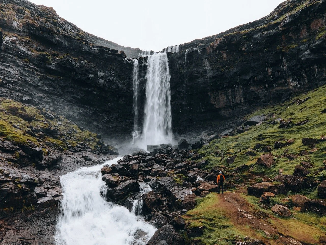
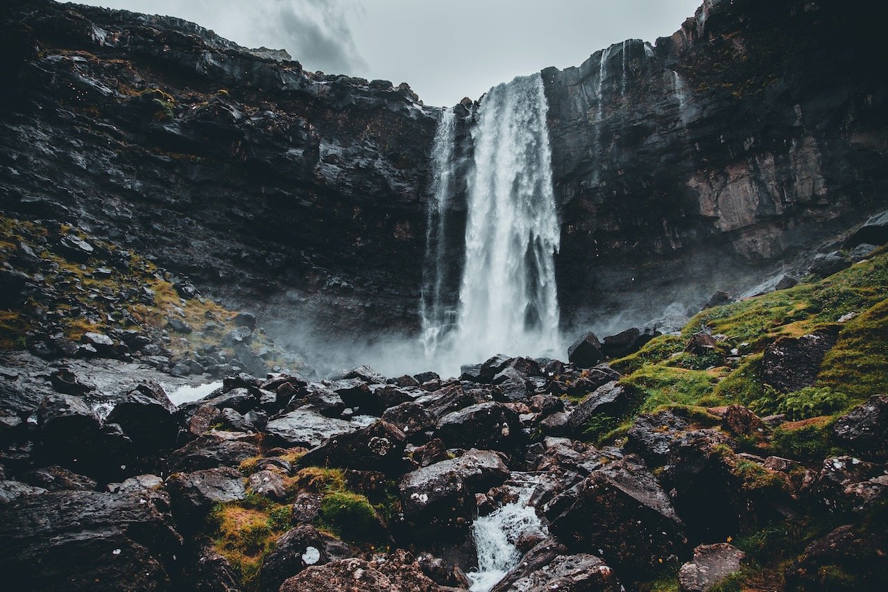
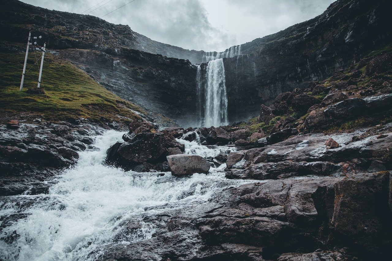
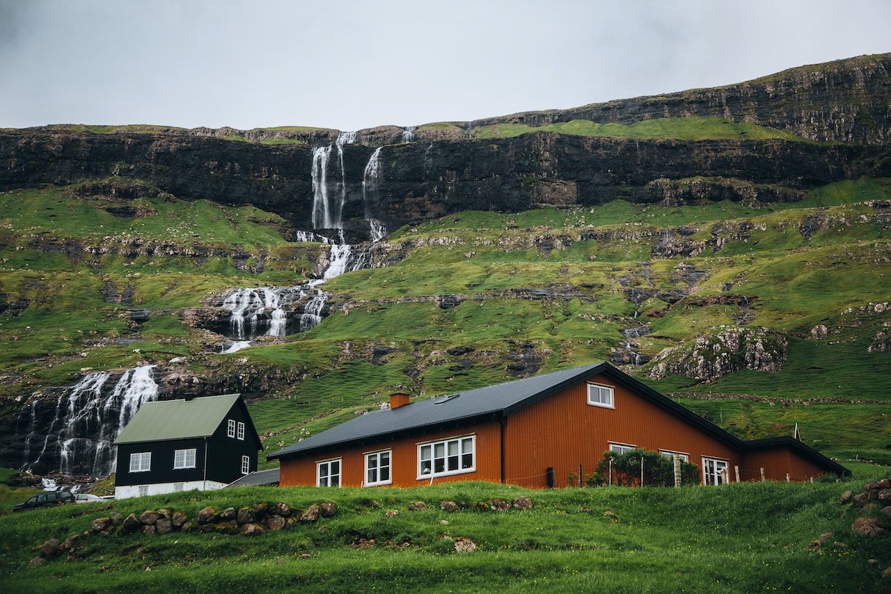
On the same road as Tjørnuvik, along the eastern coast of Streymoy, you will eventually pass the Fossá Waterfall. It’s name literally translates to ‘river with waterfalls’, how appropriate. This behemoth is the largest in the entire country, standing 140 meters tall. You can see it up close and personal, and also from the western coast of the neighboring island of Eysturoy.
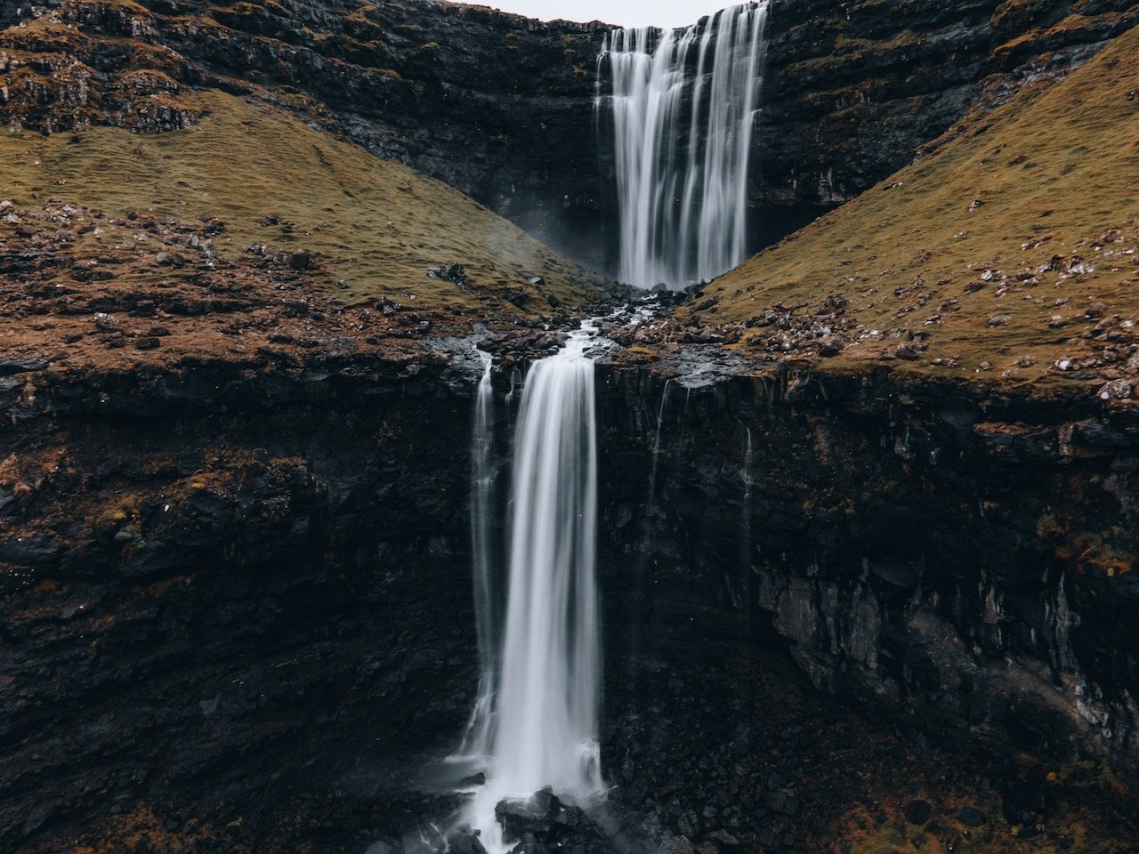
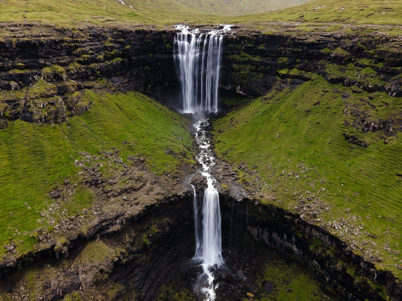
What was truly magical for me was that I was the only person there when I visited. For a place with such natural significance, this really surprised me. You can hike up the two steps of the waterfall if you wanted to but I was pretty tired already from the flight in. I really loved the raw tones from the falls, the spray from the water, and the rushing sound whooshing around you. Probably one of my favorite places in the whole country!
Kvivik is an old settlement in the Faroe Islands and is the location of Viking home ruins. The village features the Kvivik Church, built in 1903, a rowing club (Kvívíkar Sóknar Róðrarfelag), and a school. What I liked about the village was the small stream that ran through it down to the water and how the town has built around it so seamlessly. And I can’t get over the colorful homes as well.

Another village on the northeast coast of the island is Haldarsvík. The crown jewel of the town though isn’t even in the town at all, but just a short hike away. I am talking about Kluftáfossur, a tall and skinny waterfall that is flanked by two tall cliff faces. Just one of many waterfalls in the Faroe Islands, there are none that look quite like it in the country so it is worth seeing.

Tórshavn is the capital of the Faroe Islands and translates to ‘Thor’s Harbor’ (Blog Post: A Journey to the Faroese Capital of Tórshavn). It is situated on the southeastern coast and contains about 40% of the entire Faroese population. The Norse established their government here, specifically on the Tinganes peninsula, meeting for the first time in 825.
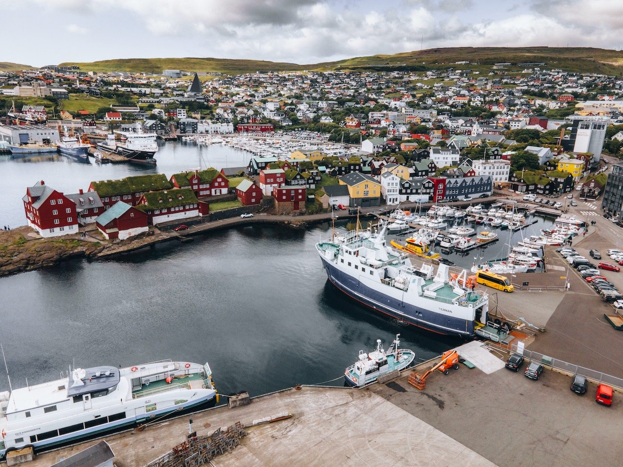
As with most capital cities in the Nordics, there is always a cathedral of significance. Tórshavn Cathedral is the second oldest in the country and consecrated in 1788. It is situated in the center of the town, admits the old town and a small botanical garden and cemetery to its sides.
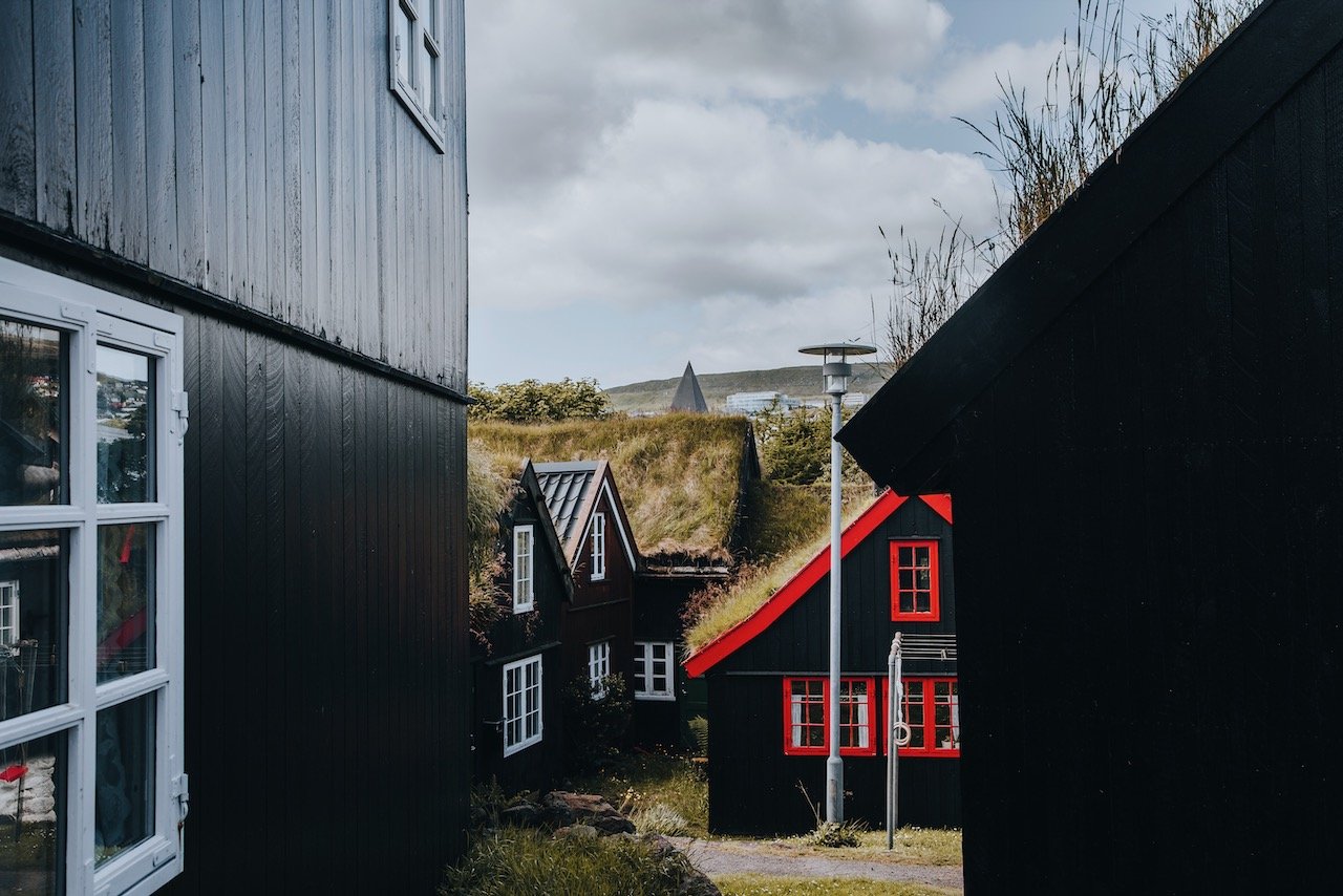
The Tórshavn old town is small but very charming. Take a walk through this area and immerse yourself in the turf roofed homes that are reminiscent of the older Faroese era. Be sure to take caution when photographing this area as these are people's actual homes.
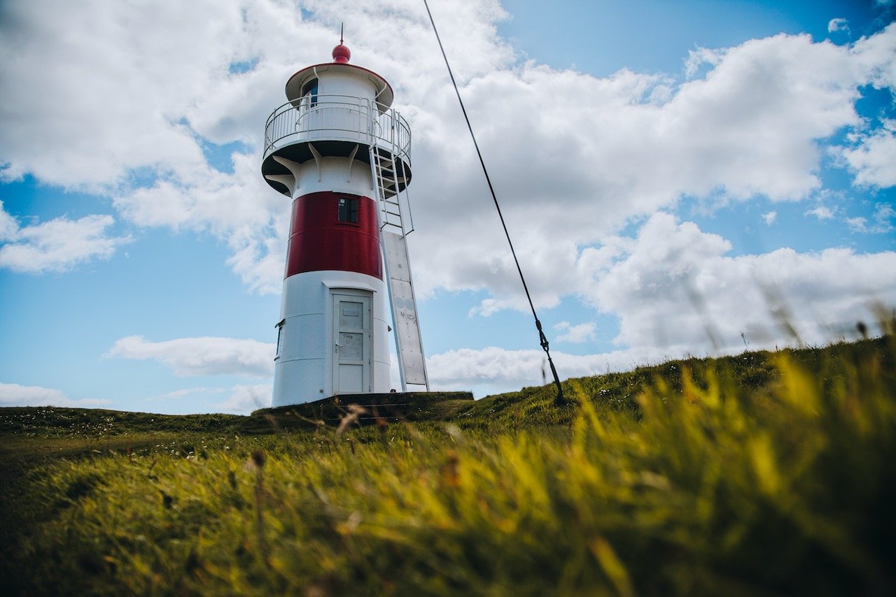
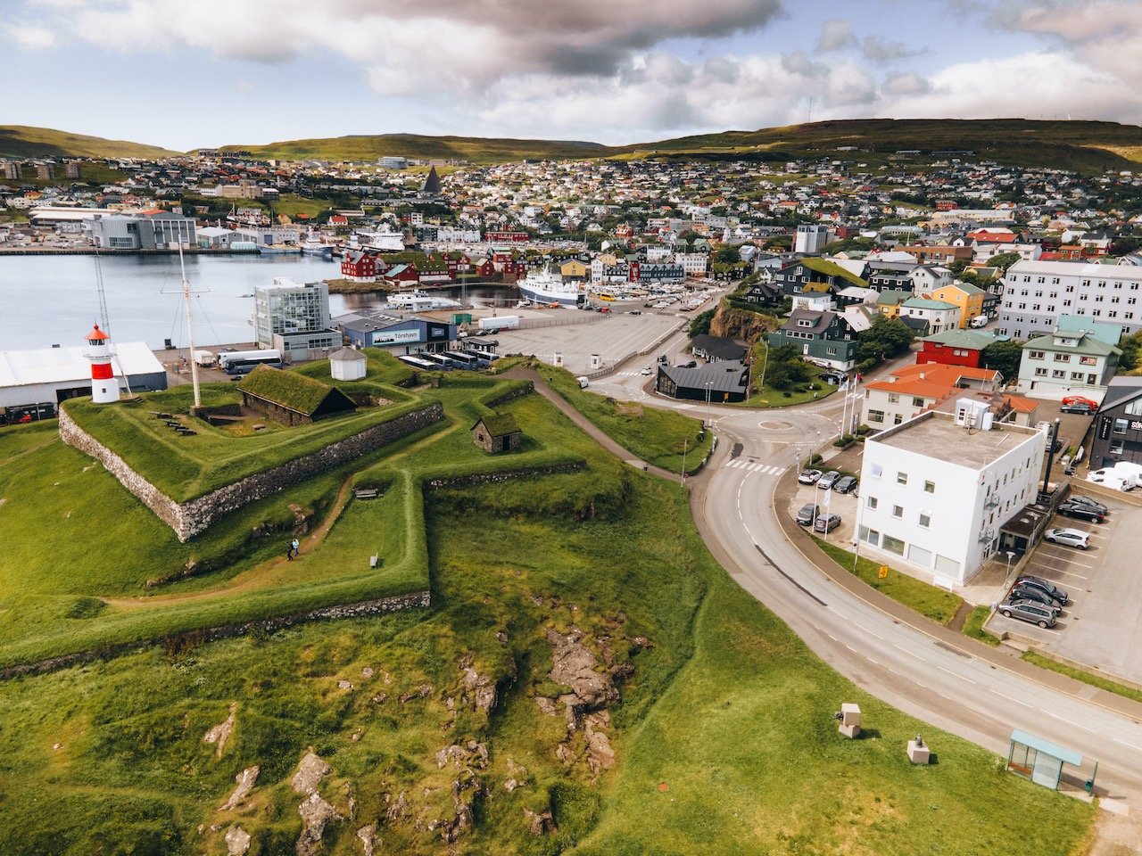
For those who love lighthouses, the Skansin fortress features a red and white lighthouse with great views over the entire city. It was built in 1580 to protect the town from pirates. You will see some canon remnants of the time used for this defensive purpose. The British also used this fort as a military base in World War II.
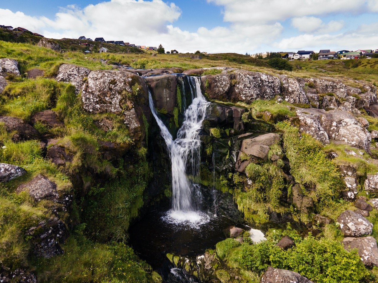
Svartafoss Waterfall, Tórshavn, Faroe Islands (ISO 200, 4.5 mm, f/2.8, 1/30 s)
Lastly, when you get a little bit outside of the city, you return to nature. One such place is the Svartafoss Waterfall, just 2 kilometers north of the city center.
On the western coast of Streymoy, you will find the Magnus Cathedral (Kirkjubømúrurin). It is the ruins of an old cathedral in the village of Kirkjubøur. More importantly, these ruins are the largest in the Faroes.
They date back to the year 1300 and is thought to actually have never been finished. After some religious restructuring within the Faroe Islands, the structure was left to decay for centuries.
Now of course, this is not a comprehensive list of what to see in Streymoy, however it should be a good representation of what you can expect when you visit. I tried to highlight what I truly enjoyed and hopefully you feel the same. I will discuss more on what to see on each of the Faroese islands in future posts!