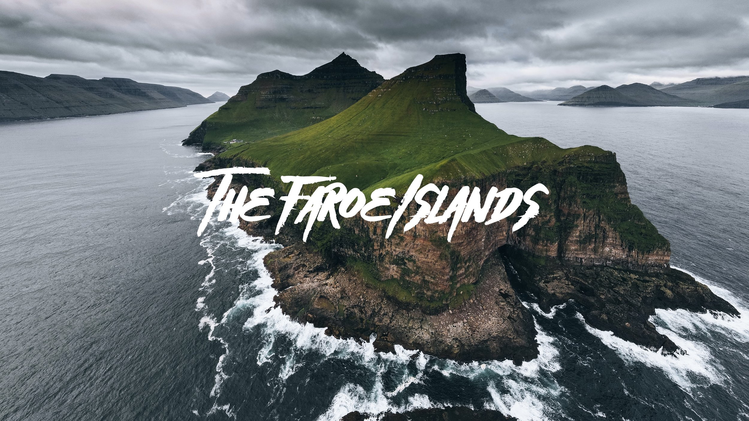
A Journey to the Faroe Islands: The Island of Vágar

Muláfossur Waterfall, Gasadalur, Faroe Islands (ISO 200, 4.5 mm, f/2.8, 1/60 s)
(Some links in this post are affiliate links. If you click through and take action, I'll be compensated.) If you are also interested in any PRINTS from any of my posts, be sure to check out my store where you can buy prints as posters, in metal/wooden frames or on canvas.
**This post is the 2nd of a 11-post series discussing what to see in this part of the Faroe Islands (You can check out the other parts in the list below, separated by each specific island (just click on the island name to see the blog post. Everything is also summarized in another post here.**
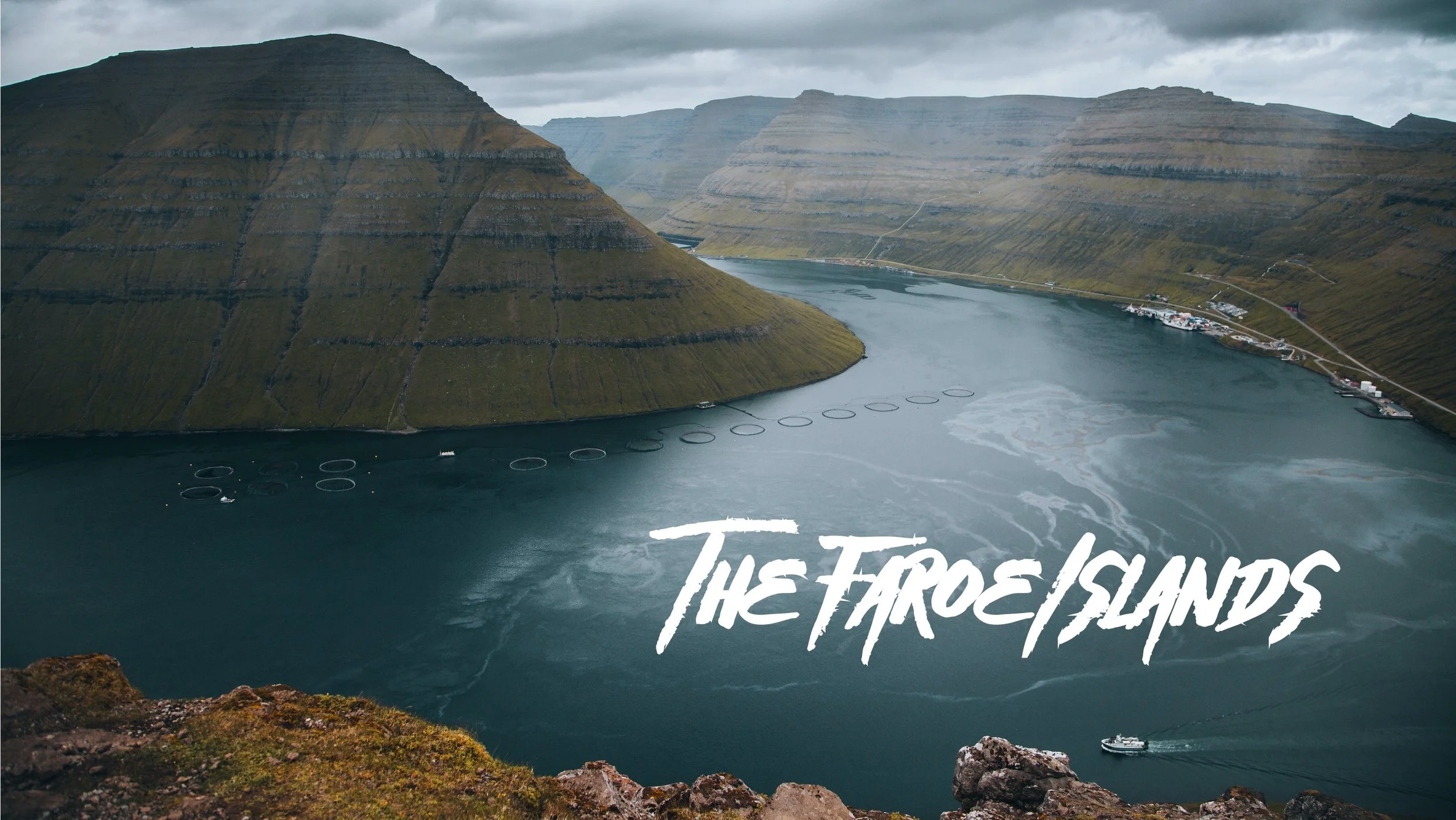
The Faroe Islands, or the Faroes, are an archipelago located in the North Atlantic Ocean and are a part of Denmark. The subpolar oceanic climate, moderated by the Gulf Stream, make the temperature of the Faroes nearly constant throughout the year.
Origins of the Faroe Islands date back as early as 500 AD, thought to be settled by people from Great Britain or Ireland. [Funfact: The population of sheep (70,000) outnumber the human population (54,000)]
Tórshavn (Blog Post: A Journey to the Faroese Capital of Tórshavn)
Vágar (Blog Post: A Journey to the Faroe Islands: The Island of Vágar)
Streymoy (Blog Post: A Journey to the Faroe Islands: The Island of Streymoy)
Eysturoy (Blog Post: A Journey to the Faroe Islands: The Island of Eysturoy)
Bordoy (Blog Post: A Journey to the Faroe Islands: The Island of Bordoy)
Kalsoy (Blog Post: A Journey to the Faroe Islands: The Island of Kalsoy)
Vidoy (Blog Post: A Journey to the Faroe Islands: The Island of Vidoy)
Mykines (Blog Post: A Journey to the Faroe Islands: The Island of Mykines)
Sandoy (Blog Post: A Journey to the Faroe Islands: The Island of Sandoy)
Kunoy (Blog Post: A Journey to the Faroe Islands: The Island of Kunoy)
The Waterfalls of the Faroe Islands (Blog Post: The Waterfalls of the Faroe Islands)
In this blog post, I will cover the island of Vágar. A Google Map of these places I will talk about can be seen at the end of this article. Check out my drone video on the island of Vágar in the Faroe Islands below!

Vágar island of the Faroese archipelago is one of the ‘large islands’ and its general shape resembles a dog’s head (so they say). Since the airport is located on this island, it is the first taste of the Faroe Islands that tourists get. This airport served as an airfield during World War II and was used by the British, with the consent of the islanders. The airport was then modernized and commercialized for use in later years. It’s also a great island to start your Faroe Islands road trip adventure.
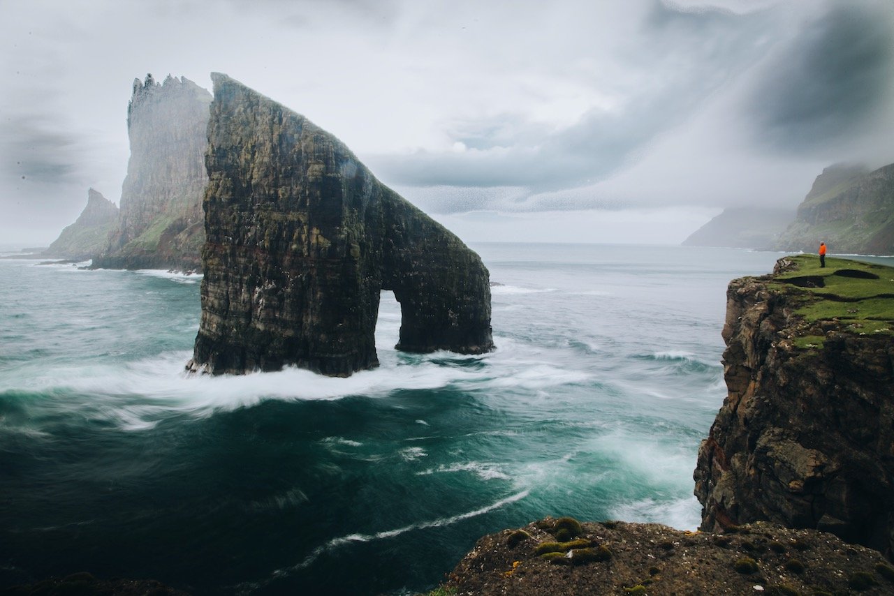
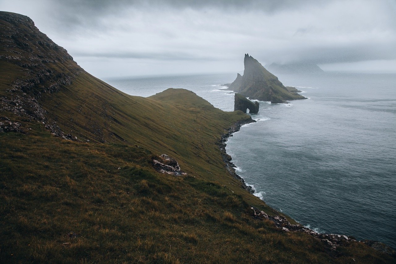
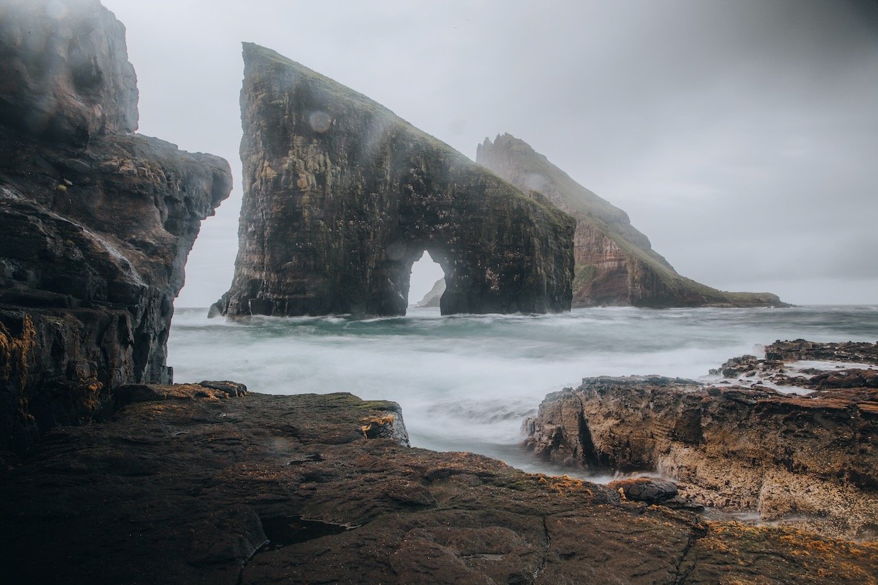
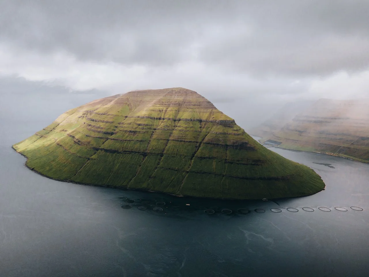
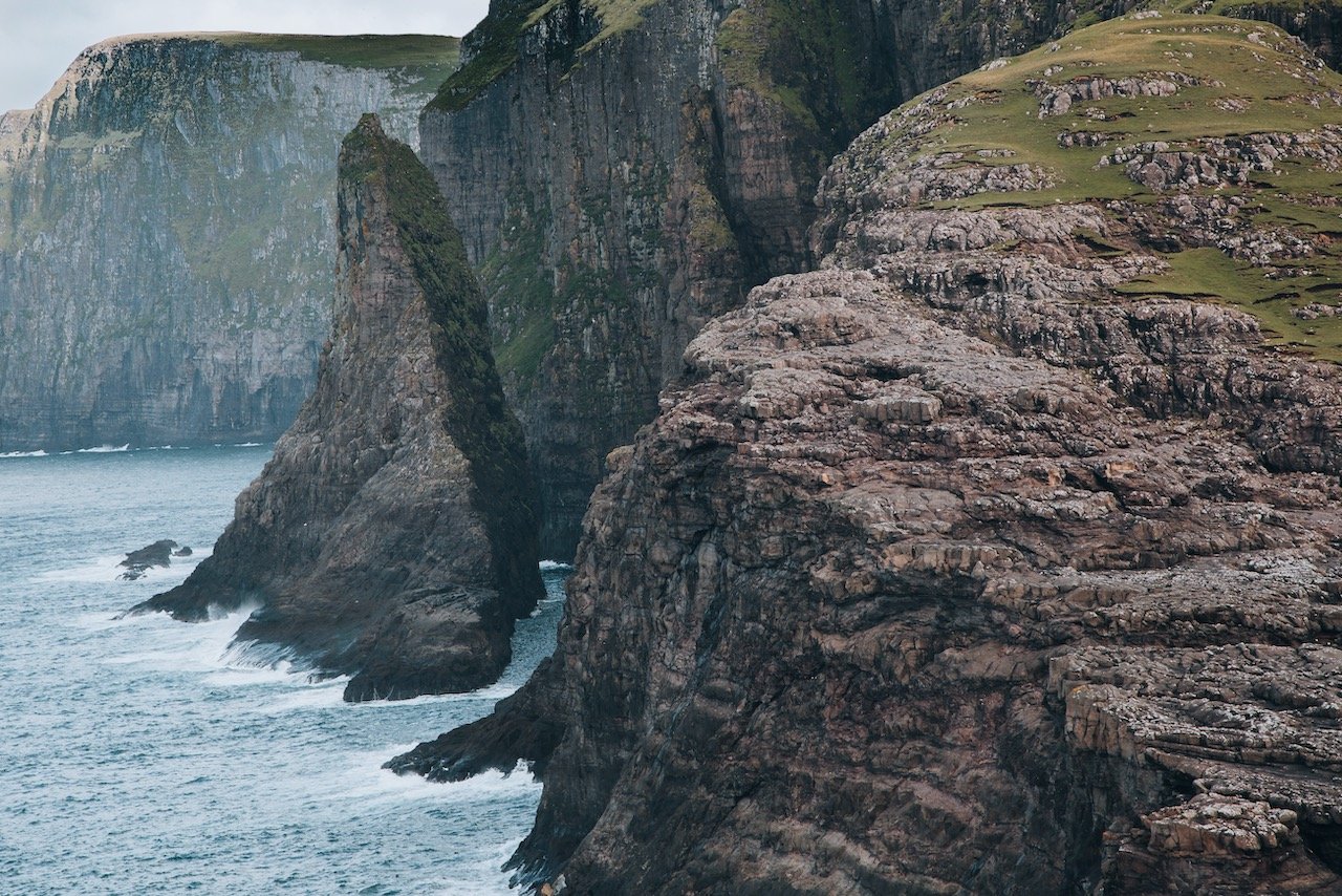
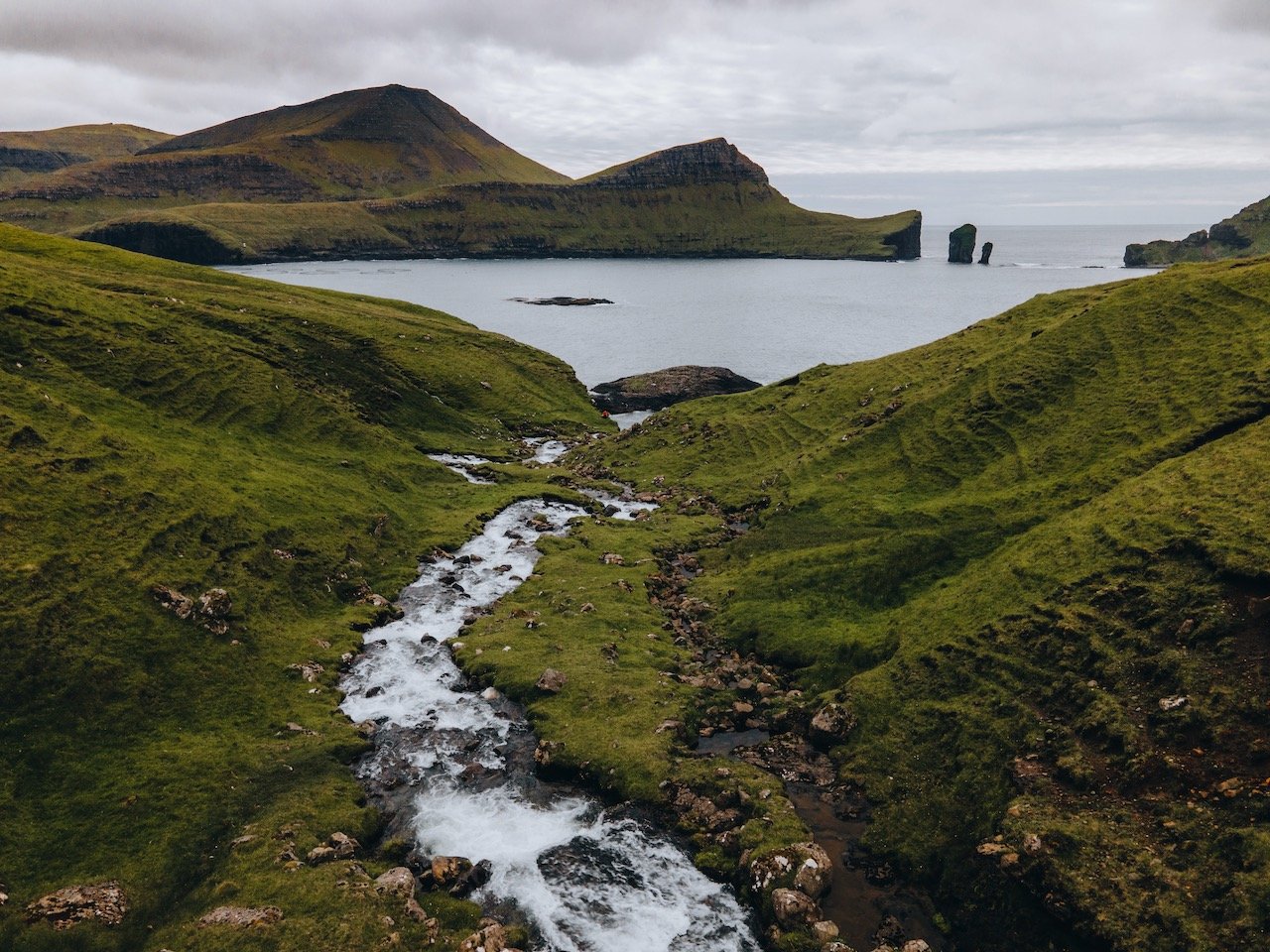
Tindhólmur and Drangarnir are two of the most iconic smaller islands/rocks that aren’t exactly accessible from Vágar, but with a 3 hour hike, you can see them up close and personal.
Tindhólmur’s landscape is distinct, containing 5 peaks in succession at its highest point. They even have names: Ytsti, Arni, Lítli, Breiði, Bogni, which translate to Farthest, Eagle, Small, Broad and Bent, respectively. The peak(s) are 262 meters tall and the island is only inhabited by sheep.
Drangarnir is composed of two sea stacks between Tindhólmur and Vágar, aptly called Stóri and Lítli Drangur, meaning ‘large’ and ‘small’ sea stack. It is absolutely stunning when you get up close to it amidst the crashing oceans waves and turquoise blue water. We even saw a seal or two here.
To hike here, you need an official guide. This is because hikers require the landowner’s permission and without that permission, you can be fined. Tours start at 11am on Saturdays, Sundays, and Wednesdays. You can book it here.
I would say that the hike isn’t too bad, fitness-wise. Towards the end of the hike, you start to ascend in elevation and descend when you get close to the coastline. I would just be cautious if the terrain is wet/muddy and make sure you have sure footing.
If you like some of my photos that you have come across, just know that I have many prints showcasing a variety of landscapes, including Faroe, available for purchase below! (Sold as Posters, Canvas, or in Metal-Frames and Wooden-Frames).


Bøddalafossur Waterfall, Vágar, Faroe Islands (ISO 100, 24 mm, f/22, 0.6 s)
The Bøsdalafossur waterfall, one of many Faroese waterfalls is 30 meters tall and located on the western coast of vágar. From here, you can watch the planes fly into the valley that you just hiked through on their final approach to the airport. Also, be careful, it can be VERY windy here.
Vágar, Faroe Islands (ISO 200, 105 mm, f/9, 1/100 s)
In order to reach this waterfall, you have to hike Sørvágsvatn Trail. This is more of a long walk (45 minutes) rather than a grueling hike. When you part at the trailhead, you have to pay the hiking fee, which is 200 Danish Krona. The path is well kept, with the exception of some muddy parts and the elevation does not drastically change. There are many birds in this area as it is a popular nesting place.
Once you near the end of the trail you will finally get to the Bøsdalafossur waterfall and you’ll also get to Trælanípa (Slave Cliff). This nearly perpendicular rock wall protrudes 142 meters out of the sea. From here you can get a great view of Sørvágsvatn lake as well as the southern tips of Streymoy and Sandoy islands.

Witches Finger (Trøllkonufingur), Sandavágur, Faroe Islands (ISO 200, 105 mm, f/9, 1/320 s)
Another cool landmark to see, which doesn’t require much hiking is via the Witches Finger Trail (Trøllkonufingur). The short path from the parking area in Sandavágur leads you to a viewpoint that then reveals a 313 meter tall rock formation emerging from the sea. This monolith is climbable, 11 people have done it before, but I imagine they were pros….I am definitely not.

Faroe Islands (ISO 200, 105 mm, f/4, 1/1600 s)
The Legend of Trøllkonufingur is as follows:
Trøllkonufingur is the finger of a witch that came to throw the Faroe Islands to Iceland. When she came to the sea south of Vágar, the sun came up and she was turned into stone and fell into the ocean.
She was so big that when she reached the bottom of the sea, the back of her head and her finger were above the surface. The back of her head is the island of Koltur, and the finger is Trøllkonufingur.
It is said that in 1844 a member of the Danish royal entourage climbed Trøllkonufingur. At the top he waved to Crown Prince Frederik, as he sailed past it. As climbing down, he realized that he had left one of his gloves at the top. He decided to climb up again to get it. Having just climbed it the first time he was tired and stumbled and fell into his death.
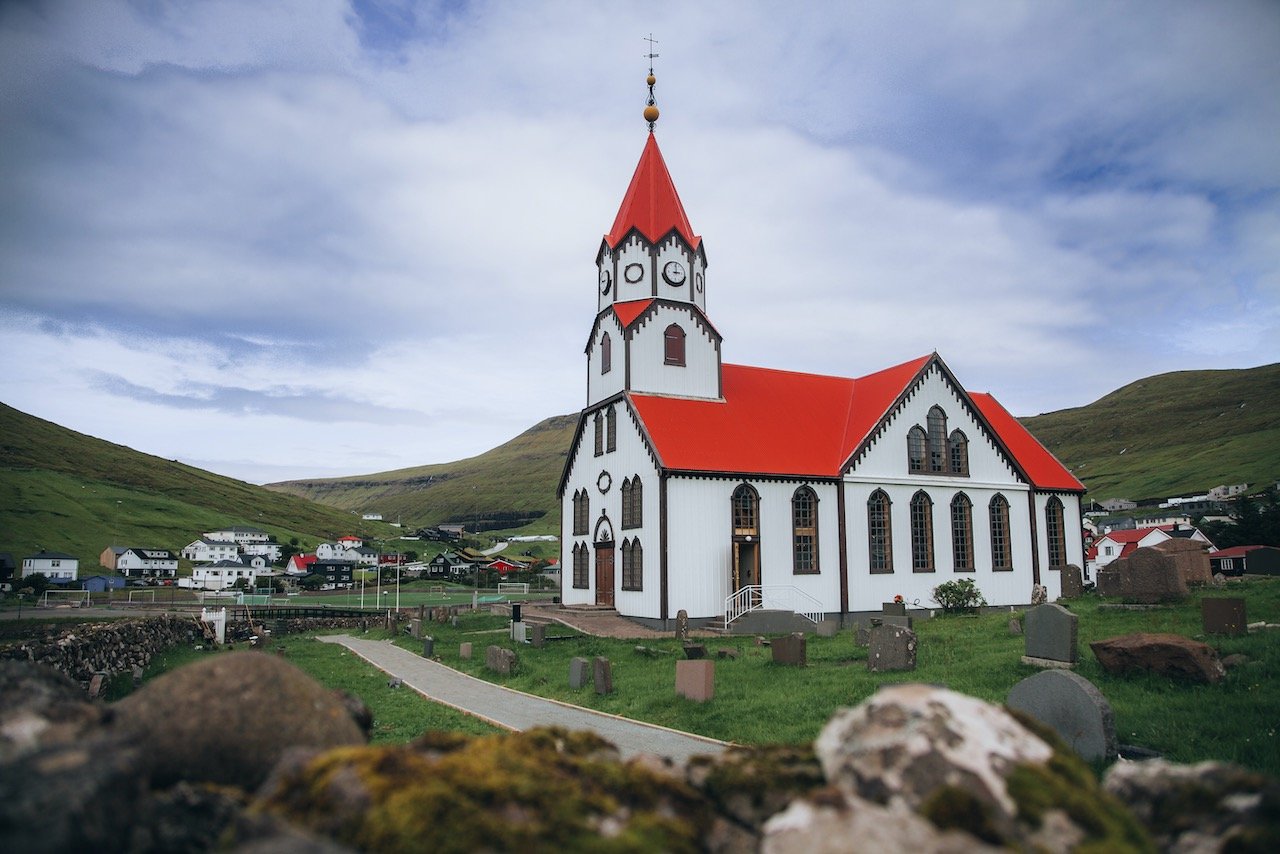
Sandavágur Church, Vágar, Faroe Islands (ISO 100, 24 mm, f/4, 1/1000 s)
In the same village as The Witches Finger trail, stands the Sandavágur Church (Sandavágs kirkja). It is nearly impossible to miss due to its distinctive red roof. It was consecrated in 1917 and features a memorial outside dedicated to the large number of ships sunk during World War II.
Dunnesdrangar is another rock formation that is accessible by foot near Vágar airport. The trail leading here is only 3 kilometers and starts at the village of Sørvágur. These monoliths are around 70 meters tall and come right out of the ocean.
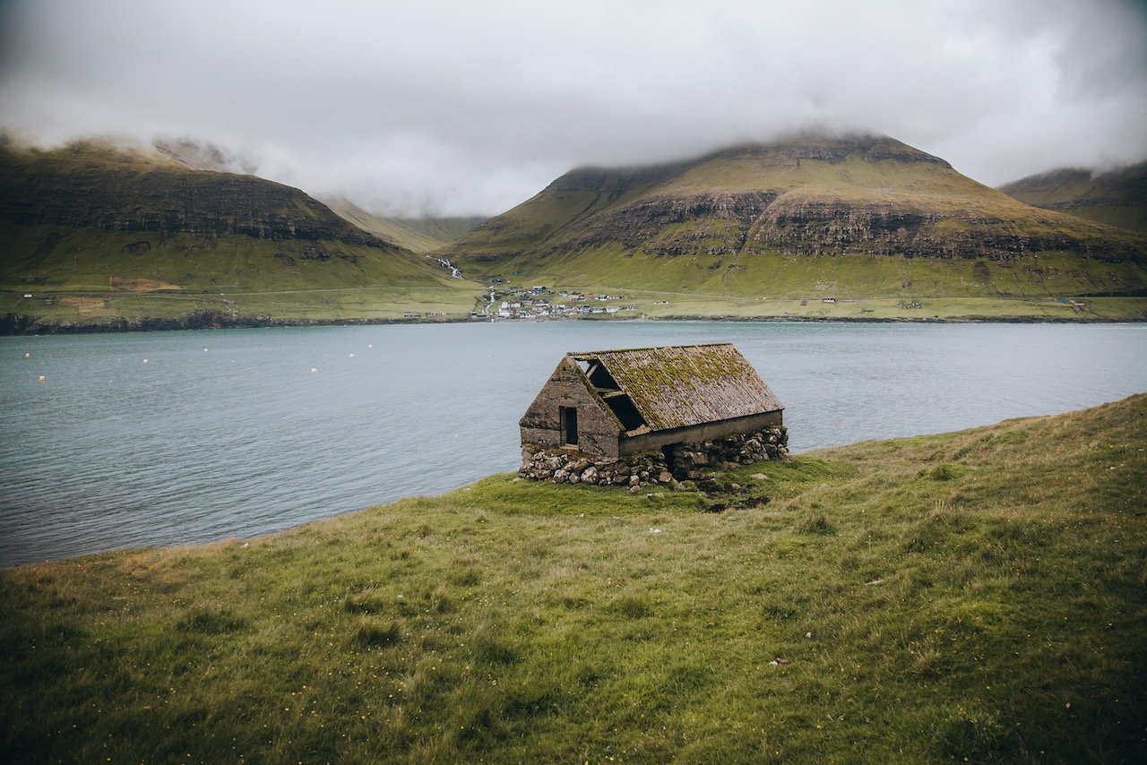
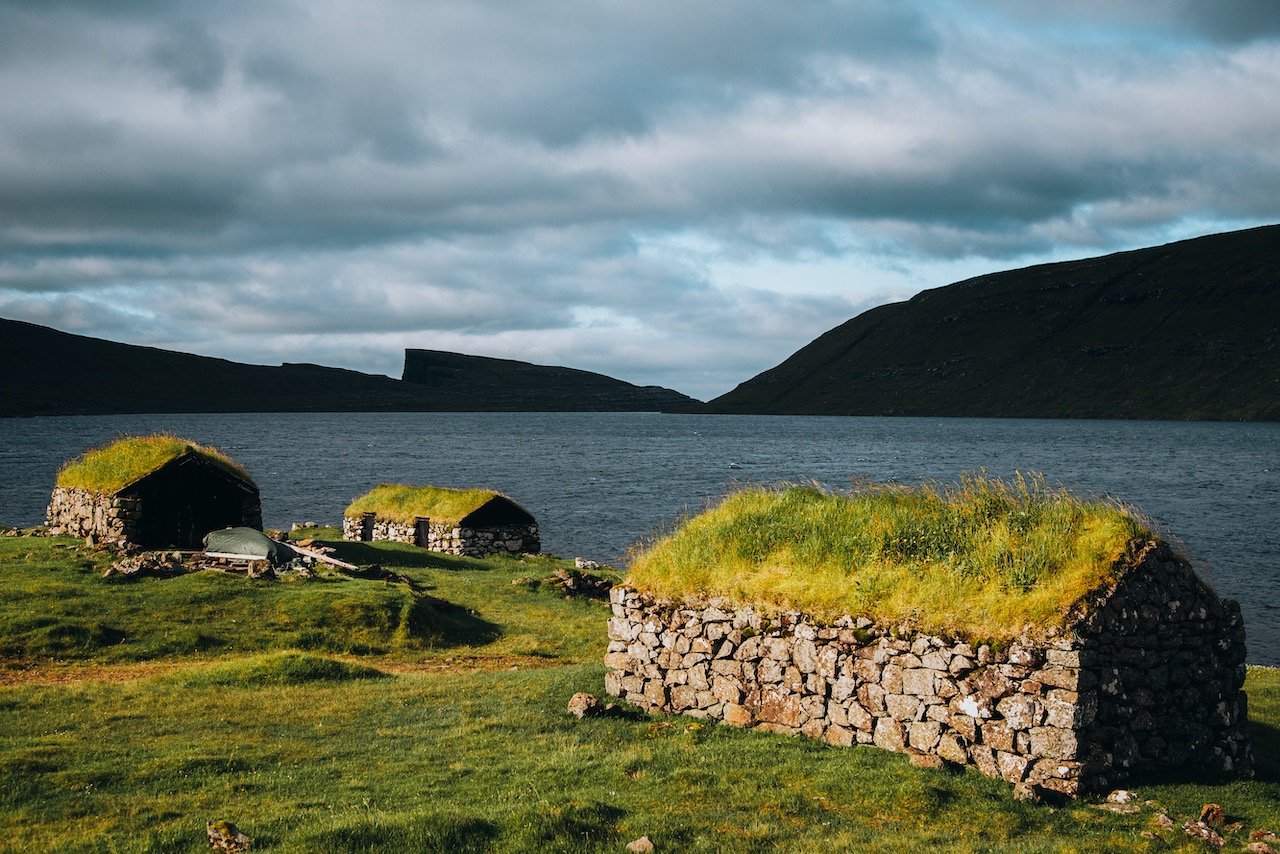
The village of Bøur happens to be one of the most beautiful in the entire Faroe Islands. From there, you get great views of Tindhólmur and the Drangarnir sea stacks. What is most special here are the traditional turf roof homes that the Faroe Islands are known for. It is thought to be older than 1350 AD.
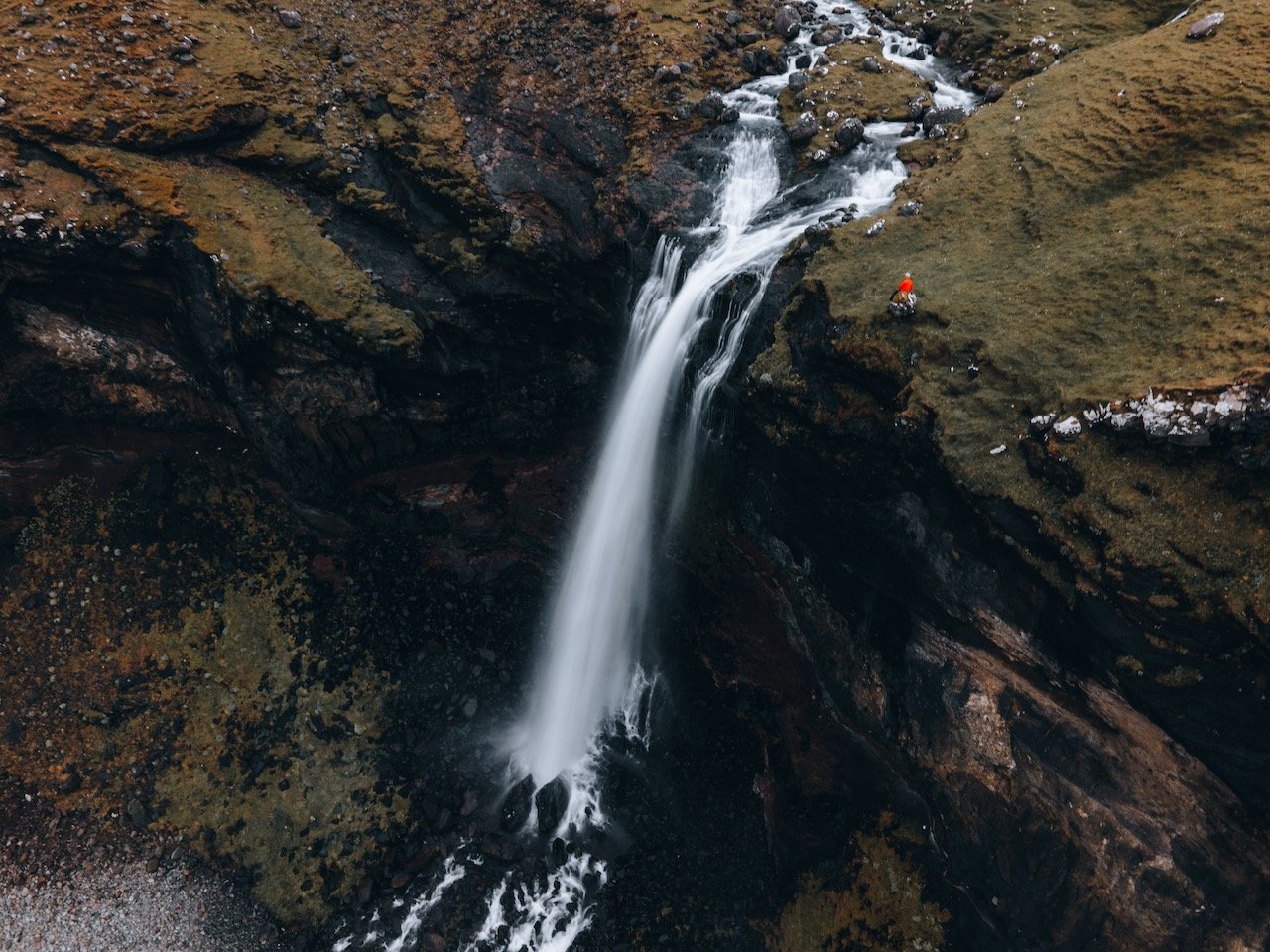
The Skarðsáfossur waterfall is nearby Bøur, on the same road, and is accessible from the road side after 5 minutes of walking. If you find a parking area off the roadside before the tunnel to the small town of Gásadalur, you can then make your way to the cliff side by following the stream of water leading you down there. I know of no way to get down to the beach, however you can still hang out at the summit of the waterfall. If you have a drone like me, you can get some pretty spectacular views.
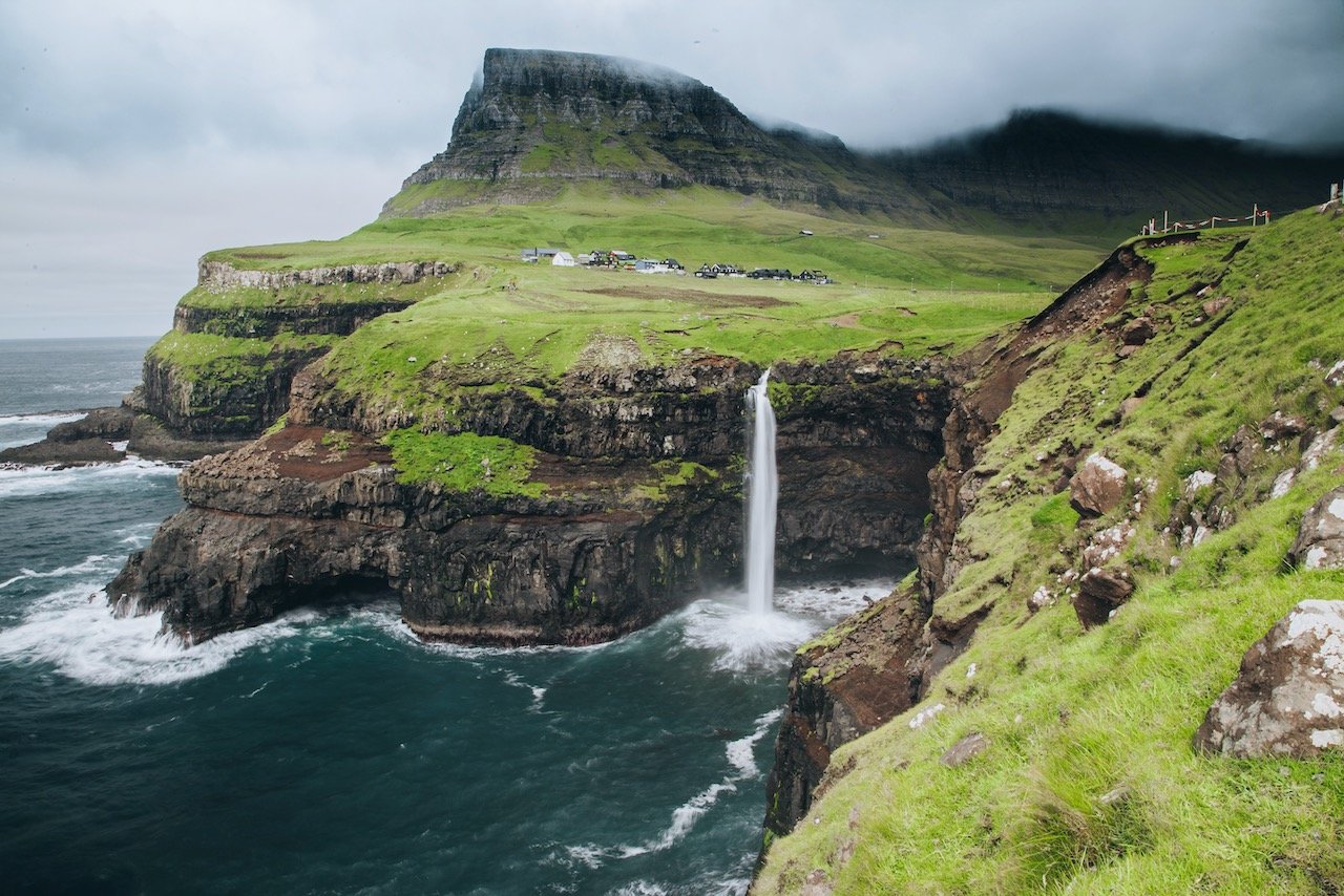
Múlafossur Waterfall, Gasadalur, Faroe Islands (ISO 100, 24 mm, f/22, 0.5 s)
The Múlafossur Waterfall is located in the village of Gásadalur. This village used to only be accessible by foot before the Gásadalstunnilin tunnel was constructed. Only 25 homes exist in this small and secluded village, but they sure are lucky to have their own waterfall (in my humble opinion).
Múlafossur Waterfall translates to ‘Promontory Waterfall’ and features a 30 meter drop. On the windiest of days, not much of the water actually drops into the water below before it is blown away by the wind. There are many sheep that inhabit this area as well so be on the lookout for them.
I had limited time in the Faroe Islands, so the second I landed, I picked up my rental car from JustDrive (AMAZING experience with them by the way, you should rent the Fiat 500 all electric car), and blitzed the island of Vágar and still had hours left in the day. This is just how close everything is and how easily accessible it is. It will be one of your favorite islands in Faroe!
This summary of Vágar is not comprehensive but provides you a basis with the main sights to see on this Faroese island. I will highlight other islands in future posts!