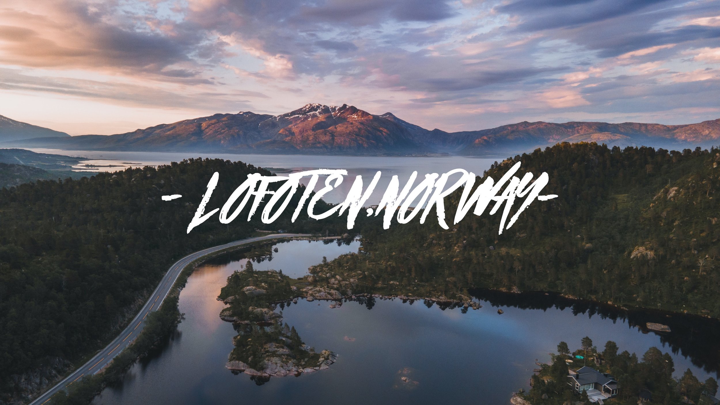
The Epic Lofoten Islands Road Trip
Svolvaer, Lofoten, Norway (ISO 200, 4.5 mm, f/2.8, 1/50 s)
(Some links in this post are affiliate links. If you click through and take action, I'll be compensated.) If you are also interested in any PRINTS from any of my posts, be sure to check out my store where you can buy prints as posters, in metal/wooden frames or on canvas.
**This is a summary post of a 5-post series discussing what to see in the Lofoten Islands (You can check out the other parts below, separated by each specific island: Part 1, Part 2, Part 3, Part 4, Part 5.**
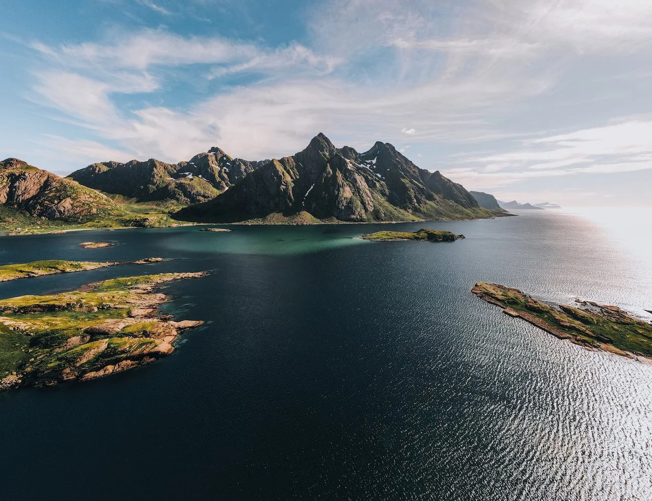
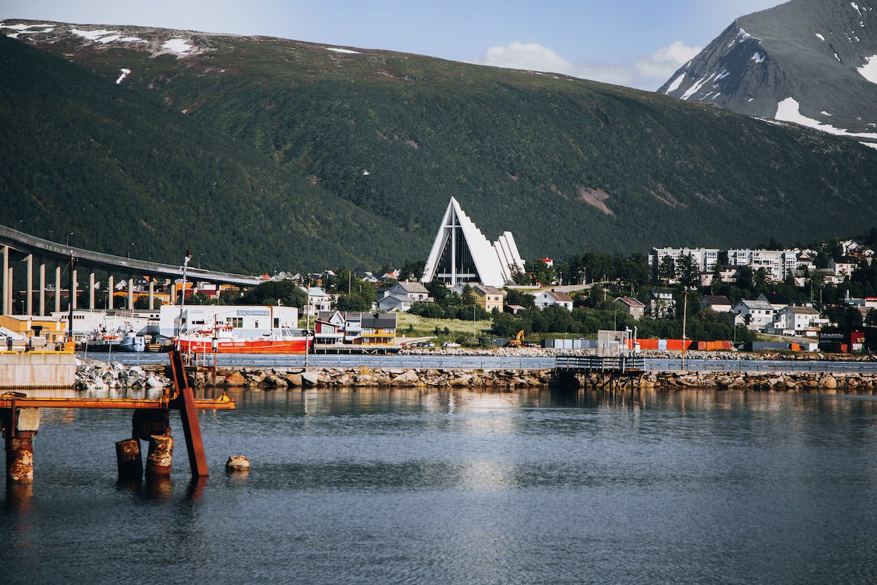
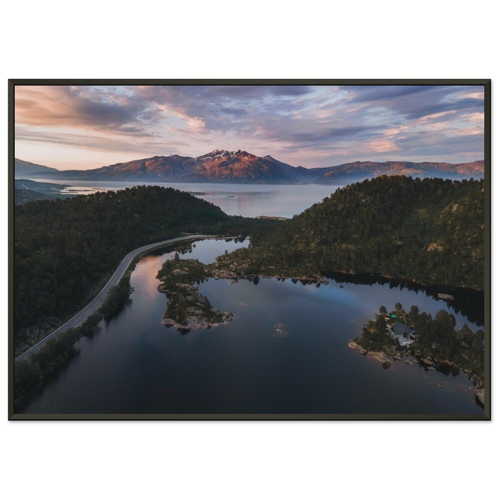
The Lofoten Islands are arguably one of the most beautiful archipelagos in the world. It is located in Northern Norway (Nordland County), within the Arctic circle tucked between the 68th and 69th northern parallels. I picked up a camper van with Arctic Campers in Tromsø, Norway (Blog Post: A Guide to Exploring Tromsø, Norway’s Northernmost City in the Arctic Circle) and had started the road trip towards Lofoten (about 4-5 hour drive).
The definition of which islands constitute Lofoten are always up for debate but for the purposes of this blog post series, I will cover 5 of the islands and reference some others. From North to South, they are composed of:
Gimsøy
Austvågøya (Blog Post: A Journey to the Lofoten Islands: The Island of Austvågøya)
Vestvågøya (Blog Post: A Journey to the Lofoten Islands: The Island of Vestvågøya)
Flakstadøya (Blog Post: A Journey to the Lofoten Islands: The Island of Flakstadøya)
Moskenesøya (Blog Post: A Journey to the Lofoten Islands: The Island of Moskenesøya)
Værøy (Blog Post: A Journey to the Lofoten Islands: The Island of Værøy)
In this blog post, I will break down some of the best places to see in each island of Lofoten. A Google Map of these places I will talk about can be seen at the end of this article. Check out my drone video on the Lofoten Islands below!

Ever since I explored Iceland for the first time in a camper van (Check out my Iceland trips here), I was hooked. This to me is the best way of exploring a new place with such natural beauty. So when I planned a trip to Lofoten, I knew I wanted to start my trip research by finding a good camper van provider.
I decided to go with Arctic Campers. They had decent rates and a great fleet of vehicles, which were modern, most with a proper refrigerator, and very easy to drive. Unfortunately, they are based in Oslo and Tromsø, each several hours away from Lofoten. Therefore, I booked a flight to Tromsø, explored the city a bit, then picked up the van and drove the 4 hours down to the top of Lofoten.
When you come from the US like myself, a 4 hour drive actually isn’t that bad. It’s amazing how far you can get in Europe driving four hours in one direction. In the US, you can still be in the same STATE.
If you like some of my photos that you have come across, just know that I have many prints showcasing a variety of landscapes, including Norway, available for purchase below! (Sold as Posters, Canvas, or in Metal-Frames and Wooden-Frames).

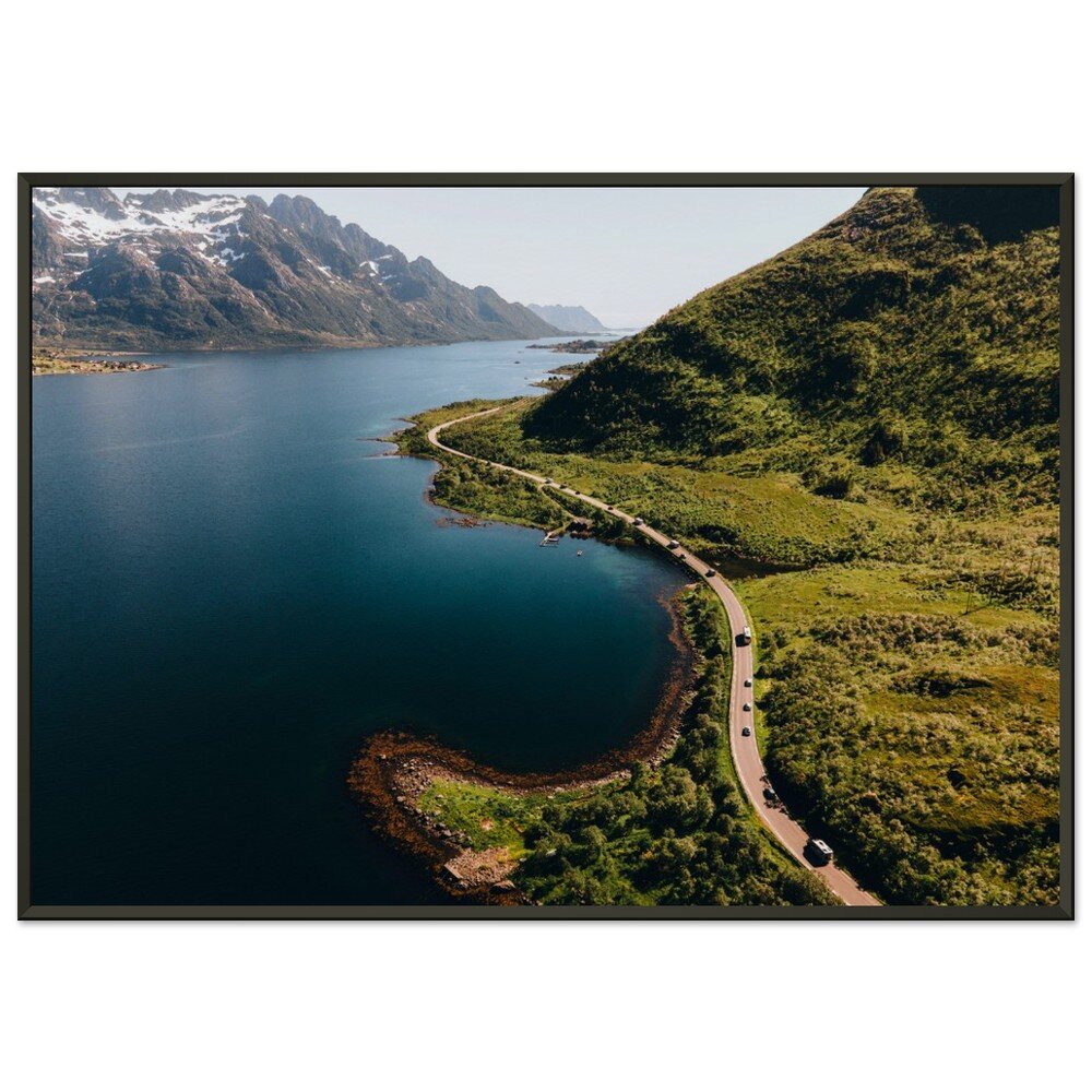


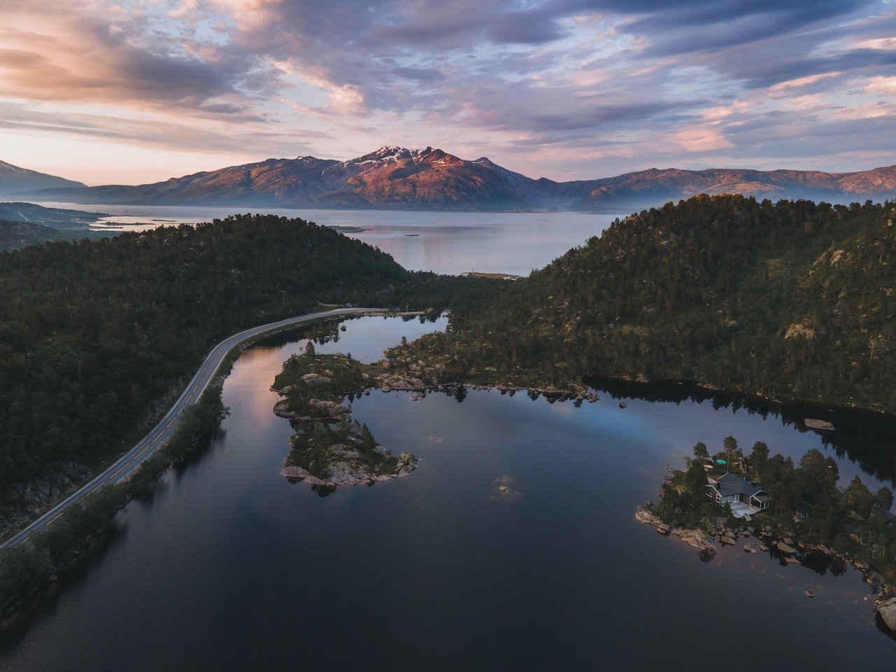
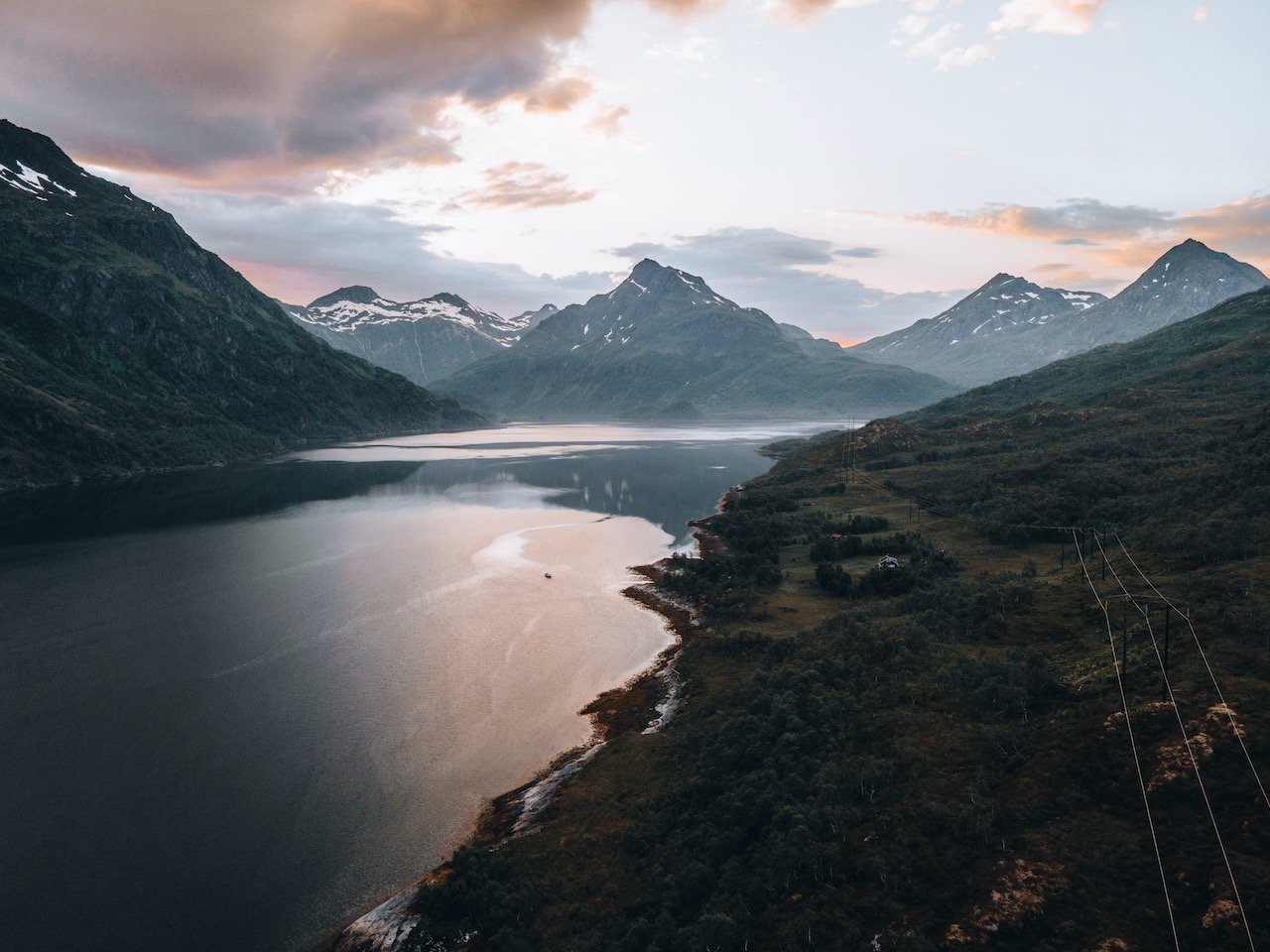
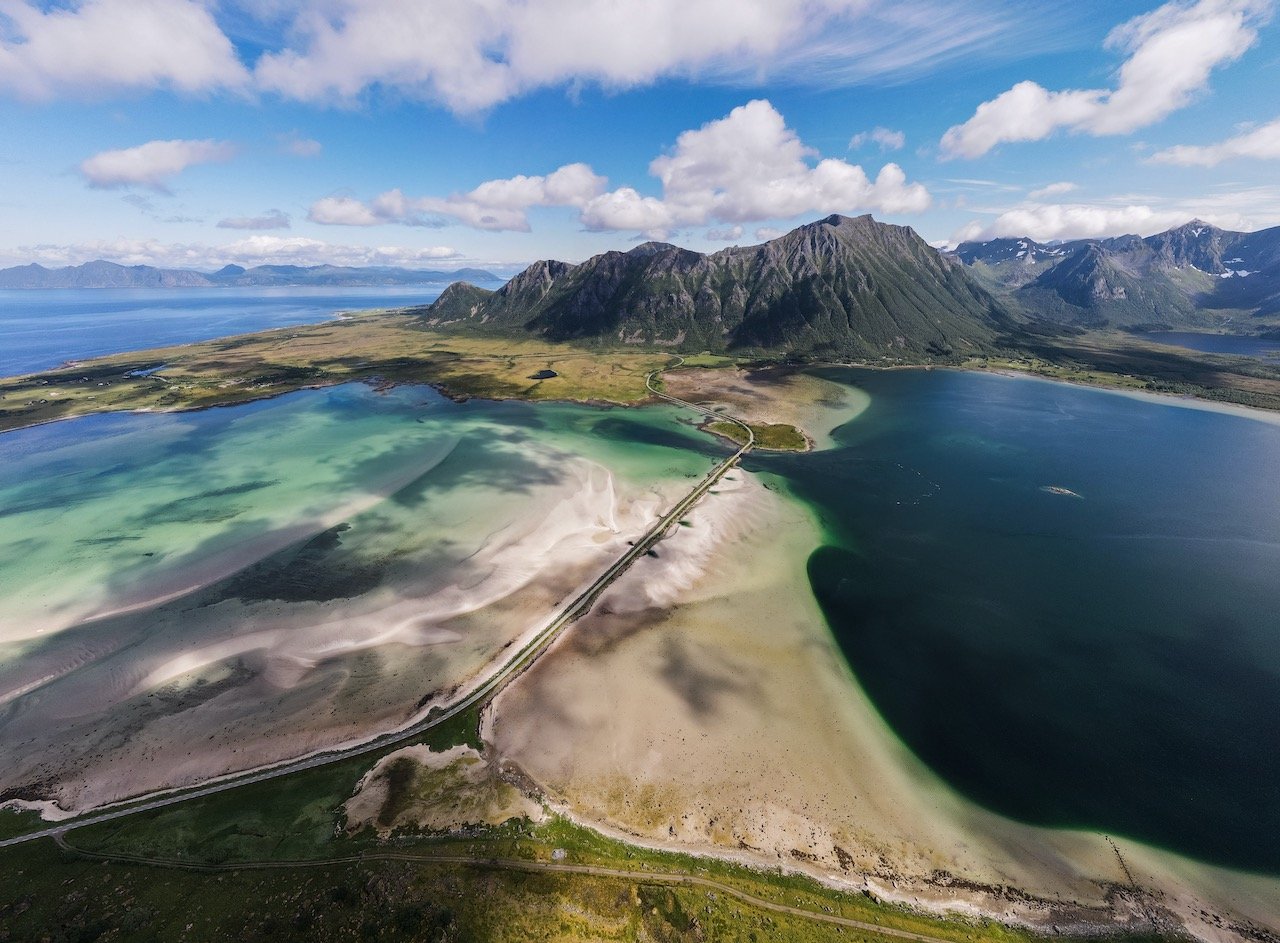
Before you reach Lofoten, you have to drive through the Norwegian countryside a bit, and those views are spectacular. If you managed to stop anytime you wanted to take a photo, you would never reach Lofoten (a GOOD problem to have). Nonetheless, in Nordland County, we took some breaks here and there to stretch and recharge before pressing on to the first Lofoten island of Austvågøya.
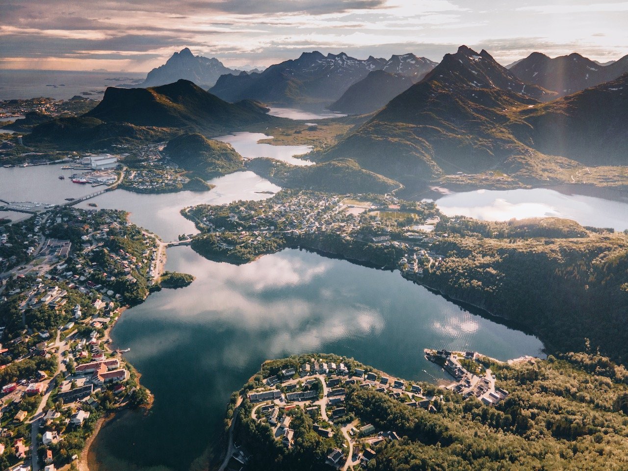
Austvågøya
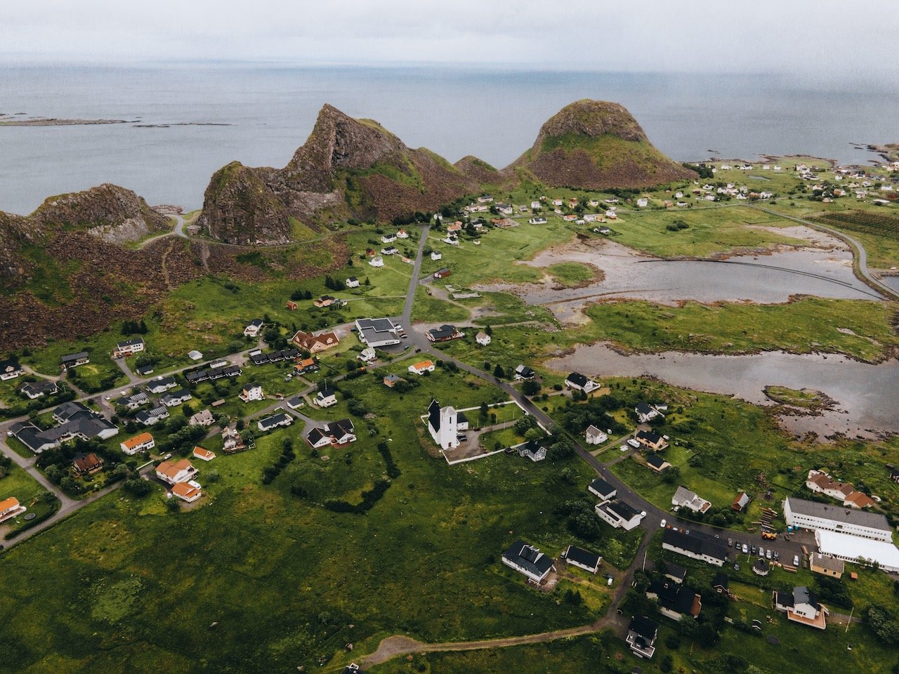
Austvågøya is the largest island in Lofoten, located between the West fjord (Vestfjorden) and the Norwegian Sea. This island has a population of 9,000, with most in the town of Svolvær. This will be the first island you reach if you are coming from Northern Norway via the E10 road. Next to this island in the Lofoten archipelago is Gimsøya (which I have not written about since I didn’t visit it). Here are some of my favorite places from Austvågøya:
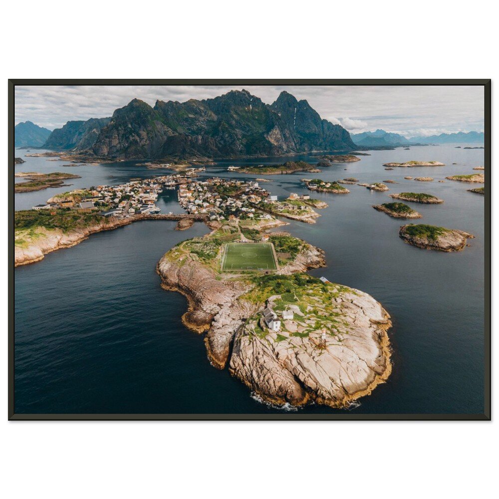
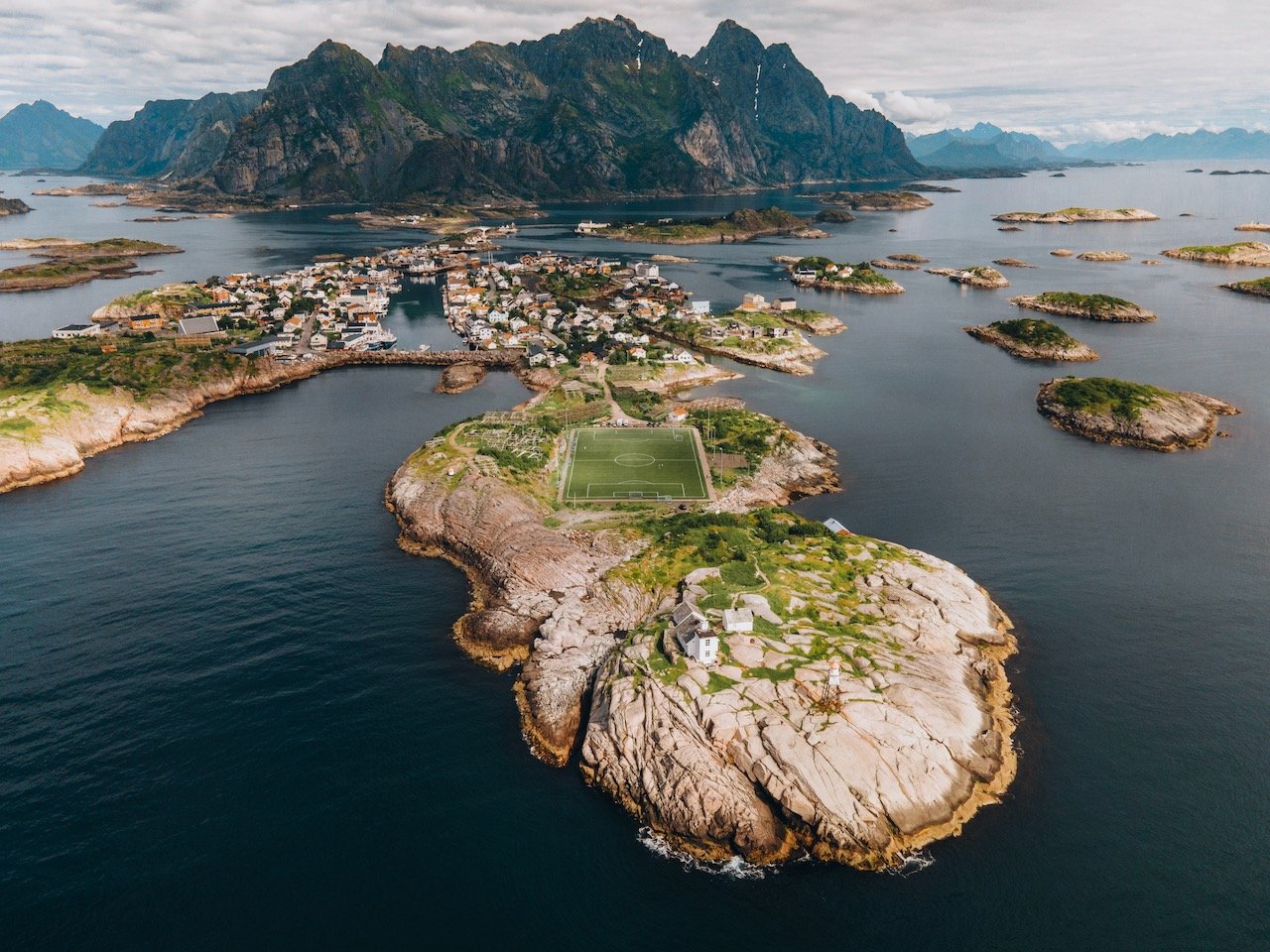
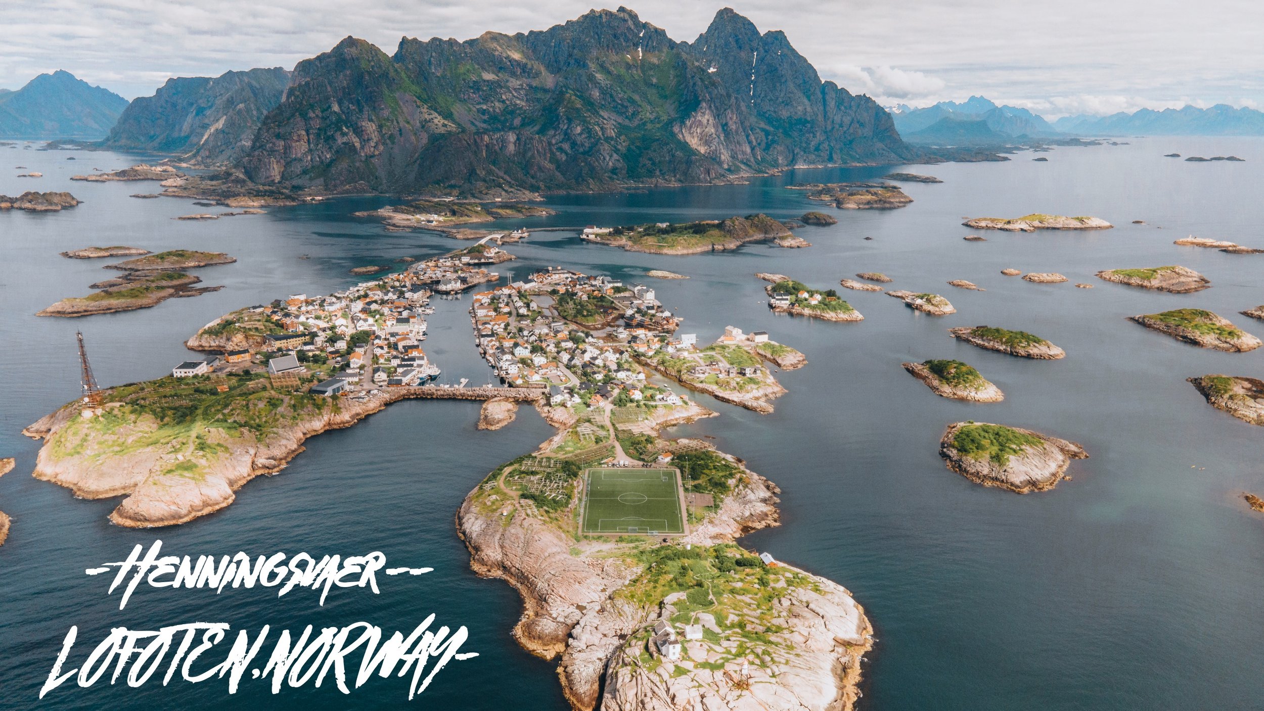
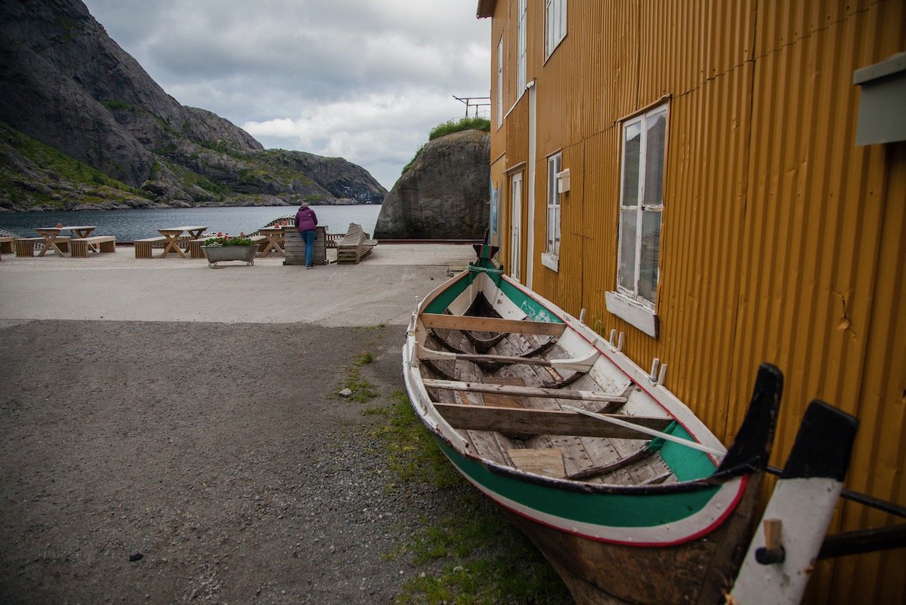
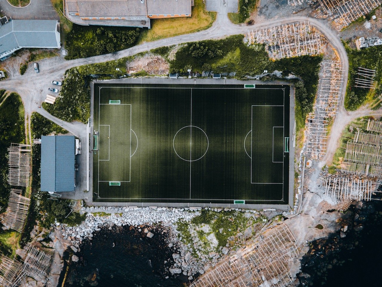
Henningsvær - this fishing village was one of my favorites. We parked in the town center and walked around a bit but here you can find a big harbor, cafes, an art gallery, and even a football stadium. Make you way to the furthest point in the water to catch a glimpse of the football pitch, which is flanked by dozens of fish drying racks.
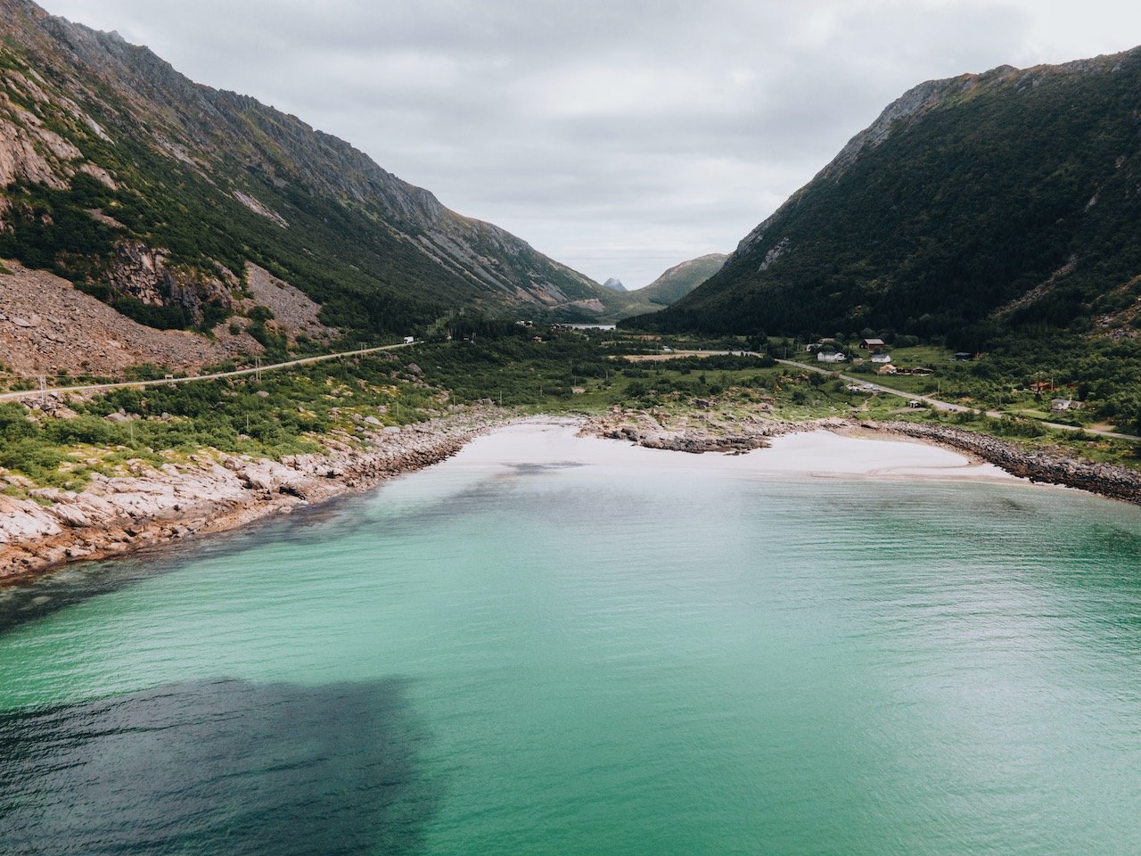
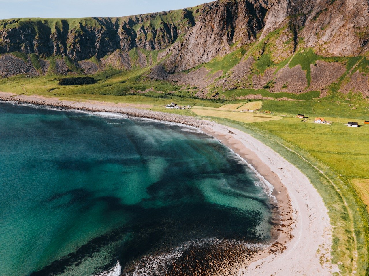
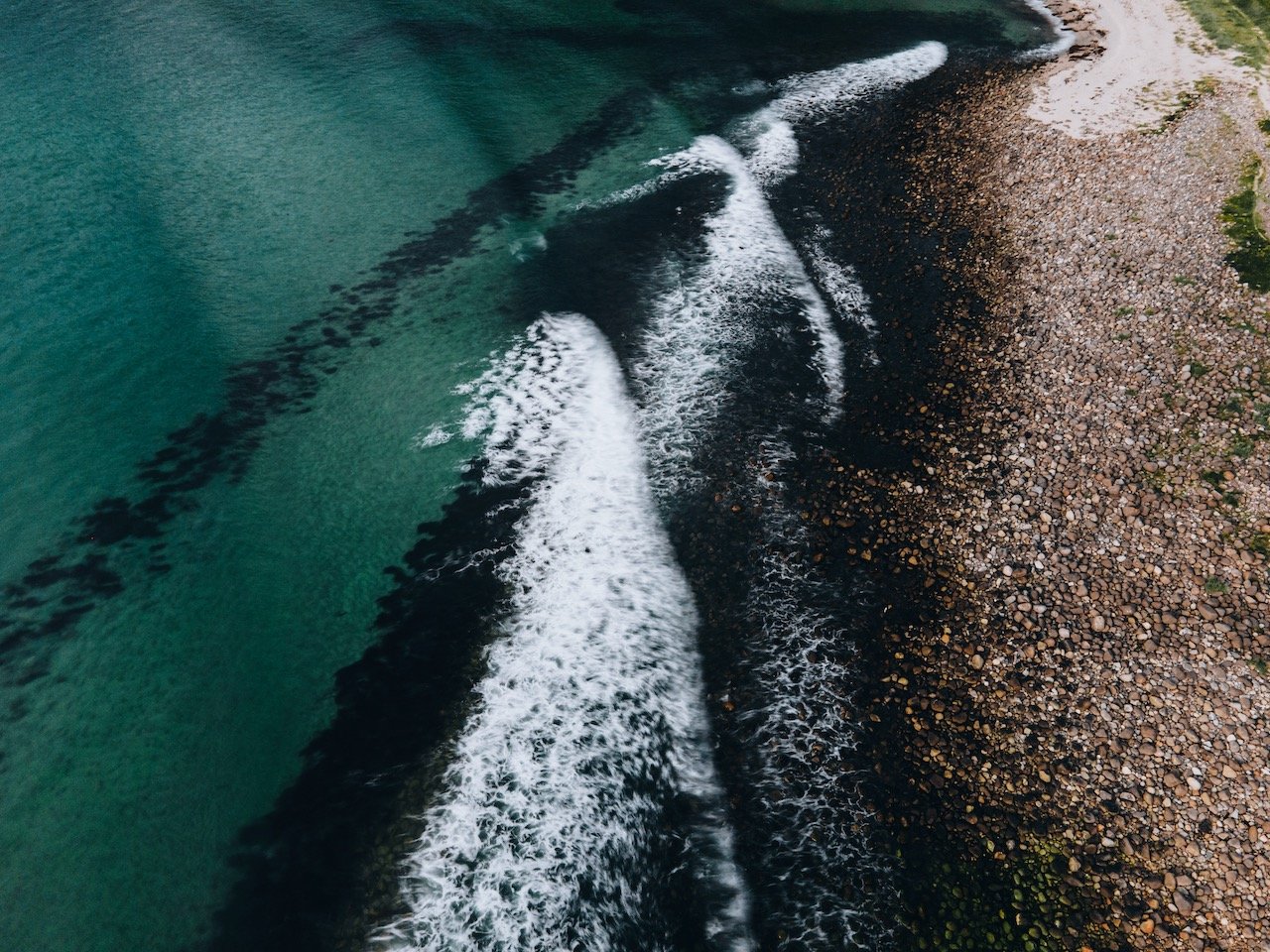
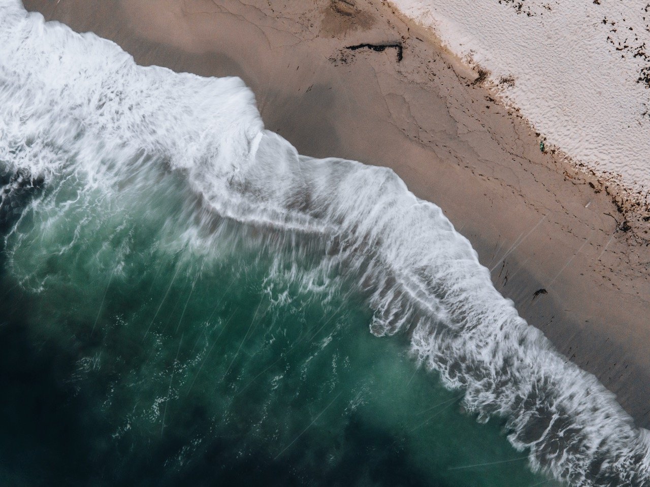
Rørvikstranda - is a beach we saw on the way towards Henningsvær. The tide was low and the water was such an intense turquoise color and with the blooming flowers, it made for such an enchanting spot.
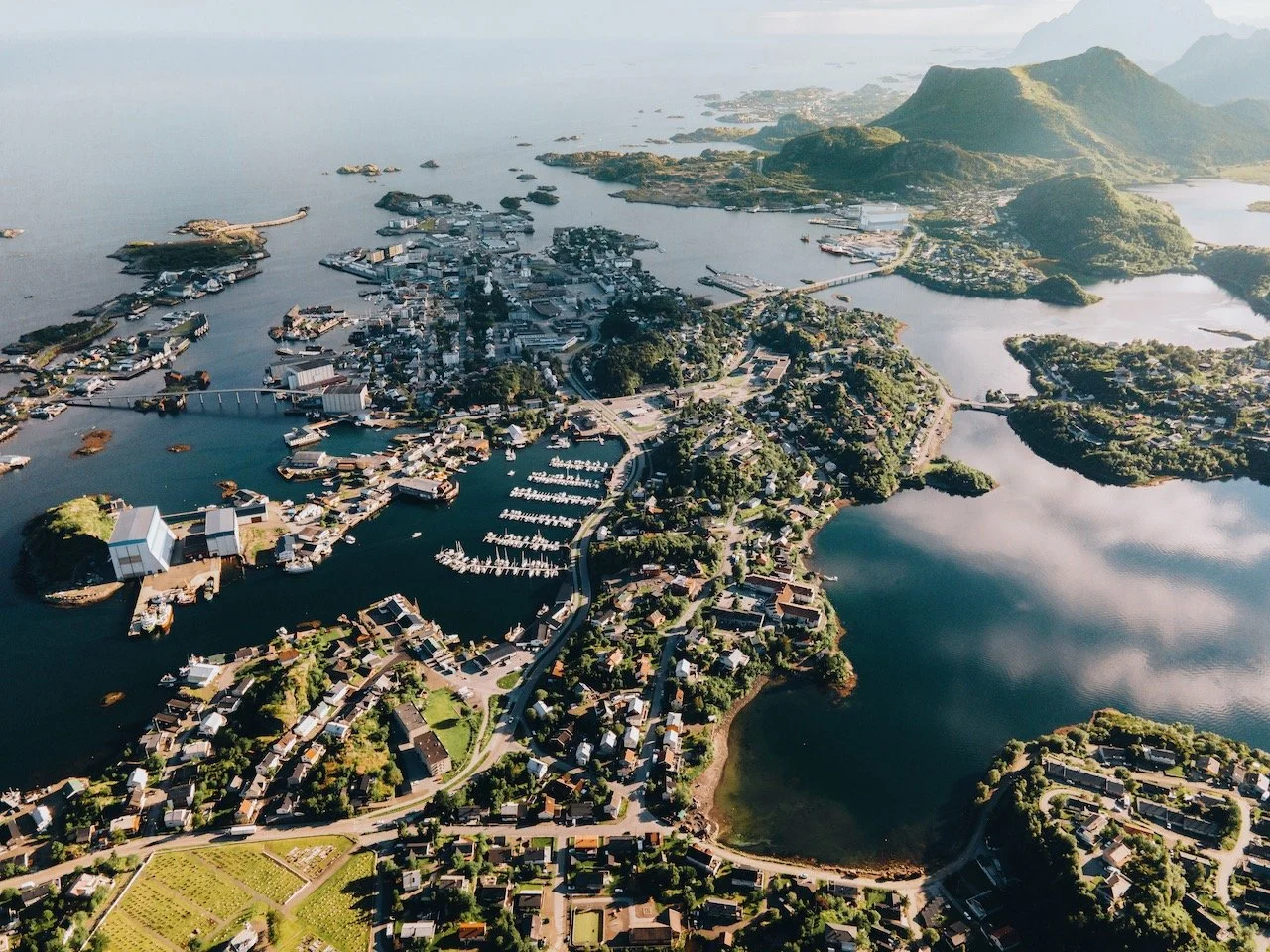
Svolvær - this is the largest city on the island and a perfect spot for a break in your road trip. Take a walk around and stop up on food and gas supplies here.
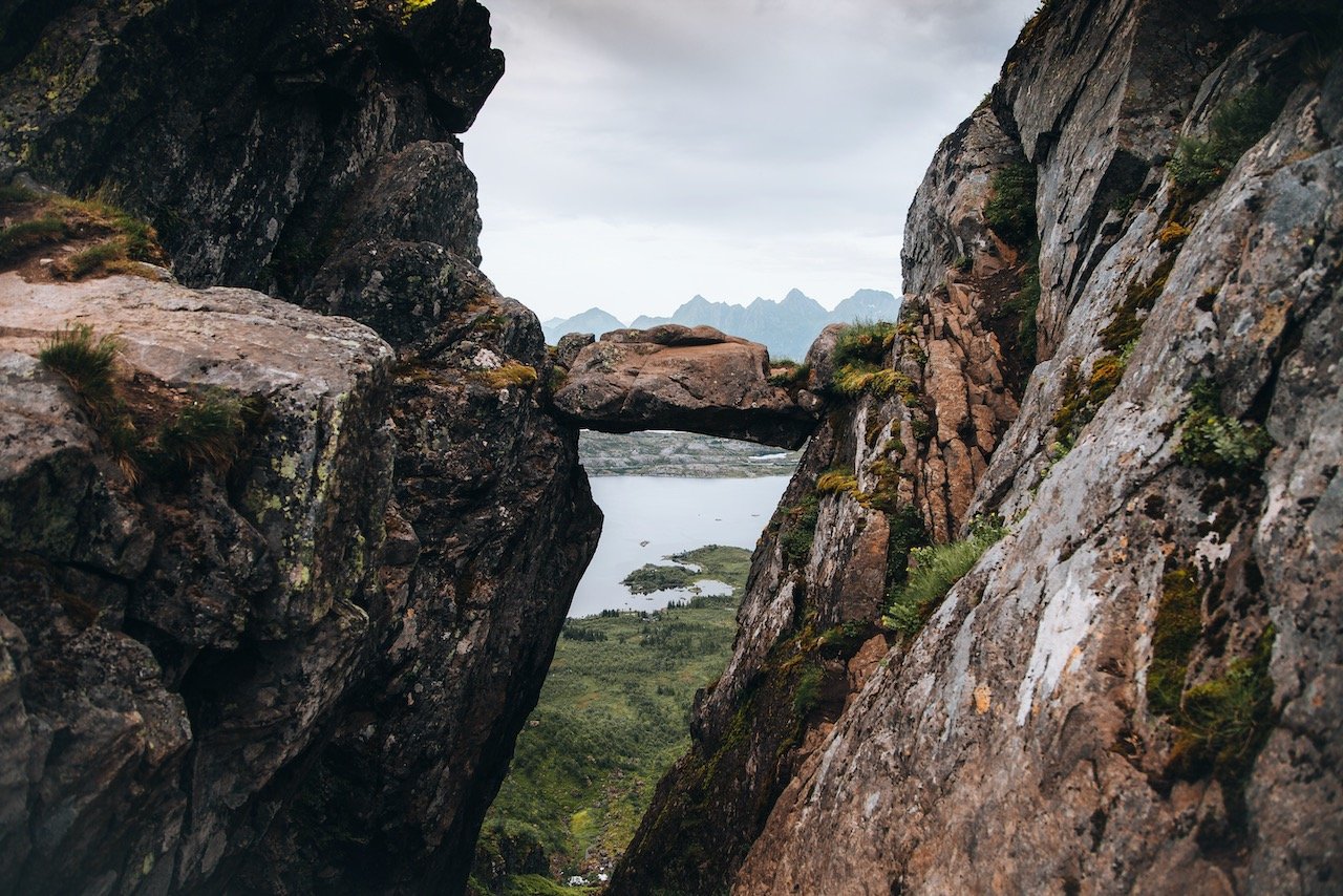
Fløya, Djevelporten - these mountain peaks give you the best views over Svolvær. They are of varying difficulty but take at least 2 hours each.
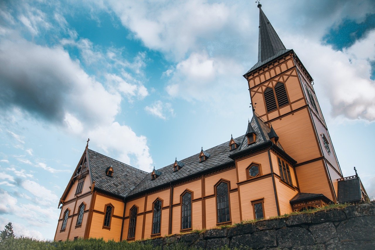
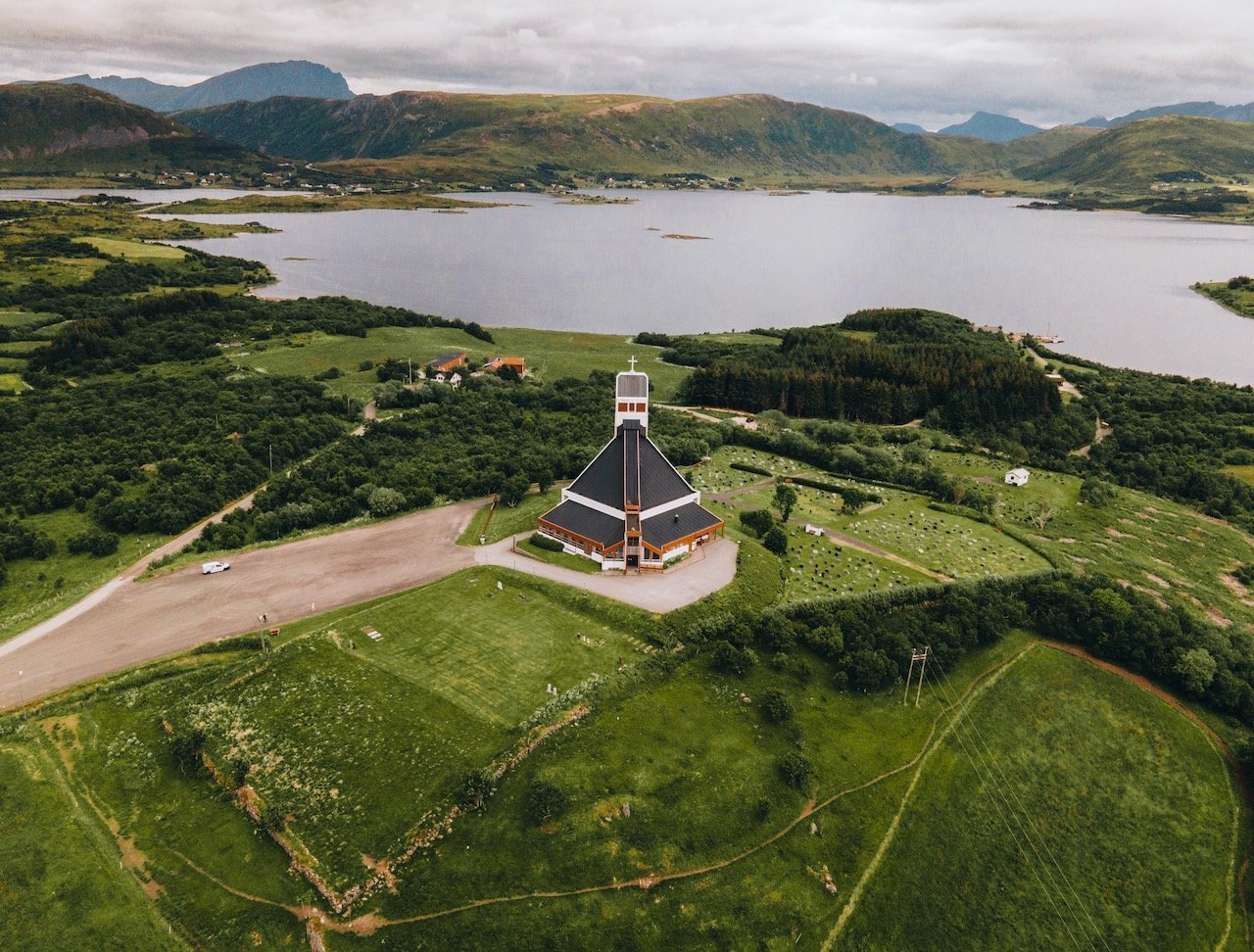
Vågan Church - I thought this church was stunning and it can be found in the small town of Kabelvåg.
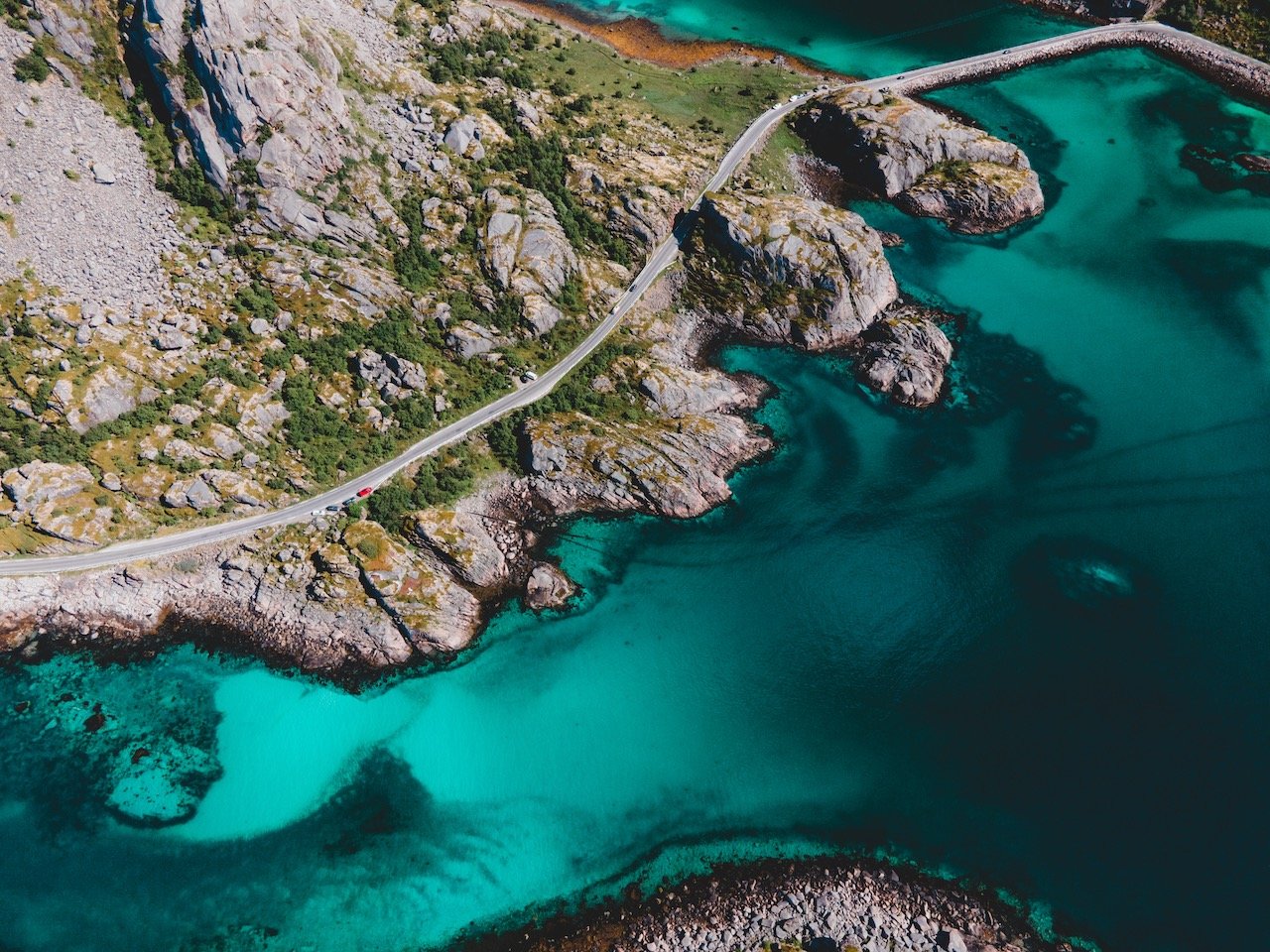
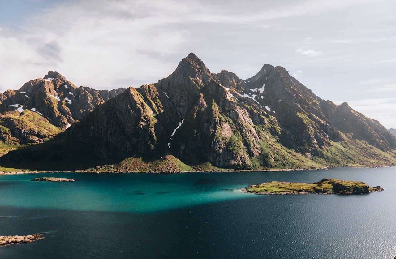
Djupfjorden - This area is also on the way towards Henningsvær. There is a rocky outcrop here just on the side of the road, perfect for catching the sun and having a picnic. The water color is such a deep emerald/teal here.
Matmora - this is a mountain hike we did in about 2 hours total. The view over the entire area as well as the beach below easily made it one of our favorites hikes in the whole trip.
Vestvågøya
Vestvågøya is the next island in the Lofoten archipelago, accessible via the E10 road and south of Gimsøya. The island is known for having an array of different topographies and geologies. The interior of the island is composed of mostly marsh, while the north and south portions of the islands are very mountainous (the highest point being Himmeltindan at 964 meters high). The town of Leknes is the largest on the island. Here were some of my favorite parts of the island:
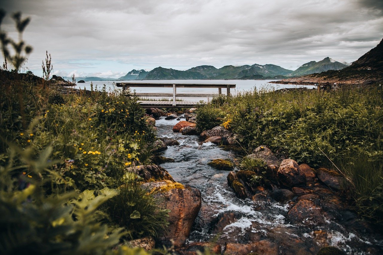
Mærvoll - we spent a few hours here after our long hiking days to just relax and do nothing. This can be described as a coastline area with towering mountains in the distance and a rocky beach just in front of you. Best of all, we had it all to ourselves.
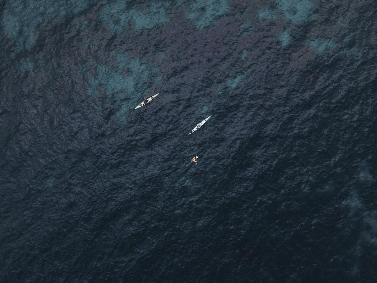
Eggum - is also located along the coastline. We set up a Midnight Kayaking tour here with Northern Explorer. After some adjustments with our initial reservation to a day with better weather. We went on the coolest kayaking trip you can imagine. We kayaked among a small archipelago, welcomed by eagles, jellyfish, and other animals, while having the intense orange/red rays of the midnight sun in the background. Incredible.
Borge Church - a pretty unusual looking church, painted red and white, sitting in the middle of a vast plateau in Borg.
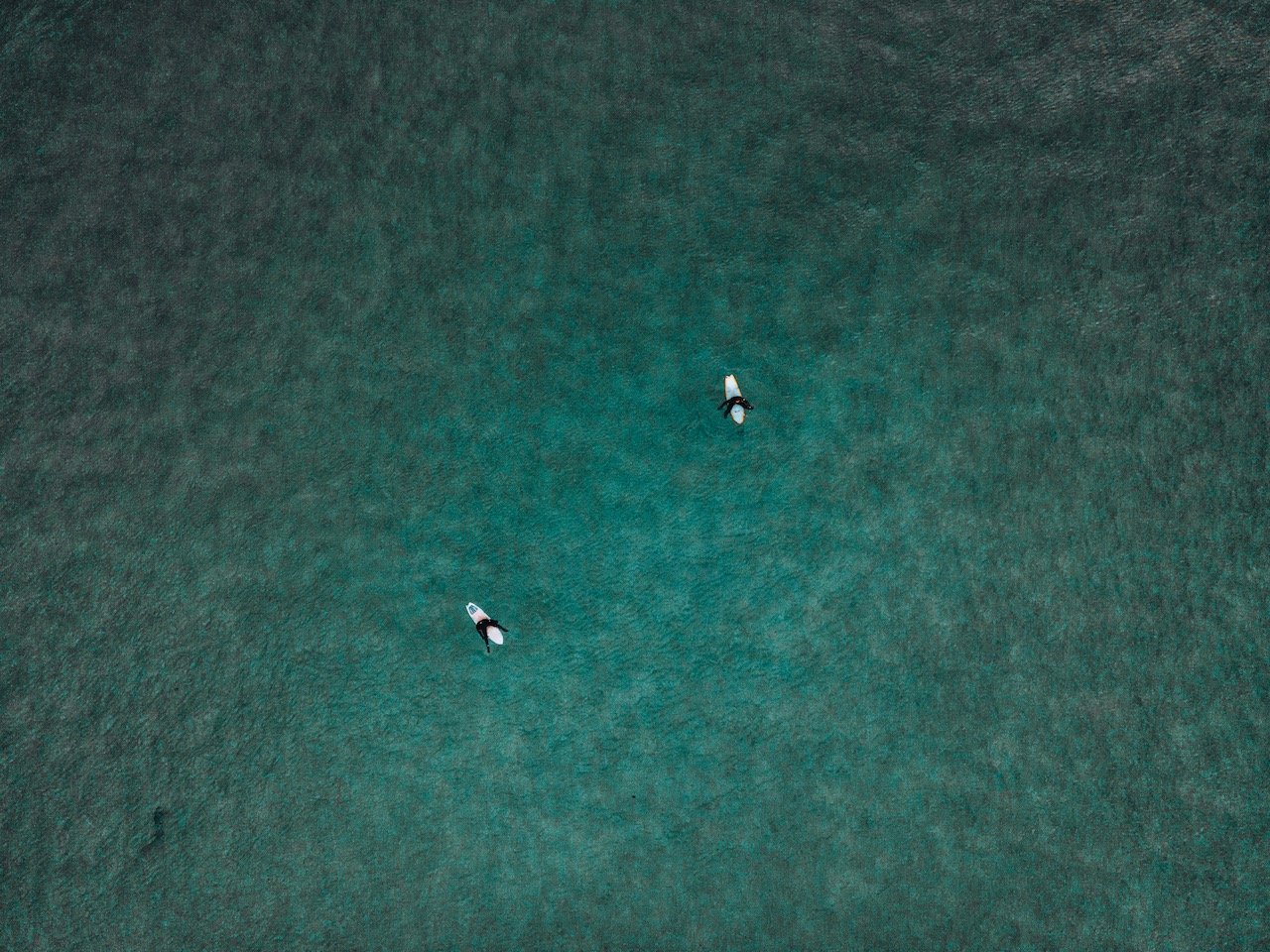
Unstad - this town also has its own beach. Surfing is the thing to do here. You can book surfing lessons in a proper surf camp but you can also enjoy the surroundings staying OUT of the water too. A very serene place.
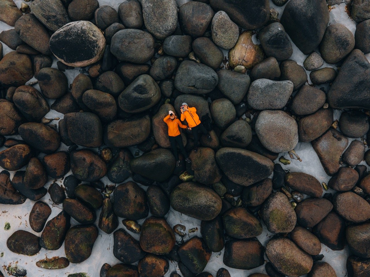
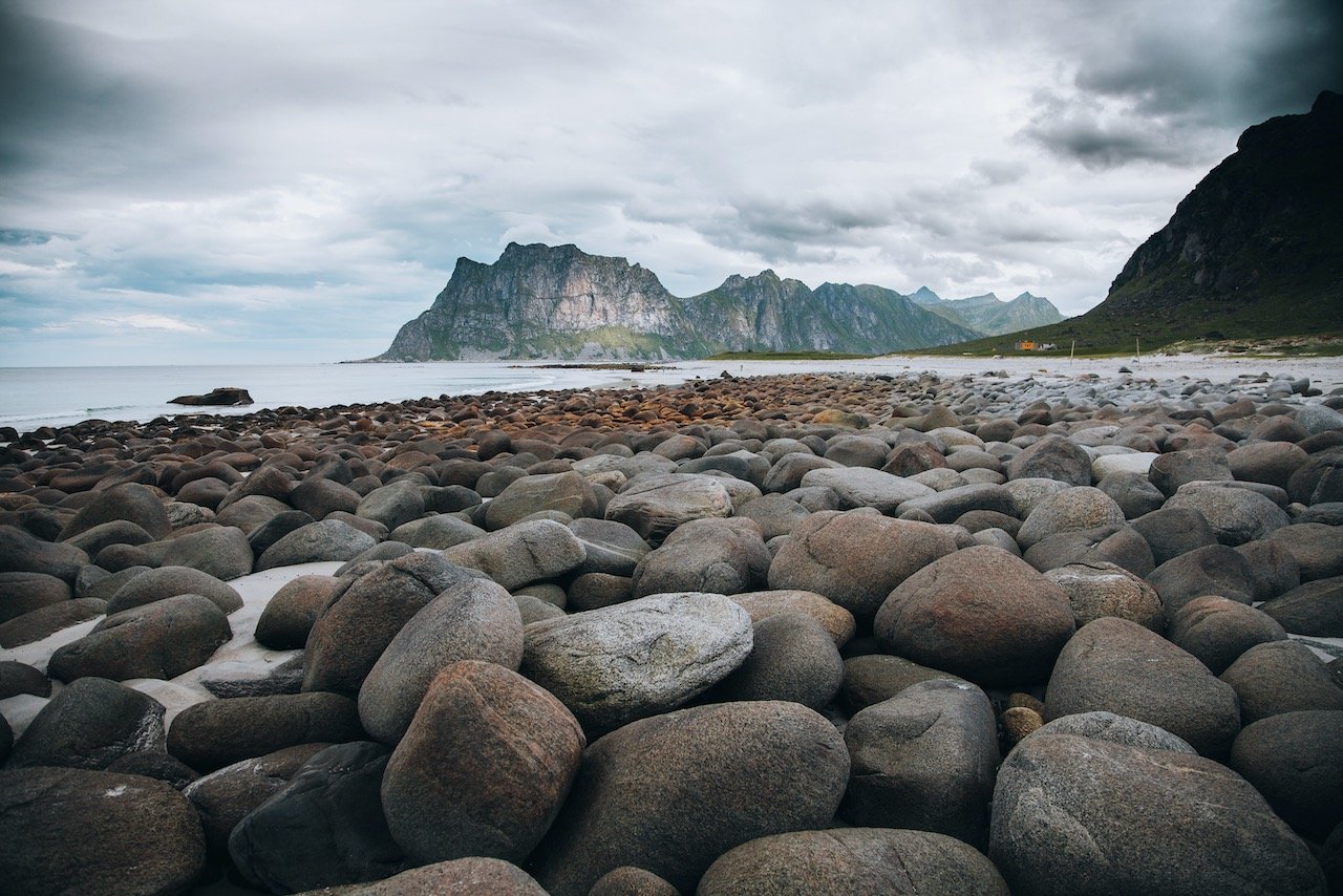
Uttakleiv Beach - a nice beach adorned with many large boulders that go all the way out into the sea. A great alternative to Unstad Beach if you had to pick just one.
Offersøykammen - a hike that took about 2 hours. Not much to see on the way up but amazing once you get to the top. You can get a great 360 degree view of the entire island.
Flakstadøya
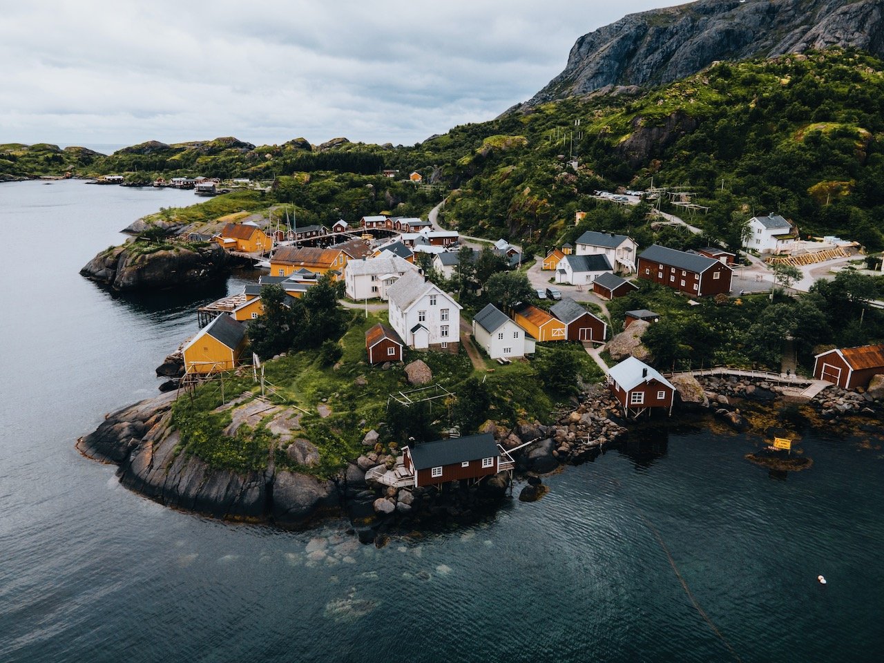
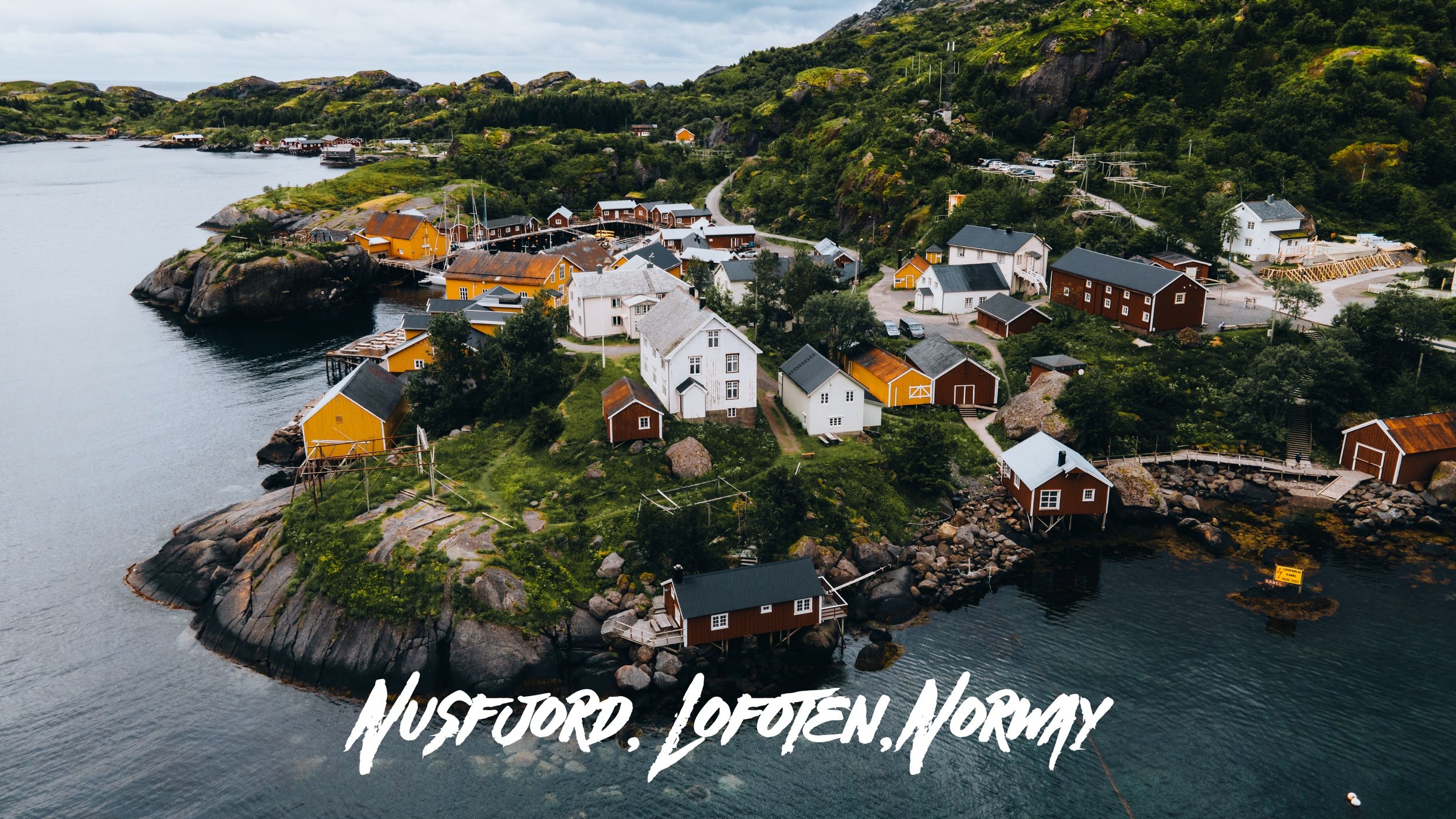
Flakstadøya is located southwest of Vestvågøya and connected to the rest of Lofoten via the E10 highway. The island boasts quite a few villages such as Fredvang, Nusfjord, and Vikten. Speaking of which, these are some of the places I highly recommend seeing:
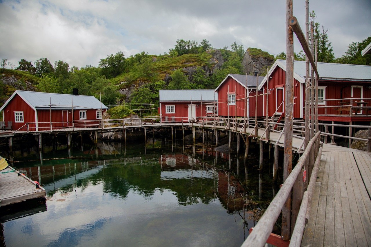
Nusfjord - this village was totally off my radar. My girlfriend found it and so we went to check it out. After parking in the center of town, we quickly realized we were in someplace special. This village is adorned with red and yellow fisherman cabins, standing over turquoise blue water, with large mountains in the background. We walked around here taking in the sights. It seemed like a great place to spend the night as well (if we didn’t have our camper van).
Vikten - is another small village on the northwestern coast of the island. It has a beach but is mostly known for its Glass blowing cafe. This cozy spot gives you a glimpse of the glass blowing process as there is always someone making a design to be sold. You can get a beverage at the cafe and chill in one of the many comfortable spaces in the building.
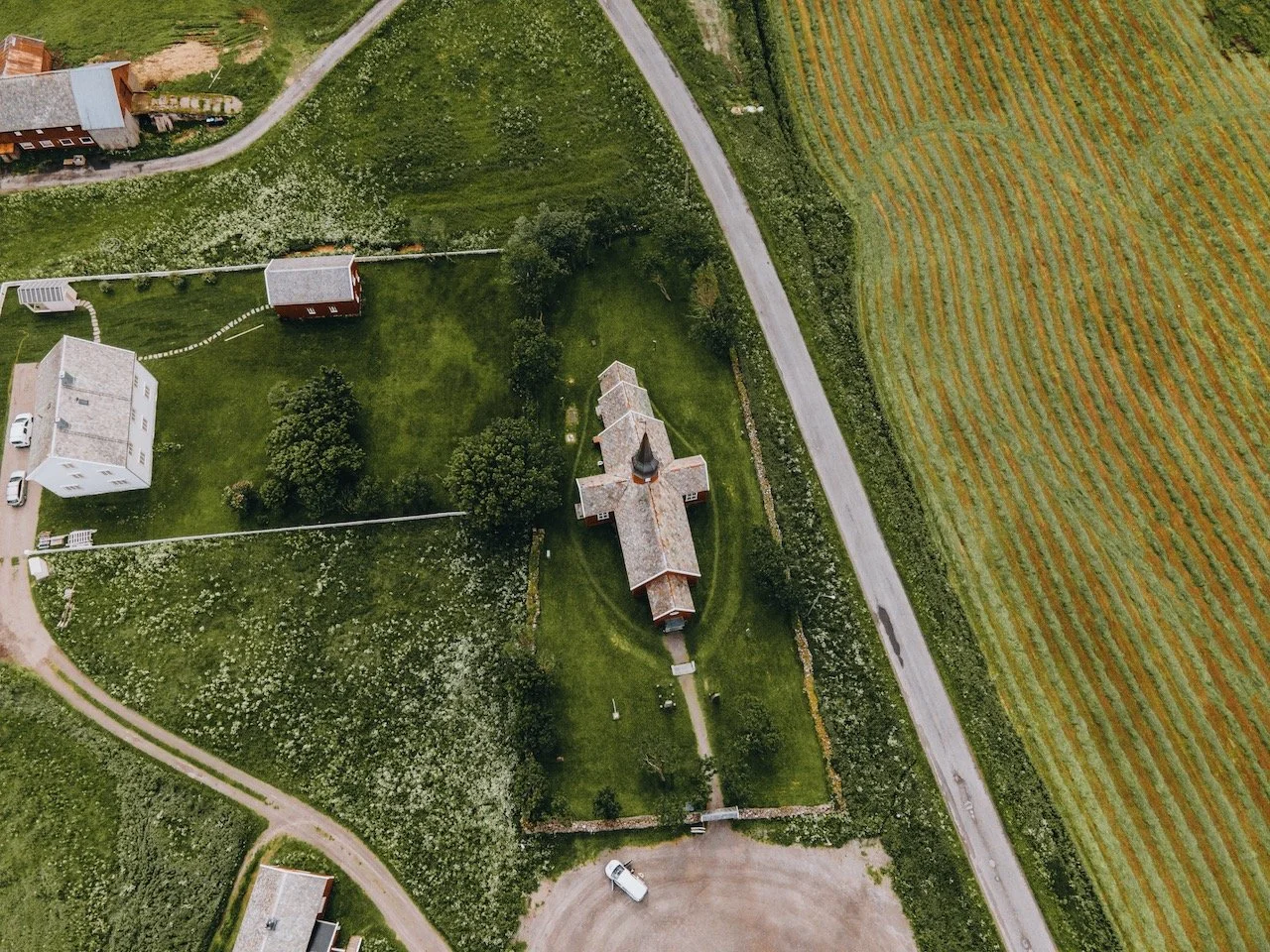
Flakstad Church - I really liked the overall design of this church and its color. It was on the main road so easy to stop by at.

Moskenesøya
Moskenesøya makes up the Southern portion of the Lofoten archipelago (That is connected to the mainland). The E10 highway takes you here from neighboring Flakstadøya. The islands boasts many villages and settlements though mostly inland and on the east side as those that were established along the west coast were abandoned due to severe weather. Some great places to see on this island are:
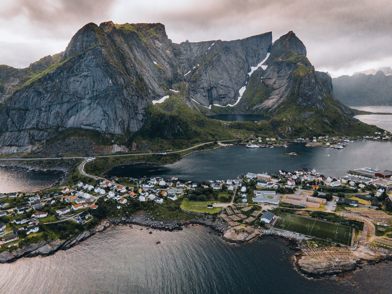
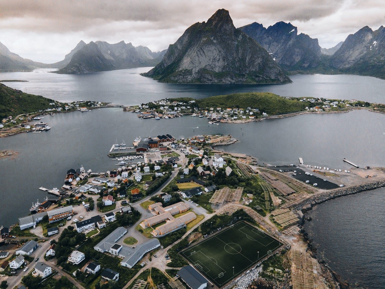
Reine - this is a large town on the island that is impossible to miss. Here you can also recharge (gas, food, coffee) while also checking out the Reine Viewpoint as well as hiking Reinebringen. The hike requires some decent fitness as the ascent is completely done via a stone stairway. Further in this town is a large collection of fish drying racks, in keeping with the Norwegian cultural practice.
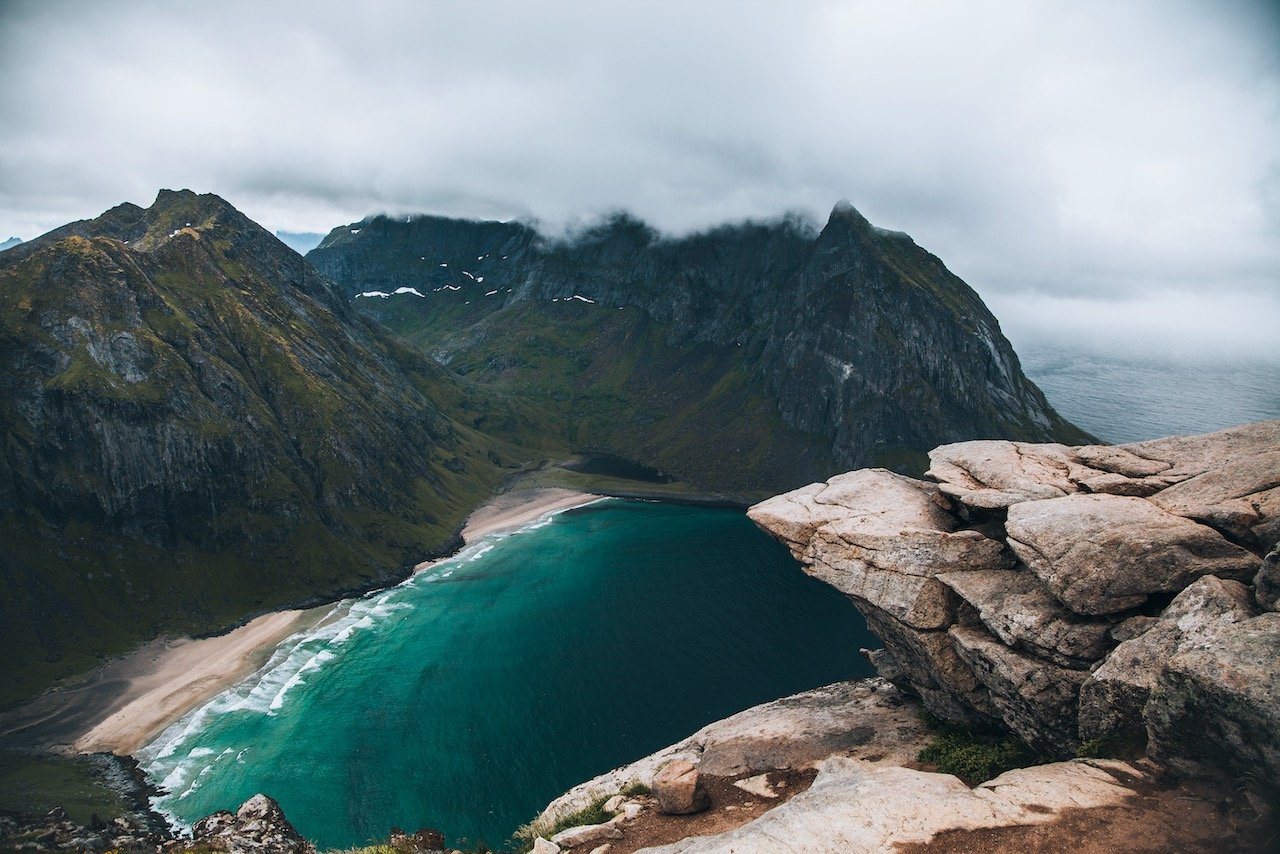
Ryten - this is perhaps the most popular hike in ALL of Lofoten, but it is worth it. It took several hours (around 4) and the weather was pretty bad but once we got to the top, the view was gorgeous. The mountain is 543 meters high and gives the best view of Kvalvika Beach below.
Kvalvika Beach - this is also only reachable by food. You start the Ryten hike and veer off to the left of the path on a plateau and then descend again to the beach. When the sun is shining, the water produces a deep emerald color which is just amazing to see with the mountain backdrop. I recommend doing the Ryten hike first, followed by this beach hike.
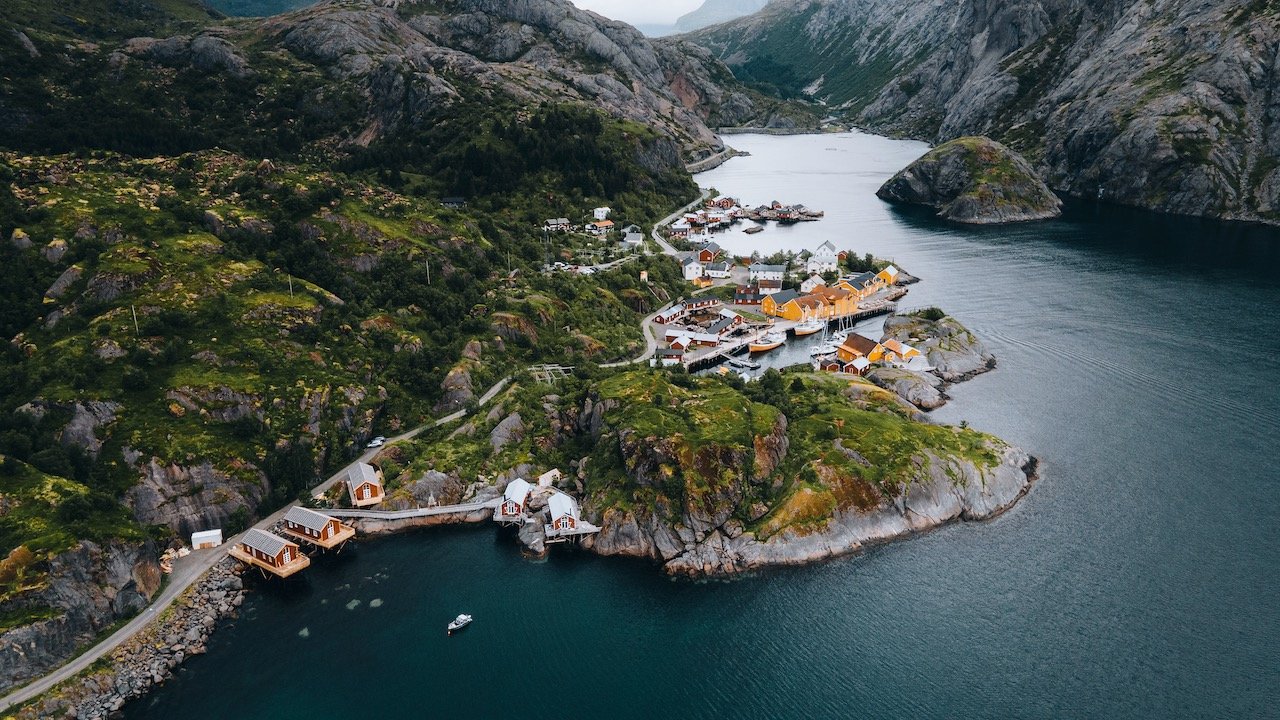
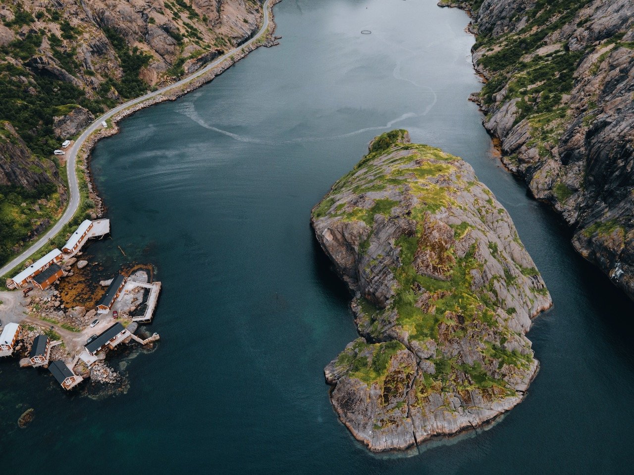
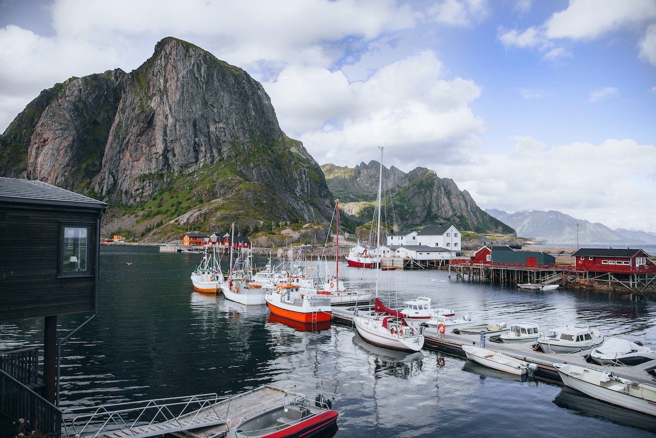
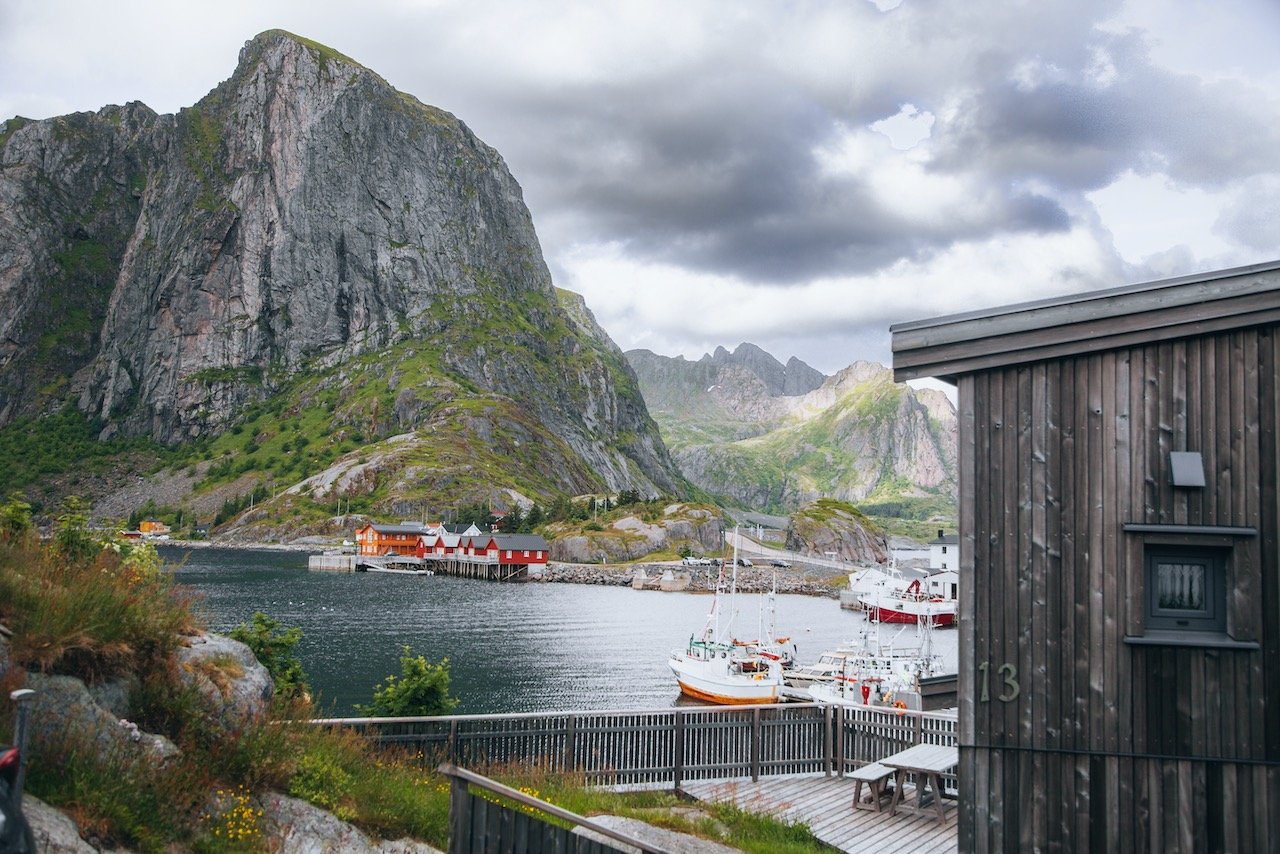
Hamnøy and Sakrisøy - these are classy fishing villages with rorbu or rorbuer (plural), which translate roughly to ‘fisherman’s cabin’. You can rent these cabins and they have various amenities in them, the most common one being a sauna. They are so picturesque as well and as such, are the most common photos seem from Lofoten.
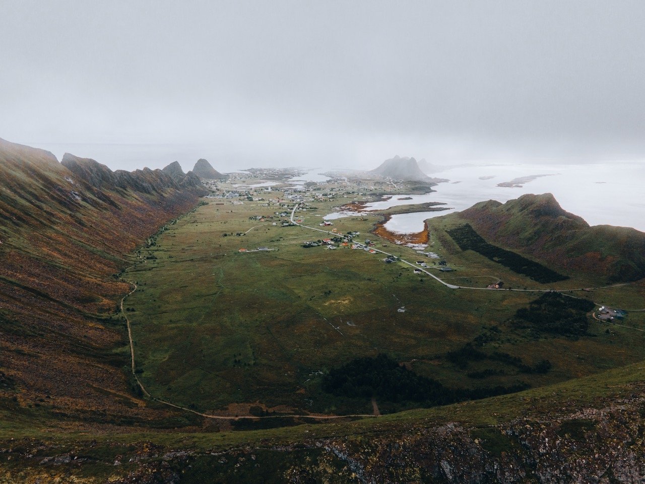

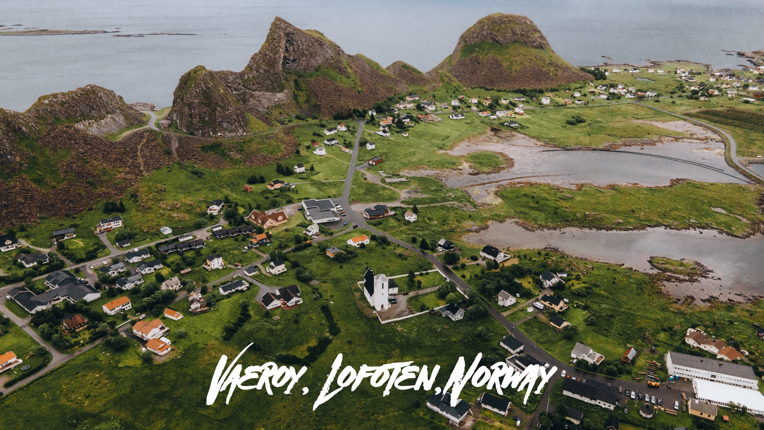
Værøy
Værøy is reachable by ferry from Moskenesøya. It is loosely considered to be a part of Lofoten. The island itself has a rather small population of 728 which had dwindled over the years.
In an effort to boost tourism to the island, the ferry service going to and from the island is free. You can even go from Bødo to Værøy, then to Moskenes by the ferry for free. However, if you go with this route, you MUST stay in Værøy for at least one night.
The villages are Sørland and Nordland. Some other spots to check out on the island are:
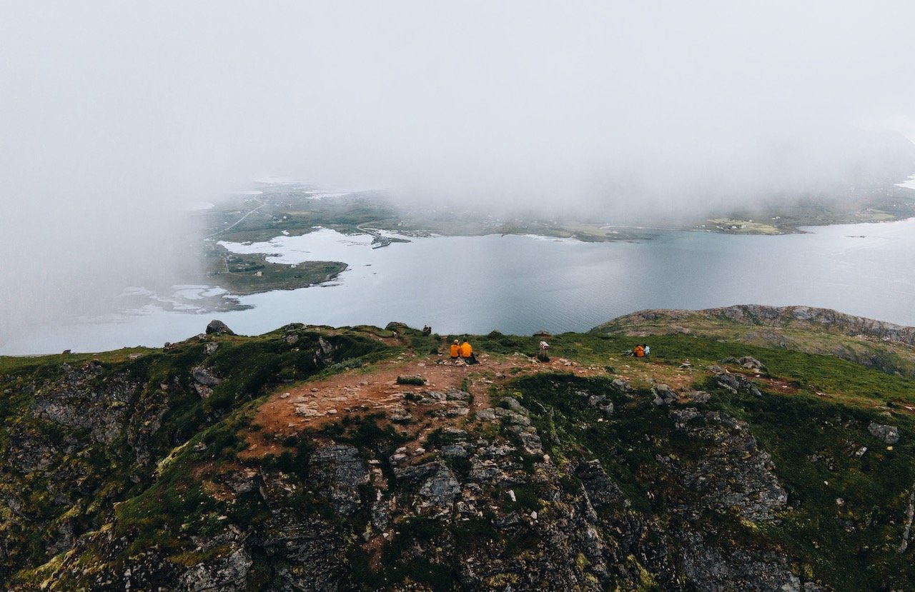
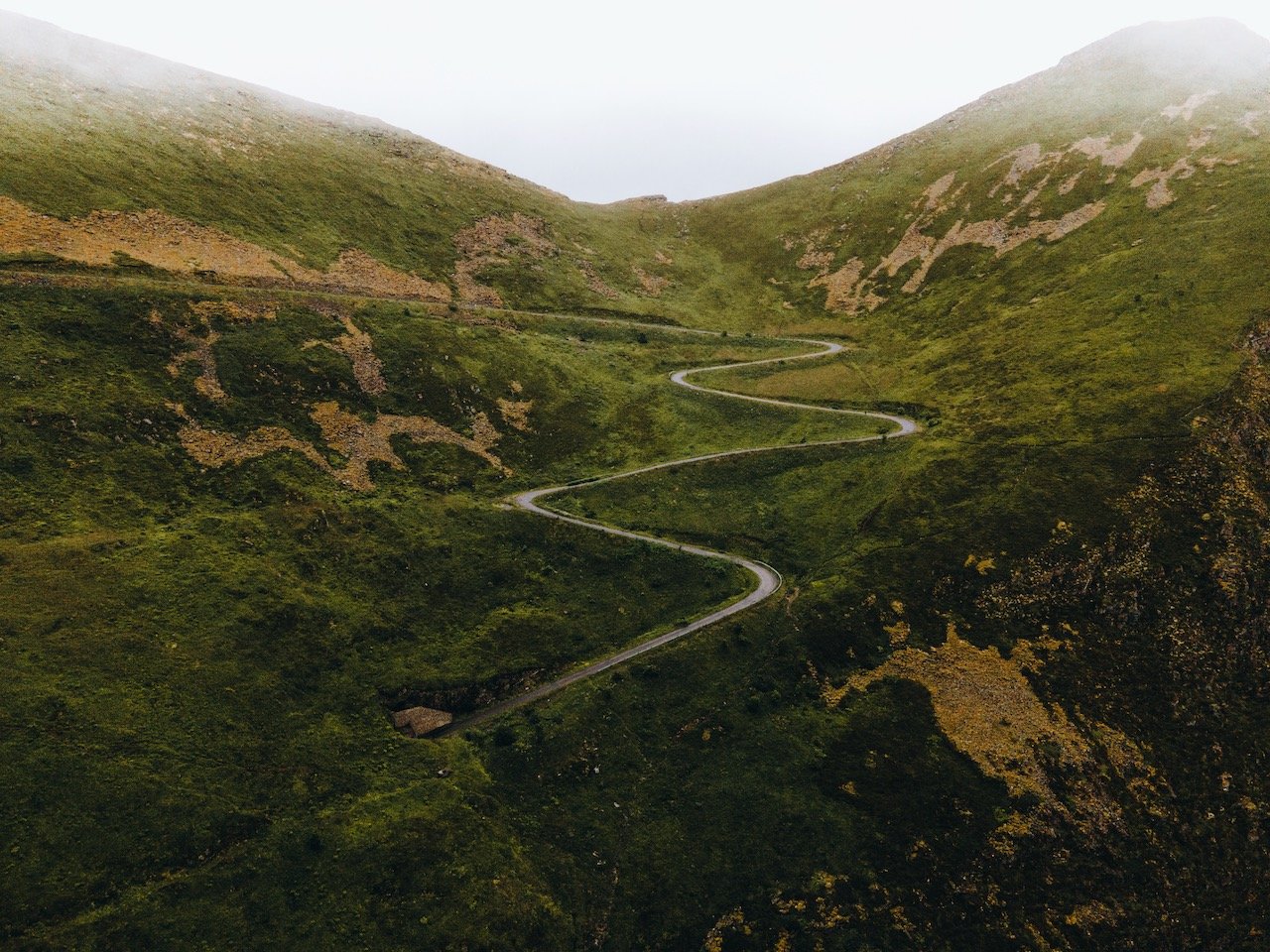
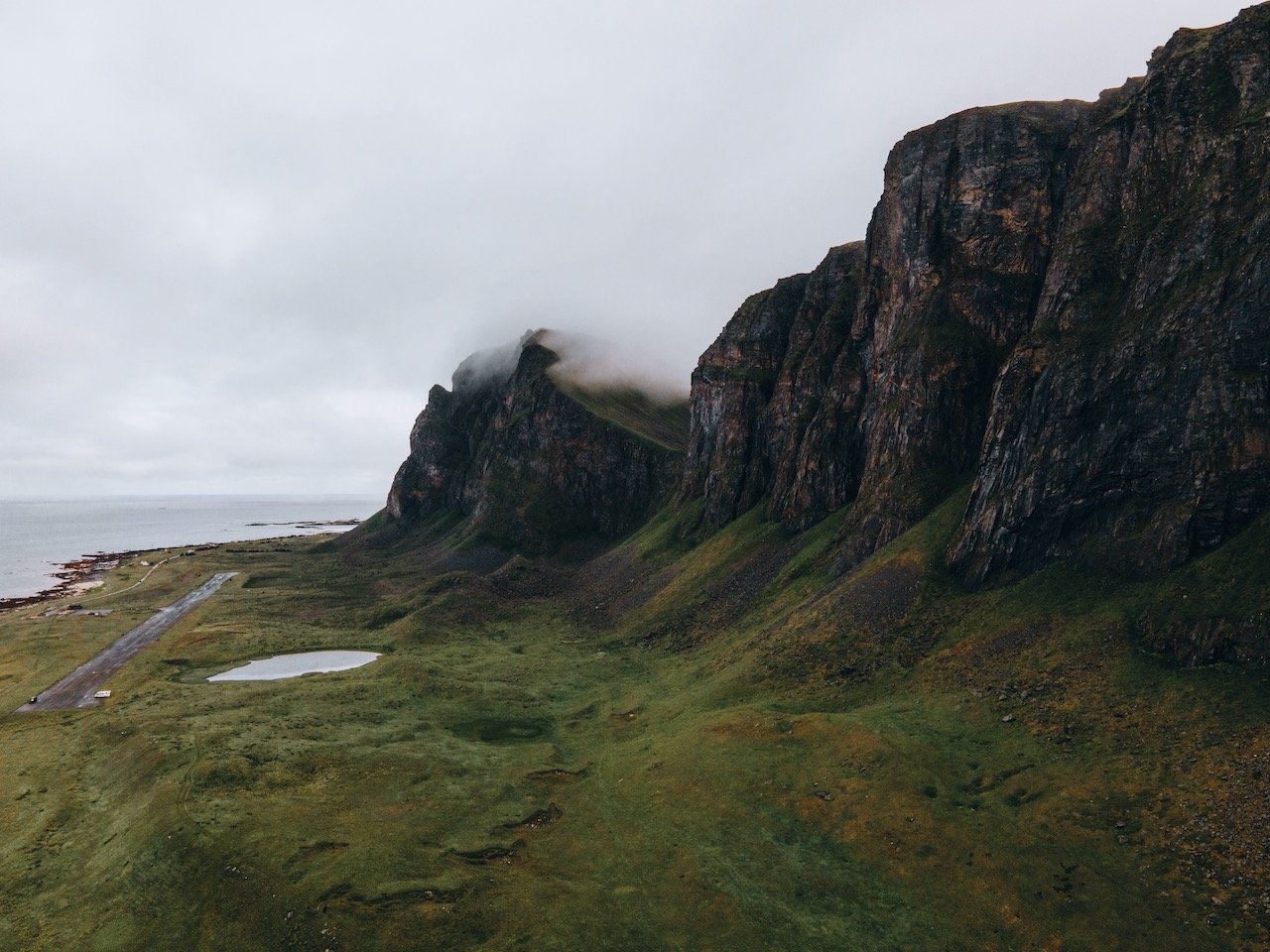
Håen - this hike is gorgeous. After reaching the trailhead, you hike up a valley which then meets a roadway, so you can hike on the road (which is closed to cars) or go via the rougher paths. You will reach a NATO radar station here and find sweeping views of the rest of the island. Our time here unfortunately was mired with fog, so we can only imagine what the view was like.
Væroyhornet - This is also another area that you can hike in on the backside of the island. It gives you a different vantage point than Håen.
There you have it, a general guide on what to do and see in the Lofoten islands. For even more specific information on each island, be sure to check out my blog posts outlining each one that I have presented at the top of this post.
Furthermore, as someone who swears by camper van road trips now, it’s my favorite way to travel. I have been lucky enough to see other destinations by way of camper van as well (with many more to come I’m sure). Feel free to check out my posts on Iceland and New Zealand, both done via camper van.