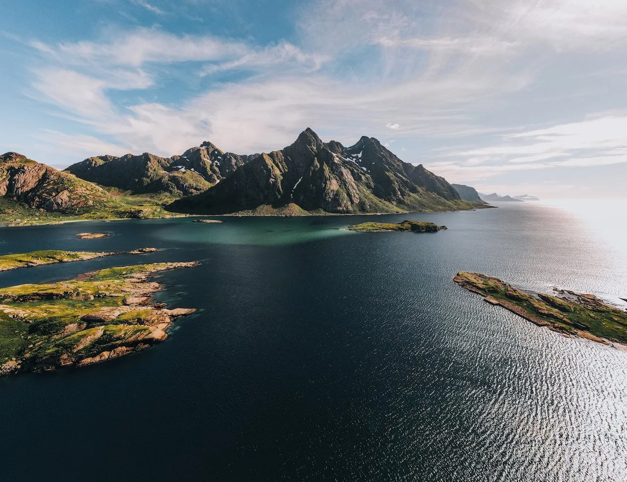
A Journey to the Lofoten Islands: The Island of Værøy

Vaeroy, Lofoten, Norway (ISO 400, 4.5 mm, f/2.8, 1/40 s)
(Some links in this post are affiliate links. If you click through and take action, I'll be compensated.) If you are also interested in any PRINTS from any of my posts, be sure to check out my store where you can buy prints as posters, in metal/wooden frames or on canvas.
**This post is the 5th of a 5-post series discussing what to see in this part of the Lofoten Islands (You can check out the other parts below, separated by each specific island: Part 1, Part 2, Part 3, Part 4, Part 5. Everything is also summarized in another post here.**
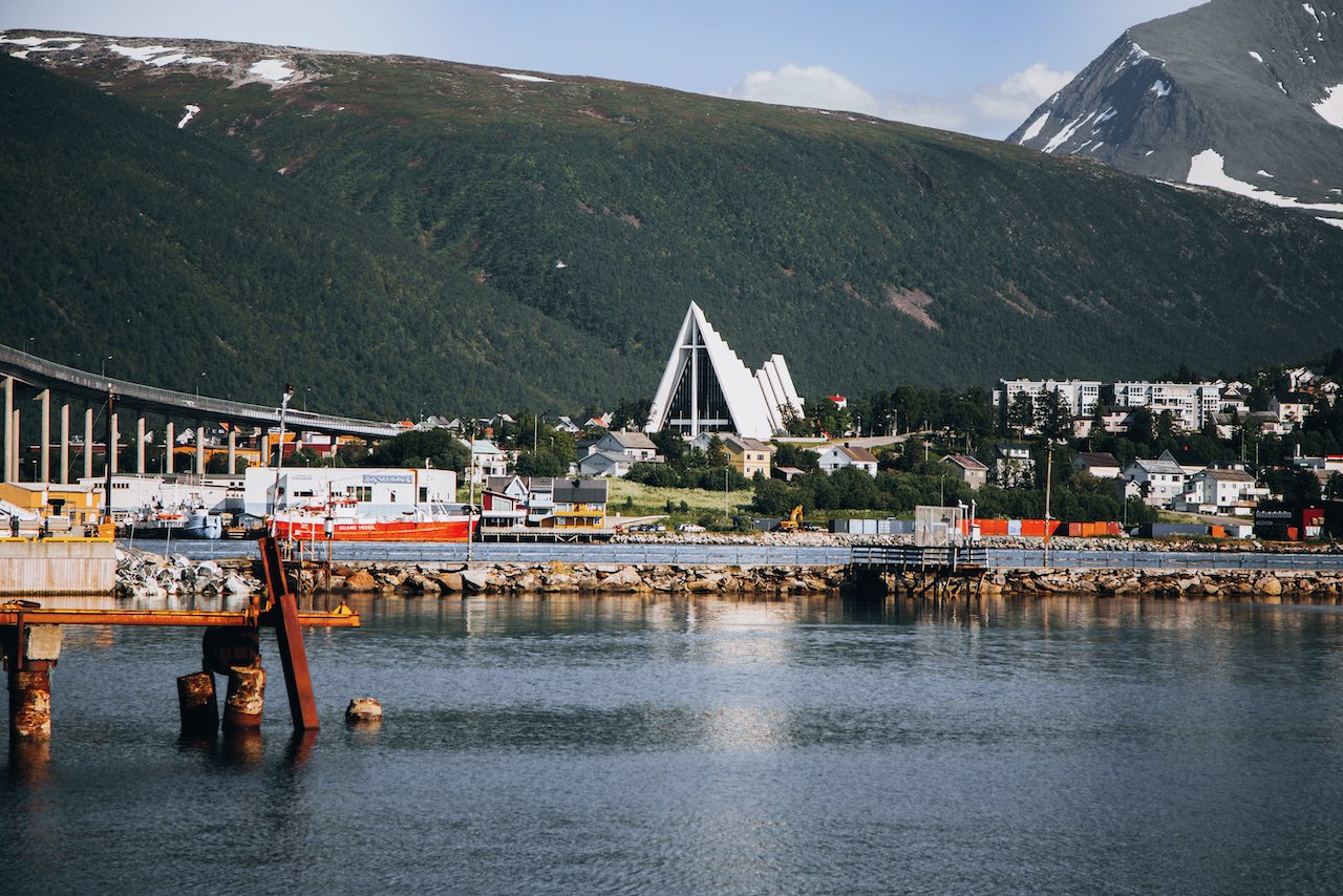
The Lofoten Islands are arguably one of the most beautiful archipelagos in the world. It is located in Northern Norway (Nordland County), within the Arctic circle tucked between the 68th and 69th northern parallels. I picked up a camper van with Arctic Campers in Tromsø, Norway (Blog Post: A Guide to Exploring Tromsø, Norway’s Northernmost City in the Arctic Circle) and had started the road trip towards Lofoten (about 4-5 hour drive).

The definition of which islands constitute Lofoten are always up for debate but for the purposes of this blog post series, I will cover 5 of the islands and reference some others. From North to South, they are composed of:
Gimsøy
Austvågøya (Blog Post: A Journey to the Lofoten Islands: The Island of Austvågøya)
Vestvågøya (Blog Post: A Journey to the Lofoten Islands: The Island of Vestvågøya)
Flakstadøya (Blog Post: A Journey to the Lofoten Islands: The Island of Flakstadøya)
Moskenesøya (Blog Post: A Journey to the Lofoten Islands: The Island of Moskenesøya)
Værøy (Blog Post: A Journey to the Lofoten Islands: The Island of Værøy)
In this blog post, I will cover the island of Værøy. A Google Map of these places I will talk about can be seen at the end of this article. Check out my drone video of Værøy below!

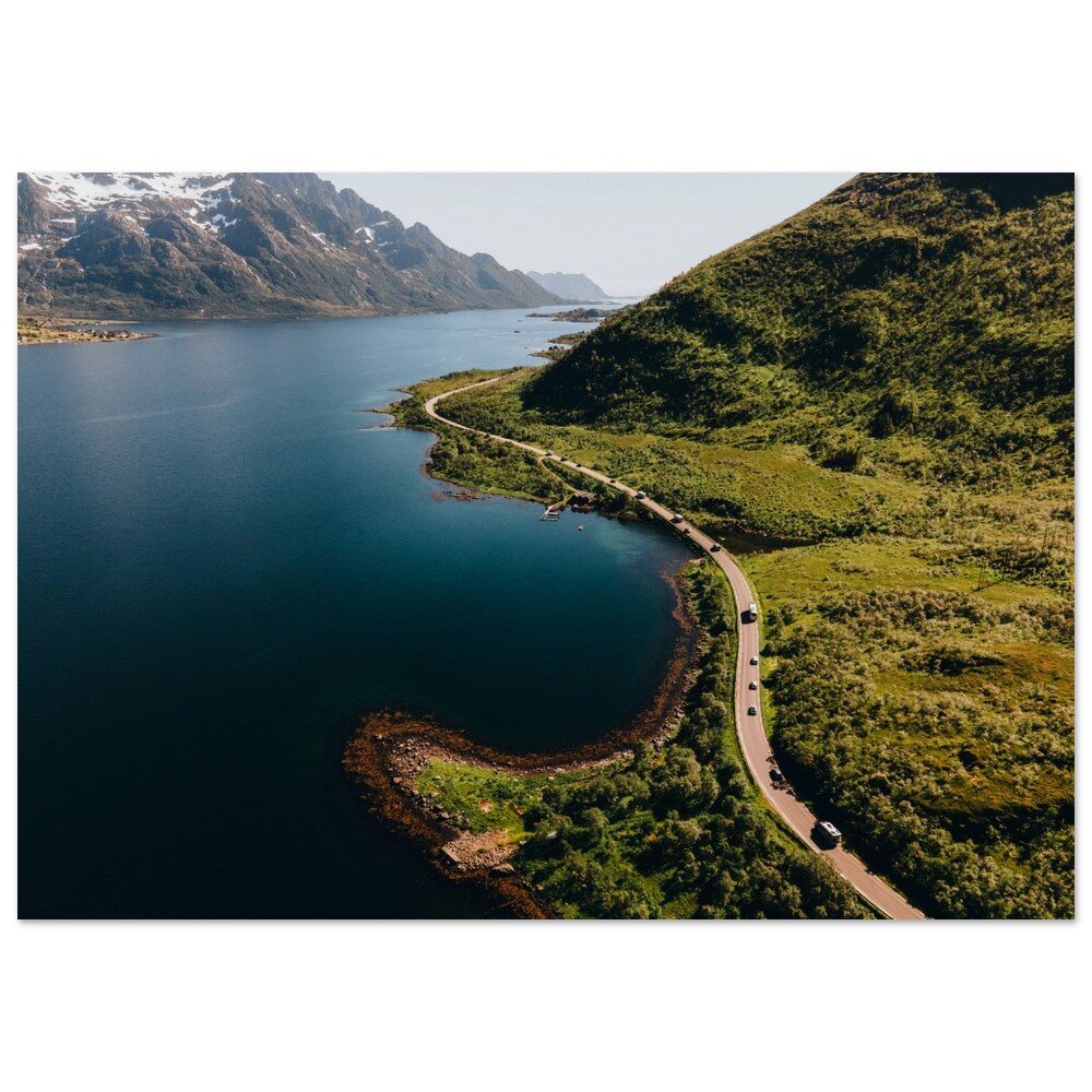
To get to the island of Vaeroy, you must take a ferry, or swim. The ferry schedule between Moskenes and Vaeroy is available here. On the day we went, we knew we were going to have to be on Vaeroy for 12 hours before getting the ferry back with pretty bad weather. Instead of going ourselves, we decided to go with our campervan, which was a brilliant choice since:
The weather was rainy and cold the entire time, so we could hunker down in the van.
The ferry from Moskenes to Vaeroy and back is FREE!
If you like some of my photos that you have come across, just know that I have many prints showcasing a variety of landscapes, including Norway, available for purchase below! (Sold as Posters, Canvas, or in Metal-Frames and Wooden-Frames).


Vaeroy, Lofoten, Norway (ISO 400, 4.5 mm, f/2.8, 1/60 s)
We didn’t know this last part but since a week before we took the ferry, it became free to promote more people to visit the island since its population has been dwindling. Furthermore, you can take the ferry from Bødo to Vaeroy, then to Moskenes (you MUST stay at least one night in Vaeroy for this to be free). This means you can go from Lofoten to Vaeroy to the Norwegian mainland, cutting off a ton of driving off your trip.

Vaeroy, Lofoten, Norway (ISO 400, 4.5 mm, f/2.8, 1/50 s)
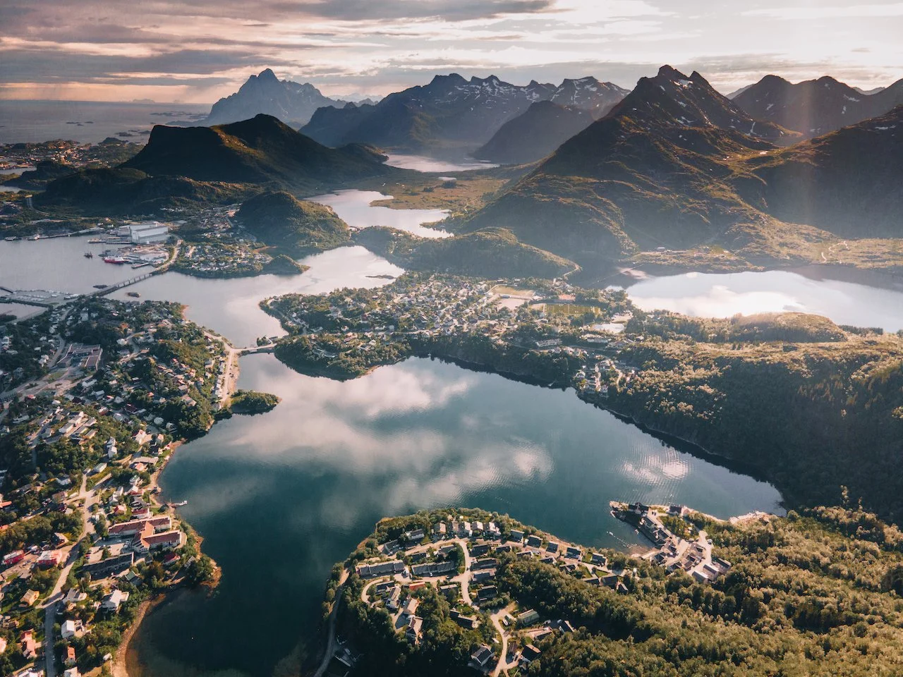
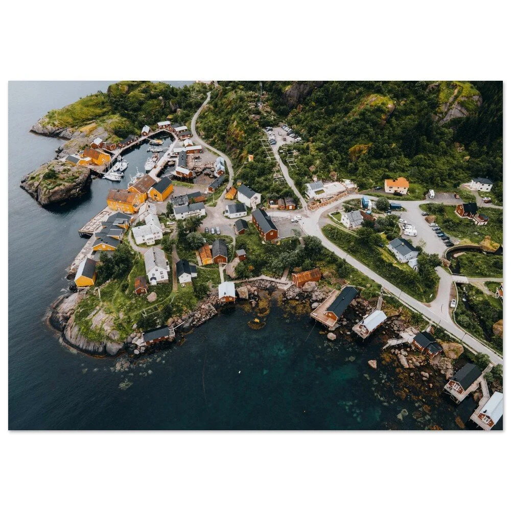
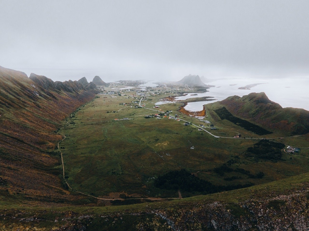
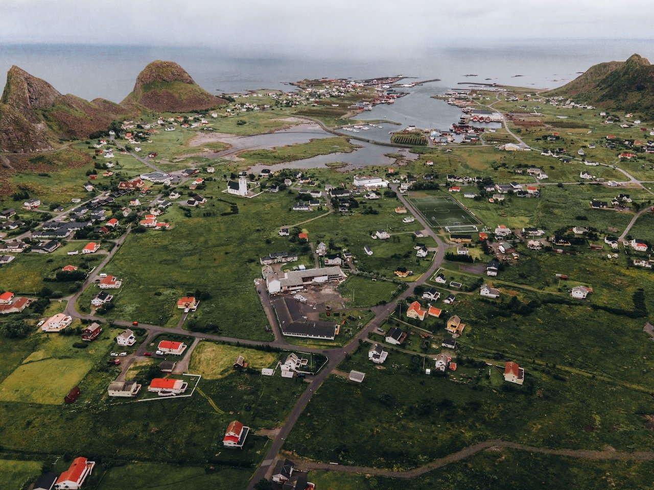
The main town in Vaeroy is called Sørland. This resort and fishing village is the administrative center of the municipality with a population of 640. The two other villages on the islands are Nordland and Mostad, located 5 kilometers to the north and southwest, respectively.

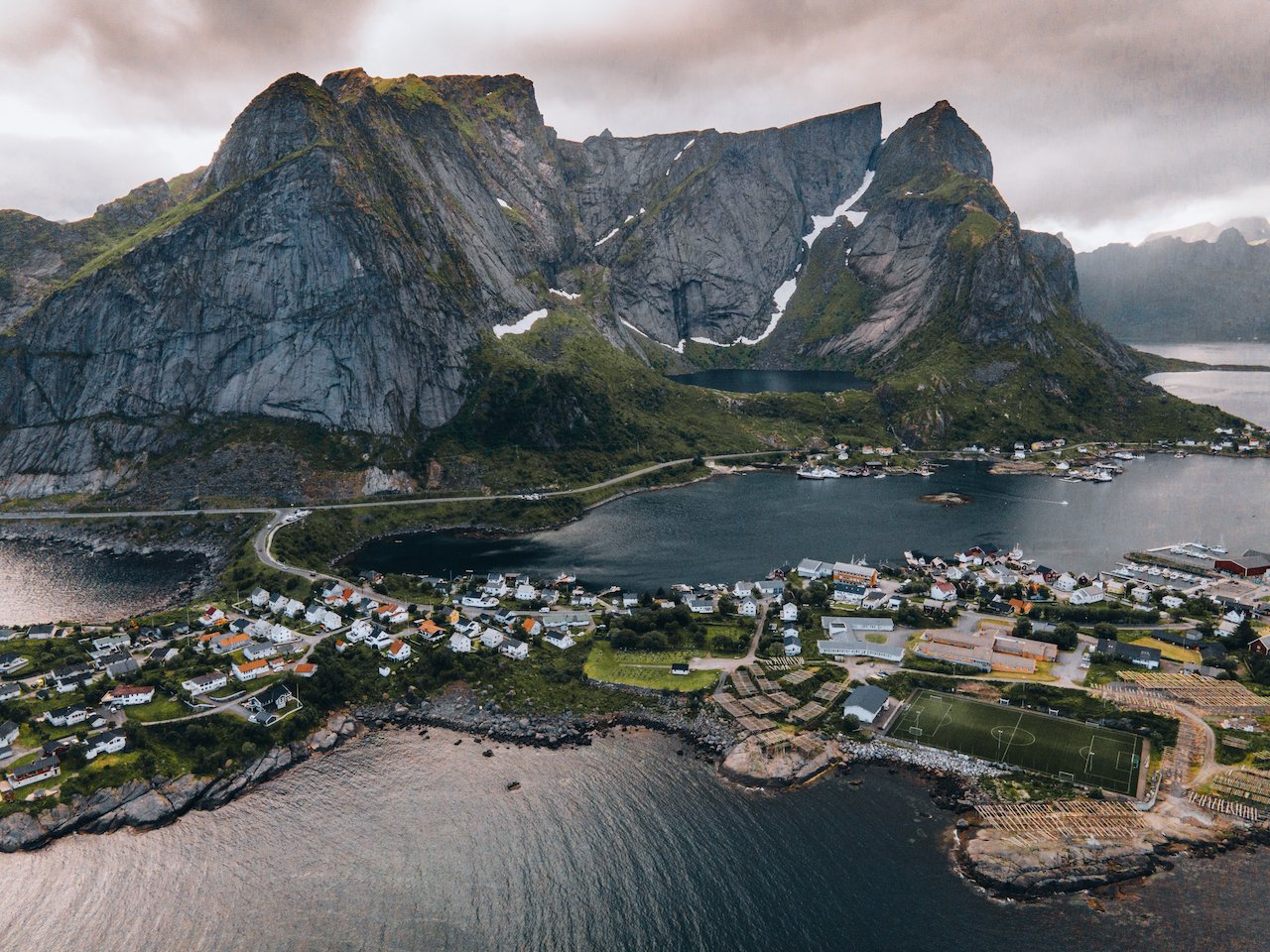
One of the best views perhaps in all of Lofoten happens to be at Håen. The weather was pretty terrible when we came there so we weren’t able to get a glimpse of what some people would call ‘the most beautiful view I have ever seen’. This hike, which is also called Håheia is pretty easy. Once you reach the trailhead, you simply walk uphill towards a long windy road and you can hike up via the countryside or the road.
Nordlandshagen, Vaeroy, Norway (ISO 400, 4.5 mm, f/2.8, 1/60 s)
After perhaps an hour or so, you will reach a NATO radar station, which stipulates that you cannot take any photos or videos of the area. It was foggy when we got up to the top, it looked like an enchanting meadow with blooming wildflowers. A great juxtaposition of color amidst the gray fog.

Vaeroy, Lofoten, Norway (ISO 200, 4.5 mm, f/2.8, 1/60 s)
Another place to check out is Værøyhornet. You can take this route to check out Håen as well, but with a different starting point. From here you get an amazing view of Moskenestraumen to Lofotodden.
Sørland, Vaeroy, Norway (ISO 400, 4.5 mm, f/2.8, 1/40 s)
In the middle of our drive on Vaeroy, we reached a part of the road that seemed to be so wide and used for something other than driving on. We found out it was actually a runway and part of a regional airport that used to operate between 1986-1990. Unfortunately, in 1990, the airport was shut down.
This was due to a fatal accident that was blamed on heavy wind conditions which stressed the aircraft enough to cause structural failure. The airport’s location next to the mountain, plus the heavy winds that are known to occur in this area, make it a nightmare to try and land a plane of any type, so the airport was shuttered.
You can reach a beach on the north side of the island, weather permitting, at a spot called Nordlandshagen. It’s a gorgeous beach with white sand and turquoise water and a great place to see the midnight sun. It was one of the most peaceful areas in all of Lofoten, mostly because we were only just a handful of tourists on the island.
After our 12 hours on Vaeroy, we took the ferry back to Moskenes and headed back to Tromsø, where our road trip originated. If you decide to do the same route, split the drive back into two days. It’ll be much more relaxed that way.