The EPIC Iceland Road Trip: Eastern Iceland (Part IV)

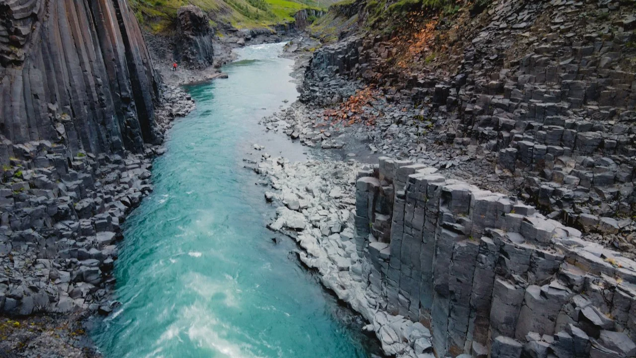
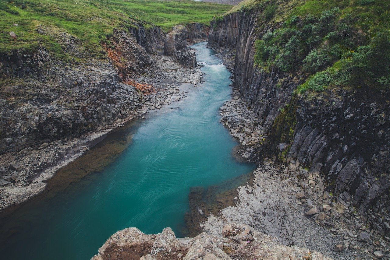
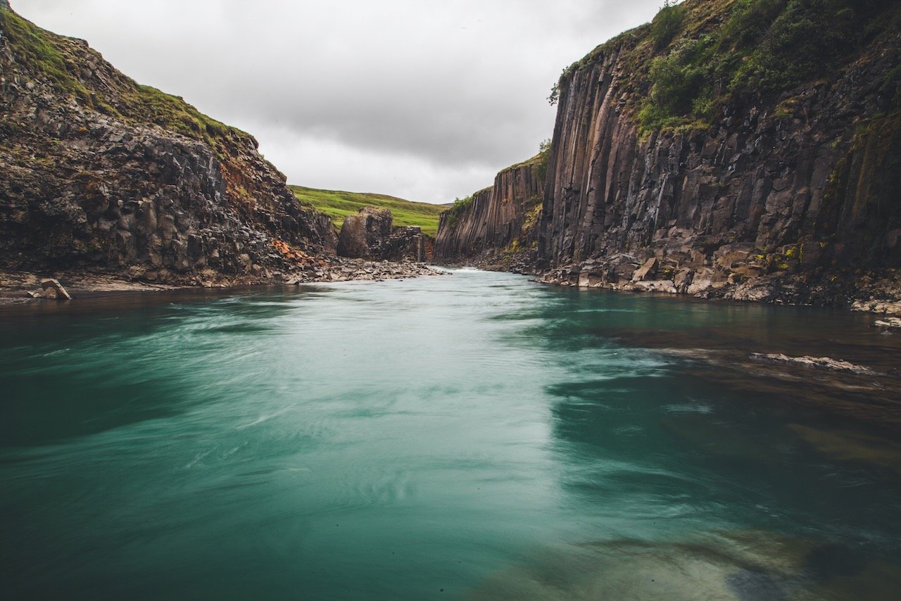
Stuðlagil Canyon, Iceland (ISO 280, 4.5 mm, f/2.8, 1/10 s)
(Some links in this post are affiliate links. If you click through and take action, I'll be compensated.) If you are also interested in any PRINTS from any of my posts, be sure to check out my store where you can buy prints as posters, in metal/wooden frames or on canvas.
**This post is the 4th of a 6-post series discussing what to see in this part of Iceland (You can check out the other parts here: Part 1, Part 2, Part 3, Part 4, Part 5, Part 6. Everything is also summarized in another post here.**
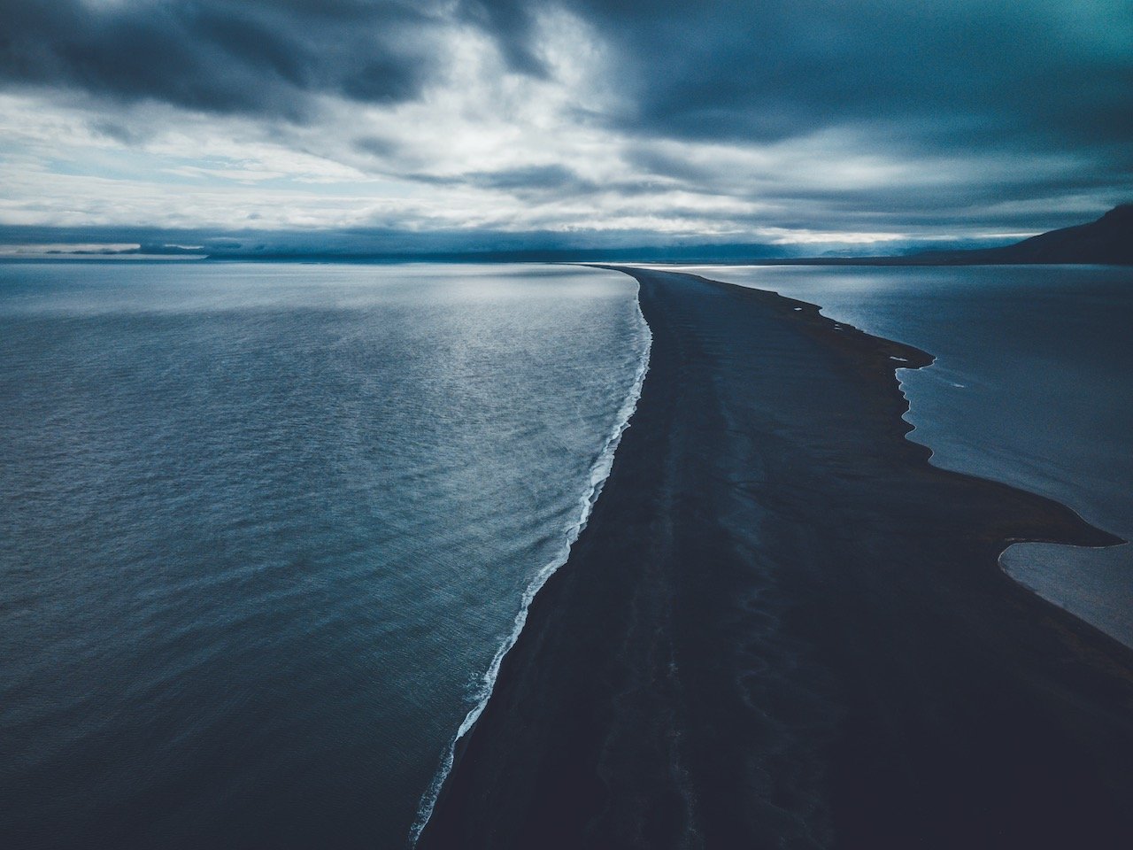
If you’ve gone this far through the Iceland South Coast, continue your way through Eastern Iceland for more wonderful, off the beaten path, places too see. What you’ll find immediately is that there will be less tourists after you pass the town of Höfn since most people only do (or have time for) the South Coast on their travels. (You can find a Google map of the places I will discuss at the end of this post.)
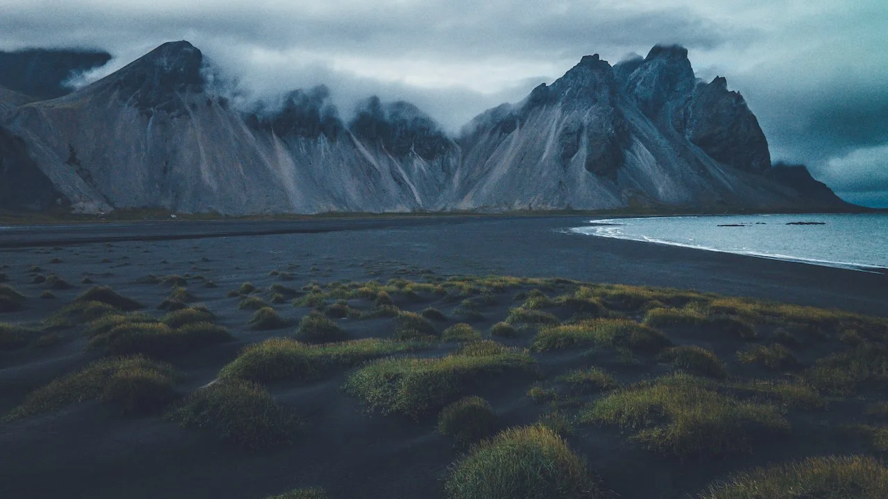
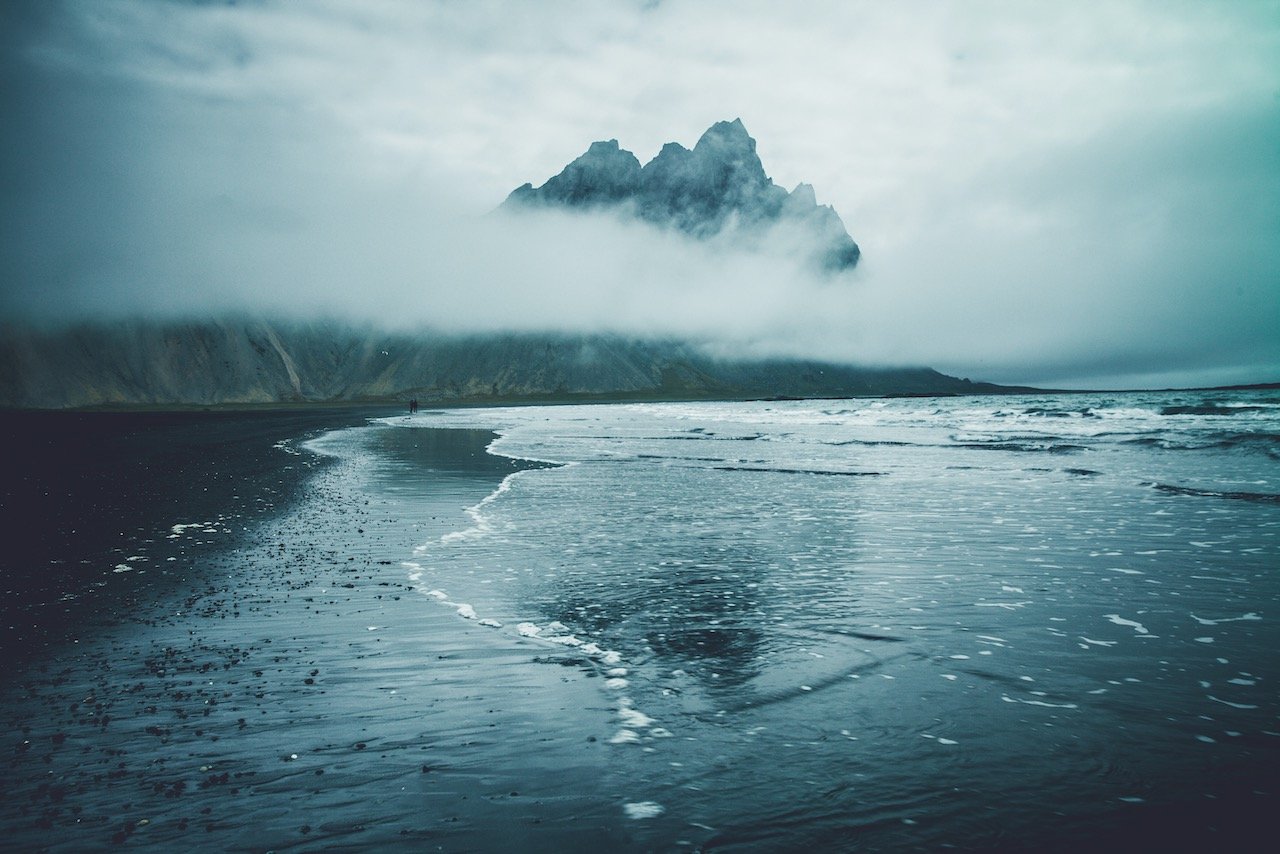
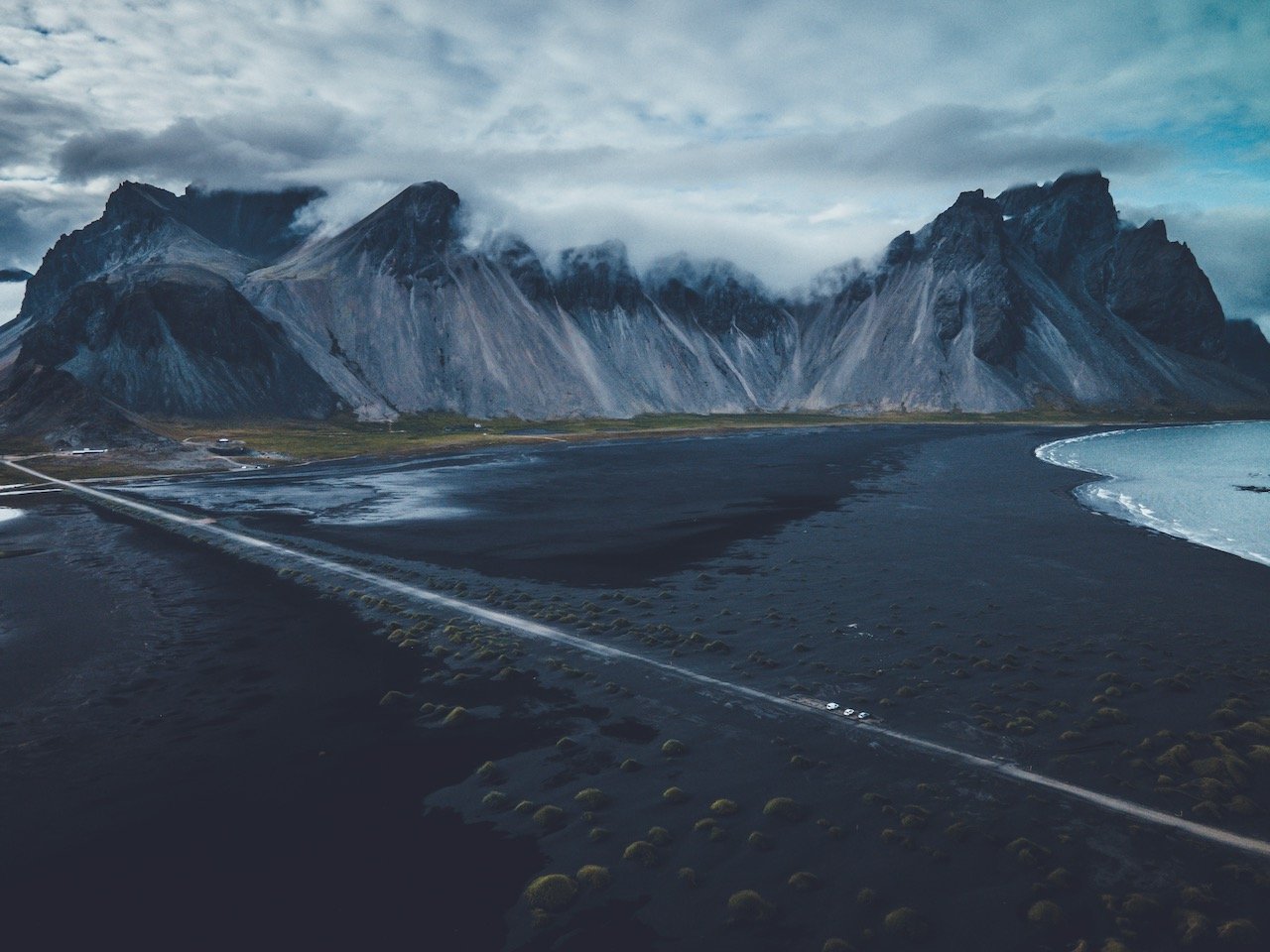
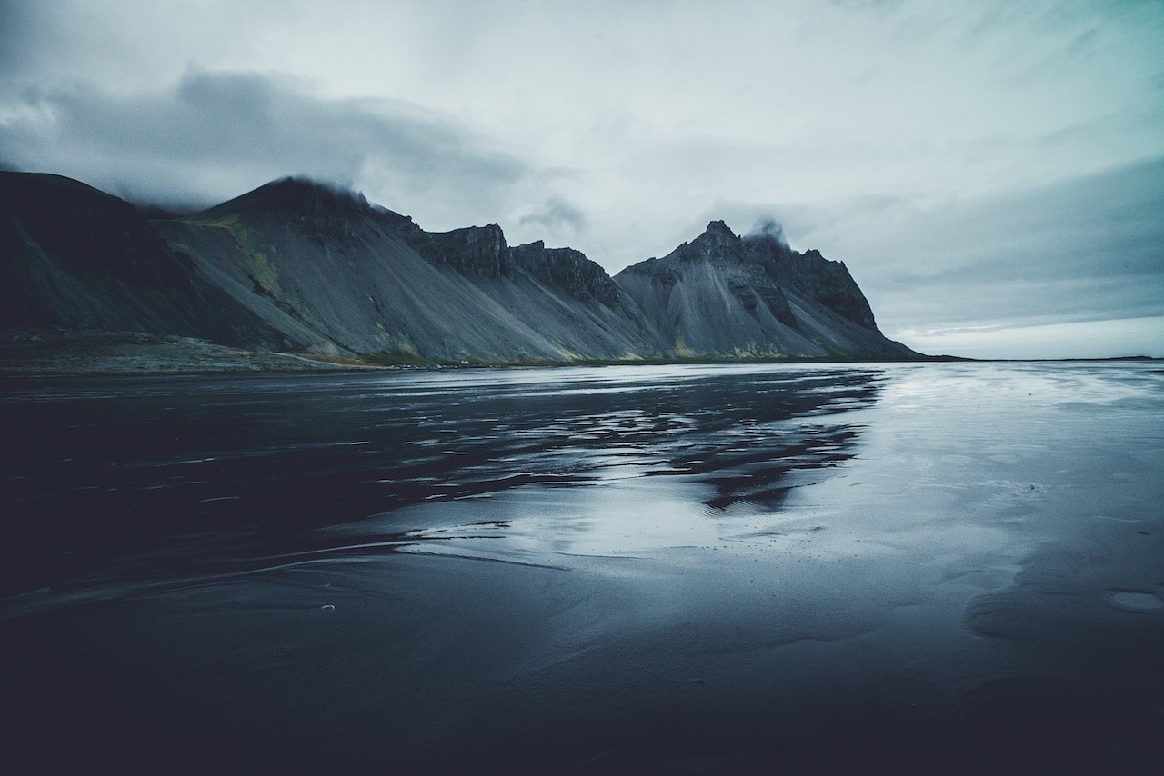
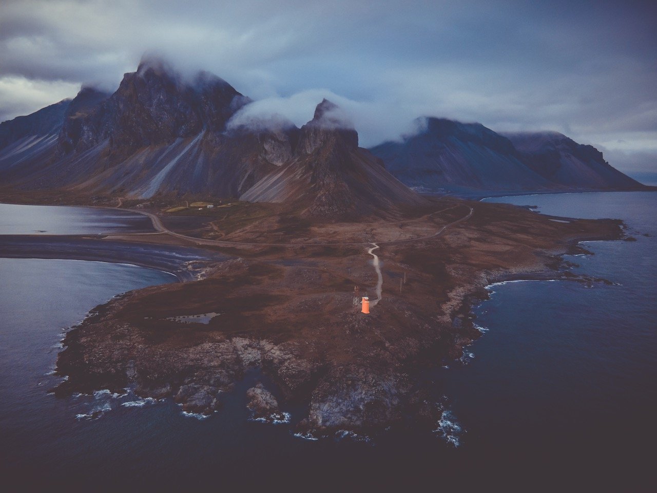
Once at the town of Höfn, just nearby is Vestrahorn Mountain, one of the most distinguishable and iconic mountains in the entire country. You can drive here just for the day and access the black sand beach next to the mountain by getting a ticket for a small fee at the nearby Viking Cafe.
Furthermore, you can choose to camp here and access the beach late in the evening and early in the morning to maximize your chances of having the place to yourself.
If you have the weather and timing on your side, you’ll find that most of the beach will have a small layer of water on it, allowing you to walk on it and take the most amazing photos of the mountain, reflected in the mirror that the water creates.
Check out my drone video below on Vestrahorn Mountain in Iceland!
About half an hour from Vestrahorn is yet another orange color lighthouse. Hvalnes Lighthouse is gorgeous for the fact that it’s bright color is an epic contrast to the area it’s surrounded by (as a lighthouse should be). It’s located on a gorgeous peninsula that is probably one of the windiest parts of the entire country. It’s not so popular to visit but is worth seeing as it’s just less than half a kilometer off the ring road.
There are some pretty cool waterfalls on this side of the country as well, albeit a little more secluded and harder to get to than the ones on the South Coast. This means a few more gravel roads that’ll get you to where you want to go. Not all the roads are created equal. I remember going up to 70 km/h on some, and only 20 km/h on others. Better to be safe and go a little slower if need be.
You can reach two waterfalls by taking road 95 off of the ring road, and then road 931 towards Litlanesfoss and Hengifoss. Both are accessed from a nearby car park and the hike itself is almost entirely up hill on the way to Hengifoss.
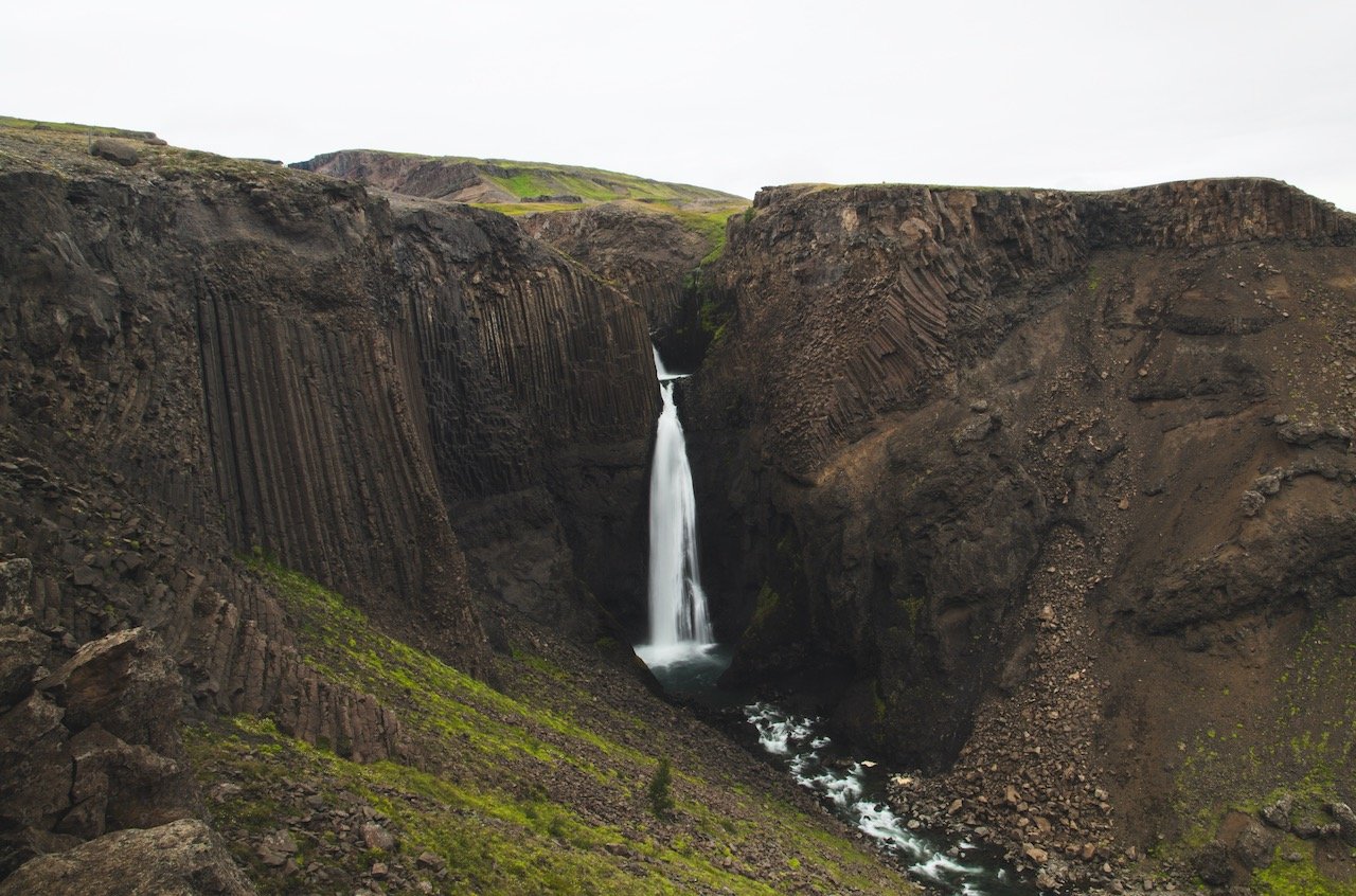
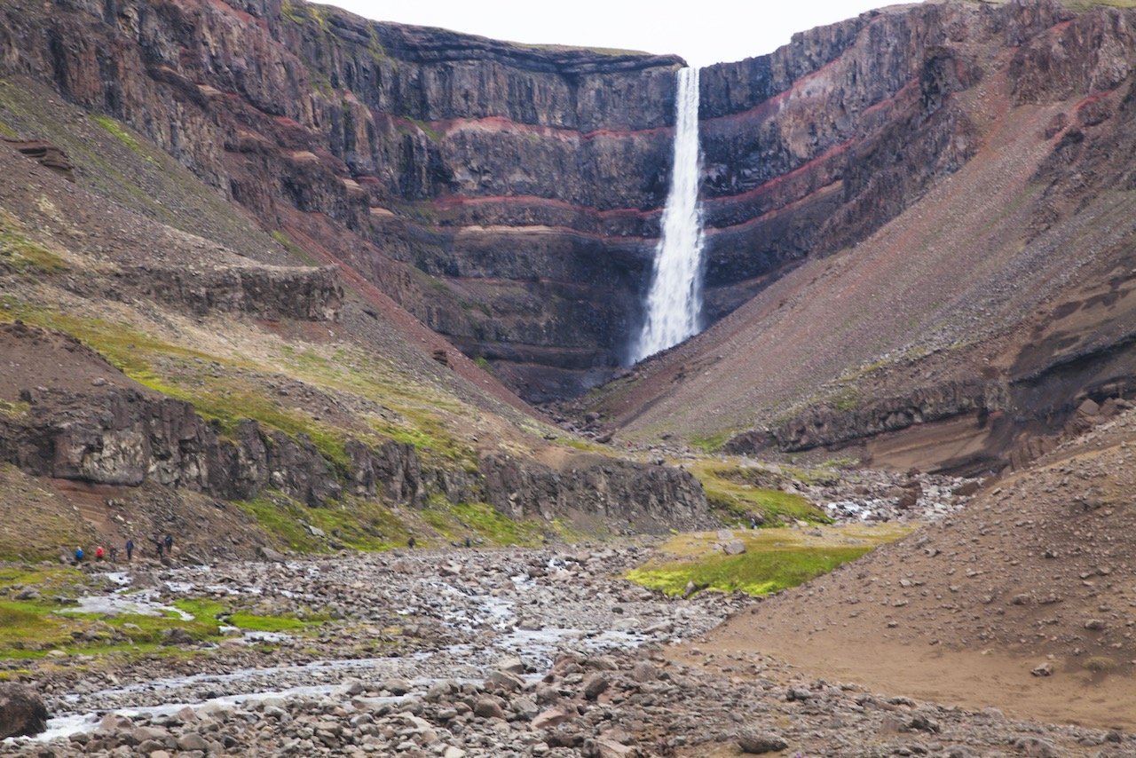
Litlanesfoss is the first stop on the hike and has similar features to Svartifoss in the Skaftafell Nature Reserve. It’s surrounded by hexagonal shaped basalt rock formations, which makes it one of the more distinguished looking waterfalls in the area. Makes sense since it’s name is also ‘Stuðlabergsfoss’, which means ‘Basalt Column Falls’. The waterfall is about 30 meters high and there is a viewpoint which allows you to perfectly capture the entire scene.
Hengifoss is the end point of the hike and is most recognized by the red layers of clay on its cliffs, evidence of the volcanic eruptions that have occurred here in the past. Hengifoss is the third tallest in the country at a height of 128 meters. The hike itself is about 2.5 kilometers each way from the car park.
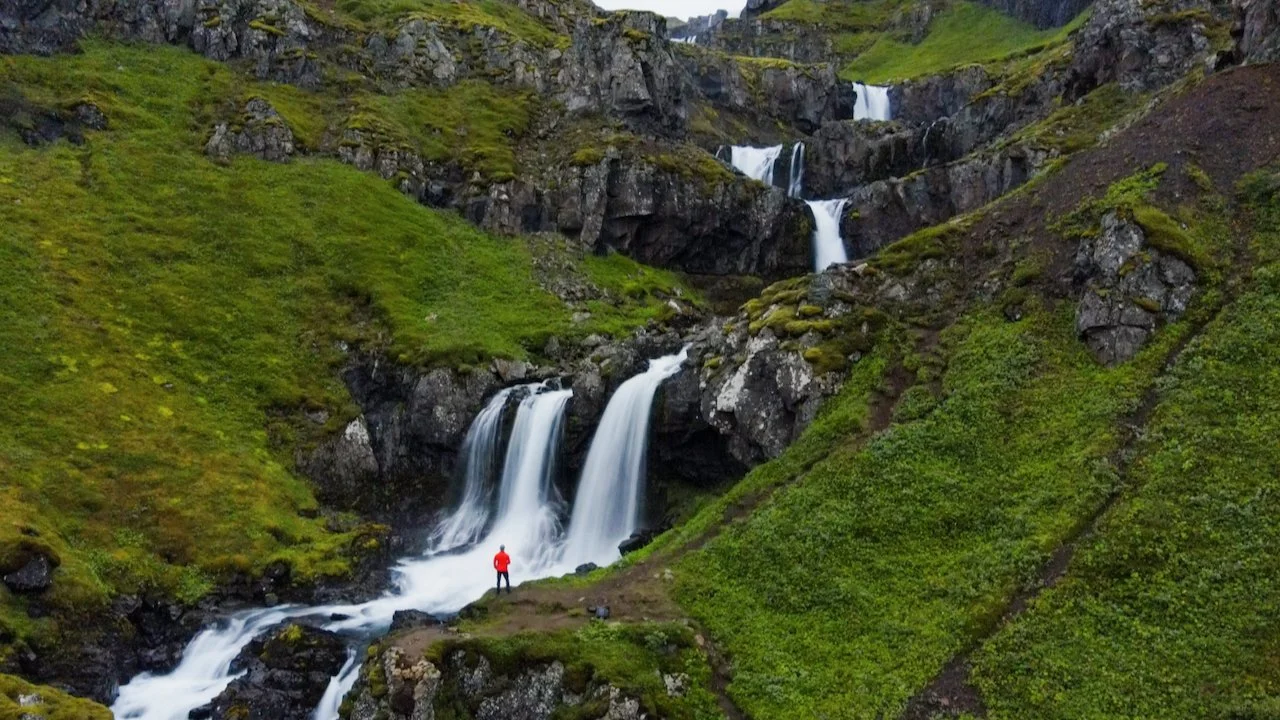
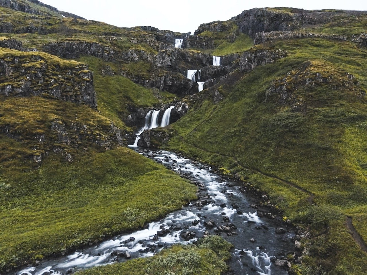
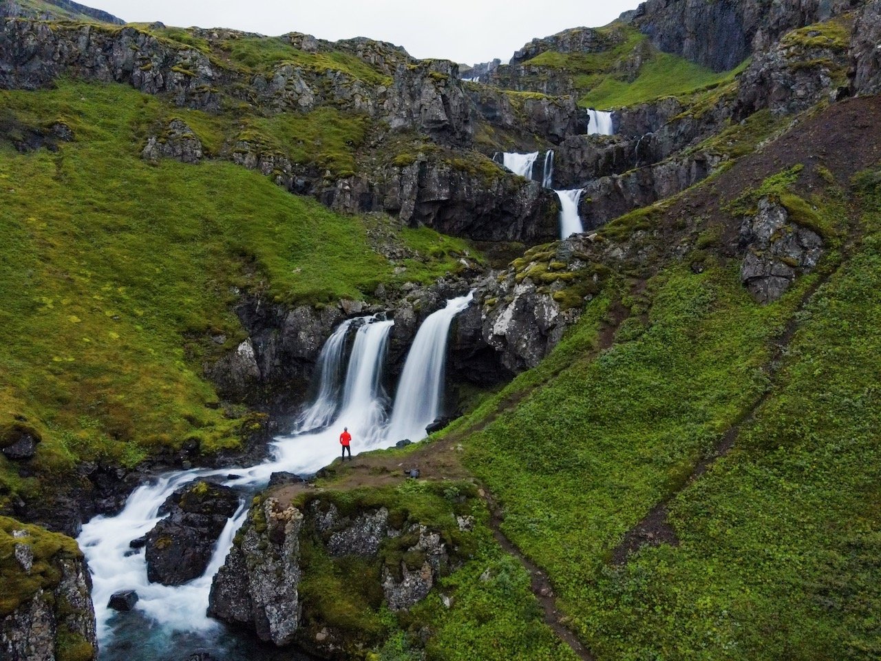
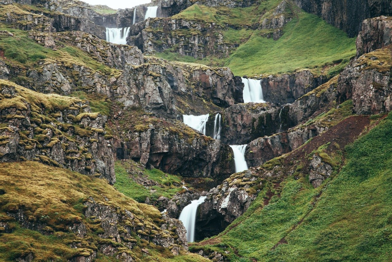
Klifbrekkufossar is perhaps one of my FAVORITE places in all of Iceland. Picture this: you’re driving along and after seeing maybe 20 waterfalls at this point, are looking for something a bit more distinguished. All of Iceland’s waterfalls are unique and gorgeous, but after you’ve seen so many of them, you get a little de-sensitized to them.
I decided to turn off of the ring road towards this specific one (‘Klifbrekkufossar’ means ‘cliff slope waterfalls’). This gravel road (#953) takes you through the countryside, with vast changes in elevation and winding roadways. Once you get to the falls, you will be left breathless. It’s a collection of several smaller waterfalls which the water cascades down to the stream below. I went here twice in my trip to Iceland and no one was their either time.
People talk about hidden gems in a country, only for that place to be crawling with people. I truly believe that Klifbrekkufossar is a gem to see. It’s location is not ideal for seeing, and therefore it’s not as well known as others.
If you like some of my photos that you have come across, just know that I have many prints showcasing a variety of landscapes in Iceland, available for purchase below! (Sold as Posters, Canvas, or in Metal-Frames and Wooden-Frames).


If you continue on road 953 towards the water, you can follow it along the coastline until you reach another awesome orange-colored lighthouse called Dalatangi, located in the village of Mjóifjörður, home to 11 people.
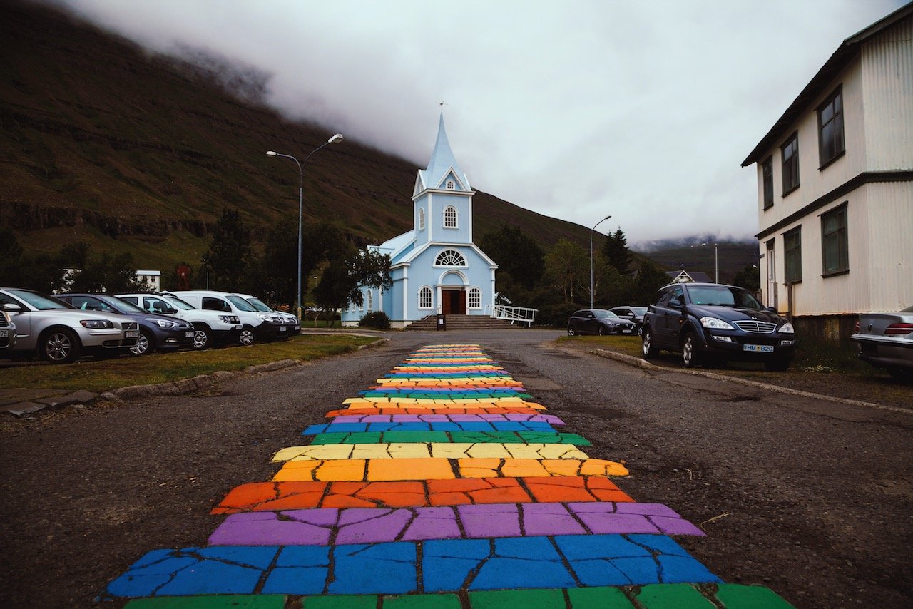
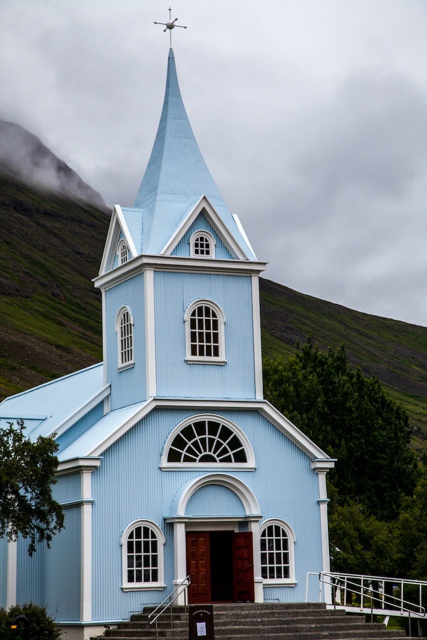
Another nice town to check out, just off the ring road, is Seyðisfjörður, reached by taking road number 93. This is an excellent place to stop at for a bite to eat or cup of coffee. The town is small, walkable, and every bit as charming as you’d expect. The centerpiece of the town is probably it’s light-blue colored church, Seyðisfjarðarkirkja. If you can’t find it, don’t worry, just look for the rainbow colored steps leading up to its doors.