The EPIC Iceland Road Trip: The South Coast (Part II)

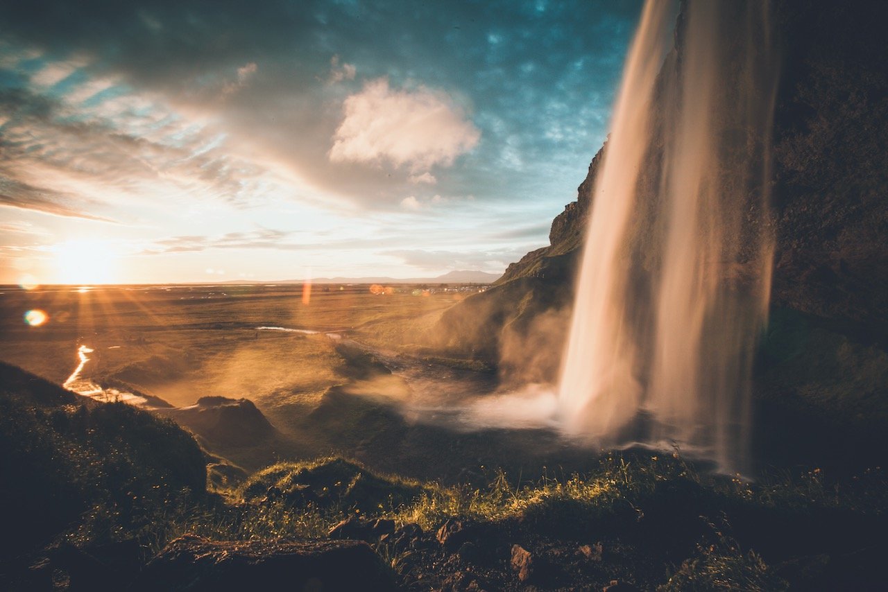
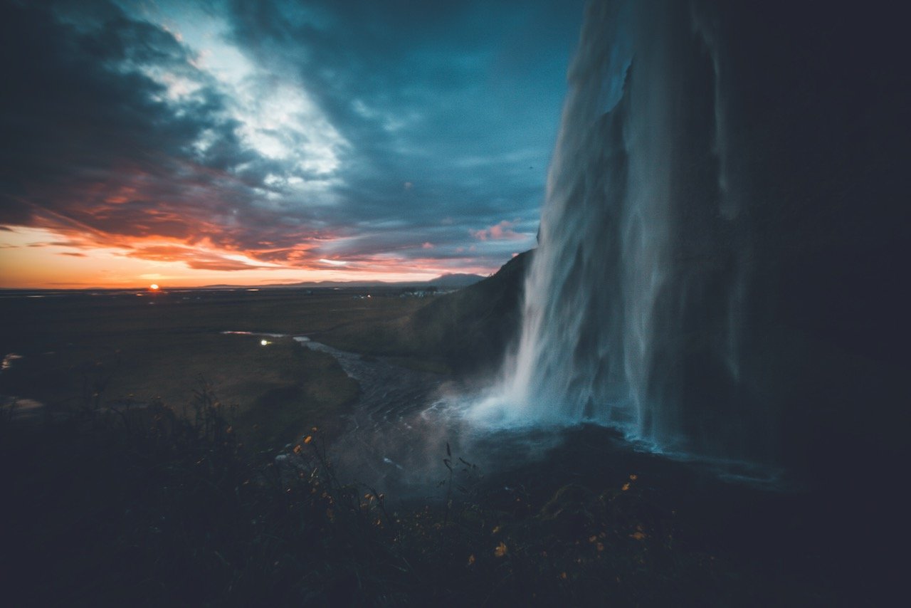
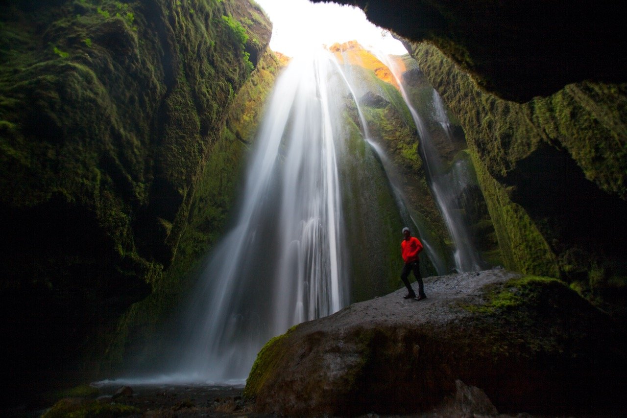
Seljalandsfoss Waterfall, Iceland (ISO 100, 16 mm, f/22, 0.5 s)
(Some links in this post are affiliate links. If you click through and take action, I'll be compensated.) If you are also interested in any PRINTS from any of my posts, be sure to check out my store where you can buy prints as posters, in metal/wooden frames or on canvas.
**This post is the 2nd of a 6-post series discussing what to see in this part of Iceland (You can check out the other parts here: Part 1, Part 2, Part 3, Part 4, Part 5, Part 6. Everything is also summarized in another post here.**
Continue on your trip along Iceland’s South Coast by taking the ring road to one of its most remarkable waterfalls (You can find a Google map of the places I will discuss at the end of this post).
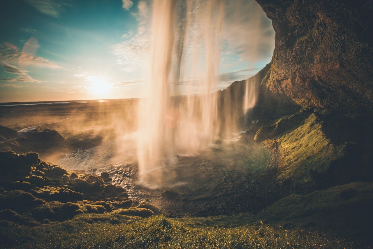
Seljalandsfoss is best seen during non-peak times, but perhaps the best time to go is at sunset or right before during golden hour. This is one of the only waterfalls in Iceland where you can walk behind it, so if you time it just right, you can have the sun set right behind the falling water and the result is breathtaking. This path is however closed in the winter months since there is a large accumulation of ice and snow that makes it dangerous to walk on.
Also for those photographers wanting to catch the perfect photo from every angle of these falls, BRING A TOWEL. There is constant spray here that goes in every which direction. It is not consistent with regards to direction but at some point during your photoshoot, you will get hit with it, so protect your equipment and expect to have to wipe off your lens a few times for the perfect shot.
There is also a campsite in this area, so it may be best to camp here for the night to enjoy the waterfalls at sunset as well as sunrise when the amount of tourists have drastically decreased.
Check out my drone video below of Iceland’s Waterfalls!

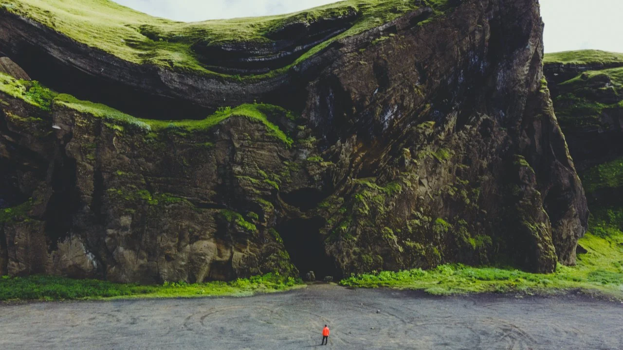
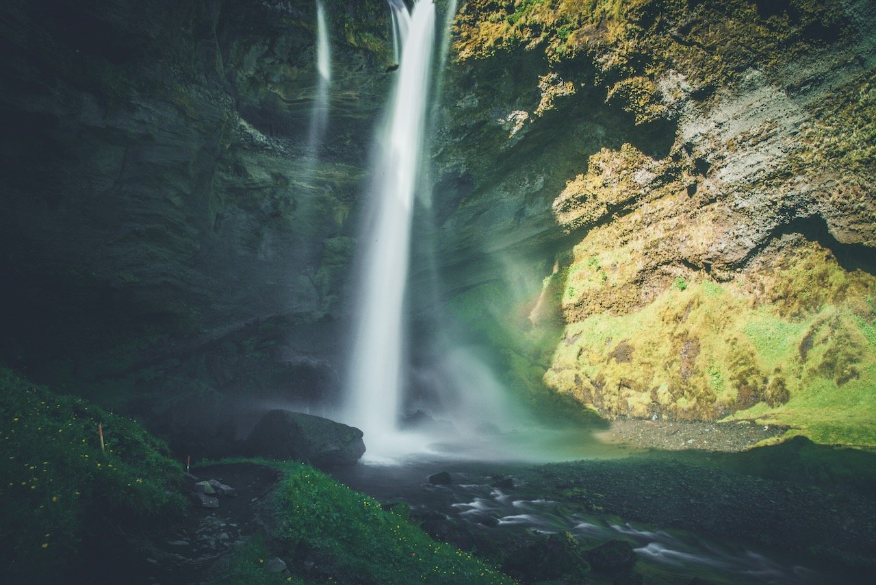
Perhaps a small secret about this area is the waterfall that is just a few hundred meters away from Seljalandsfoss. If you walk towards the camping area from this waterfall, you will eventually get to a spot where you have to walk on rocks protruding through the water of a small creek. This is the entrance to Gljufrabui.
Gljufrabui Waterfall, Iceland (ISO 400, 16 mm, f/4, 1/4 s)
This waterfall is not the biggest, nor the most impressive, but its position inside this crevice in the cliffs is what makes it amazing. You can feel the spray on your face immediately and can hear the power of the falls. You will get wet as soon as you enter this area so cover up and protect your camera equipment as much as you can. I was able to set up a tripod and snap a quick photo without too much water accumulation on my lens.
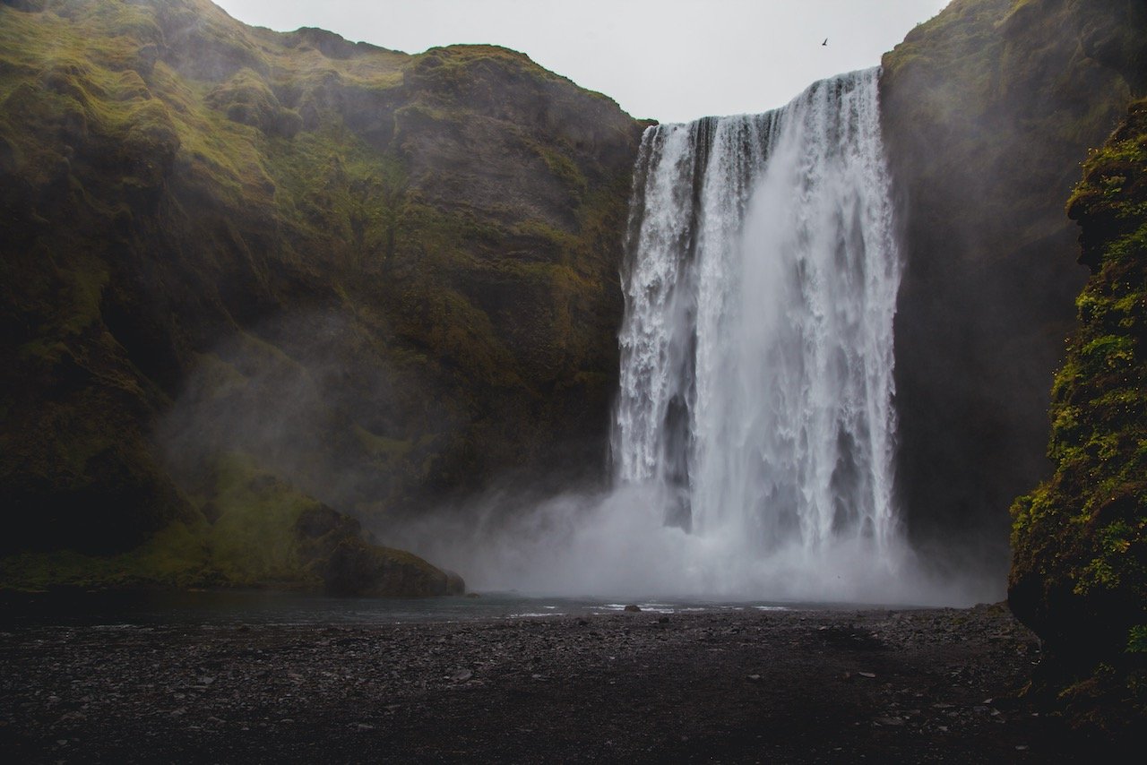
Keep heading east on the ring road and you’ll come up to another pair of waterfalls, Skógafoss and Kvernufoss. Skógafoss is quite popular as well, as it is a stop on many South Coast tours, therefore the best times to go are in the mornings or later evenings. It’s impossible to take a bad photo of this waterfall. You can walk right up to it and I find the best photos are the ones of people surrounded by white water.
There is a pathway on the right side of the falls that leads to a viewpoint over Skógafoss. It’s a pretty different perspective and a nice area to hike a little further as there are a few other minor waterfalls there too. A few hundred meters from here is Kvernufoss which is another waterfall you can walk behind for great photos. Not only that, the path leading up to it is just perfect on a warm summer day. The lush grass is as good as it gets.
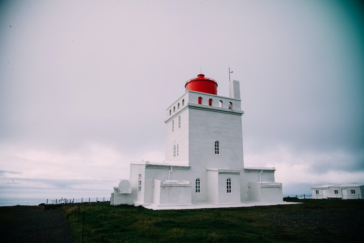
Dyrhólaey Lighthouse, Iceland (ISO 100, 24 mm, f/4, 1/1250 s)
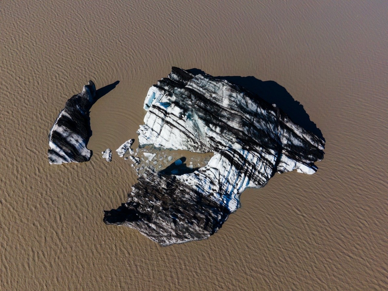
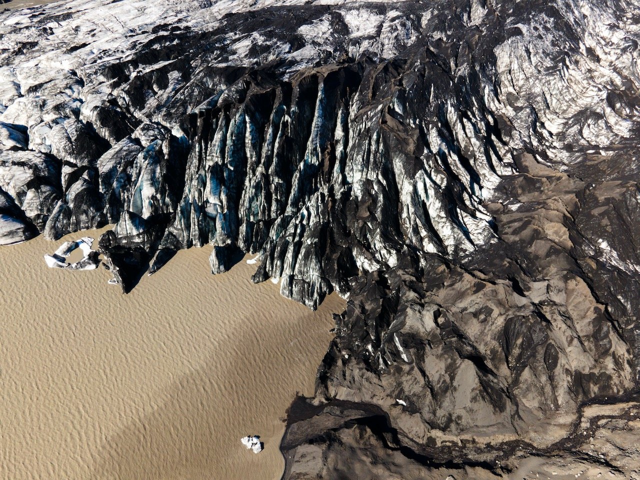
The next stop on the ring road is the Sólheimajökull Glacier, the first of a few glaciers that are nestled along the South Coast. The sad reality is that although the glacier is absolutely massive, there are many signs posts along the barren landscape that mark where the glacier was at several years ago. Therefore, the glacier itself has receded quite a bit. At the car park, you just take a gravely path in the direction of the glacier and can walk right up to it. A lot of it is covered in dirt and you’ll find some small icebergs floating in the chocolate-milk colored lake. If you feel so inclined, you can also booked yourself a hiking trip where experienced guides take you on the glacier itself.
One of the emerging popular things to do is to see the Sólheimasander Plane Wreck. You can read all about the history of this plane crash here, but to summarize, it is the remnants of a Super DC-3 type plane that crash landed during bad weather. The captain managed to crash land the plane and all passengers were uninjured, and were later rescued. Due to the barren landscape and unforgiving conditions of the area, the ability to recover the plane could not be done, so it was stripped of everything valuable and left to the elements.
If you like some of my photos that you have come across, just know that I have many prints showcasing a variety of landscapes in Iceland, available for purchase below! (Sold as Posters, Canvas, or in Metal-Frames and Wooden-Frames).


There is a parking area along the ring road which serves as the starting point of this 7 km round trip hike. The area is still unforgiving as you are exposed to the windy and desolate conditions so best to be prepared. It must be said to not take anything from the plane and do not sit or stand on it, as it has incurred damage over the years by tourists.
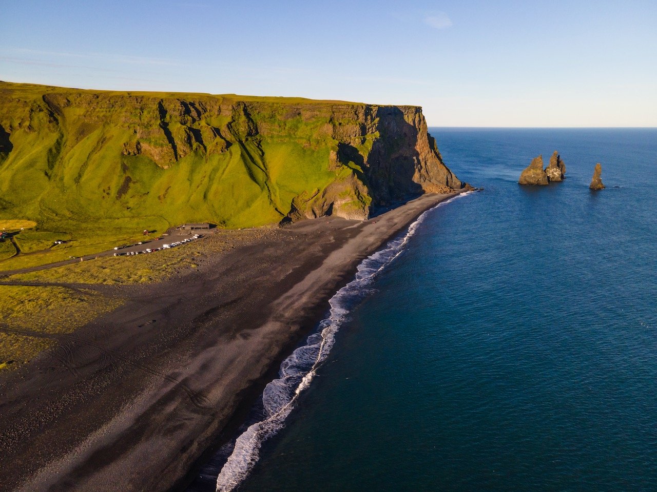
Dyrhólaey is the southernmost tip of Iceland and is defined as a ‘promontory’, but it’s essentially a massive cliffside plateau that juts out into the Atlantic water. The car ride to this area is gorgeous, especially during golden hour. If you lack a 4x4, use a lot of caution traversing up the road to the top of Dyrhólaey as the road is: 1) gravel and 2) has plenty of potholes and 3) is barely wide enough for 2 cars at any time.

As anxiety-ridden as you may be to get to the top, the views are worth it. Here you can see for miles towards Reynisfjara Beach. This is a fantastic place to watch the sunset and have a picnic even. Take some time to also walk around and check out the cliff side formations and the Dyrhólaey Lighthouse.
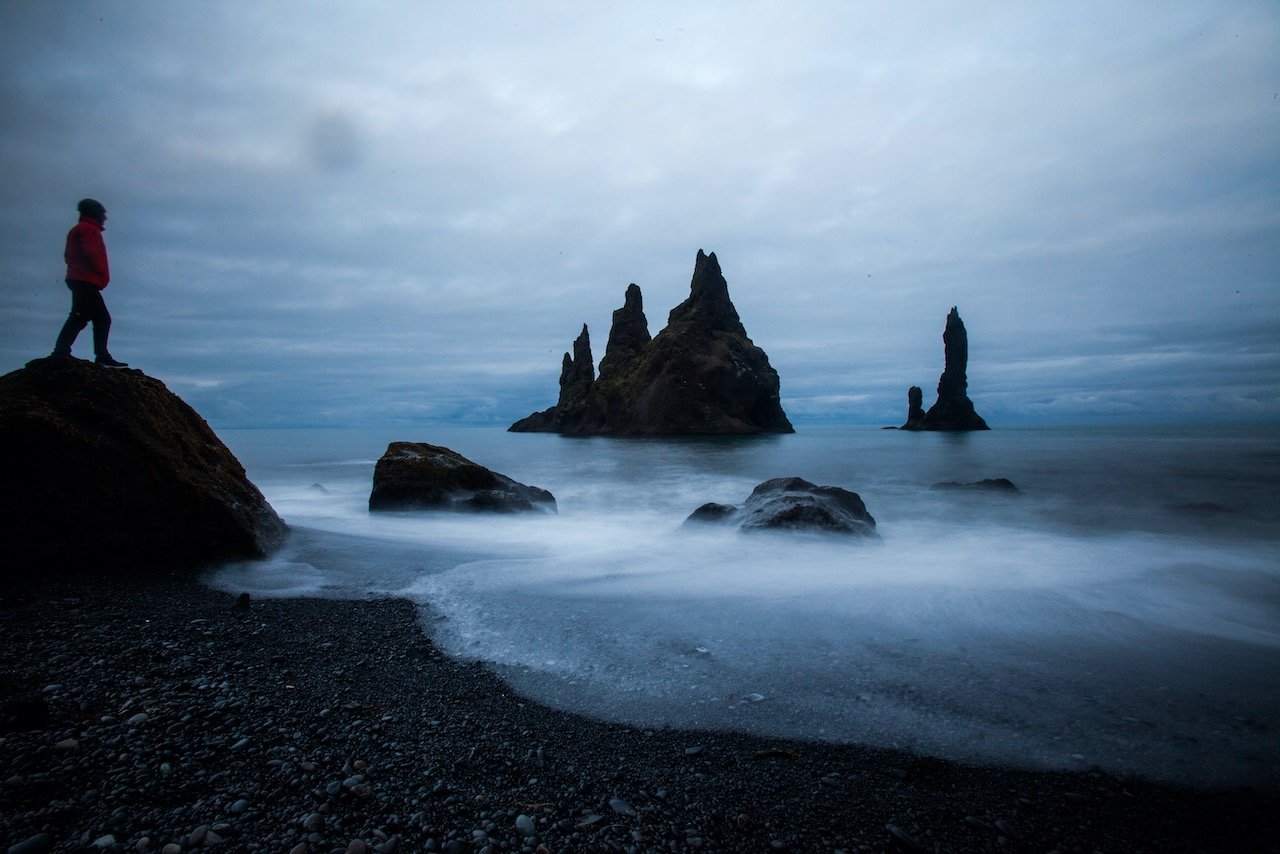
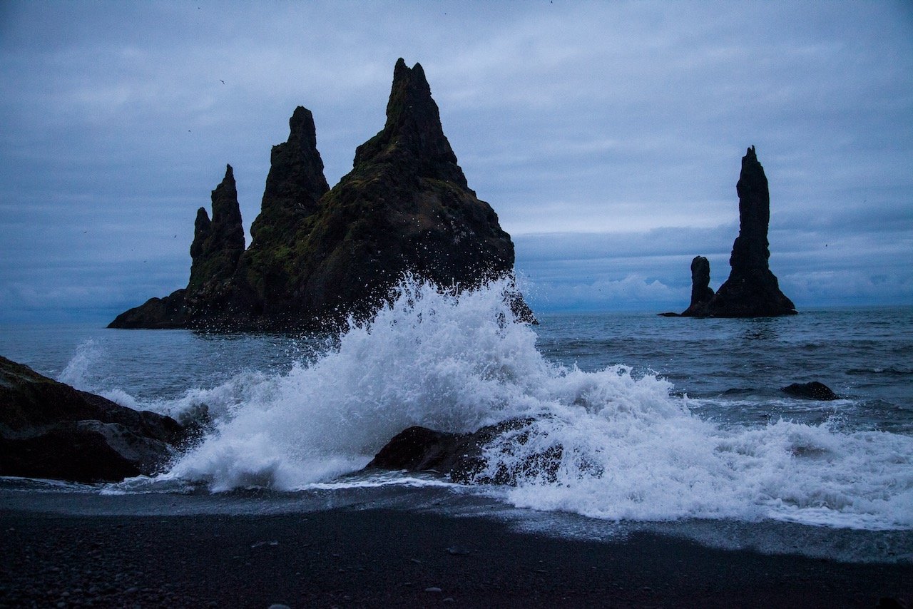
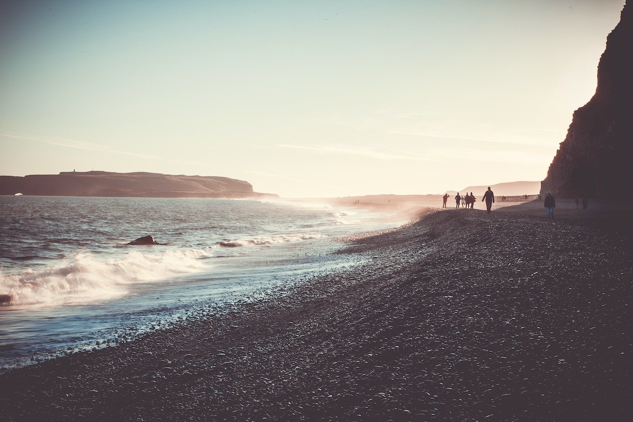
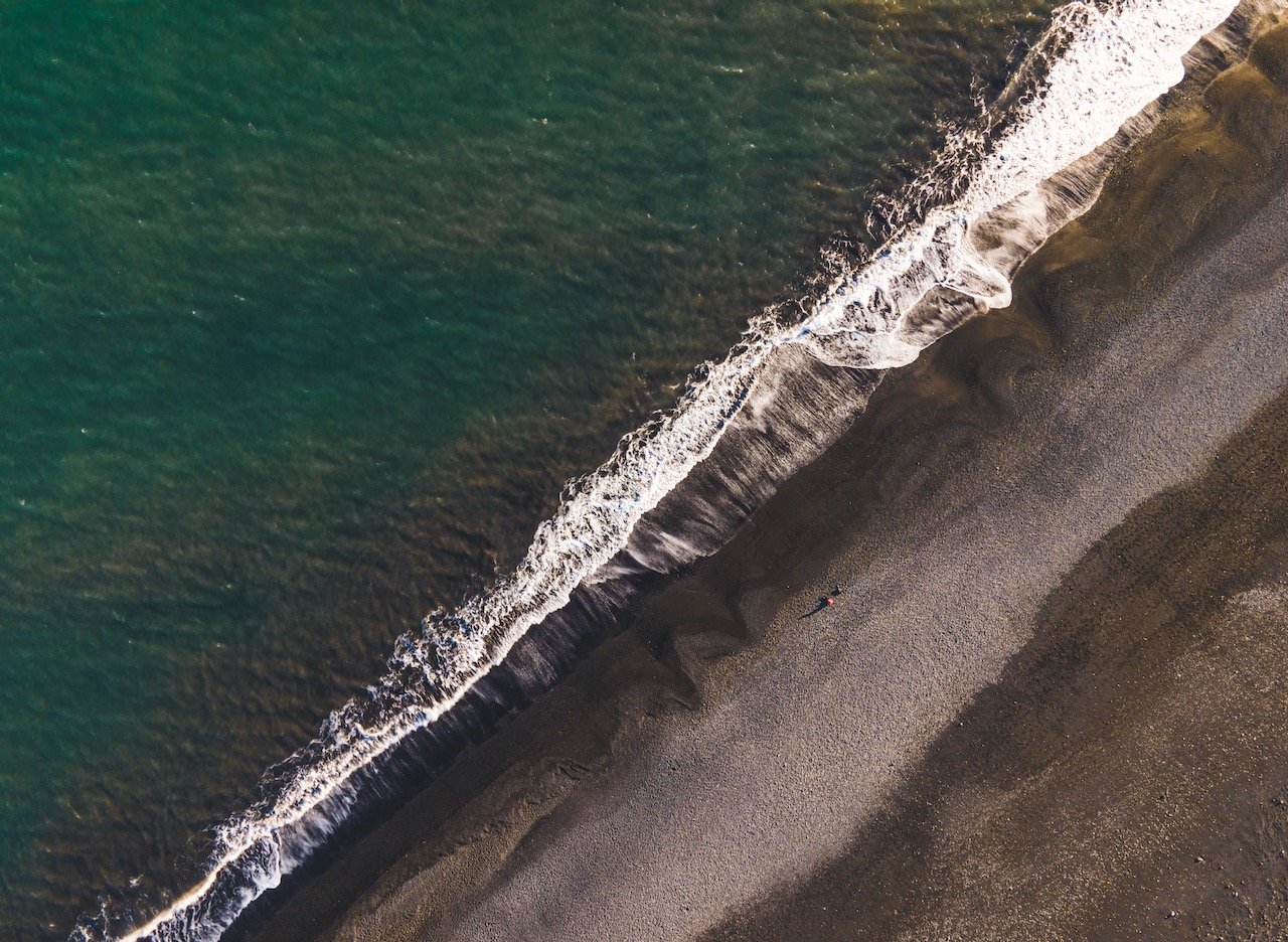
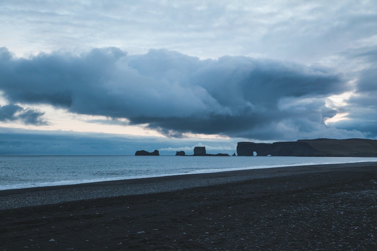
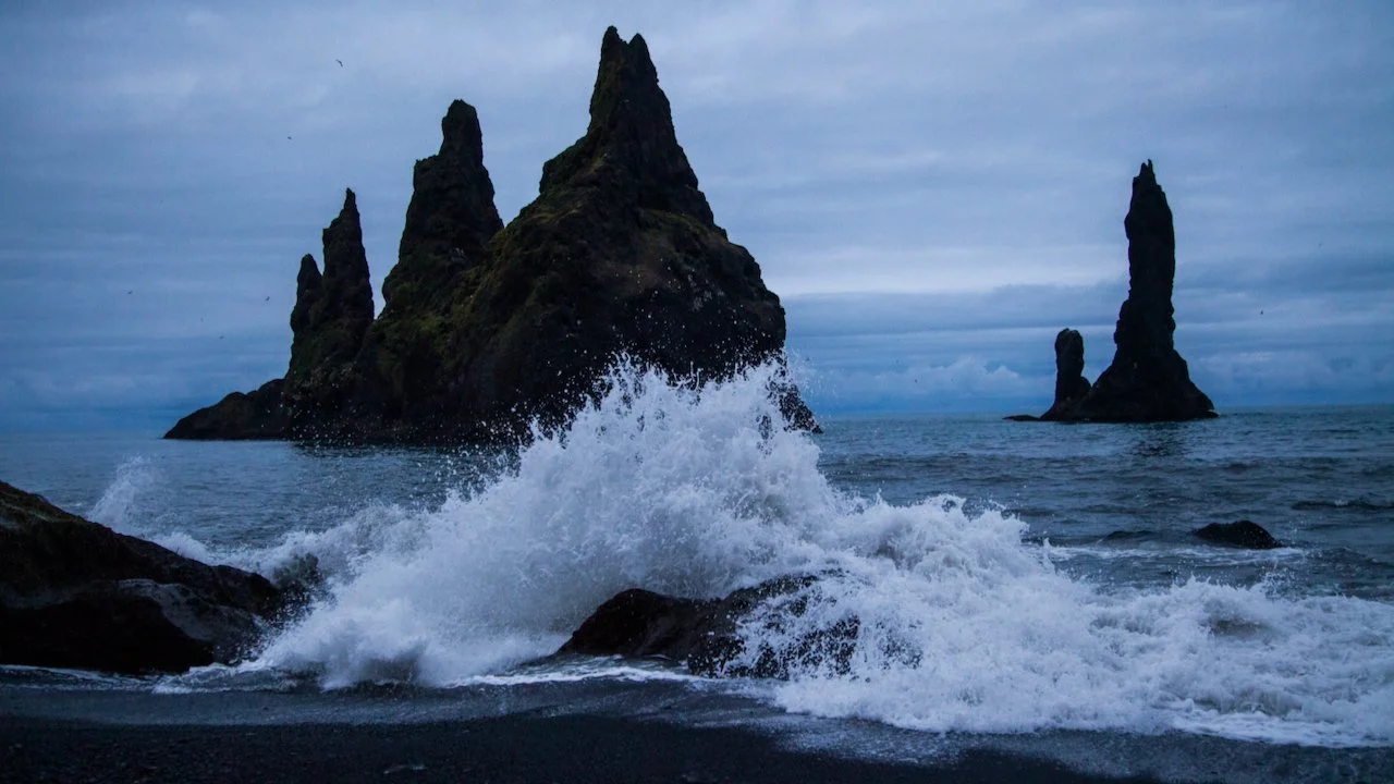
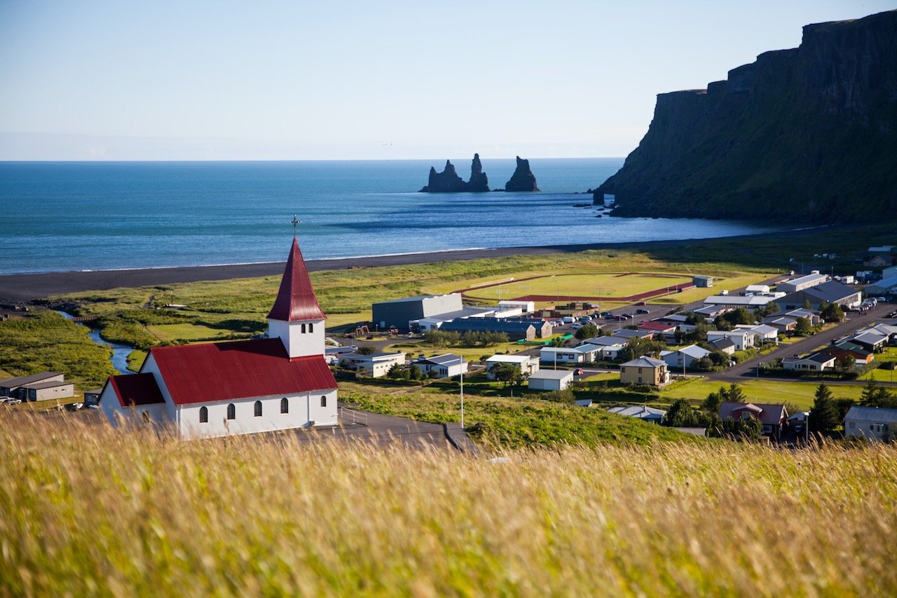
From the cliffs around Dyrhólaey, you can easily spot the black sand beach, Reynisfjara (looking east). This beach is quite popular for a reason. It’s located just before the town of Vik and the beach stretches as far as the eye can see, leading you to Reynisdrangar, the set of basalt columns that jut out of the sea and provide for some great photographic material.
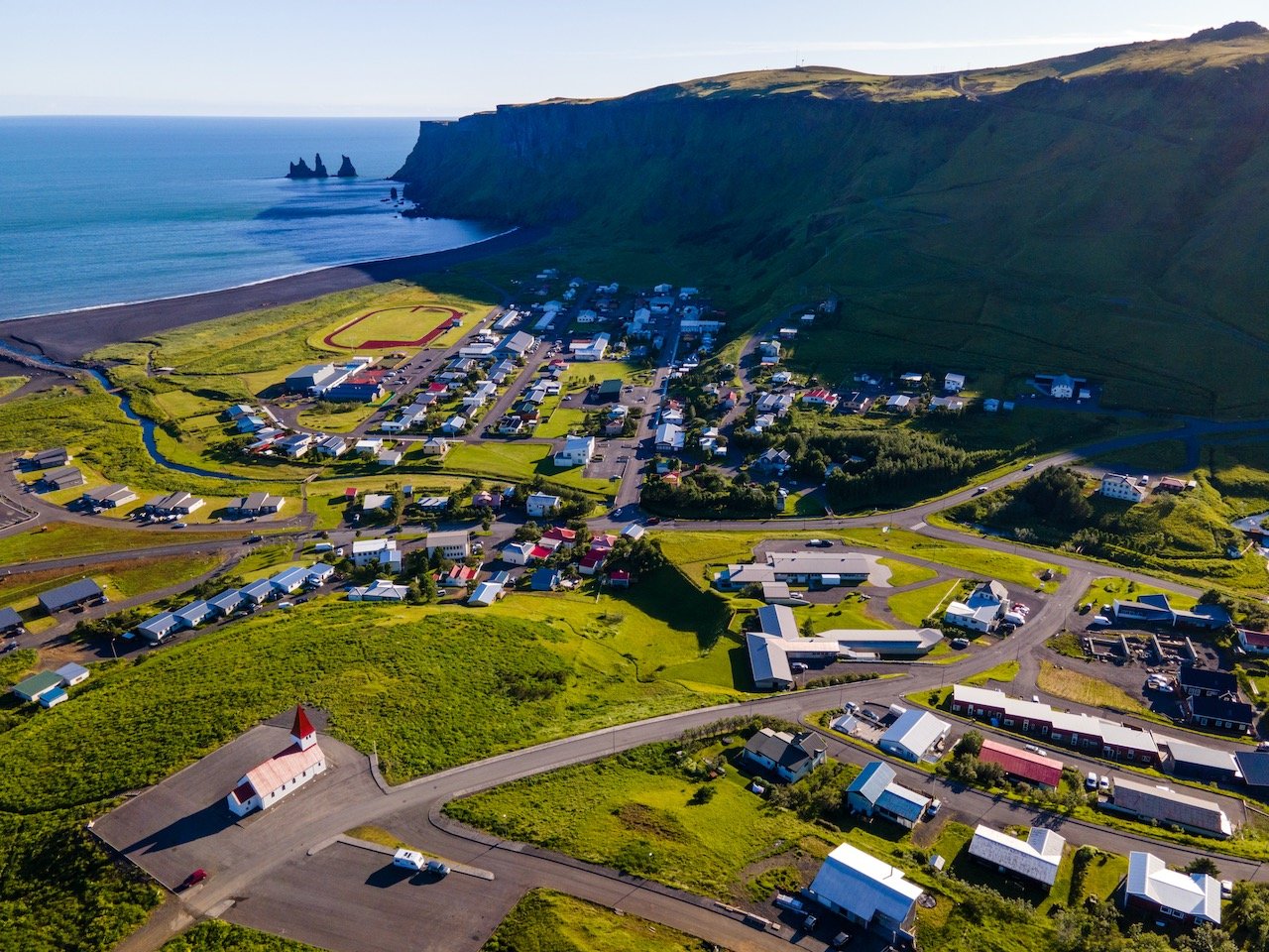
From the parking area, you can see a stack of hexagonal columns that are popular for photographs as well or you can choose to walk back towards Dyrhólaey along the beach, or the other direction towards Reynisdrangar. [PROTIP: to get the best photos of Reynisdrangar, make your way down Reynisfjara, heading east until you reach what seemingly looks like the end of the beach (coordinates: 63°24'05.1"N 19°02'08.0"W). Then keep going in the same direction by climbing over a few large rocks to access the other side of the beach that faces the town of Vik. This is where you can get up close to the sea stacks].
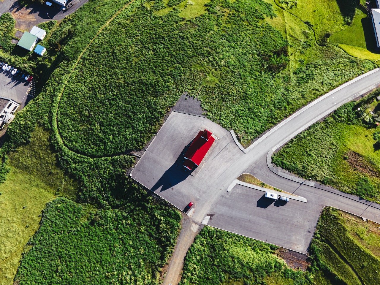
The town of Vik (full name: Vík í Mýrdal) is an excellent place to spend a few hours at. Here you can replenish your supply of food and gas up the car as well as enjoy the views of the town from the Vik Church. Specifically, if you drive towards the church, there is a road leading up to a cemetery that’s the highest point in the city.